Thingiverse

More Hawaiian Relief Maps by pmoews
by Thingiverse
Last crawled date: 3 years, 1 month ago
Here are four additional relief maps of the Hawaiian islands.
The maps are based on the same NOAA data,http://www.ngdc.noaa.gov/dem/squareCellGrid/download/460,
as the map of "The Big Island" - hawaii.stl - thing:105474.
The NOAA file was sampled at intervals of 12 arc seconds to give
the following files -
maui.stl ------------ 200 rows x 220 columns
molokai_lanai.stl - 200 rows x 220 columns
oahu.stl ------------ 200 rows x 220 columns
kauai.stl ----------- 150 rows x 300 columns
The vertical scale is a little over 200 meters per mm.
Similar models
thingiverse
free

Hawaii Relief Map by pmoews
...noaa has a portal that helps one find many similar data sets. see...
3dwarehouse
free

Hawaiian Fishing Canoe
...aiian islands. #3d_challenge_039 #boat #hawaiian_canoe #outrigger #paddle #rowboat #rowing #rowing_boat #sailing #vintage #wooden
thingiverse
free

Laser Cut Hawaiian Islands Map by Jonathan_K1906
...jonathan_k1906
thingiverse
i drew this map of the hawaiian islands using illustrator. i plan to laser cut it soon with 3mm wood.
3dwarehouse
free

Globe NOAA Global Relief Model
...globe noaa global relief model
3dwarehouse
globe noaa global relief model
thingiverse
free

Relief Maps of Bora Bora by pmoews
...guide and http://www.jspacesystems.or.jp/ersdac/gdem/e/1.html for an overview a fortran program similar to those in things 118327 and 121275 was used...
thingiverse
free

Kauai Relief Maps by pmoews
...om the usgs national map.
http://viewer.nationalmap.gov/viewer/
the programs used were described in things 106099 and 116103.
thingiverse
free

Martinique and the Caribbees by pmoews
...columns of two byte signed integers. a fortran program similar to those in things 118327 and 121275 was used...
thingiverse
free

San Francisco Relief Map by pmoews
...ce code is provided. although the data file can be obtained from the noaa web site a zipped version is included for convenience.
grabcad
free

Column
...column
grabcad
200 x 200 h-beam column
3dwarehouse
free

Hawaiian Landscapes
...hawaiian landscapes
3dwarehouse
a collection of landscapes from the beautiful hawaiian islands.
Hawaiian
turbosquid
$2

Hawaiian bed
...osquid
royalty free 3d model hawaiian bed for download as ma on turbosquid: 3d models for games, architecture, videos. (1234160)
3d_export
$7

Hawaiian pizza 3D Model
...hawaiian pizza 3d model
3dexport
pizza hawaiian food juice orange other
hawaiian pizza 3d model rv80 95179 3dexport
turbosquid
$28

Hawaiian style tables
...yalty free 3d model hawaiian style tables for download as max on turbosquid: 3d models for games, architecture, videos. (1495488)
turbosquid
$20

Hawaiian Bedroom Furniture A
...an bedroom furniture a for download as max, fbx, obj, and dwg on turbosquid: 3d models for games, architecture, videos. (1695734)
turbosquid
$199

A350-800 Hawaiian
... available on turbo squid, the world's leading provider of digital 3d models for visualization, films, television, and games.
turbosquid
$199

A350-900 Hawaiian
... available on turbo squid, the world's leading provider of digital 3d models for visualization, films, television, and games.
turbosquid
$19

Hawaiian BBQ Sauce
... available on turbo squid, the world's leading provider of digital 3d models for visualization, films, television, and games.
turbosquid
$19

Hawaiian Hand Sign Figurine
...ian hand sign figurine for download as max, stl, fbx, and obj on turbosquid: 3d models for games, architecture, videos. (1679031)
turbosquid
$29

3D Hawaiian Kiosk Booth Design
... available on turbo squid, the world's leading provider of digital 3d models for visualization, films, television, and games.
3d_export
$95
Falcon3D MD 80 Hawaiian 3D Model
...ght cargo corporate mcdonnell douglas us plane planes jet jetliner md-80
falcon3d md 80 hawaiian 3d model falcon3d 73148 3dexport
Pmoews
thingiverse
free

Pheasant by pmoews
...pheasant by pmoews
thingiverse
123d catch version of a ceramic pheasant. the stl file is at 40% scale.
thingiverse
free

A Pelican by pmoews
...s
thingiverse
a neighbor's pelican model. it was digitized with autodesk's recap photo. the stl file is scaled at 40%.
thingiverse
free

Walrus by pmoews
...ews
thingiverse
a thrift store walrus, gray, weights over a kilogram, maybe a garden ornament. a 123d-catch copy at half scale.
thingiverse
free
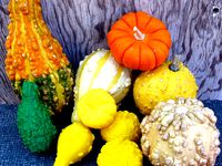
Five Gourds by pmoews
...five gourds by pmoews
thingiverse
here are five gourds suitable for a fall display. they were digitized with 123d catch.
thingiverse
free
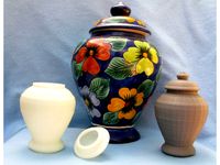
Vase with Lid by pmoews
...vase with lid by pmoews
thingiverse
a neighbor wanted a copy of a favorite vase. here are half size versions as stl files.
thingiverse
free

Pineapple by pmoews
.... fairly accurate - prints well without support. for other stl files based on real pineapples see things 4560, 7228 and 438266.
thingiverse
free
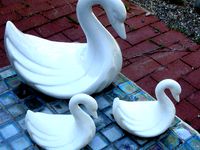
Ceramic Swan by pmoews
...ceramic swan by pmoews
thingiverse
a thrift store ceramic swan without markings. the 123-d catch file is at half scale.
thingiverse
free
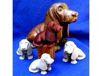
Basset Hound by pmoews
...basset hound by pmoews
thingiverse
an autodesk recap photo copy of a basset hound bought at an estate sale. about 4/10 scale.
thingiverse
free
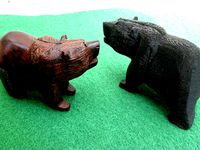
A Black Bear by pmoews
... by pmoews
thingiverse
a 123d catch version of a wood carving of a bear. a souvenir of new mexico. the stl file is full scale.
thingiverse
free

Model Fish - Trout by pmoews
...model fish - trout by pmoews
thingiverse
openscad "doddle". meant to be a rainbow trout.
Relief
3d_export
$20
relief
...relief
3dexport
relief
turbosquid
$1

Relief
...
turbosquid
royalty free 3d model relief for download as obj on turbosquid: 3d models for games, architecture, videos. (1438537)
3d_export
$15
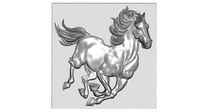
horse relief
...horse relief
3dexport
horse relief
3d_export
$10

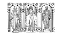
jesus relief
...jesus relief
3dexport
jesus relief
3d_export
$10

rome relief
...rome relief
3dexport
rome relief
3d_export
$10

fish relief
...fish relief
3dexport
fish relief
3d_export
$10

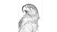
eagle relief
...eagle relief
3dexport
eagle relief
3d_export
$10
eagle relief
...eagle relief
3dexport
eagle relief
3d_export
free

3d relief
...3d relief
3dexport
3d relief
turbosquid
free
Relief
... available on turbo squid, the world's leading provider of digital 3d models for visualization, films, television, and games.
Maps
3d_ocean
$5

Map
...map
3docean
geography map ocean travel world world map
a world map
3d_ocean
$5

Old Map
...old map
3docean
dirty map ocean old map paper pirates rotten travel world map
an old map
turbosquid
$3

Map
... available on turbo squid, the world's leading provider of digital 3d models for visualization, films, television, and games.
3d_ocean
$3

Map of Iran
...map of iran
3docean
flag iran map outline
an outline map of iran
3d_ocean
$2

Map of the USA
...map of the usa
3docean
america flag globe map united states usa
an outline map of the usa
3ddd
$1

Abstract Maps
... город , picture
abstract maps by artist jazzberry blue
3d_ocean
$5

Honduras Map
...honduras map
3docean
3d cinema4d honduras map mapa
honduras map designed in cinema 4d r17
3d_ocean
$2

Map of Germany
...map of germany
3docean
black country europe germany gold map outline red yellow
a simple outline map of germany
3d_ocean
$2

Map of Australia
...map of australia
3docean
australia banner country down under earth flag globe map ocean south
an outline map of australia
3d_ocean
$2

Map of Russia
...of russia
3docean
asia banner earth europe flag globe map russia russian federation siberia sovjet union
an outline map of russia
More
turbosquid
$15

more
... available on turbo squid, the world's leading provider of digital 3d models for visualization, films, television, and games.
3ddd
free

more
...more
3ddd
amore , шкаф
шкаф amore abj 301
turbosquid
$49

Thomas More
...osquid
royalty free 3d model thomas more for download as fbx on turbosquid: 3d models for games, architecture, videos. (1617580)
turbosquid
$15

Visign for More
... available on turbo squid, the world's leading provider of digital 3d models for visualization, films, television, and games.
turbosquid
$15

Table - Moree
... available on turbo squid, the world's leading provider of digital 3d models for visualization, films, television, and games.
3ddd
free

Glam-More Caracole
...glam-more caracole
3ddd
glam-more , тумба
размеры: 37w x 18d x 32h
design_connected
free

The More, The Merrier Candlestick
...e merrier candlestick
designconnected
free 3d model of the more, the merrier candlestick by muuto designed by campbell, louise.
turbosquid
$27

fantasy plants and more
...d model fantasy plants and more for download as blend and obj on turbosquid: 3d models for games, architecture, videos. (1711843)
3ddd
$1

Betibu Chairs & More
...betibu chairs & more
3ddd
chairs&more
.betibu chairs & more
turbosquid
$139

AW139(more accurate)
... available on turbo squid, the world's leading provider of digital 3d models for visualization, films, television, and games.