Thingiverse
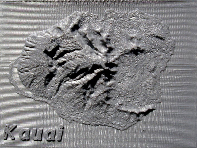
Kauai Relief Maps by pmoews
by Thingiverse
Last crawled date: 3 years ago
Here are improved versions of relief maps for Kauai and Niihau. See thing:106099 for the earlier version. There is also a high resolution map of a portion of the north coast of Kauai.
The three maps are:
Kauai_step.stl 140 x 190 points at 12 arc second intervals
Niihau_step.stl 200 x 200 points at 6 arc second intervals
Kauai_coast.stl 175 x 175 points at 1 arc second intervals
Data for the first two maps came from NOAA
http://www.ngdc.noaa.gov/mgg/dem/demportal.html
Data for the high resolution map was from the USGS National Map.
http://viewer.nationalmap.gov/viewer/
The programs used were described in things 106099 and 116103.
Similar models
thingiverse
free

Pearl Harbor and Oahu by pmoews
...9.
pearl_harbor.stl is a relief map obtained by sampling the data set at 2 second intervals.
fortran source code is included.
thingiverse
free

Switzerland and Denmark Relief Maps by pmoews
...d to be easily visualized. one way to do so is to use the many kml files available at the site. kml files open in google earth.
thingiverse
free

Martinique and the Caribbees by pmoews
...columns of two byte signed integers. a fortran program similar to those in things 118327 and 121275 was used...
thingiverse
free

Galapagos and its Volcanos by pmoews
...were constructed from nasa's srtm3 data:http://dds.cr.usgs.gov/srtm/version2_1/ using a program similar to that described in thing:121275. stl files are: galapagos.stl...
thingiverse
free

More Hawaiian Relief Maps by pmoews
... 220 columns
kauai.stl ----------- 150 rows x 300 columns
the vertical scale is a little over 200 meters per mm.
thingiverse
free

Hawaii Relief Map by pmoews
...noaa has a portal that helps one find many similar data sets. see...
thingiverse
free

Relief Map of The Sutter Buttes by pmoews
...ta, and the openscad program that calculated the relief map, are included. "aster gedem is a product of meti and nasa"
thingiverse
free

San Francisco Relief Map by pmoews
...ce code is provided. although the data file can be obtained from the noaa web site a zipped version is included for convenience.
thingiverse
free

Alcatraz - Telegraph Hill Maps by pmoews
...e that outputs openscad code is included. when the openscad code is executed a relief map containing telegraph hill is produced.
thingiverse
free

Mount Jefferson - Oregon by tpsully
...r creating files at 3 arcsecond resolution is available up on github under the gnu license. go to github and search for srtm2stl.
Kauai
thingiverse
free

Kauai by cepeza
...kauai by cepeza
thingiverse
kauai
sketchfab
$12

Kauai Mountains
... in realitycapture by capturing reality from 492 images in 01h:01m:35s. - kauai mountains - buy royalty free 3d model by wyattroy
thingiverse
free

Kauai Bowl with Fish by pmoews
...bowls are:a galapagos bowl - thing:127868 and a crimea bowl thing:261630. the stl files were assembled in stages using openscad.
thingiverse
free

Kauai Topographical Map by Sleepingmarmot
... striation.
this is also printed about as small as i'd go 115mm on the longest side, it would probably do great much larger.
thingiverse
free

Coffee Scoop - Minimalist - 1oz by
...scoop. inspiration from design found in retail store in kauai hi. reverse engineered design by kadooka. other products designed...
thingiverse
free

Conference Table Holder for Markers by CrLz
...this is intended as a conversation piece at the kauai makerspace ic@kcc conference room. small holes are well sized...
cg_trader
$10

TIDELLI - 7315 - Kauai Bar Stool
...tidelli - 7315 - kauai bar stool
cg trader
produto 7315 - kauai bar stool
tipo de produto bar stool
coleções kauai
cg_trader
$10

TIDELLI - 7320 - Namoradeira Kauai
...tidelli - 7320 - namoradeira kauai
cg trader
produto 7320 - namoradeira
tipo de produto sofa
coleções kauai
cg_trader
$10

TIDELLI - 7307 - Cadeira Kauai
...tidelli - 7307 - cadeira kauai
cg trader
produto 7307 - cadeira
tipo de produto chair
coleções kauai
Pmoews
thingiverse
free

Pheasant by pmoews
...pheasant by pmoews
thingiverse
123d catch version of a ceramic pheasant. the stl file is at 40% scale.
thingiverse
free

A Pelican by pmoews
...s
thingiverse
a neighbor's pelican model. it was digitized with autodesk's recap photo. the stl file is scaled at 40%.
thingiverse
free

Walrus by pmoews
...ews
thingiverse
a thrift store walrus, gray, weights over a kilogram, maybe a garden ornament. a 123d-catch copy at half scale.
thingiverse
free
Five Gourds by pmoews
...five gourds by pmoews
thingiverse
here are five gourds suitable for a fall display. they were digitized with 123d catch.
thingiverse
free
Vase with Lid by pmoews
...vase with lid by pmoews
thingiverse
a neighbor wanted a copy of a favorite vase. here are half size versions as stl files.
thingiverse
free

Pineapple by pmoews
.... fairly accurate - prints well without support. for other stl files based on real pineapples see things 4560, 7228 and 438266.
thingiverse
free
Ceramic Swan by pmoews
...ceramic swan by pmoews
thingiverse
a thrift store ceramic swan without markings. the 123-d catch file is at half scale.
thingiverse
free
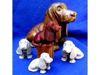
Basset Hound by pmoews
...basset hound by pmoews
thingiverse
an autodesk recap photo copy of a basset hound bought at an estate sale. about 4/10 scale.
thingiverse
free
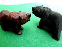
A Black Bear by pmoews
... by pmoews
thingiverse
a 123d catch version of a wood carving of a bear. a souvenir of new mexico. the stl file is full scale.
thingiverse
free

Model Fish - Trout by pmoews
...model fish - trout by pmoews
thingiverse
openscad "doddle". meant to be a rainbow trout.
Relief
3d_export
$20
relief
...relief
3dexport
relief
turbosquid
$1

Relief
...
turbosquid
royalty free 3d model relief for download as obj on turbosquid: 3d models for games, architecture, videos. (1438537)
3d_export
$15
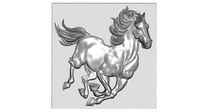
horse relief
...horse relief
3dexport
horse relief
3d_export
$10

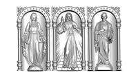
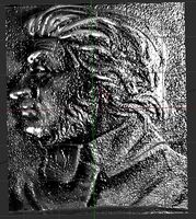
jesus relief
...jesus relief
3dexport
jesus relief
3d_export
$10

rome relief
...rome relief
3dexport
rome relief
3d_export
$10

fish relief
...fish relief
3dexport
fish relief
3d_export
$10

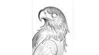
eagle relief
...eagle relief
3dexport
eagle relief
3d_export
$10
eagle relief
...eagle relief
3dexport
eagle relief
3d_export
free

3d relief
...3d relief
3dexport
3d relief
turbosquid
free
Relief
... available on turbo squid, the world's leading provider of digital 3d models for visualization, films, television, and games.
Maps
3d_ocean
$5

Map
...map
3docean
geography map ocean travel world world map
a world map
3d_ocean
$5

Old Map
...old map
3docean
dirty map ocean old map paper pirates rotten travel world map
an old map
turbosquid
$3

Map
... available on turbo squid, the world's leading provider of digital 3d models for visualization, films, television, and games.
3d_ocean
$3

Map of Iran
...map of iran
3docean
flag iran map outline
an outline map of iran
3d_ocean
$2

Map of the USA
...map of the usa
3docean
america flag globe map united states usa
an outline map of the usa
3ddd
$1

Abstract Maps
... город , picture
abstract maps by artist jazzberry blue
3d_ocean
$5

Honduras Map
...honduras map
3docean
3d cinema4d honduras map mapa
honduras map designed in cinema 4d r17
3d_ocean
$2

Map of Germany
...map of germany
3docean
black country europe germany gold map outline red yellow
a simple outline map of germany
3d_ocean
$2

Map of Australia
...map of australia
3docean
australia banner country down under earth flag globe map ocean south
an outline map of australia
3d_ocean
$2

Map of Russia
...of russia
3docean
asia banner earth europe flag globe map russia russian federation siberia sovjet union
an outline map of russia