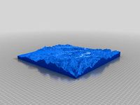
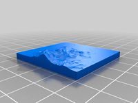
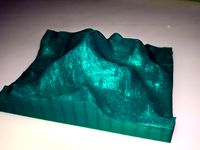
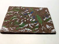
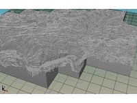
480 topographic 3d models found
Download or buy, then render or print from the shops or marketplaces.
3D Models below are suitable not only for printing but also for any
computer graphics like CG, VFX, Animation, or even CAD. You can print these 3d models on
your favorite 3d printer or render them with your preferred render engine.
Please note that the 3D model database is only a Search Engine. You should
visit the original websites. Most of the models can be easily imported and rendered
with Autodesk 3ds Max, Maya, Blender, C4D, and Sketchup. Check for online
3d model conversions tools for your file format.
Shown 2 of
4 pages
thingiverse
free

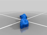
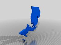
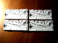
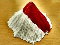
Rhode Island Topographical Map by NeatoBrian
... smallest state in the union!
check out the unofficial challenge group! - http://www.thingiverse.com/groups/unofficial-challenges
thingiverse
free
Topographic Continents by Windchill22
...king a better one. two files, one with a shorter base extension, and one with a larger base to match the rest of the continents.
thingiverse
free
Gift - Topographical 3D Model of Catskills Lodge Property by ferret7
...to a 20mm thick 3d model using artsoft-3d, magics rp was used to cleanup and cut out the property along the deeds boundary lines.
thingiverse
free
Park City Topographical Map by kevinbrice
...prints with or without label.v
resorts covered by this map:
snow bird
alta
clayton
solitude
canyons
iron mt
park city
deer valley
thingiverse
free
Topographical Terrain System by Gartherio
...as senmove kaj montras altecon! aldonu ofte forgesatan elementon al viaj ludoj. faru specialiĝi pri grimpado farinda. rimarkindu.
thingiverse
free

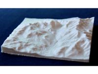
Topographical model of Southampton, UK by thowe
... of wight.
it was created using terrain2stl; a web-based service that converts publicly available hgt files to useful stl files
thingiverse
free

Topographical model of The Isle of Wight, UK by thowe
...d by x1.5.
it was created using terrain2stl; a web-based service that converts publicly available hgt files to useful stl files
thingiverse
free

Topographical model of Loch Lomond, Scotland by thowe
... the loch.
it was created using terrain2stl; a web-based service that converts publicly available hgt files to useful stl files
thingiverse
free

Boulder Topographic iPhone 6 Case by bmartinezrahoe
... design yourself:https://cad.onshape.com/documents/22bb571769eb6e82bd098ef7/w/973e3b7af9c6d94aaed76183/e/e37e85c271475d20c3ddb318
thingiverse
free

Golden Topographic iPhone 6,7,7Plus Case by bmartinezrahoe
... design yourself:https://cad.onshape.com/documents/53c8604f46c490feb794322a/w/a36f5313a8a7b8ef302fd1d9/e/e2d05ffea8eb4eeaf9adb950
thingiverse
free
Lake Nacimiento & San Antonio Topographic Map by partsoven
...b.com/thatcherc/terrain2stlhttp://jthatch.com/terrain2stl/
give this guy some btc love... ;)
1kxaawojyq57sphdvgmrmyiq9f9m5awkzv
thingiverse
free

Mount Tamalpais 3D Topographical Model by albill
...rce digital elevation data was grabbed from the usgs national map viewer.
this is my first attempt to make one of these models.
thingiverse
free

Rahwah Wilderness west branch trail topographical map by pwnstar89
...rimbleoutdoors.com/viewtrip/514812http://www.oriconline.org/what_to_do/trails_and_trips/backpacking_trips/cc-west_branch_loop.pdf
thingiverse
free
Topographical Heatmap of r/place by Physics_Dude
...epresent the most active pixel areas. a 16px gaussian blur was added before 3d extrusion. source heatmap was generated by /u/opl_
thingiverse
free

Topographic 3D Map - Danube Bend (Dunakanyar) by ignisVeneficus
...it with 0.05 layer height, and from every 10 layer 2 with different color (black), in this case every mm contains 2 contour line.
thingiverse
free
Fajardo 4 by luxoccano
...fajardo 4 by luxoccano thingiverse topographic ...
thingiverse
free
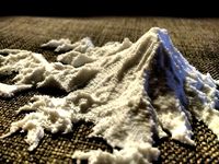
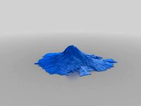
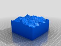
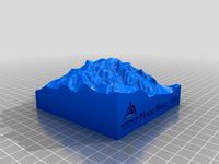
Mount Everest by Synergist
...mount everest by synergist thingiverse this is a 3d topographic map of mount everest generated from bing maps data...
thingiverse
free

Santa Barbara County Topographic Print by Xaxis
...le for those with bigger printers, because it would look great huge! white filament looks awesome if your not going to paint it.
thingiverse
free
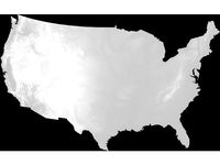
3D Topographic Maps of US States by nlorang
...,000 facets to enable easy slicing or cutting.
more details about how these files were generated is at https://imgur.com/a/fmy19.
thingiverse
free
Mallorca by deanoddg92
...mallorca by deanoddg92 thingiverse island of mallorca topographic ...
thingiverse
free

UK by blackwellj
...uk by blackwellj thingiverse topographic map of the...
thingiverse
free

Zelda II: The Adventure of Link NES Hyrule topographical map by videospacegames
...d game. only prints out one color and you can paint it if you'd like. i am not a good painter so i didn't do that. enjoy!
thingiverse
free

Keystone Topo by FionnMac74
...keystone topo by fionnmac74 thingiverse this is a topographicl map of...
thingiverse
free

Fajardo by luxoccano
...fajardo by luxoccano thingiverse testing the use of topographic ...
thingiverse
free

Boston map by adamskee
...boston map by adamskee thingiverse topographicl map of...
thingiverse
free

Longs Peak Relief (Topographical) map by hrabbot
...odel is sized to present the popular keyhole route approach, starting from the east and looping toward the summit from the north.
thingiverse
free
Fajardo 2 by luxoccano
...fajardo 2 by luxoccano thingiverse testing more topographic ...
thingiverse
free

Uluru by allan_1969
...uluru by allan_1969 thingiverse a topographicl model of uluru (ayers...
thingiverse
free

Eberron Globe by DragonWorkshop
...eberron globe by dragonworkshop thingiverse 3d topographicl globe of...
thingiverse
free

OR Map by mollyelismith
...or map by mollyelismith thingiverse oconee river segment topographic ...
thingiverse
free

Mt. Langley by ccondra
...mt. langley by ccondra thingiverse topographicl map of mt....
thingiverse
free

Hungary Topo 1000meter/pixel by lelehel
...hungary topo 1000meter/pixel by lelehel thingiverse topographic map of...
thingiverse
free
Michigan Map by LunaSoll
...michigan map by lunasoll thingiverse the full sized topographic map of...
blendswap
free
Topographical (contour lines) material for sculpting
...ed to be a tool for sculpting but renderings look really nice.)latest change on 2015/05/13, 21:17:09changed default preview image
thingiverse
free

Squamish Topo Map by Dann6968
...squamish topo map by dann6968 thingiverse topographicl map of squamish. work in...
thingiverse
free

Tennessee Height Map by Austin_Bradley230
...tennessee height map by austin_bradley230 thingiverse height/elevation/topographic map of...
thingiverse
free
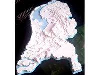
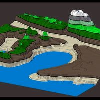
Netherlands Topographic 3D Map #MakerEdChallenge 2.0 by mitrasmit
...s to your printer bed. for more interesting calculations, check the comment section.
if you make one, please share your result!
thingiverse
free
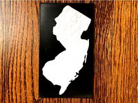
Topographic map of New Jersey by cmh
...equires really fiddling with all the settings. i wonder if blendr might have had better results but i haven't learned it yet.
thingiverse
free
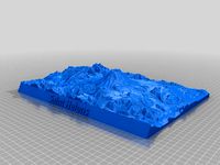
Mount Everest Topography by kevinbrice
...mount everest topography by kevinbrice thingiverse a topographicl map of mt everest and surrounding...
thingiverse
free

Vancouver - British Columbia - 3D Map - Topographic by ProteanMan
...nel/ucz64raasrj9v66rt3bdeo2w
check out my websitehttp://proteanman.com
follow me on twitterhttps://twitter.com/protean_man
enjoy!
thingiverse
free

Meteor Crater National Landmark Topology by andrew_vm
...national landmark topology by andrew_vm thingiverse this is a topographic model of the crater in winslow,...
thingiverse
free

Mt. Fuji by Mahaganr
...mt. fuji by mahaganr thingiverse topographic map of mt. fuji using...
thingiverse
free
United States Height Map by Austin_Bradley230
...united states height map by austin_bradley230 thingiverse height/elevation/topographic map of the united...
thingiverse
free
Sawtooth National Forest
...sawtooth national forest thingiverse topographic map of sawtooth national forest, idaho, stanley, redfish...
thingiverse
free
Lake Tahoe 3D puzzle by CarterArris
...thingiverse a 3d puzzle of lake tahoe from a topographicl ...
thingiverse
free

Organ Mountains Toothpaste Squeezer by NightSnake
...by nightsnake thingiverse organ mountains toothpaste squeezer, useful and topographiclly ...
thingiverse
free
Bassin de Thau by Kalou
...bassin de thau by kalou thingiverse topographic rendering from srtm (shuttle radar topography...
thingiverse
free

Machu Picchu, Peru Topology by CassiaRose
...machu picchu, peru topology by cassiarose thingiverse a topographicl .stl of machu picchu, peru and a bit of...
thingiverse
free

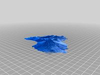
Grand Canyon by Synergist
...canyon by synergist thingiverse i created this in the topographic app for windows from bing maps elevation...
thingiverse
free

Massanutten Map by 3D_Education
...this is our first attempt at printing off a topographicl map of the massanutten region in mcgaheysville,...
thingiverse
free

Tepuys of the Gran Sabana, Venezuela by gluetolf
...of the gran sabana, venezuela by gluetolf thingiverse 3d topographic map created using dhm data from...
thingiverse
free
Topography- Hogbacks, Garfield County- Colorado by JayJo
...county- colorado by jayjo thingiverse usgs data converted to topographic map elevation height...
thingiverse
free

Rough Sketch of Ghosts of Saltmarsh Landmass by red-triangle
...saltmarsh landmass by red-triangle thingiverse a quick and dirty topographic map of ghosts of saltmarsh. nothing...
thingiverse
free
Theodolite by Mathteacher
...theodolite by mathteacher thingiverse practice topographicl survey with your students. use law of cosines outside...
thingiverse
free
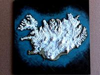
Iceland by conorokane
...iceland by conorokane thingiverse iceland topographic model, created from heightmap data. printed in pla at...
cgriver
$136

SplineLand
...do it quickly, in just a few clicks your topographicl data in form of splines can become a...
thingiverse
free

Map of Bergen by AndreyBezrukov
...map of bergen by andreybezrukov thingiverse topographicl map of bergen, norway. that web page helped me...
thingiverse
free

Holden Village by joshsamuelson
...valley in washington state. this is based on the topographic maps of the area from the usgs...
thingiverse
free

Motatapu MTB ride by GSV_NFA
...motatapu mtb ride by gsv_nfa thingiverse topographicl relief map of area between wanaka / glendhu bay...
thingiverse
free

Continental United States Topography by Tree_House_Fire
...continental united states topography by tree_house_fire thingiverse 1000ft contour topographic 3d model of the continental united states. z values...
thingiverse
free

Handy Soap Dish by Rachella001
...rachella001 thingiverse this is a soap dish inspired by topographicl lines of the earth. it is the perfect little...
thingiverse
free
Mount Everest by Tree_House_Fire
...mount everest by tree_house_fire thingiverse 100ft contour topographic 3d model of mount everest. represents elevations above 20000ft....
thingiverse
free

Mount Fuji by Tree_House_Fire
...mount fuji by tree_house_fire thingiverse 100ft contour topographic 3d model of mount fuji. represents elevations above 5000ft....
thingiverse
free
Mount Rainier by Tree_House_Fire
...mount rainier by tree_house_fire thingiverse 100ft contour topographic 3d model of mount rainier. represents elevations above 5000ft....
thingiverse
free
Mount Adams by Tree_House_Fire
...mount adams by tree_house_fire thingiverse 100ft contour topographic 3d model of mount adams. represents elevations above 5000ft....
thingiverse
free

Mount Baker by Tree_House_Fire
...mount baker by tree_house_fire thingiverse 100ft contour topographic 3d model of mount baker. represents elevations above 5000ft....
thingiverse
free

Mount Hood by Tree_House_Fire
...mount hood by tree_house_fire thingiverse 100ft contour topographic 3d model of mount hood. represents elevations above 5000ft....
thingiverse
free
Mount Shasta by Tree_House_Fire
...mount shasta by tree_house_fire thingiverse 100ft contour topographic 3d model of mount shasta. represents elevations above 5000ft....
thingiverse
free
Mt. Everest from SRTM data by bld
...everest generated from shuttle radar topography mission (srtm) 90m topographic data. this fulfills a long overdue promise (see http://www.thingiverse.com/thing:8763)...
thingiverse
free

Mount Everest by iteration2
...mount everest by iteration2 thingiverse topographicl map of mount everest, using data from the nasa...
thingiverse
free

Olympus Mons by tchau188
...of the moon of mars. this was created using topographic maps in order to capture accurate...
thingiverse
free

Mt Timp (Timpanogos) by Tree_House_Fire
...mt timp (timpanogos) by tree_house_fire thingiverse 100ft contour topographic 3d model of mt timp (timpanogos). represents elevations above...
thingiverse
free

3D Topo: South Dakota by thebert
...3d topo: south dakota by thebert thingiverse topographic map of south dakota. z axis stretched a little...
thingiverse
free

Denali (Mount McKinley) by Tree_House_Fire
...denali (mount mckinley) by tree_house_fire thingiverse 100ft contour topographic 3d model of denali (mount mckinley). represents elevations above...
thingiverse
free

Frenchman Mountain (Las Vegas, NV) by mWagner84
...las vegas, nv. it was made from high resolution topographicl scans of the area and google topography...
thingiverse
free

Taiwan Island (台灣地形鑰匙圈) by ardylai
...island (台灣地形鑰匙圈) by ardylai thingiverse 台灣地形鑰匙圈 3d taiwan island topographic ...
thingiverse
free

Paint Brush Holder - Wave _ Topo Pattern by mdwyn85
...mdwyn85 thingiverse this is a free flowing wave and/or topographic type pattern with multiple sized holes to hold your...
thingiverse
free

Grand Teton by Jcoltrane
...grand teton by jcoltrane thingiverse this is a 3d topographicl map of the grand teton and the surrounding peaks...
thingiverse
free

3D Topo: Minnesota by thebert
...3d topo: minnesota by thebert thingiverse 3d topographic map/model of minnesota. (some exaggeration of z axis) check...
thingiverse
free

Hollywood Hills Relief Map by 32Studios
...the hollywood hills and the famous sign. we took topographicl data from google maps to create this 3d printed...
thingiverse
free

Sarcophagus02 by cerberus333
...dissatisafaction with my earlier model's face looking like a topographic map. i also wanted this to be a bit...
thingiverse
free

Crater Lake by Tree_House_Fire
...crater lake by tree_house_fire thingiverse 100ft contour topographic 3d model of crater lake, oregon. lake and topography/bathymetry...
thingiverse
free

Sample Moon Texture by tchau188
...sample moon texture by tchau188 thingiverse i used a topographic map to generate a 3d model of a section...
thingiverse
free
Mount St Helens - Before and After by Tree_House_Fire
...- before and after by tree_house_fire thingiverse 100ft contour topographic 3d model of mount st helens. peak part represents...
thingiverse
free
Franconia Notch by Physwiz
...in the new hampshire white mountains. created with usgs topographic data. includes mts. lafayette, liberty, flume, cannon, north and...
thingiverse
free

NYC Elevation Map by kylemcdonald
...nyc elevation map by kylemcdonald thingiverse a topographicl map of nyc based on the 1/3 arc second...
thingiverse
free

Bolaven Plateau (Lao PDR / Laos) Topography by MTORO003
...additional details on this project can be found at: https://matthewtoro.com/2016/09/08/topographic3d-printing-the-bolaven-plateau-laos/ ...
thingiverse
free

Landscape: Jendemsfjellet in Norway by ogelybogely
...and post a "make". thanks :) this is a topographicl stl of the jendemsfjellet mountain in norway, the most...
thingiverse
free

Oso, WA Landslide by Tree_House_Fire
...oso, wa landslide by tree_house_fire thingiverse 5ft contour topographic 3d model of oso, washington landslide which occurred march...
thingiverse
free

Cascade Peaks by Tree_House_Fire
...cascade peaks by tree_house_fire thingiverse 100ft contour topographic 3d model of mount rainier, mount adams, mount hood,...
thingiverse
free

Lake Coeur d'Alene by TheShnozer
...lake coeur d'alene by theshnozer thingiverse a 3d topographic map of lake coeur d'alene made up for father's...
thingiverse
free

Canyon topography 2.... by hpucismjrbb85
...how to create a flat base surface of a topographicl region after extruding it out in blender so that...
thingiverse
free
Gavins File Holder by FowlerInnovations
...my desk organized. inspiration was contour lines on a topographic graphic map. max dimensions are 4"w x 6"l x...
thingiverse
free

El Huascarán (Highest peak in Peru) by dafairlie
...peak in peru) by dafairlie thingiverse this is a topographicl replica of peru's highest mountain, el huascarán, at 6746...
thingiverse
free
CA San Andreas map by jaqtikkun
...would love to see a remix that actually includes topographicl ...
thingiverse
free

United States Height Map Puzzle by Austin_Bradley230
...united states height map puzzle by austin_bradley230 thingiverse height/topographic map puzzle of the united states. eventually i will...
thingiverse
free

Sequoia Tube by yeahsharvin
...kiln. the texture on the outside is actually a topographic map of sequoia national park. i edited the file...
thingiverse
free

3D N&Arrow Compass 2Color for Single Extruder Printers by ruicosta3silva
...simple 3d 2color compass to add to architecture models, topographic models, etc... n and arrow are both 5mm height,...
thingiverse
free
Mont Blanc 10km by MadisonMtng
...level and is ranked 11th in the world in topographic prominence. 1:100,000...
thingiverse
free

Boulder County by xylo04
...boulder county by xylo04 thingiverse a topographicl model of boulder county, colorado, usa generated with http://jthatch.com/terrain2stl/...
thingiverse
free

Middle Earth Topography Map
...middle earth topography map thingiverse this is a topographicl map of tolkien's middle earth. the map represents a...
thingiverse
free

Royal Basin - Royal Lake Topo map by seth0941
...lake topo map by seth0941 thingiverse this is a topographicl map of royal basin - royal lake trail. i...
thingiverse
free

Desktop Mountain - Denali by 3DCentralVA
...the old saying goes! generated using "open street maps" topographicl data don't have a printer? head on over to...
thingiverse
free

Watzmann by mafrmt00
...watzmann by mafrmt00 thingiverse this topographicl relief shows the watzmann. the watzmann (austro-bavarian: watzmo) is...
thingiverse
free
Mount St Helens by Nscale_toni
...mount st helens by nscale_toni thingiverse this is a topographic terrain map of mount saint helens created with "terrain2stl"...
thingiverse
free

Inverted Riverbed in Gale Crater, Mars by conorokane
...the mound with an inverted fluvial or river channel. topographic inversion occurs when sediments are cemented together, forming a...
thingiverse
free
Chicago Marathon Magnet
...chicago marathon magnet thingiverse topographicl map for the chicago marathon. fun fact: there's not...
thingiverse
free
Caprock Canyon Topography by Drazen
...caprock canyon topography by drazen thingiverse this is a topographicl map of caprock canyon in the panhandle of texas....
sketchfab
$45

Plaza San Bartolomé scan Full raw scan
...plaza san bartolomé in logroño, la rioja. survey using topographic gps. coord. etrs89. - plaza san bartolomé scan full...
thingiverse
free
Bochum by Mardor
...bochum by mardor thingiverse this topographicl model of the city of bochum has been derived...
thingiverse
free

EcoHome Demo Model by BDan
...has a green roof covered in dirt, hence the topographicl relief lines, i think it looks awsome! printed in...
thingiverse
free

Mount Rainier Terrain
...the cascade range of the pacific northwest, the most topographiclly prominent mountain in the contiguous united states, and the...
thingiverse
free
Oregon Native American Tribes Map by PortlandPrints
...portlandprints thingiverse oregon native american tribes map this 19-piece topographicl map roughly shows where various native american tribes lived...
thingiverse
free
Sudbury, Ontario by mikebourgeault
...site (http://jthatch.com/terrain2stl/) that lets you create .stl files from topographicl map data. i wanted to create a 3d map...
thingiverse
free

Charleston SC 3D Peninsula and Harbor (LaserCut) by rantmakes
...i've wanted to do for a while, a 3d hypsographic/topographic representation of the charleston south carolina peninsula and harbor....
thingiverse
free

Seattle / Western Washington Topography by lmgreco
...seattle / western washington topography by lmgreco thingiverse semi-abstracted topographic map of the seattle / western washington area. gis...
thingiverse
free
Ayers Rock / Uluru by DocBiber
...the model everey 2,5m and so i got a topographicl model showing the heights. using the sandbox tool i...
thingiverse
free

Slide Puzzle 3x3 by xzw
...fix that! i'll design another one soon with a topographic map on top. included .f3d file in case you...
thingiverse
free

Ukraine topography by Semargl
...ukraine topography by semargl thingiverse this is a topographic map of the ukraine. it was created using europe...
thingiverse
free

Hawaii (Big Island) by sitts314
...(big island) by sitts314 thingiverse this is a 3d topographicl map of the big island of hawaii. print with...