Thingiverse

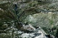
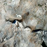
Yosemite's Glacier Point featuring the 4-Mile trail and the Ledge Trail by Shapespeare
by Thingiverse
Last crawled date: 3 years ago
This is a 3d topo map of Yosemite's Glacier Point showing two of the trails which connect Glacier Point to the valley floor. The 4-mile trail is a steep and strenuous hike. The Ledge trail is an insane scramble over dangerous steep terrain, so dangerous that the trail was officially closed years ago following a number of fatalities. You can still climb it (people climb far sillier rocks in Yosemite) but don't say you weren't warned.
This model may not be used as a navigation aid and the accuracy of the routes shown is not guaranteed. The model was made using Lidar data from http://opentopo.sdsc.edu/ which was collected to study rockfall. Keep that in mind if you are considering the Ledge route.
Here is my video tutorial showing how to make 3d prints from Lidar https://www.youtube.com/watch?v=t4-ICkvyJv0
Similar models
thingiverse
free

Yosemite's Glacier Point Ski Trail by Shapespeare
...3d printing today podcast available on itunes, stitcher radio or direct from the source at http://threedprintingtoday.libsyn.com/
thingiverse
free

Yosemite's Royal Arch Route 3d topo by Shapespeare
...ry not to think about that as you climb the cliff.
you can see my tutorial video at https://www.youtube.com/watch?v=t4-ickvyjv0
thingiverse
free

Yosemite's Snow Creek Trail by Shapespeare
...to study nitrogen export and made available on http://opentopo.sdsc.edu/. the lidar point cloud was gridded to a 0.5m resolution.
thingiverse
free

Yosemite's 4 mile trail switchbacks 3d topo by Shapespeare
...libsyn.com/
the technique for making these models is detailed in my youtube video https://www.youtube.com/watch?v=t4-ickvyjv0.
thingiverse
free

Yosemite Valley's Cathedral Rocks by Shapespeare
...3d printing today podcast available on itunes, stitcher radio or direct from the source at http://threedprintingtoday.libsyn.com/
thingiverse
free

Yosemite's Mist Trail 3d map by Shapespeare
...lected as part of a study of rockfall in yosemite.
you can see my tutorial video at https://www.youtube.com/watch?v=t4-ickvyjv0
thingiverse
free

Yosemite's Lembert Dome by Shapespeare
...taset made available on http://opentopo.sdsc.edu/.
you can see my tutorial video at https://www.youtube.com/watch?v=t4-ickvyjv0
thingiverse
free

Yosemite Valley's Cathedral Spires 3dTopo by Shapespeare
...3d printing today podcast available on itunes, stitcher radio or direct from the source at http://threedprintingtoday.libsyn.com/
thingiverse
free

Yosemite's Echo Peaks by Shapespeare
...and made available on http://opentopo.sdsc.edu/.
you can watch my tutorial video at https://www.youtube.com/watch?v=t4-ickvyjv0
thingiverse
free

Yosemite's Cathedral Peak Southeast Buttress by Shapespeare
...3d printing today podcast available on itunes, stitcher radio or direct from the source at http://threedprintingtoday.libsyn.com/
Yosemite
3ddd
$1
Yosemite Acacia Nightstand
...cacia , тумба
yosemite acacia nightstand.модель в трех форматах.карты и рендер в архиве.
3ddd
$1

Yosemite Iron Diamond Mirror
...yosemite iron diamond mirror
3ddd
yosemite , diamond
yosemite iron diamond mirror
3ddd
free

Yosemite Bedding Collection
...ное бельё , croscill
постельное бельё yosemite фирмы croscill
размер матраса 160x200 см.
3d_ocean
$25
Yosemite National Park
... river shew spectacular terrain yosemite
very high detailed higypoly part from the yosemite national park with 8192*8192 texture.
3d_export
$15

Yosemite Sam 3D Model
... model
3dexport
yosemite sam toon cartoon loony toons kid caracter high poly cute gun
yosemite sam 3d model buncic 76332 3dexport
turbosquid
$4
Triple Divide Peak - Yosemite
...ee 3d model triple divide peak - yosemite for download as fbx on turbosquid: 3d models for games, architecture, videos. (1341729)
turbosquid
$10

Buena Vista Lake Yosemite
...d model buena vista lake yosemite for download as obj and fbx on turbosquid: 3d models for games, architecture, videos. (1214984)
thingiverse
free

Yosemite
...aker 2+.
for more information on documentation, visit my school blog: http://3dprinting.illustratingmath.com/2019/09/25/yosemite/
thingiverse
free

Yosemite Valley by cepeza
...yosemite valley by cepeza
thingiverse
yosemite valley
3d_sky
$8

Yosemite Acacia Nightstand
...acia nightstand
3dsky
yosemite acacia nightstand
yosemite acacia nightstand.model three formatah.karty and render in the archive.
Shapespeare
thingiverse
free
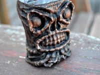
Tikithulu by Shapespeare
...sed coconut shrimp.
eldritch pu pu platters.
the mad strumming of infernal ukuleles.
dead cthulhulu orders another maitai.
thingiverse
free

Crater Lake 3dtopo by Shapespeare
...on how to make models from digital elevation data can be found on my blog at
http://www.the3dprintedfuture.com/shapespeare/?p=1
thingiverse
free

Kilimanjaro by Shapespeare
...he "collectible mountain" version which includes the bast down to sea level see http://www.thingiverse.com/thing:239792
thingiverse
free

Alexander the Printable by Shapespeare
...w.thingiverse.com/thing:239407 and added a base to make it printable with an extruder bot. pretty amazing for a cell phone scan!
thingiverse
free

Pig Skull Sense3d scan by Shapespeare
...by shapespeare
thingiverse
this is what was inside http://www.thingiverse.com/thing:224314 . the rest is headcheese yummmm. . .
thingiverse
free

Tuolumne Meadows to Mt Lyell 3d Topo by Shapespeare
...tuolumne meadows to mt lyell 3d topo by shapespeare
thingiverse
3d topo for zachary
thingiverse
free

Kirkwood lift map by Shapespeare
...wood ski area showing all the lifts in contrasting color. there is a single color version for you single extruder folks as well.
thingiverse
free
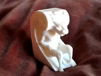
Biltmore Gargoyle by Shapespeare
...florida. he kind of reminds me of harry potter's house elf dobby.
it isn't often you can get that close to a gargoyle.
thingiverse
free

Monument Valley 3d map by Shapespeare
...s on how to make models from digital elevation data can be found on my blog at http://www.the3dprintedfuture.com/shapespeare/?p=1
thingiverse
free

Cathedral range topo by Shapespeare
...on how to make models from digital elevation data can be found on my blog at
http://www.the3dprintedfuture.com/shapespeare/?p=1
Glacier
turbosquid
$110

Glacier
...
royalty free 3d model glacier for download as blend and obj on turbosquid: 3d models for games, architecture, videos. (1555606)
turbosquid
$15

Melting glacier
...id
royalty free 3d model melting glacier for download as max on turbosquid: 3d models for games, architecture, videos. (1239070)
turbosquid
$79

Glacier Rock
... available on turbo squid, the world's leading provider of digital 3d models for visualization, films, television, and games.
turbosquid
$5

Ice Glacier
... available on turbo squid, the world's leading provider of digital 3d models for visualization, films, television, and games.
3ddd
$1

Витрины "Glacier"
... архиве 4 витрины. фабрика "glacier". сайт: zavod-rbt.ru
маты настроены, текстуры прилагаются. без наполнения (декора).
turbosquid
$20

HTC 10 Glacier Silver
... available on turbo squid, the world's leading provider of digital 3d models for visualization, films, television, and games.
turbosquid
$19

Htc 10 Glacier Silver
... available on turbo squid, the world's leading provider of digital 3d models for visualization, films, television, and games.
turbosquid
$2

Philips Massiv Aqua Glacier
... available on turbo squid, the world's leading provider of digital 3d models for visualization, films, television, and games.
3d_export
$10

The Rettenbach glacier in Soelden Austria 3D Model
...rettenbach glacier in soelden austria 3d model
3dexport
the rettenbach glacier in soelden austria 3d model bu1266 78009 3dexport
turbosquid
$2

glacier express passenger panorama train
... glacier express passenger panorama train for download as obj on turbosquid: 3d models for games, architecture, videos. (1708056)
Ledge
design_connected
$11

Ledges
...ledges
designconnected
todd merrill ledges computer generated 3d model. designed by magakis, gary.
turbosquid
$8

Kohler Ledges Lavatory
... available on turbo squid, the world's leading provider of digital 3d models for visualization, films, television, and games.
turbosquid
$5

Shelf - Crown Ledge
... available on turbo squid, the world's leading provider of digital 3d models for visualization, films, television, and games.
turbosquid
$3

Grind Ledge - Skate Ramp
...edge - skate ramp for download as 3ds, obj, c4d, fbx, and dae on turbosquid: 3d models for games, architecture, videos. (1153546)
archive3d
free

Cornice 3D Model
...cornice 3d model archive3d cornice ledge cornice2 - 3d model for interior 3d...
archive3d
free

Cornice 3D Model
...cornice 3d model archive3d cornice ledge cornice - 3d model for interior 3d...
archive3d
free

Сornice 3D Model
...сornice 3d model archive3d cornice ledge molding ?ornice - 3d model for interior 3d...
archive3d
free

Cornice 3D Model
...cornice 3d model archive3d cornice ledge cornice finestra a - 3d model for interior 3d...
archibase_planet
free

Cornice
...cornice archibase planet cornice ledge so cornice - 3d model (*.gsm+*.3ds) for interior 3d...
archive3d
free

Cornice 3D Model
...cornice 3d model archive3d cornice ledge concrete construction cornice- 3d model for interior 3d...
Trail
3d_export
$10

trailing ivy
...trailing ivy
3dexport
trailing ivy
3d_export
$10
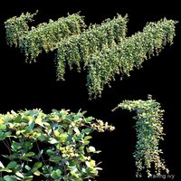
trailing ivy 2
...trailing ivy 2
3dexport
trailing ivy 2
3d_export
$10

trailing ivy 3
...trailing ivy 3
3dexport
set trailing ivy 3.
turbosquid
$10

trail 1
... available on turbo squid, the world's leading provider of digital 3d models for visualization, films, television, and games.
3d_export
$16

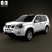
Nissan x-trail t32
...nissan x-trail t32
3dexport
nissan x-trail t32 for 3d printing
3d_export
$15
Marble trail 3D Model
...rt
marble trail bridge мрамор
marble trail 3d model download .c4d .max .obj .fbx .ma .lwo .3ds .3dm .stl trueline 109495 3dexport
3d_export
$65

tree-lined trail
...tree-lined trail
3dexport
simple rendering of the scene file
3d_export
$40

Nissan X-trail 3D Model
...nissan x-trail 3d model
3dexport
car x-trail nissan suv cars auto instaauto 2011
nissan x-trail 3d model llirik 101209 3dexport
3d_ocean
$3

Beach Sand with Bird Trails
... a beach for game development and 3d modelling art. 1 color and 1 bump file in png format, made from 100% original photo content.
3d_ocean
$89
Nissan X-Trail 2011
...y, in real units of measurement, qualitatively and maximally close to the original. model formats: - *.max (3ds max 2008 scanl...
Mile
design_connected
$13

Miles wall
...miles wall
designconnected
delightfull miles wall computer generated 3d model.
3ddd
$1

Настенный светильник - MILES
...ник miles от компании delightfull.
сайт производителя -http://www.delightfull.eu/en/heritage/wall/miles-hotel-lamp.php
turbosquid
$9

Miles Credenza
... available on turbo squid, the world's leading provider of digital 3d models for visualization, films, television, and games.
3ddd
$1

Lamp MILES DAVIS
...nish
ø60 x h.40-160 cmhttp://www.eichholtz.com/lamp-miles-davis-0084002887114.aspx
corona mat
3dsmax 2014 / obj / fbx
3ddd
$1

Delightfull - Miles Table light
...delightfull - miles table light
3ddd
delightful
delightfull - miles table light
turbosquid
$20

MIles Wittman Armchair
...rmchair for download as max, max, 3ds, dwg, dxf, fbx, and obj on turbosquid: 3d models for games, architecture, videos. (1650204)
3ddd
$1

Декоративная панель Miles & Lincoln
...декоративная панель miles & lincoln
3ddd
панель
декоративные панели miles & lincoln
turbosquid
$15

Miles No.2 & Ripples Box
...iles no.2 & ripples box for download as max, max, and obj on turbosquid: 3d models for games, architecture, videos. (1561272)
3ddd
free

Delightfull Miles Standing Lamp
...re
dimensions
h=177cm
d=65 cm
weight
aprox. 18,5 kghttp://www.delightfull.eu/en/heritage/floor/miles-standing-lamp.php
3ddd
free

MILES WHITE BRASS ARMOIRE
...miles white brass armoire
3ddd
шкаф из серии regency distribution
Point
3ddd
$1
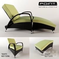
Point
...nt , садовая мебель
кресло tahiti ref. 72096 (74x95x93)
пуф tahiti ref. 72052 (54x71x46)
3ddd
free
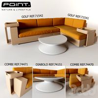
Point
...f. 71541 (220x100x83)
столики combi ref. 74470 (50x50x59) и ref. 74471 (50x50x79)
стол журнальный diabolo ref. 74151 (130x130x35)
3ddd
$1
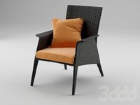
Point armchair
... ротанг
сайт производителяhttp://www.point1920.com/archivos/varios/point-feelings/
turbosquid
$21

Loft Point
...turbosquid
royalty free 3d model loft point for download as on turbosquid: 3d models for games, architecture, videos. (1446385)
turbosquid
$20

Point Of Sale
...id
royalty free 3d model point of sale for download as blend on turbosquid: 3d models for games, architecture, videos. (1661269)
turbosquid
$8
Sale Points
...y free 3d model sale points for download as 3ds, max, and obj on turbosquid: 3d models for games, architecture, videos. (1301072)
turbosquid
$3
Point Of Sale
...free 3d model point of sale for download as 3ds, max, and obj on turbosquid: 3d models for games, architecture, videos. (1301061)
turbosquid
$250

Crown Point
... available on turbo squid, the world's leading provider of digital 3d models for visualization, films, television, and games.
turbosquid
$25

Flash point
... available on turbo squid, the world's leading provider of digital 3d models for visualization, films, television, and games.
turbosquid
$22

Ball-Point
... available on turbo squid, the world's leading provider of digital 3d models for visualization, films, television, and games.
Featuring
turbosquid
$55

feature wall
... available on turbo squid, the world's leading provider of digital 3d models for visualization, films, television, and games.
turbosquid
$30

Water Feature
... available on turbo squid, the world's leading provider of digital 3d models for visualization, films, television, and games.
3ddd
$1
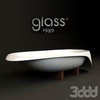
1989 GLASS-features
...1989 glass-features
3ddd
ванна
ванна с хвостом на деревянной ноге
turbosquid
$39

Animated Granite Water Feature
... available on turbo squid, the world's leading provider of digital 3d models for visualization, films, television, and games.
turbosquid
$15

Hyundai Feature Car Platform
... available on turbo squid, the world's leading provider of digital 3d models for visualization, films, television, and games.
turbosquid
$15

2 way feature fixture
... available on turbo squid, the world's leading provider of digital 3d models for visualization, films, television, and games.
turbosquid
$87
MALE HUMAN HEAD WITH ELONGATED FEATURE
... available on turbo squid, the world's leading provider of digital 3d models for visualization, films, television, and games.
3d_export
free
Download free Exterior Features 3D Model
...
exterior base factory
exterior features 3d model download free .c4d .max .obj .fbx .ma .lwo .3ds .3dm .stl f0x3z 107565 3dexport
turbosquid
$10

Modular 3D Feature Wall Panels. Cubes
...ure wall panels. cubes for download as 3ds, obj, fbx, and dae on turbosquid: 3d models for games, architecture, videos. (1194990)
3d_export
$19

Ponds lakes Lotus leaf park water features Lotus
...nds lakes lotus leaf park water features lotus
3dexport
1.ponds lakes lotus leaf park water features lotus 2.files include 3dmax
4
turbosquid
$9

Office Chair 4-4
... available on turbo squid, the world's leading provider of digital 3d models for visualization, films, television, and games.
3d_export
$5
doors- 4
...doors- 4
3dexport
doors 4
3d_export
$5
hinge 4
...hinge 4
3dexport
hinge 4
3ddd
$1

Штора №4
...штора №4
3ddd
штора №4
3d_export
free
playstation 4
...playstation 4
3dexport
playstation 4
turbosquid
$1
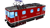
re 4-4 electric locomotive
... free 3d model re 4 4 electric locomotive for download as obj on turbosquid: 3d models for games, architecture, videos. (1707845)
3ddd
$1

nexus 4
...nexus 4
3ddd
lg , телефон
nexus 4
3ddd
$1
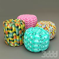
4 Poufs
...4 poufs
3ddd
пуф
4 soft poufs
turbosquid
$12

Calligraphic Digit 4 Number 4
...hic digit 4 number 4 for download as max, obj, fbx, and blend on turbosquid: 3d models for games, architecture, videos. (1389332)
3ddd
$1
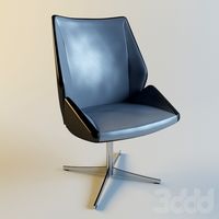
Dauphin 4+
...dauphin 4+
3ddd
кресло
dauphin 4+ конференц кресло