3dCadBrowser

Sacramento City
by 3dCadBrowser
Last crawled date: 7 years, 1 month ago
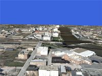
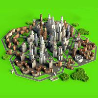
Sacramento City 3D Modelfor 3ds Max, Maya, Cinema 4D, Lightwave, Softimage, Blender and other 3D modeling and animation software.This 3D model in projected spatial NAD83 UTM zone 10N planar Cartesian metric coordinates centered on XY-plane with Z-axis points up. Centering on XY-plane is required for correct rendering to prevent z-buffer floating point precision inaccuracy for every camera angle, zoom and position.To get true North American Datum 1983 Universal Transverse Mercator Zone 10N SRID 26910 coordinate reference system based on the WGS84 datum for calculations, if needed, simply 2D transform every vertex X coordinate by 630858,739076939 and every vertex Y coordinate by 4270507,87974359.All vertices in 64-bit double-precision floating-point format with correct DEM for ground elevation data and with correct buildings heights and positions.Entire scene bounds (in GPS coordinates):Top-Left corner (-121,53076171875 / 38,5309788944002),Bottom-Right corner (-121,409912109375 / 38,6254539720908).0.3 meters per pixel ground textures resolution..OBJ is native file format for this 3D model.For any questions about this 3D model please contact me directly at andrewlock3d@gmail.com.Model includes: American River Parkway, Raley Field, Ziggurat Building, Downtown Plaza, Wells Fargo Center, Cesar Chavez Park, US Bank, California Epa Building, US Federal Courthouse, California Fruit Building, Elks Club Building, Cathedral of Blessed, Sheraton Grand, 1201 K Tower, Esquire Plaza, California State Capitol, Meridian Plaza 1, Capitol Park, South Side Park, Sity Cemetery, Capitol Square, Crocker Park, O`Neil Park, Renaissance Tower and more.This 3D object can be downloaded in .max, .obj, .3ds, .fbx, .dxf, .lwo, .stl, .wrl, .ma, .dae, .x and .asc file formats.
Similar models
3dcadbrowser
free
Rockford City
...mail.com.this 3d object can be downloaded in .max, .obj, .3ds, .fbx, .dxf, .lwo, .stl, .wrl, .ma, .dae, .x and .asc file formats.
3dcadbrowser
free

Baltimore City
...mail.com.this 3d object can be downloaded in .max, .obj, .3ds, .fbx, .dxf, .lwo, .stl, .wrl, .ma, .dae, .x and .asc file formats.
3dcadbrowser
free
Austin City
...mail.com.this 3d object can be downloaded in .max, .obj, .3ds, .fbx, .dxf, .lwo, .stl, .wrl, .ma, .dae, .x and .asc file formats.
3dcadbrowser
free

Niagara Falls City
...and more.this 3d object can be downloaded in .max, .obj, .3ds, .fbx, .dxf, .lwo, .stl, .wrl, .ma, .dae, .x and .asc file formats.
3dcadbrowser
free

Birmingham City
...and more.this 3d object can be downloaded in .max, .obj, .3ds, .fbx, .dxf, .lwo, .stl, .wrl, .ma, .dae, .x and .asc file formats.
3dcadbrowser
free

New York City Bronx
...mail.com.this 3d object can be downloaded in .max, .obj, .3ds, .fbx, .dxf, .lwo, .stl, .wrl, .ma, .dae, .x and .asc file formats.
3dcadbrowser
free
Newark International Airport
...mail.com.this 3d object can be downloaded in .max, .obj, .3ds, .fbx, .dxf, .lwo, .stl, .wrl, .ma, .dae, .x and .asc file formats.
3dcadbrowser
free

Ottawa City
...and more.this 3d object can be downloaded in .max, .obj, .3ds, .fbx, .dxf, .lwo, .stl, .wrl, .ma, .dae, .x and .asc file formats.
3dcadbrowser
free

San Diego City
...and more.this 3d object can be downloaded in .max, .obj, .3ds, .fbx, .dxf, .lwo, .stl, .wrl, .ma, .dae, .x and .asc file formats.
3dcadbrowser
free

Tallahassee City
...and more.this 3d object can be downloaded in .max, .obj, .3ds, .fbx, .dxf, .lwo, .stl, .wrl, .ma, .dae, .x and .asc file formats.
Sacramento
turbosquid
$4

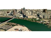
Sacramento
... available on turbo squid, the world's leading provider of digital 3d models for visualization, films, television, and games.
3ddd
$1

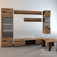
Диван "SACRAMENTO".
...водитель: hasta.
коллекция: life.
модель: sacramento.
стек модификаторов не свернут.
архив содержит файлы под 3ds max 2010/2011.
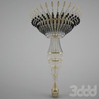
3ddd
$1

светильник Globo "sacramento"
...ильник австрийской компании globo lighting
серия "sacramento" выполнен в 3-х цветах
артикул и размеры указаны на превью
3d_export
$199

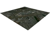
sacramento city california usa 100km
...der ready. 1. suitable for games, games, education, architecture etc. 2. mainly used for town and urban planning, real estate etc
3ddd
$1

Сакраменто Dream Land
...сакраменто dream land 3ddd dream land , dreamland , sacramento , капитоне , россия , сакраменто кровать сакраменто (фабрика...
archive3d
free

Bed 3D Model
...archive3d bed double bed bedroom furniture bed dream land sacramento n260113 - 3d model (*.3ds) for interior 3d...
3d_sky
free

Sacramento Dream Land
...sacramento dream land
3dsky
kapitone russia
sacramento bed (dream factory land, russia)
3dlancer
free

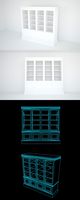
3D Model Chest Of Sacramento
...3d model chest of sacramento
3dlancer
3d model chest of sacramento download
description:
3dlancer
free

3D Model Mirror Of Sacramento
...3d model mirror of sacramento
3dlancer
3d model mirror of sacramento download
description:
3dlancer
free

3D Model Night Sacramento
...3d model night sacramento
3dlancer
3d model night sacramento download
description:
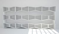
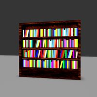
Library
3d_ocean
$5
Library
...library
3docean
book book case library
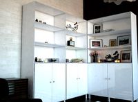
library
3d_export
$6

library
...library
3dexport
a ready-made model of a library for use in peru
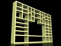
3d_ocean
$5
Library
...library
3docean
book books furniture home home design interior library
home design…
turbosquid
$15
library
...turbosquid
royalty free 3d model library for download as max on turbosquid: 3d models for games, architecture, videos. (1351741)
turbosquid
$9
Library
...turbosquid
royalty free 3d model library for download as max on turbosquid: 3d models for games, architecture, videos. (1433110)
turbosquid
$7

Library
...turbosquid
royalty free 3d model library for download as max on turbosquid: 3d models for games, architecture, videos. (1363568)
turbosquid
$5
Library
...turbosquid
royalty free 3d model library for download as max on turbosquid: 3d models for games, architecture, videos. (1309343)
3ddd
$1
classic library
...classic library
3ddd
library
classic library
3dsmax 2008 vray
3d_export
$10
Library
...library
3dexport
3d_export
free
library
...library
3dexport
City
3d_export
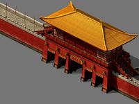
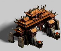
$18
imperial city-city gate-city wall 782
...imperial city-city gate-city wall 782
3dexport
imperial city-city gate-city wall 782<br>3ds max 2015
3d_export
$18
imperial city-city gate-city wall 785
...imperial city-city gate-city wall 785
3dexport
imperial city-city gate-city wall 785<br>3ds max 2015
3d_export
$40
city
...city
3dexport
a city with non-standard architecture.
design_connected
$9
City
...city
designconnected
emmemobili city dining tables computer generated 3d model. designed by ferruccio laviani.
3ddd
$1
Диван City
...диван city
3ddd
city , softline
диван city (фирма softline)
3ddd
$1
Гостиная CITY
...гостиная city
3ddd
city , дятьково
гостиная city производства дятьково
3d_export
$18
imperial city-shabak-city wall
...imperial city-shabak-city wall
3dexport
imperial city-shabak-city wall<br>3ds max 2015
3d_export
$18
imperial city-shabak-city gate
...imperial city-shabak-city gate
3dexport
imperial city-shabak-city gate<br>3ds max 2015
turbosquid
$300

City
...ty
turbosquid
royalty free 3d model city for download as 3ds on turbosquid: 3d models for games, architecture, videos. (1235306)
turbosquid
$249

city
...ity
turbosquid
royalty free 3d model city for download as ma on turbosquid: 3d models for games, architecture, videos. (1340610)
Objects
3d_export
$40
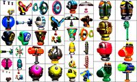
cartoon - objects
...cartoon - objects
3dexport
cartoon - objects<br>cartoon objects dae fbx cg lowpoly collection pack 3d 3dmodel object
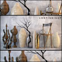
3ddd
free
decorative objects
...decorative objects
3ddd
decorative objects can be used for corners
3ddd
$1
Interior Objects
...interior objects
3ddd
interior objects,i make most of the design. voila..!
3ddd
$1
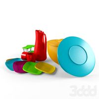
Plastic Objects
...ner , пластик
plastic, objects, kitchen, jar, dish, cup, bowl, pitcher, plate, container
turbosquid
$5
WC object
...rbosquid
royalty free 3d model wc object for download as c4d on turbosquid: 3d models for games, architecture, videos. (1554177)
turbosquid
$2

Bathroom objects
...
royalty free 3d model bathroom objects for download as blend on turbosquid: 3d models for games, architecture, videos. (1224432)
3d_export
$20

table with objects
...table with objects
3dexport
turbosquid
$10

Bull Object
...y free 3d model bull object for download as max, fbx, and obj on turbosquid: 3d models for games, architecture, videos. (1699706)
turbosquid
$5

Ritual Objects
...free 3d model ritual objects for download as ma, fbx, and obj on turbosquid: 3d models for games, architecture, videos. (1611233)
archive3d
free
Objective 3D Model
...-glass objective lens
objective n120508 - 3d model (*.gsm+*.3ds) for interior 3d visualization.
Cad
turbosquid
$20

cad lab
... available on turbo squid, the world's leading provider of digital 3d models for visualization, films, television, and games.
cg_studio
$36

Cad Classroom3d model
...cad classroom3d model
cgstudio
.max - cad classroom 3d model, royalty free license available, instant download after purchase.
turbosquid
$25

3D CAD Ring
...osquid
royalty free 3d model 3d cad ring for download as 3dm on turbosquid: 3d models for games, architecture, videos. (1221561)
turbosquid
$20

3D CAD Earrings
...id
royalty free 3d model 3d cad earrings for download as 3dm on turbosquid: 3d models for games, architecture, videos. (1221571)
turbosquid
$20

3D CAD Ring
...osquid
royalty free 3d model 3d cad ring for download as 3dm on turbosquid: 3d models for games, architecture, videos. (1221564)
turbosquid
$15

3D CAD Earrings
...id
royalty free 3d model 3d cad earrings for download as 3dm on turbosquid: 3d models for games, architecture, videos. (1221577)
turbosquid
$15

3D CAD RINGS
...squid
royalty free 3d model 3d cad rings for download as 3dm on turbosquid: 3d models for games, architecture, videos. (1221568)
turbosquid
$12

3D CAD Ring
...osquid
royalty free 3d model 3d cad ring for download as 3dm on turbosquid: 3d models for games, architecture, videos. (1221559)
turbosquid
$10

3D CAD Ring
...osquid
royalty free 3d model 3d cad ring for download as 3dm on turbosquid: 3d models for games, architecture, videos. (1221585)
turbosquid
$10

3D CAD Ring
...osquid
royalty free 3d model 3d cad ring for download as 3dm on turbosquid: 3d models for games, architecture, videos. (1221579)
Download
turbosquid
$2

Download Icon
... available on turbo squid, the world's leading provider of digital 3d models for visualization, films, television, and games.
3d_export
$10
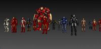
iron man download
...iron man download
3dexport
iron man 3d model download
3d_export
free

man download in the fbx
...ublish a man 3d model in the fbx format this model was provided by website in free type . download and enjoy this man 3d model
turbosquid
free

Home Model Free Download
...d
free 3d model home model free download for download as max on turbosquid: 3d models for games, architecture, videos. (1271205)
turbosquid
free

Building Model Free Download
...ree 3d model building model free download for download as max on turbosquid: 3d models for games, architecture, videos. (1271192)
turbosquid
free

Villa Home Free Download
...d
free 3d model villa home free download for download as max on turbosquid: 3d models for games, architecture, videos. (1271166)
3d_export
$10

original new goldfish download goldfish sculpture 3d drawing download
...g machine carving drawing design, digital art sculpture small goldfish, gold, silver and copper jewelry casting small fish model.
3d_export
$10

female body art model download 3d large chest female model download
...t female upper body model download sculpture model, female body basic model material download downloadable stl format, obj format
3d_export
$15
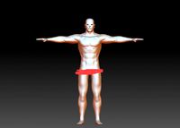
3d man body model download
...nload
3dexport
3d man body model download, man body basic model download, normal muscle man posture model, stl manikin download.
3d_export
$5

scale ball stl format download
... format download
3dexport
scale ball stl format download, 3d dragon scale ball download, wood carving machine string bead design
Free
design_connected
$13

Free
...free
designconnected
parri design free armchairs computer generated 3d model. designed by marco maran.
turbosquid
$5
free
... available on turbo squid, the world's leading provider of digital 3d models for visualization, films, television, and games.
turbosquid
$5

Free
... available on turbo squid, the world's leading provider of digital 3d models for visualization, films, television, and games.
turbosquid
free
Free
... available on turbo squid, the world's leading provider of digital 3d models for visualization, films, television, and games.
design_connected
free
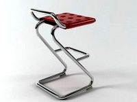
Free barstool
...free barstool
designconnected
free 3d model of free barstool by kristalia designed by graffeo, monica.
3d_export
$5
free mixamo
...free mixamo
3dexport
free mixamo
3d_export
free

free rocks
...free rocks
3dexport
free price rock
turbosquid
free

Free Free Standing Punching Bag
... available on turbo squid, the world's leading provider of digital 3d models for visualization, films, television, and games.
turbosquid
free
character free
...urbosquid
free 3d model character free for download as blend on turbosquid: 3d models for games, architecture, videos. (1321193)
turbosquid
free
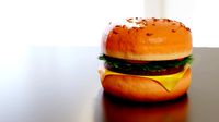
Hamburger Free
...urbosquid
free 3d model hamburger free for download as blend on turbosquid: 3d models for games, architecture, videos. (1592262)