3DWarehouse

Peace River Railway Bridge
by 3DWarehouse
Last crawled date: 1 year, 7 months ago
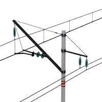
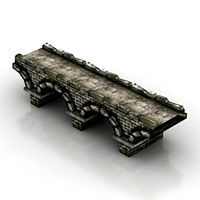
Completed in 1918 by the Canadian Bridge Company, this Truss-type bridge continues to be used to this day. Originally intended only for rail traffic it was modified to carry road traffic which lasted until a separate road bridge was built in 1968. It is still in use as a railway bridge, being a vital link in a line running to Hay River on the south shore of Great Slave Lake in the Northwest Territories. The structure from east to west consists of 9 spans; 1 deck plate girder, 3 deck trusses, 1 through truss (for navigation clearance when built), 3 deck trusses and 1 deck plate girder. The Central Canada Railway (CCR) was incorporated by the Alberta Legislature in 1913.1 It had authority to build a railway from a point in Townships 74 or 75, ranges 18 or 19, West of the 5th Meridian in the vicinity of Aggie or Kenzie to Peace River Landing. From Peace River Landing the railway could proceed westerly to Townships 81, Range 4, West of the 6th Meridian, which is the Waterhold district directly north of Dunvegan. The charter also provided for a branch from Peace River Landing northerly to Township 94, Range 22, West of the 5th Meridian on the Battle River. Battle River is now known as the NotiKewan River but the agricultural district retained the Battle River name. It has a total length of 529.1 m (approx. 1736 feet). http://www.peaceriverchamber.com/history_of_peace_river.html http://peacerivermuseum.blogspot.com/search/label/Transportation #bridge #Canada #Peace_River #rail #railway #span #Truss
Similar models
3dwarehouse
free

East Pine River Rail Bridge
...ww.youtube.com/watch?v=fk1sml_pnd8 #bridge #british_columbia #creek #dawson #girter #pier #pine_river #rail #railway #span #truss
3dwarehouse
free

Alexandra Bridge, Ottawa
...ct #gatineau #jai #long #ontario #ottawa #quebec #railway #river #road #span #steel #street #structure #traffic #transport #truss
3dwarehouse
free

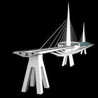
Oresundsbron part 1
... #bridge #copenhagen #danmark #denmark #fluke #flukeworld #köpenhamn #malmoe #malmö #skåne #sverige #sweden #tony #wiren #öresund
3dwarehouse
free

Oresundsbron part 2
... #bridge #copenhagen #danmark #denmark #fluke #flukeworld #köpenhamn #malmoe #malmö #skåne #sverige #sweden #tony #wiren #öresund
3dwarehouse
free

Oresundsbron part 4
... #bridge #copenhagen #danmark #denmark #fluke #flukeworld #köpenhamn #malmoe #malmö #skåne #sverige #sweden #tony #wiren #öresund
3dwarehouse
free

Oresundsbron Textured
... #bridge #copenhagen #danmark #denmark #fluke #flukeworld #köpenhamn #malmoe #malmö #skåne #sverige #sweden #tony #wiren #öresund
3dwarehouse
free

Oresundsbron part 3
... #bridge #copenhagen #danmark #denmark #fluke #flukeworld #köpenhamn #malmoe #malmö #skåne #sverige #sweden #tony #wiren #öresund
3dwarehouse
free

Oresundsbron Simplified
... #bridge #copenhagen #danmark #denmark #fluke #flukeworld #köpenhamn #malmoe #malmö #skåne #sverige #sweden #tony #wiren #öresund
3dwarehouse
free

Dalton Bridge
...le one-lane bridge, it is one of the oldest covered bridges still used for vehicle traffic #bridge #covered_bridge #new_hampshire
3dwarehouse
free

Fulham Railway Bridge
...th 5 spans actually across the river. there are also two ajoint further spans on the southern shore, and one ajoint on the north.
Peace
3ddd
$1

PEACE LILY 2
...peace lily 2
3ddd
цветок , горшок
peace lily 2
turbosquid
$20

Peace lily
...
royalty free 3d model peace lily for download as obj and fbx on turbosquid: 3d models for games, architecture, videos. (1484968)
turbosquid
$29

Peace symbol
... 3d model peace symbol for download as 3ds, obj, c4d, and fbx on turbosquid: 3d models for games, architecture, videos. (1324266)
vizpark
$26

Peace Lily
...et of 6 realistic 3d models of the spathiphyllum vivaldi plant. the set ready to render for pbr workflows and various 3d formats.
turbosquid
$9

Peace Symbol
...d model peace symbol for download as 3ds, obj, fbx, and blend on turbosquid: 3d models for games, architecture, videos. (1199868)
turbosquid
$270

Peaceful city
... available on turbo squid, the world's leading provider of digital 3d models for visualization, films, television, and games.
turbosquid
$70

Peace Maker
... available on turbo squid, the world's leading provider of digital 3d models for visualization, films, television, and games.
turbosquid
$1

Bracelet peace
... available on turbo squid, the world's leading provider of digital 3d models for visualization, films, television, and games.
turbosquid
$50

Gandhi Peace
...ds, dxf, lwo, obj, wrl, c4d, fbx, 3dm, blend, lxo, dae, and s on turbosquid: 3d models for games, architecture, videos. (1438697)
turbosquid
$10

Peaceful portrait sculpture
...free 3d model peaceful portrait sculpture for download as ztl on turbosquid: 3d models for games, architecture, videos. (1625878)
Railway
archibase_planet
free
Railway
...tact wire railroad contact wire railway line
railway contact wire n210814 - 3d model (*.gsm+*.3ds) for exterior 3d visualization.
3d_export
$9

railway stations
...railway stations
3dexport
railway stations<br>сollection of four railway stations.
turbosquid
$10
Railway
...yalty free 3d model railway for download as max, obj, and fbx on turbosquid: 3d models for games, architecture, videos. (1283992)
turbosquid
$29

railway
... available on turbo squid, the world's leading provider of digital 3d models for visualization, films, television, and games.
3d_export
$5

railway tank
...railway tank
3dexport
low-poly railway tank model
3d_export
$65

railway
...railway
3dexport
simple rendering of the scene file
3d_export
$65

railway
...railway
3dexport
simple rendering of the scene file
3d_export
$65
railway
...railway
3dexport
simple rendering of the scene file
3d_export
$65

railway
...railway
3dexport
simple rendering of the scene file
3d_export
$65
railway
...railway
3dexport
simple rendering of the scene file
River
3ddd
$1

River
...river
3ddd
зеркало river mirror by caryn moberlyhttp://www.rivermirrors.co.uk/
turbosquid
$2

river
...turbosquid
royalty free 3d model river for download as blend on turbosquid: 3d models for games, architecture, videos. (1281294)
turbosquid
$20

River
... available on turbo squid, the world's leading provider of digital 3d models for visualization, films, television, and games.
3ddd
$1

River Table
...
3ddd
river , greg klassen
river table,greg klassen furniture.
стол и столик из массива.
3d_export
$65

river
...river
3dexport
simple rendering of the scene file
3d_export
$65

river
...river
3dexport
simple rendering of the scene file
3d_export
$65

river
...river
3dexport
simple rendering of the scene file
3d_export
$65

river
...river
3dexport
simple rendering of the scene file
3d_export
$65

river
...river
3dexport
simple rendering of the scene file
3d_export
$65

river
...river
3dexport
simple rendering of the scene file
Bridge
3d_export
free
bridge and destroyed bridge
...bridge and destroyed bridge
3dexport
bridge and destroyed bridge
3d_ocean
$19
Bridge
...bridge
3docean
3d bridge building
3d bridge
archibase_planet
free

Bridge
...bridge
archibase planet
bridge foot-bridge construction
bridge n130715 - 3d model (*.gsm+*.3ds) for exterior 3d visualization.
3ddd
free
The Bridge
...the bridge
3ddd
мост
the bridge
3d_ocean
$7
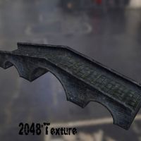
Bridge
...bridge
3docean
bridge low polygon medi evil bridge old bridge
2048 * texture obj, fbx and blend format. game ready model.
archibase_planet
free
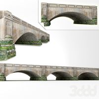
Bridge
...net
bridge foot-bridge construction
bridge ponte de tijolos n250515 - 3d model (*.gsm+*.3ds+*.max) for exterior 3d visualization.
3d_export
$18
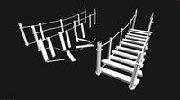
arch bridge-bridge-stairs
...arch bridge-bridge-stairs
3dexport
arch bridge-bridge-stairs<br>3ds max 2015
3d_export
$5

bridge
...bridge
3dexport
bridge - 3d model ( gsm : 3ds )
3d_export
$5

bridge
...bridge
3dexport
wood bridge all textures in 4k
3ddd
$1
Bridge
...bridge
3ddd
bridge , мост
мост для экстерьера