Thingiverse
OpenScad Height Maps v0.5 by WilliamAAdams
by Thingiverse
Last crawled date: 2 years, 12 months ago
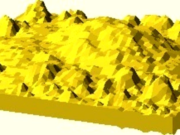
I needed the ability to quickly generate a tile from a height map. A height map is essentially a grayscale picture. If you think of each of the 'pixel' values representing a 'z' value for a vertex in a mesh, then you can imagine applying those z values, and what you get is a mesh transformed into a 'landscape'.
This thing is just a further refinement of the technique in OpenScad.
Although I am highlighting the technique by applying it to what looks like a landscape, I've also applied it to font rendering as well. There are a couple of ways of doing fonts in OpenScad. One is to use a 'bitmap' and essentially do height mapping, by representing each pixel as a cube.
Another method is to use the font information, and use the outlines to actually draw polygons and linear_extrude() them.
Yet a third way is to use a tool to export the font outlines into a .dxf file, and then load from there with a linear_extrude.
What you can do here is take the font, generate grayscale images of each character, in a format that is essentially OpenScad code. Then apply those images to a mesh, just like a landscape, and you've got extruded fonts!
The cool thing about this generalized technique is that you can use it for anything. The routine gives you absolute control over the size and resolution. So, for example, using the same basic grayscale image, you can print at 48x48 millimeters, with a resolution of 4 facets per millimeter. That would be great if you're printing on a machine with .25mm layer resolution. It would turn out fairly smooth. On the other hand, if you don't want to wait the hours required for that, you can simply change the resolution to be 1mm/facet, and still get a decent print.
The pictures here demonstrate the technique being applied to both terrain and characters.
There are two routines, which can be found in the MeshRenderer.scad file:
shell_extrude_height_map() - To be used when your height map information is represented by single values.
shell_extrude_color_map() - To be used when your height map information is still grayscale, but represented by triplets.
Oh yes, and one of the parameters to this routine: solid=true
That means that while you're prototyping, you can say 'solid=false', and it will simply generate a polygon surface. Then when you're done playing around, you can say 'solid=true', and you'll get a proper 2-manifold solid that you can then press 'F6' on and go take a walk.
I know, it's a lot of words, but look at the pretty pictures!! The 64x64 resolution mountain scene took 5 hours to render. The 48x48 took about 1.5 hours.
NOTE: Although I can easily generate single characters using this technique, actually generating them en masse as shown in the picture, has some problems. The structure ends of not being 2-manifold. I plan to improve the general text handling aspects later. But, the basic height mapping technique will remain the same.
Similar models
thingiverse
free

Texture Mapping in OpenScad! by WilliamAAdams
... very good investment.
update: 21092011
added blog entry: http://williamaadams.wordpress.com/2011/09/21/openscad-texture-mapping/
thingiverse
free

Crystal Star Tree by weirdnoise
...(i.e. the length of the star points).
the star polygon was my first foray into recursively-defined shapes; feel free to steal it.
thingiverse
free

DOTFONT (variable width OpenSCAD font with by TakeItAndRun
...t generated from a vector matrix.
the black lines in the picture are just a workaround for thingiverse`s picture scaling routine.
thingiverse
free

Openscad font by Dippo
...ter by letter.
i used this polygon generator program (http://www.thingiverse.com/thing:9290) to create the letters very quickly.
thingiverse
free

OpenScad Virtual Machine - v0.1 by WilliamAAdams
... usage in the openscad vm. the most complex object 'camera' shows how to nest csg operations as well as primitive parts.
thingiverse
free

super simple cookie cutter generator
... music or watch movies in the background.
ps: in order not to violate the copyright, i used a hand-painted picture as an example.
thingiverse
free

QR Code Generator for OpenSCAD by ridercz
...elf - was done by the perfect qrcode-generator by kazuhiko arase. i just added openscad code generation and simple web interface.
thingiverse
free

OpenSCAD Bitmap Fonts Module by tbuser
...;ll try to keep this up to date, but you can always find the latest version on github at http://github.com/tbuser/openscad-bitmap
thingiverse
free

Procedural weathered fractal terrain in OpenSCAD by Amatulic
...resulting file is large and has way more resolution than you need for printing. read the comments at the beginning of the script!
thingiverse
free

OpenSCAD wave vase designer by jamcultur
...used to generate different shapes.
please post your makes! i'd love to see what kind of designs other people come up with. :)
Williamaadams
thingiverse
free

Toy Panel by WilliamAAdams
... most basic pieces of the klikko math system. it is a builder system where you can click panels together to form various shapes.
thingiverse
free

Yazzo by WilliamAAdams
...the connectors. the openscad file allows you to parameterize these connectors, and create any sizes you might want to play with.
thingiverse
free

Gandhi Lithophane by WilliamAAdams
...a lithophane of gandhi on a stamp.
any number of lithophane prints can be made by simply changing a file name in the .fab script.
thingiverse
free

Yazzo Servo Linkage by WilliamAAdams
...elative sizing of things. by default the arm is 1/2" thick to match the size of the sleeve bearing that's at the joint.
thingiverse
free

Faceted Drinking Cup by WilliamAAdams
...se for quite some years, but i was getting thirsty, so i designed this simple cup to test out printing with translucent filaments
thingiverse
free

Yazzo UClip Keyed by WilliamAAdams
...tandard key on the edge of it, so that you can attach something, or a number of things to it by sliding the key into their notch.
thingiverse
free

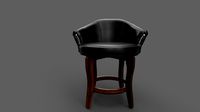
Cobra Chair by WilliamAAdams
... curves, and see how the curve reacts. it would probably be much easier to model with a different type of curve, but here it is.
thingiverse
free

Coaster Blob by WilliamAAdams
...s a convenient blobby cup holder. put some sticky rubber feet pads on the bottom, and it will make a nice addition to your desk.
thingiverse
free

Yazzo Female Clevis by WilliamAAdams
...mm plastic filament probably. good enough for prototyping. printing on its side would probably be best for structural strength.
thingiverse
free

Simple Tetrahedron by WilliamAAdams
....
this thing is a simple vertex constructed from vinyl tubing. there are no actual files, only pictures that show the technique.
V0
turbosquid
$39

Cybertech Drone v0
... available on turbo squid, the world's leading provider of digital 3d models for visualization, films, television, and games.
3d_export
$30

Drone V0 RedManga 3D Model
... ship patrol spy recon
drone v0 redmanga 3d model download .c4d .max .obj .fbx .ma .lwo .3ds .3dm .stl iggydesign 106751 3dexport
3d_export
$30

Drone V0 Wood 3D Model
...film practice project scfi
drone v0 wood 3d model download .c4d .max .obj .fbx .ma .lwo .3ds .3dm .stl iggydesign 106752 3dexport
3d_export
$30

Cybertech Drone V0 3D Model
...ation student project
cybertech drone v0 3d model download .c4d .max .obj .fbx .ma .lwo .3ds .3dm .stl iggydesign 109656 3dexport
3dfindit
free

PAN-V0
...pan-v0
3dfind.it
catalog: festo
3dfindit
free

PAN-V0
...pan-v0
3dfind.it
catalog: festo
3dfindit
free

PAN-V0S
...pan-v0s
3dfind.it
catalog: festo
3dfindit
free

QSL-V0
...qsl-v0
3dfind.it
catalog: festo
3dfindit
free

PAN-V0S
...pan-v0s
3dfind.it
catalog: festo
3dfindit
free

QSL-V0
...qsl-v0
3dfind.it
catalog: festo
Openscad
thingiverse
free
OpenSCAD sphere
...openscad sphere
thingiverse
basic project for openscad.
thingiverse
free
Openscad Football by KySyth
...openscad football by kysyth
thingiverse
openscad not tested
thingiverse
free

Openscad Apple by KySyth
...openscad apple by kysyth
thingiverse
openscad apple = not tested
thingiverse
free
Plugs with openscad by benengel
...plugs with openscad by benengel
thingiverse
plugs with openscad and fontawesome
thingiverse
free

Openscad spirals by mafmuf
...openscad spirals by mafmuf
thingiverse
just fooling around with openscad.
thingiverse
free

Practice on OpenScad by ajensen906
...practice on openscad by ajensen906
thingiverse
a very crude practice on openscad
thingiverse
free
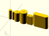
Batteries in OpenSCAD by roman_hegglin
...batteries in openscad by roman_hegglin
thingiverse
common batteries as modules for openscad.
thingiverse
free
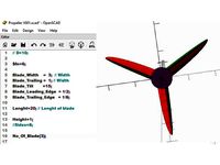
OpenScad Propeller by KySyth
...se
trying to make a propeller with openscad = not tested
this is some of the results
added the openscad file but still need work
thingiverse
free
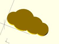
Openscad Cloud by Twanne
...openscad cloud by twanne
thingiverse
openscad cloud.
size can be adjusted
thingiverse
free
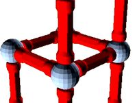
Geomag for OpenScad by vicnet
...geomag for openscad by vicnet
thingiverse
openscad file to design geomag things.
Height
turbosquid
$5
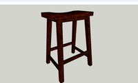
Height Stool
...ree 3d model height stool for download as blend, obj, and fbx on turbosquid: 3d models for games, architecture, videos. (1703076)
cg_studio
$20
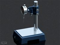
Height Gauge3d model
...ndustrial height gauge tool indutsrial
- height gauge 3d model, royalty free license available, instant download after purchase.
turbosquid
$6
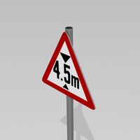
4.5 meters in height
...oyalty free 3d model 4.5 meters in height for download as max on turbosquid: 3d models for games, architecture, videos. (1213038)
turbosquid
$1
Counter Height Stool
... model counter height stool for download as obj, dae, and skp on turbosquid: 3d models for games, architecture, videos. (1318792)
turbosquid
$10
low height cabinet
...ow height cabinet for download as max, max, fbx, obj, and max on turbosquid: 3d models for games, architecture, videos. (1545300)
turbosquid
$5
Counter Height Bench
... available on turbo squid, the world's leading provider of digital 3d models for visualization, films, television, and games.
3ddd
free
Stanley furniture - Avalon heights
...stanley furniture - avalon heights
3ddd
stanley furniture
stanley furniture - avalon heights metal base empire writing desk
3d_ocean
$1
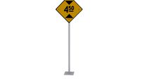
Maximum height sign
...ure applied. the object is ready to import and render in both formats. the model has been built to be able to subdivide flawle...
turbosquid
$20
Low height cabinet design
...y free 3d model low height cabinet design for download as max on turbosquid: 3d models for games, architecture, videos. (1402496)
turbosquid
$15
Atlantis Bar Height chair
...y free 3d model atlantis bar height chair for download as max on turbosquid: 3d models for games, architecture, videos. (1271123)
Maps
3d_ocean
$5

Map
...map
3docean
geography map ocean travel world world map
a world map
3d_ocean
$5

Old Map
...old map
3docean
dirty map ocean old map paper pirates rotten travel world map
an old map
turbosquid
$3

Map
... available on turbo squid, the world's leading provider of digital 3d models for visualization, films, television, and games.
3d_ocean
$3

Map of Iran
...map of iran
3docean
flag iran map outline
an outline map of iran
3d_ocean
$2

Map of the USA
...map of the usa
3docean
america flag globe map united states usa
an outline map of the usa
3ddd
$1

Abstract Maps
... город , picture
abstract maps by artist jazzberry blue
3d_ocean
$5

Honduras Map
...honduras map
3docean
3d cinema4d honduras map mapa
honduras map designed in cinema 4d r17
3d_ocean
$2

Map of Germany
...map of germany
3docean
black country europe germany gold map outline red yellow
a simple outline map of germany
3d_ocean
$2

Map of Australia
...map of australia
3docean
australia banner country down under earth flag globe map ocean south
an outline map of australia
3d_ocean
$2

Map of Russia
...of russia
3docean
asia banner earth europe flag globe map russia russian federation siberia sovjet union
an outline map of russia
5
turbosquid
$6
Rock 5-5
...urbosquid
royalty free 3d model rock 5-5 for download as obj on turbosquid: 3d models for games, architecture, videos. (1639063)
3d_export
$5
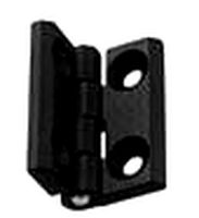
hinge 5
...hinge 5
3dexport
hinge 5
turbosquid
$10
A-5
... available on turbo squid, the world's leading provider of digital 3d models for visualization, films, television, and games.
turbosquid
$2
A-5
... available on turbo squid, the world's leading provider of digital 3d models for visualization, films, television, and games.
turbosquid
$12

Calligraphic Digit 5 Number 5
...hic digit 5 number 5 for download as max, obj, fbx, and blend on turbosquid: 3d models for games, architecture, videos. (1389333)
3ddd
$1

5 роз
...5 роз
3ddd
5 роз в стеклянной вазе
design_connected
$11

iPhone 5
...iphone 5
designconnected
apple iphone 5 computer generated 3d model.
3ddd
$1
Lola 5
...lola 5
3ddd
miniforms
lola 5 miniforms 300*65*134
3ddd
$1
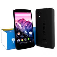
Nexus 5
...dd
nexus , phone , телефон
google nexus 5 phone
3d_ocean
$15
iPhone 5
...iphone 5
3docean
3d 4d apple cinema iphone model modeling phone screen texture
iphone 5 3d model and texture realistic iphone 5.