Thingiverse

Martinique and the Caribbees by pmoews
by Thingiverse
Last crawled date: 3 years ago
Here are relief maps of Martinique and some of the Caribbees.
Data was taken from GMTED2010, a USGS data set available from the earth explorer web site.
http://earthexplorer.usgs.gov/
GMTED2010 is a global elevation data set in geotiff format. A 7.5 arc-second resolution file, 10n090w_20101117_gmted_mea075.tif, was downloaded and converted to "raw" format with Adobe Photoshop. The raw format file contains 14400 rows and 9600 columns of two byte signed integers. A fortran program similar to those in things 118327 and 121275 was used to treat the raw file.
Stl files are:
st_kitts_nevis.stl 210 x 210 points at 7.5 arc-seconds
guadaloupe.stl 240 x 200 points at 15 arc-seconds
dominica.stl 170 x 240 points at 7.5 arc-seconds
martinique.stl 250 x 260 points at 7.5 arc-seconds
st_lucia.stl 155 x 220 points at 7.5 arc-seconds
st_vincent.stl 150 x 300 points at 7.5 arc-seconds
The fortran program that created the openSCAD polyhedron commands is included.
Similar models
thingiverse
free

Réunion and Mauritius by pmoews
...nion_small.stl.
mauritius.stl and mauritius_small.stl
the fortran code which made the openscad polyhedron commands is included.
thingiverse
free

Relief Maps of Bora Bora by pmoews
...guide and http://www.jspacesystems.or.jp/ersdac/gdem/e/1.html for an overview a fortran program similar to those in things 118327 and 121275 was used...
thingiverse
free

Pearl Harbor and Oahu by pmoews
...9.
pearl_harbor.stl is a relief map obtained by sampling the data set at 2 second intervals.
fortran source code is included.
thingiverse
free

Galapagos and its Volcanos by pmoews
...were constructed from nasa's srtm3 data:http://dds.cr.usgs.gov/srtm/version2_1/ using a program similar to that described in thing:121275. stl files are: galapagos.stl...
thingiverse
free

Kauai Relief Maps by pmoews
...om the usgs national map.
http://viewer.nationalmap.gov/viewer/
the programs used were described in things 106099 and 116103.
thingiverse
free

Guam Relief Map by pmoews
... converted to an array, (210x240), of real numbers with a fortran program.
openscad code and the array of numbers are included.
thingiverse
free

Relief Map of The Sutter Buttes by pmoews
...ta, and the openscad program that calculated the relief map, are included. "aster gedem is a product of meti and nasa"
thingiverse
free

Mount Fuji and Mount Etna by pmoews
...columns of two byte signed integers. fortran code very similar to that described in thing:118327 was used to write...
thingiverse
free

Switzerland and Denmark Relief Maps by pmoews
...d to be easily visualized. one way to do so is to use the many kml files available at the site. kml files open in google earth.
3dwarehouse
free

Portas 240 x 210
...portas 240 x 210
3dwarehouse
portas de correr vidro 240 x 210
Caribbees
cgriver
$695

V-Ray for Revit - Chaos Group
...el salvador, guatemala, haiti, honduras, jamaica, lesser antilles - caribbees nicaragua, panama, puerto rico, turks and caicos...
cgriver
$333

UNIVERSAL V-RAY 3.0 RENDER NODES - Chaos Group
...el salvador, guatemala, haiti, honduras, jamaica, lesser antilles - caribbees nicaragua, panama, puerto rico, turks and caicos...
cgriver
$333

V-Ray Standalone - Chaos Group
...el salvador, guatemala, haiti, honduras, jamaica, lesser antilles - caribbees nicaragua, panama, puerto rico, turks and caicos islands)want it...
thingiverse
free
Réunion and Mauritius by pmoews
...from earth explorer, http://earthexplorer.usgs.gov/ see thing:125606 martinique and the caribbees two sizes of map are provided. they differ in...
cgriver
$520

V-Ray 3.3 for Maya 1 YEAR Long Term / Rental / Annual License - Chaos Group
...el salvador, guatemala, haiti, honduras, jamaica, lesser antilles - caribbees nicaragua, panama, puerto rico, turks and caicos...
cgriver
$520

V-Ray 3.3 for Nuke 1 YEAR Long Term / Rental / Annual License - Chaos Group
...el salvador, guatemala, haiti, honduras, jamaica, lesser antilles - caribbees nicaragua, panama, puerto rico, turks and caicos...
cgriver
$399

Upgrade from v2.0 to v3.0 | V-Ray for Maya - Chaos Group
...el salvador, guatemala, haiti, honduras, jamaica, lesser antilles - caribbees nicaragua, panama, puerto rico, turks and caicos islands)want it...
cgriver
$350

V-Ray for Revit 1 YEAR Long Term Rental License - Chaos Group
...el salvador, guatemala, haiti, honduras, jamaica, lesser antilles - caribbees nicaragua, panama, puerto rico, turks and caicos...
cgriver
$350

V-Ray 3 for SketchUp 1 YEAR Long Term / Rental / Annual License - Chaos Group
...el salvador, guatemala, haiti, honduras, jamaica, lesser antilles - caribbees nicaragua, panama, puerto rico, turks and caicos...
Martinique
3ddd
$1

Martinique Console MTQ06
...martinique console mtq06
3ddd
консоль , marge carson
martinique console mtq06
3d_export
$5

Martinique Velvet Armchair
...port
format: 3ds max 2016 export: fbx, obj, 3ds, mat render: vray (5.x), corona (5) polys: 32120 verts: 32124 units: millimeters
3ddd
free

Merge Carson / Martinique
...marge carsonhttp://unitedarts.ru/marge_carson/marge%20carson%20%d0%b2%20%d0%bd%d0%b0%d0%bb%d0%b8%d1%87%d0%b8%d0%b8.html
3ddd
$1

Тумба Tommy Bahama Island Estate арт. 531-621
...tommy bahama , island estate , тумбочка прикроватная тумба martinique night stand item #531-621 бренд: tommy bahama home collection:...
3d_sky
$8

Martinique Console MTQ06
...martinique console mtq06
3dsky
console marge carson
martinique console mtq06
thingiverse
free

Martinique island terrain by Mvetto
...erse
terrain lansdscape model of caribbean martinique island.
made in .stl format thanks to http://jthatch.com/terrain2stl/ site
thingiverse
free

Emporte pièce Martinique by xav2211
...emporte pièce martinique by xav2211
thingiverse
it's a biscuit cutter.
sketchfab
$5

Martinique Woman by Malvina Hoffman
...s taken on an iphone 6+ and processed with recap 360.
- martinique woman by malvina hoffman - buy royalty free 3d model by phil
3dbaza
$4

Martinique chair (321583)
...;br>verts: 26 101<br>xform: yes<br>box trick: yes<br>model parts: 4<br>formats: 3ds max 2017, obj, fbx
thingiverse
free

Pastry cutter ( petit pâtés créoles) from Martinique island ! by xav2211
... xav2211
thingiverse
pastry cutter ( petit pâtés créoles) from martinique island !
one side for cutting, other side for welding.
Pmoews
thingiverse
free

Pheasant by pmoews
...pheasant by pmoews
thingiverse
123d catch version of a ceramic pheasant. the stl file is at 40% scale.
thingiverse
free

A Pelican by pmoews
...s
thingiverse
a neighbor's pelican model. it was digitized with autodesk's recap photo. the stl file is scaled at 40%.
thingiverse
free

Walrus by pmoews
...ews
thingiverse
a thrift store walrus, gray, weights over a kilogram, maybe a garden ornament. a 123d-catch copy at half scale.
thingiverse
free
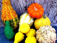
Five Gourds by pmoews
...five gourds by pmoews
thingiverse
here are five gourds suitable for a fall display. they were digitized with 123d catch.
thingiverse
free
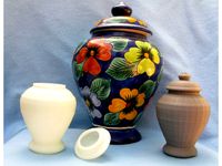
Vase with Lid by pmoews
...vase with lid by pmoews
thingiverse
a neighbor wanted a copy of a favorite vase. here are half size versions as stl files.
thingiverse
free

Pineapple by pmoews
.... fairly accurate - prints well without support. for other stl files based on real pineapples see things 4560, 7228 and 438266.
thingiverse
free
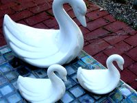
Ceramic Swan by pmoews
...ceramic swan by pmoews
thingiverse
a thrift store ceramic swan without markings. the 123-d catch file is at half scale.
thingiverse
free
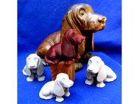
Basset Hound by pmoews
...basset hound by pmoews
thingiverse
an autodesk recap photo copy of a basset hound bought at an estate sale. about 4/10 scale.
thingiverse
free
A Black Bear by pmoews
... by pmoews
thingiverse
a 123d catch version of a wood carving of a bear. a souvenir of new mexico. the stl file is full scale.
thingiverse
free

Model Fish - Trout by pmoews
...model fish - trout by pmoews
thingiverse
openscad "doddle". meant to be a rainbow trout.