CG Trader

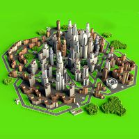
Manhattan Island New York City Streets Buildings Road Networks
by CG Trader
Last crawled date: 1 year, 11 months ago
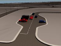
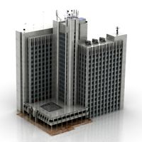
New York City Manhattan Island Streets and Buildings this model is based on real data therefore this is a realistic buildings and streets setup of Manhattan Island in New York City, USA 15 building groups, separated to top and side parts of the buildings, are setup so that you can add variety to buildings (color materials and/or textures) Groups can be turned off/on UV mapped with overlapping UVs the model is positioned on a flat surface (all buildings are on the “floor” - no elevation data included) geometry is polygonal quads and tris model is untextured and renders fast FREE / gratis Manhattan Island low poly model included this 3D model is/can be licensed (commercial use is fine) under Creative Commons Attribution-ShareALike 2.0 (CC-BY-SA) license buildings and streets data from OpenStreetMap / www.openstreetmap.org Attribution : © OpenStreetMap contributors / http://www.openstreetmap.org/copyright POINTS/VERTS : 916517
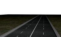
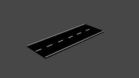
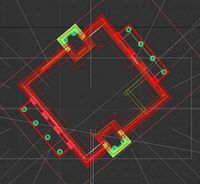
POLYGONS : 455216 .c4d - native format .fbx - v7.1 .dae - v1.5 .obj Manhattan Island New York City Road Network and Streets this model is based on real data therefore this is a realistic road network and streets setup of Manhattan Island in New York City, USA 2 objects included | 1. roads and streets 2. squares and plazas UV mapped with overlapping UVs the model is positioned on a flat surface (road network is on the “floor” - no elevation data included) geometry is polygonal quads and tris model is untextured and renders fast this model is fully compatible with the “Manhattan Island NYC Buildings and Streets” 3D model and vice versa this 3D model is/can be licensed (commercial use is fine) under Creative Commons Attribution-ShareALike 2.0 (CC-BY-SA) license buildings and streets data from OpenStreetMap / www.openstreetmap.org Attribution : © OpenStreetMap contributors / http://www.openstreetmap.org/copyright POINTS/VERTS : 310574
POLYGONS : 312255 .c4d - native format .fbx - v7.1 .dae - v1.5 .dxf .obj manhattan new york nyc road network system streets infrastructure architectural map cartography city gps navigation roads squares realistic buildings island street architectural street city street city buildings city map city street city streets map manhattan new york nyc buildings
Similar models
cg_trader
$29

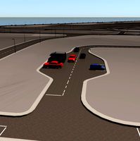
Manhattan Island in New York City Road Network and Streets
...s realistic topological topology street architectural street city street city map city street city streets map manhattan new york
cg_trader
$29

New York City 5 Boroughs Jersey Newark Road Network and Streets
... realistic architectural street architectural street city street city map city street city streets new york united states usa map
cg_trader
$29

Leipzig Road Network and Streets
...hy city gps navigation roads squares realistic topology street architectural street city street city map city street city streets
cg_trader
$29

Stuttgart Road Network and Streets
...hy city gps navigation roads squares realistic topology street architectural street city street city map city street city streets
cg_trader
$29

Osaka Road Network and Streets
... cartography city gps navigation roads squares realistic topological topology exterior cityscape city map city streets japan city
cg_trader
$29

Guangzhou Road Network and Streets
...p cartography city gps navigation roads squares realistic topological topology exterior cityscape china map city map city streets
cg_trader
$29

Bogota Road Network and Streets
...ectural map cartography city gps navigation roads squares realistic topological topology exterior cityscape city map city streets
cg_trader
$29

Copenhagen Road Network and Streets
...ectural map cartography city gps navigation roads squares realistic topological topology exterior cityscape city map city streets
cg_trader
$29

Singapore Road Network and Streets
...ectural map cartography city gps navigation roads squares realistic topological topology exterior cityscape city map city streets
cg_trader
$29

Rome Road Network and Streets
...ectural map cartography city gps navigation roads squares realistic topological topology exterior cityscape city map city streets
Manhattan
3ddd
$1

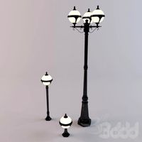
EICHHOLTZ / Manhattan
...eichholtz / manhattan
3ddd
eichholtz
eichholtz lamp manhattan
3ddd
$1

JNL, Manhattan
... стеллаж
jnl, manhattan 300*40http://www.jnl.ru/product.aspx?family=console&product;=manhattan
3ddd
$1

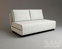
TURRI / MANHATTAN
...turri / manhattan
3ddd
turri
диван manhattan от turri,текстуры в файле.
3ddd
$1

MLE Manhattan
...mle manhattan
3ddd
mle
бра производителя освещения для отелей mle manhattan
3ddd
$1

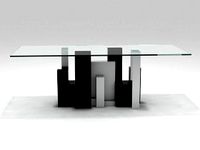
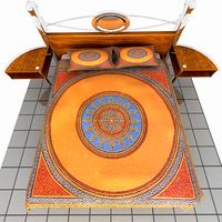
Диван Alberta Manhattan
...a manhattan
3ddd
alberta , manhattan
модульный диван manhattan.
фабрика alberta salotti.
3ddd
$1

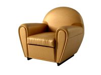
FromItalia / Manhattan
...ddd
formitalia , fromitalia
fromitalia кресло "manhattan" размеры 114.5/95 h85
turbosquid
$500

Lower Manhattan
...squid
royalty free 3d model lower manhattan for download as on turbosquid: 3d models for games, architecture, videos. (1488281)
turbosquid
$4

Manhattan Lamp
...uid
royalty free 3d model manhattan lamp for download as max on turbosquid: 3d models for games, architecture, videos. (1285975)
turbosquid
$45

Bank of Manhattan
...ty free 3d model bank of manhattan for download as ma and obj on turbosquid: 3d models for games, architecture, videos. (1250531)
turbosquid
$6

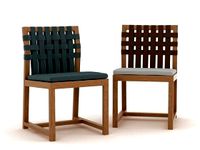
Manhattan Chair
...ee 3d model manhattan chair for download as max, fbx, and obj on turbosquid: 3d models for games, architecture, videos. (1651633)
Networks
3ddd
$1
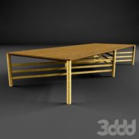
Network table by Henge
...network table by henge
3ddd
henge
network table by henge
3d_export
$35

network office design
...network office design
3dexport
network office 3d model design
turbosquid
$120

Global Network
... available on turbo squid, the world's leading provider of digital 3d models for visualization, films, television, and games.
turbosquid
$40
Road Network
... available on turbo squid, the world's leading provider of digital 3d models for visualization, films, television, and games.
turbosquid
$4

social Network
... available on turbo squid, the world's leading provider of digital 3d models for visualization, films, television, and games.
design_connected
$16
Network 149 chair
...network 149 chair
designconnected
roda network 149 chair computer generated 3d model. designed by dordoni, rodolfo.
design_connected
$16
Network 159 armchair
...twork 159 armchair
designconnected
roda network 159 armchair armchairs computer generated 3d model. designed by rodolfo dordoni.
3d_ocean
$15
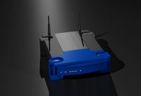
Wireless Broadband Network Router
... computer networking. similar to popular styles of wireless routers. this model was created in 3d studio max 2008 and has a ma...
3d_export
$30
Road Network 3D Model
...
3dexport
roads network highway
road network 3d model download .c4d .max .obj .fbx .ma .lwo .3ds .3dm .stl msaeed 103734 3dexport
turbosquid
$3
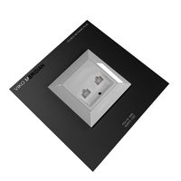
DOUBLE NETWORK PLUG
...d model double network plug for download as max, obj, and fbx on turbosquid: 3d models for games, architecture, videos. (1370379)
York
design_connected
$16
York
...york
designconnected
minotti york computer generated 3d model. designed by dordoni, rodolfo.
3ddd
$1

Klass York A
...klass york a
3ddd
klass , york a
www.klass.itpart of york series.
3ddd
free
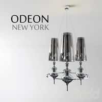
Odelon_New York
... new york
серия: new york
материал: три пвх абажура; основание железо
тип лампочки: е14-3
3ddd
$1
armchair york white_leather
...armchair york white_leather
3ddd
york , капитоне
armchair york white leather
3ddd
free
Klass York-S
...klass york-s
3ddd
klass , york-s
www.klass.itpart of york series.
3ddd
$1
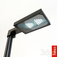
Hess / York
...нарь (столб) york, от производителя hess.http://www.hess.eu/en/produkte/produkte_leuchten/systemleuchten/york_led_levo/
design_connected
$18
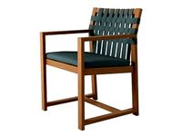
York Armchair
...york armchair
designconnected
minotti york armchair computer generated 3d model. designed by dordoni, rodolfo.
design_connected
$18
New York
...new york
designconnected
saba italia new york computer generated 3d model. designed by bicego, sergio.
3d_ocean
$12
York chair
...eatting stl york chair
he york lounge chair by modloft is a supremely sleek, incredibly stylish and sophisticated, modern chair .
3ddd
$1
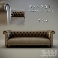
York sofa
...//www.asnaghi.it _
модель: york
размеры средней: w-2300mm, d-910mm, h-800mm
размеры большой: w-2700mm, d-910mm, h-800mm
Island
3d_export
$15

island
...island
3dexport
the island is fantastic!
3d_export
$8

of the island
...of the island
3dexport
3d model of the island
3d_export
free

island
...island
3dexport
desert island with crystals
design_connected
$11

Island
...island
designconnected
alberta island computer generated 3d model.
3d_export
free

Island
...island
3dexport
a small island in a minimalist style. with the flag of ukraine.
3d_ocean
$17

Island
...island
3docean
3d island 3d palms cartoon island cartoon palms
made in 3ds max 2014, has 9205 polygons, vray.
design_connected
$16

Island
...island
designconnected
paola lenti island computer generated 3d model. designed by rota, francesco.
3d_export
$5

island
...island
3dexport
this is no longer just a small island, but a whole location for some kind of game or animation!
turbosquid
$10

Island
...
turbosquid
royalty free 3d model island for download as fbx on turbosquid: 3d models for games, architecture, videos. (1672956)
turbosquid
$10

Island
...
turbosquid
royalty free 3d model island for download as fbx on turbosquid: 3d models for games, architecture, videos. (1672543)
Road
3d_export
free
road
...road
3dexport
ready road with textures.
turbosquid
$4

Cross road Road-sign
...ss road road-sign for download as 3ds, dae, fbx, obj, and stl on turbosquid: 3d models for games, architecture, videos. (1516042)
3d_ocean
$39

Road
...torway nascar oval poly race racetrack raceway racing realtime road speedway talladega track way
racing games for the road system
turbosquid
$1
road
...ad
turbosquid
royalty free 3d model road for download as max on turbosquid: 3d models for games, architecture, videos. (1167278)
3d_ocean
$9
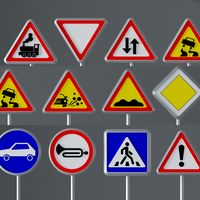
Road Signs
...road signs
3docean
outdoor road signs signpost waymark
road signs 3d models.
3d_export
$5
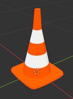
road cone
...road cone
3dexport
road cone
3d_export
free
road
...road
3dexport
3d_export
$5

road markings
...road markings
3dexport
construction of road markings
turbosquid
$25
Road
...lty free 3d model road for download as png, 3ds, obj, and fbx on turbosquid: 3d models for games, architecture, videos. (1380086)
3d_export
$5

road sign
...road sign
3dexport
road sign with the texture of a cyclist.
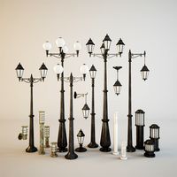
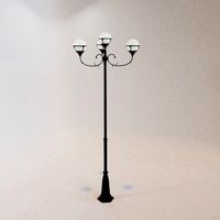
Streets
3ddd
$1
street lamp
...street lamp
3ddd
street lamp , фонарь
street lamp
3d_ocean
$4
Street lamp
...street lamp
3docean
3d 3d object lamp street street lamp
street lamp (low poly)
3d_ocean
$20
Street lamps
...low metal road street illumination street lamps street lanterns town traffic urban
this eighteen models street lamps high quality
3d_ocean
$7
Street Light
...street light
3docean
light lighting street transformer
a semi detailed street light with a transformer.
3d_ocean
$4
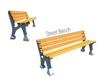
Street Bench
...street bench
3docean
bench streer bench street
street bench model - .ma - .obj
3d_export
free

Street with StreetLights
...street with streetlights
3dexport
street, with streetlights.
3d_export
$5
street lamp
...street lamp
3dexport
street light for parks.
3ddd
free
Street light
...street light
3ddd
фонарь
street light
turbosquid
$1

Street Signs 04 Street Names
...ree 3d model street signs 04 street names for download as fbx on turbosquid: 3d models for games, architecture, videos. (1672588)
turbosquid
$1

Street Signs 03 Street Names
...ree 3d model street signs 03 street names for download as fbx on turbosquid: 3d models for games, architecture, videos. (1672050)
City
3d_export
$18
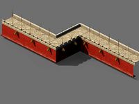
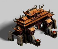
imperial city-city gate-city wall 782
...imperial city-city gate-city wall 782
3dexport
imperial city-city gate-city wall 782<br>3ds max 2015
3d_export
$18
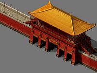
imperial city-city gate-city wall 785
...imperial city-city gate-city wall 785
3dexport
imperial city-city gate-city wall 785<br>3ds max 2015
3d_export
$40
city
...city
3dexport
a city with non-standard architecture.
design_connected
$9
City
...city
designconnected
emmemobili city dining tables computer generated 3d model. designed by ferruccio laviani.
3ddd
$1
Диван City
...диван city
3ddd
city , softline
диван city (фирма softline)
3ddd
$1
Гостиная CITY
...гостиная city
3ddd
city , дятьково
гостиная city производства дятьково
3d_export
$18
imperial city-shabak-city wall
...imperial city-shabak-city wall
3dexport
imperial city-shabak-city wall<br>3ds max 2015
3d_export
$18
imperial city-shabak-city gate
...imperial city-shabak-city gate
3dexport
imperial city-shabak-city gate<br>3ds max 2015
turbosquid
$300

City
...ty
turbosquid
royalty free 3d model city for download as 3ds on turbosquid: 3d models for games, architecture, videos. (1235306)
turbosquid
$249

city
...ity
turbosquid
royalty free 3d model city for download as ma on turbosquid: 3d models for games, architecture, videos. (1340610)
New
turbosquid
$119
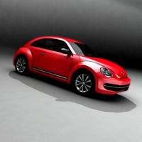
New New Beetle
... available on turbo squid, the world's leading provider of digital 3d models for visualization, films, television, and games.
3d_export
$5

New-feather
...new-feather
3dexport
new-feather
3d_export
$6

new style
...new style
3dexport
new style room
3ddd
free
New Items
...ew items
3ddd
new items , барный
барный стул от китайского производителя фирмы new items
3d_export
$6

Logo new
...logo new
3dexport
new american style logo
3d_export
$10
New jersey
...new jersey
3dexport
new jersey stp and stl format
design_connected
$20
New Deal
...new deal
designconnected
new deal computer generated 3d model.
3d_ocean
$15
New bed
... for this bed all this file format include in zip file 3ds,obj,max,zip file change material and re-size very easy very for render
3ddd
free
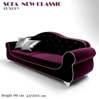
Sofa-New Classic
...sofa-new classic
3ddd
new classic
sofa,new classic
design_connected
$13
New Antiques
...new antiques
designconnected
cappellini new antiques computer generated 3d model. designed by wanders, marcel.
Buildings
archibase_planet
free
Building
...building high-rise building office building construction
building n050115 - 3d model (*.gsm+*.3ds) for exterior 3d visualization.
3d_export
$5
building
...building
3dexport
clasic building
3ddd
$1
building
...building
3ddd
здание
building
archibase_planet
free
Building
...lanet
building office office building construction
building n090914 - 3d model (*.gsm+*.3ds+*.max) for exterior 3d visualization.
archibase_planet
free
Building
...net
building tower construction high-rise building
building n100214 - 3d model (*.gsm+*.3ds+*.max) for exterior 3d visualization.
3d_export
free
Building
...building
3dexport
low poly building;
3d_export
free
Building
...building
3dexport
low poly building;
3d_export
free
Building
...building
3dexport
low poly building;
3d_export
free
Building
...building
3dexport
low poly building;
3d_export
free
Building
...building
3dexport
low poly building;