3DWarehouse

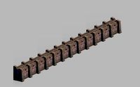
Largest city map part 1
by 3DWarehouse
Last crawled date: 1 year, 11 months ago
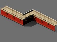
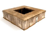
City name is Bethlehem region. The first largest city ever founded since 1620, and more than 10 million population. The tallest building in central downtown from 1885-1895-1898-1909-1913-1924-1930-1964-1969-1972-1985-1998 until the tallest one was built in 2010 exceeds over 400 m of entire height. Now it has other location of skyscraper, freeway, large station, parks, grid road, large retail, and more. Very few skyscrapers was demolished because to make way for taller modern skyscrapers since 20th. At far distance it has bay between the dock. at the west side big city it has river and industrial areas, And it has services, city halls, and more stuff in big city of US state. #Very_Big_City #Skyscrapers #City_hall #highway #Downtown #Park #old_buildings #new_buildings #Transportation #service #hotel #office #residential #buildings #map
Similar models
3dwarehouse
free

Largest city map part 1
...city, it has river and industrial areas, and it has services, city halls, and more in big city of us state. #city #bridge #street
3dwarehouse
free

Largest city map part 3
...econd tallest skyscraper was built in 2012 was shorter than the the tallest one in our city. #very_big_city #skyscraper #downtown
3dwarehouse
free

Burlington-ville (City)
...est city in the state. the tallest skyscraper was built in 1990's. it has bridges, freeways, skyscrapers, parks, and harbors.
3dwarehouse
free

West downtown district and city hall
...r the old airport now redeveloped, the tallest skyscraper was built in 1982, and the city hall located near the park and freeway.
3dwarehouse
free

(OLD) CITY built in 1920
...while downtown skyscraper is tallest building taller than uptown. in 1920 more buildings and few more skyscraper and end of city.
3dwarehouse
free

Large City - By Tsa
...rd #city #detailed #highrise #large #lowrise #metropolis #office #park #progress #skyline #skyscraper #transmitter #tsa #tv_tower
3dwarehouse
free

CITY built part 2/7
...while downtown skyscraper is tallest building taller than uptown. in 1920 more buildings and few more skyscraper and end of city.
3dwarehouse
free

Large city in year 1992
...um and the parking lot and the parking garage was built in 1990. the train station final expansion had fully built in 1985. #city
3dwarehouse
free

Largest city map part 2
...raper our state from 1973 to 1997 until 1998 surpassed by the tallest skyscraper until 2010. #very_big_city #skyscraper #downtown
3dwarehouse
free

Large city in year 1982
...d completed in 1976. in 1982 the downtown continuing building skyscrapers and the suburb expanding outside of central city. #city
Largest
turbosquid
$119

China's largest Scientific research ship Xuelong
...ntific research ship xuelong for download as ma, obj, and fbx on turbosquid: 3d models for games, architecture, videos. (1682761)
3d_ocean
$45

Massive Mosque in Abu Dhabi
...abu dhabi 3docean abu arabian dhabi emirates islam large largest minaret mosque palace pillars uae the sheik zayed mosque...
3d_export
$9

Honda Logo 3D Model
...manufacturer of automobiles and motorcycles.honda has been the world's largest motorcycle manufacturer since 1959, as well as the world's...
3d_export
$20

Great White 3D Model
...great white 3d model 3dexport shark white fish predator largest ocean jaws great white 3d model insalubrious 97283...
3d_export
$9

Milan Cathedral
...final details were completed in 1965. it is the largest church in italy—the larger st. peter’s basilica is in...
3d_export
$49

Emu 3D Model
...emu 3d model 3dexport emu dromaius novaehollandiae largest bird australia animal animals low poly lowpoly photoreal realistic...
3d_export
$6

excavator caterpillar
...<br> is one of the leading corporations producing the largest special equipment in the world. it produces earthmoving and...
3d_ocean
$4

Painted Wall
...seamless, as you can see in the preview. the largest images are 2048×2048 pixels. also included are 1024, 512...
3d_ocean
$29

Airbus-380
...jet airliner manufactured by airbus. it is the world’s largest passenger airliner, and the airports at which it operates...
3d_export
$49

Irish Elk Megaloceros Giganteus 3D Model
...irish elk deer megaloceros giganteus north american south european largest wild mammal animal animals irish elk megaloceros giganteus 3d...
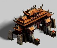
City
3d_export
$18
imperial city-city gate-city wall 782
...imperial city-city gate-city wall 782
3dexport
imperial city-city gate-city wall 782<br>3ds max 2015
3d_export
$18
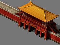
imperial city-city gate-city wall 785
...imperial city-city gate-city wall 785
3dexport
imperial city-city gate-city wall 785<br>3ds max 2015
3d_export
$40
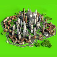
city
...city
3dexport
a city with non-standard architecture.
design_connected
$9

City
...city
designconnected
emmemobili city dining tables computer generated 3d model. designed by ferruccio laviani.
3ddd
$1

Диван City
...диван city
3ddd
city , softline
диван city (фирма softline)
3ddd
$1
Гостиная CITY
...гостиная city
3ddd
city , дятьково
гостиная city производства дятьково
3d_export
$18
imperial city-shabak-city wall
...imperial city-shabak-city wall
3dexport
imperial city-shabak-city wall<br>3ds max 2015
3d_export
$18
imperial city-shabak-city gate
...imperial city-shabak-city gate
3dexport
imperial city-shabak-city gate<br>3ds max 2015
turbosquid
$300

City
...ty
turbosquid
royalty free 3d model city for download as 3ds on turbosquid: 3d models for games, architecture, videos. (1235306)
turbosquid
$249

city
...ity
turbosquid
royalty free 3d model city for download as ma on turbosquid: 3d models for games, architecture, videos. (1340610)
Map
3d_ocean
$5

Map
...map
3docean
geography map ocean travel world world map
a world map
3d_ocean
$5

Old Map
...old map
3docean
dirty map ocean old map paper pirates rotten travel world map
an old map
turbosquid
$3

Map
... available on turbo squid, the world's leading provider of digital 3d models for visualization, films, television, and games.
3d_ocean
$3

Map of Iran
...map of iran
3docean
flag iran map outline
an outline map of iran
3d_ocean
$2

Map of the USA
...map of the usa
3docean
america flag globe map united states usa
an outline map of the usa
3ddd
$1

Abstract Maps
... город , picture
abstract maps by artist jazzberry blue
3d_ocean
$5

Honduras Map
...honduras map
3docean
3d cinema4d honduras map mapa
honduras map designed in cinema 4d r17
3d_ocean
$2

Map of Germany
...map of germany
3docean
black country europe germany gold map outline red yellow
a simple outline map of germany
3d_ocean
$2

Map of Australia
...map of australia
3docean
australia banner country down under earth flag globe map ocean south
an outline map of australia
3d_ocean
$2

Map of Russia
...of russia
3docean
asia banner earth europe flag globe map russia russian federation siberia sovjet union
an outline map of russia
Part
3d_export
$5

Parts
...parts
3dexport
parts
3d_export
$5
Part
...part
3dexport
part
3d_export
$5

Part
...part
3dexport
machine part
3d_export
$65
Part
...part
3dexport
simple rendering of the scene file
3d_export
$65
Part
...part
3dexport
simple rendering of the scene file
3d_export
$30

fan part
...fan part
3dexport
this is a part of fan of pedastal
3d_export
$10
machine parts
...machine parts
3dexport
3d part modeling work ,contact for 3d work
turbosquid
$59
Mechanical Part
...id
royalty free 3d model mechanical part for download as c4d on turbosquid: 3d models for games, architecture, videos. (1410833)
turbosquid
$17
Road parts
...bosquid
royalty free 3d model road parts for download as 3ds on turbosquid: 3d models for games, architecture, videos. (1192967)
turbosquid
$9

Cutter Parts
...squid
royalty free 3d model cutter parts for download as stl on turbosquid: 3d models for games, architecture, videos. (1220010)
1
turbosquid
$69
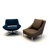
armchairs(1)(1)
... available on turbo squid, the world's leading provider of digital 3d models for visualization, films, television, and games.
turbosquid
$15
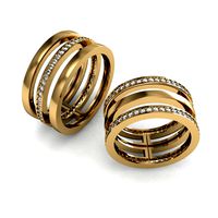
ring 1+1
... available on turbo squid, the world's leading provider of digital 3d models for visualization, films, television, and games.
turbosquid
$10
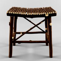
chair(1)(1)
... available on turbo squid, the world's leading provider of digital 3d models for visualization, films, television, and games.
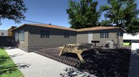
turbosquid
$8

Chair(1)(1)
... available on turbo squid, the world's leading provider of digital 3d models for visualization, films, television, and games.
turbosquid
$2

RING 1(1)
... available on turbo squid, the world's leading provider of digital 3d models for visualization, films, television, and games.
turbosquid
$1
house 1(1)
... available on turbo squid, the world's leading provider of digital 3d models for visualization, films, television, and games.
turbosquid
$1

Table 1(1)
... available on turbo squid, the world's leading provider of digital 3d models for visualization, films, television, and games.
turbosquid
$59

Formula 1(1)
...lty free 3d model formula 1 for download as max, fbx, and obj on turbosquid: 3d models for games, architecture, videos. (1567088)
design_connected
$11

No 1
...no 1
designconnected
sibast no 1 computer generated 3d model. designed by sibast, helge.
turbosquid
$2
desert house(1)(1)
...3d model desert house(1)(1) for download as 3ds, max, and obj on turbosquid: 3d models for games, architecture, videos. (1055095)