Sketchfab

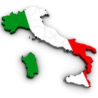
Italy with Provinces Map
by Sketchfab
Last crawled date: 2 years, 10 months ago
Italy, officially the Italian Republic is a unitary parliamentary republic in Europe. Located in the heart of the Mediterranean Sea, Italy covers an area of 301,338 km2 (116,347 sq mi) and has a largely temperate seasonal and Mediterranean climate. With around 61 million inhabitants it is the fourth most populous EU member state.
This is a digital model of the country of Italy with color-separated provinces. Neighboring countries such as Austria, France, Switzerland, Tunisia, and more can be seen.
Approx 45479 polygons.
Made with 3 and 4 point polygons.
Includes different colors to separate the provinces.
Includes separate parts for each province.
This version includes an mtl file, which your software program should read to colorize the model.
The model has basic UV mapping and NO textures are included.
Original model by Digimation and sold here with permission. - Italy with Provinces Map - Buy Royalty Free 3D model by JohnHoagland (@JohnHoagland) [cea60dc]
Similar models
cg_trader
$25

Italy With Provinces Map for 3ds and obj
... temperate seasonal and mediterranean climate. with around 61 million inhabitants it is the fourth most populous eu member state.
cg_trader
$9

Map of Poland
...try world map state cartography various models various models exterior other pl political province region nation global europe eu
sketchfab
$11

Country Home
...el by, and acquired, from poserworld, and now owned by vanishingpoint. - country home - buy royalty free 3d model by johnhoagland
sketchfab
$9

Seafarers Union
...; uploaded for sale here with permission. - seafarers union - buy royalty free 3d model by johnhoagland (@johnhoagland) [ac2225c]
sketchfab
$18

Airbus A319
... by digimation and sold here with permission. - airbus a319 - buy royalty free 3d model by johnhoagland (@johnhoagland) [f9826db]
cg_trader
$5

3D Map Of Europe
...spain france germany ireland england italy switzerland austria hungary slovakia czech republic poland belgium architectural other
free3d
free

Africa Map Colored
...africa map colored
free3d
a colored map of africa with separated countries
cg_trader
$25

Czech Republic country map 3d model
...blic country map 3d model
cg trader
czech republic country map model is a detailed high quality 3d model.
texture resolution- 2k
sketchfab
$10

Liquor Store
...el by, and acquired, from poserworld, and now owned by vanishingpoint. - liquor store - buy royalty free 3d model by johnhoagland
sketchfab
$9

Viceroy Butterfly
..., and acquired, from poserworld, and now owned by vanishingpoint. - viceroy butterfly - buy royalty free 3d model by johnhoagland
Provinces
turbosquid
$10

netherlands province map
...therlands province map for download as max, obj, fbx, and dwg on turbosquid: 3d models for games, architecture, videos. (1345423)
3d_export
$199

treviso province of treviso city italy 20km
...der ready. 1. suitable for games, games, education, architecture etc. 2. mainly used for town and urban planning, real estate etc
3d_export
$50

Cow statue
...cow statue is located in the territory of indonesia, precisely in the province of south kalimantan and in the tanah laut district
3ddd
free
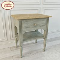
Тумбочка Comptoir de Famille
...ille , тумбочка
тумбочка province фабрики comptoir de famille.
размеры 50 x 40 x h60 cm
3ddd
$1
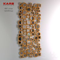
Mirror 365 DAYS
...a bignoniaceae, back side: mdf, china, guangdong province), mirror glass, frame: catalpa wood
descripción: 140x60x3,5
ref. 77742
cg_studio
$89

America3d model
...ecision america province
.3ds .max .obj .fbx - america 3d model, royalty free license available, instant download after purchase.
cg_studio
$60
Map of Italy3d model
...ily genoa bologna verona
.max .obj .3ds - map of italy 3d model, royalty free license available, instant download after purchase.
cg_studio
$35

Kansas Political Map3d model
... region province
.max .obj .3ds - kansas political map 3d model, royalty free license available, instant download after purchase.
cg_studio
$35

Iowa Political Map3d model
...ty region province
.obj .3ds .max - iowa political map 3d model, royalty free license available, instant download after purchase.
cg_studio
$35
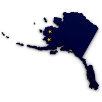
Alaska Political Map3d model
... region province
.obj .3ds .max - alaska political map 3d model, royalty free license available, instant download after purchase.
Italy
3ddd
$1

Beby Italy
...beby italy
3ddd
beby italy
p 254 973v 240 216люстра beby italy
3ddd
$1

BEBY italy
...beby italy
3ddd
beby italy
p 470 554v 305 860люстра производителя beby italy
turbosquid
$9

Italy
... available on turbo squid, the world's leading provider of digital 3d models for visualization, films, television, and games.
turbosquid
$2

Italy
...ee 3d model italy for download as max, 3ds, dxf, fbx, and obj on turbosquid: 3d models for games, architecture, videos. (1630981)
turbosquid
$2

Italy
... available on turbo squid, the world's leading provider of digital 3d models for visualization, films, television, and games.
3ddd
$1

Piumotto Busnelli Italy
...y
3ddd
piumotto busnelli italy , busnelli
черное кожаное кресло piumotto busnelli italy.
3ddd
free

Бра (Baby italy)
...бра (baby italy)
3ddd
baby italy
люстра итальянской фирмы baby italy,модель делала сама по каталогу
turbosquid
$19

Milan Italy
...osquid
royalty free 3d model milan italy for download as max on turbosquid: 3d models for games, architecture, videos. (1541360)
turbosquid
$5

Italy with regions
...
royalty free 3d model italy with regions for download as c4d on turbosquid: 3d models for games, architecture, videos. (1341832)
turbosquid
$4

NeoLoft Italy
...
royalty free 3d model kitchen from italy for download as max on turbosquid: 3d models for games, architecture, videos. (1616535)
Map
3d_ocean
$5

Map
...map
3docean
geography map ocean travel world world map
a world map
3d_ocean
$5

Old Map
...old map
3docean
dirty map ocean old map paper pirates rotten travel world map
an old map
turbosquid
$3

Map
... available on turbo squid, the world's leading provider of digital 3d models for visualization, films, television, and games.
3d_ocean
$3

Map of Iran
...map of iran
3docean
flag iran map outline
an outline map of iran
3d_ocean
$2

Map of the USA
...map of the usa
3docean
america flag globe map united states usa
an outline map of the usa
3ddd
$1

Abstract Maps
... город , picture
abstract maps by artist jazzberry blue
3d_ocean
$5

Honduras Map
...honduras map
3docean
3d cinema4d honduras map mapa
honduras map designed in cinema 4d r17
3d_ocean
$2

Map of Germany
...map of germany
3docean
black country europe germany gold map outline red yellow
a simple outline map of germany
3d_ocean
$2

Map of Australia
...map of australia
3docean
australia banner country down under earth flag globe map ocean south
an outline map of australia
3d_ocean
$2

Map of Russia
...of russia
3docean
asia banner earth europe flag globe map russia russian federation siberia sovjet union
an outline map of russia