CG Trader

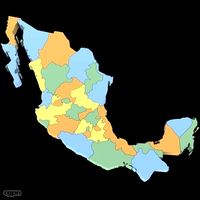
High resolution 3D relief map of Gulf of Mexico
by CG Trader
Last crawled date: 1 year, 11 months ago
Relief map of Gulf of Mexico with surrounding area. The map projection is Mercator. Geographic extents: W:-101; E:-79; S:15; N:34. The 3D relief is taken from reprojected NASA shuttle radar topography data, with the elevation exaggerated.
The relief is baked into a 750x712 mesh with 1075373 polys, 539154 vertices (for the main map). An additional 16-bit bump texture is used for fine-grained detail. The texture is rendered from color processed NASA satellite images. Separate b/w texture masks are included for: land/ocean areas rivers and inland water areas cities borders A multi-layered material (3ds Max version only) together with the provided texture masks allows extensive changes to the appearance of the map.
Possible customizations include different colorings or complete removal of separate features like cities or borders. A description of the multi-layered material and texture masks can be found in the accompanying PDF-manual. Previews are rendered with mental ray, but the project uses only standard materials. The .obj and .fbx versions will require new texture assignments after import. country countries state states relief topography topographic geography geographic shaded map maps atlas terrain landscape cartography illustration gulf of mexico mexico gulf exterior topographic map
Similar models
cg_trader
$195

Iran High resolution 3D relief maps
...te states earth relief topography topographic geography geographic illustration cartography geopolitical exterior topographic map
cg_trader
$195

Switzerland High resolution 3D relief maps
...es earth relief topography topographic geography geographic shaded cartography geopolitical illustration exterior topographic map
cg_trader
$195

Mexico High resolution 3D relief maps
...es earth relief topography topographic geography geographic shaded geopolitical cartography illustration exterior topographic map
cg_trader
$195

Florida High resolution 3D relief maps
...ntries states relief topography topographic geography geographic shaded cartography illustration exterior topographic map usa map
cg_trader
$195

Connecticut High resolution 3D relief maps
...ntries states relief topography topographic geography geographic shaded illustration cartography exterior topographic map usa map
cg_trader
$195

Afghanistan High Resolution 3D Relief Maps
...ntry countries state states earth relief topography topographic geography geographic shaded border exterior other topographic map
cg_trader
$195

Europe High resolution 3D relief maps
...ountries state states relief topography topographic geography geographic shaded cartography illustration exterior topographic map
cg_trader
$195

United Kingdom High resolution 3D relief maps
...opography topographic geography geographic shaded border illustration cartography britain united kingdom exterior topographic map
cg_trader
$195

Germany High resolution 3D relief maps
...es state states earth relief topography topographic geography geographic shaded cartography illustration exterior topographic map
cg_trader
$195

Arkansas High resolution 3D relief maps
...try countries states earth relief topography topographic geography geographic shaded cartography exterior topographic map usa map
Gulf
3ddd
$1
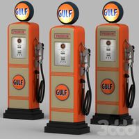
Gulf gas station
... ретро
ретро колонка gulf 50-60-х годов. в моделе используются манипуляторы для удобной регулировки значений счетчика.
3d_export
$40
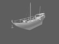
Gulf Ship 3D Model
...gulf ship 3d model
3dexport
boat
old gulf ship
3d_export
$55
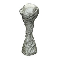
Arabian Gulf Cup
...arabian gulf cup
3dexport
turbosquid
$50
Bahrain Gulf Air
... available on turbo squid, the world's leading provider of digital 3d models for visualization, films, television, and games.
turbosquid
$99

PREMIER-II GULF AIR
... available on turbo squid, the world's leading provider of digital 3d models for visualization, films, television, and games.
3d_export
$71
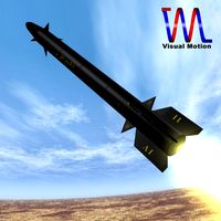
Iranian Persian Gulf Missile 3D Model
...srbm iranian short range ballistic fetah strike force truespace
iranian persian gulf missile 3d model visualmotion 60142 3dexport
turbosquid
$99

PREMIER-II GULF AIR 3DSMAX5
... available on turbo squid, the world's leading provider of digital 3d models for visualization, films, television, and games.
turbosquid
$79

Voshod 3M Gulf Racing TT
... available on turbo squid, the world's leading provider of digital 3d models for visualization, films, television, and games.
turbosquid
$65

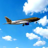
Airbus A340-300 Gulf Air
... available on turbo squid, the world's leading provider of digital 3d models for visualization, films, television, and games.
3d_export
$129
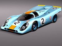
Porsche 917k GULF LeMans 24h 3D Model
...ng supercar fast germany winner classic retro oldtimer vintage antique
porsche 917k gulf lemans 24h 3d model squir 37457 3dexport
Mexico
turbosquid
$100

Mexico
... available on turbo squid, the world's leading provider of digital 3d models for visualization, films, television, and games.
3d_export
$5
eagle mexico
...eagle mexico
3dexport
tlatelolco eagle<br>for those who remember their trips to mexico, more than memorable
turbosquid
$70

Mexico Map
...ty free 3d model mexico map for download as 3ds, max, and obj on turbosquid: 3d models for games, architecture, videos. (1299218)
turbosquid
$49

New Mexico
... available on turbo squid, the world's leading provider of digital 3d models for visualization, films, television, and games.
turbosquid
$29

Soccerball Mexico
... available on turbo squid, the world's leading provider of digital 3d models for visualization, films, television, and games.
turbosquid
$15

New Mexico
... available on turbo squid, the world's leading provider of digital 3d models for visualization, films, television, and games.
turbosquid
$15

MEXICO-chair
... available on turbo squid, the world's leading provider of digital 3d models for visualization, films, television, and games.
turbosquid
$4

New-Mexico
... available on turbo squid, the world's leading provider of digital 3d models for visualization, films, television, and games.
cg_studio
$60
Mexico Map3d model
...map3d model
cgstudio
.3ds .max .obj .wrl - mexico map 3d model, royalty free license available, instant download after purchase.
turbosquid
$9

Mexico low poly
...lty free 3d model mexico low poly for download as max and obj on turbosquid: 3d models for games, architecture, videos. (1169260)
Relief
3d_export
$20
relief
...relief
3dexport
relief
turbosquid
$1

Relief
...
turbosquid
royalty free 3d model relief for download as obj on turbosquid: 3d models for games, architecture, videos. (1438537)
3d_export
$15
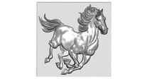
horse relief
...horse relief
3dexport
horse relief
3d_export
$10

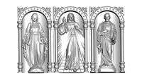
jesus relief
...jesus relief
3dexport
jesus relief
3d_export
$10

rome relief
...rome relief
3dexport
rome relief
3d_export
$10

fish relief
...fish relief
3dexport
fish relief
3d_export
$10

eagle relief
...eagle relief
3dexport
eagle relief
3d_export
$10
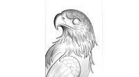
eagle relief
...eagle relief
3dexport
eagle relief
3d_export
free

3d relief
...3d relief
3dexport
3d relief
turbosquid
free
Relief
... available on turbo squid, the world's leading provider of digital 3d models for visualization, films, television, and games.
Resolution
turbosquid
$5

Cottage Low Resolution
...el cottage low resolution for download as blend, fbx, and dae on turbosquid: 3d models for games, architecture, videos. (1699415)
turbosquid
$199

Brain High Resolution
... available on turbo squid, the world's leading provider of digital 3d models for visualization, films, television, and games.
turbosquid
$39

Icicles Low Resolution
... available on turbo squid, the world's leading provider of digital 3d models for visualization, films, television, and games.
turbosquid
$15

High resolution Jug
... available on turbo squid, the world's leading provider of digital 3d models for visualization, films, television, and games.
turbosquid
$8
pattern with low resolution
... available on turbo squid, the world's leading provider of digital 3d models for visualization, films, television, and games.
turbosquid
$2

Low Resolution Sofa
...olution sofa for download as 3ds, obj, fbx, dwg, dae, and skp on turbosquid: 3d models for games, architecture, videos. (1412607)
3d_ocean
$5
High Resolution Wood Texture
...le. the high resolution allows close ups. the pack contains one high resolution diffuse map, as well as a reflection ( specula...
cg_studio
$40

High Resolution Female3d model
...cgstudio
.3ds .max .dxf .obj - high resolution female 3d model, royalty free license available, instant download after purchase.
cg_studio
$40
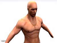
High Resolution Male3d model
...l
cgstudio
.3ds .max .dxf .obj - high resolution male 3d model, royalty free license available, instant download after purchase.
turbosquid
$35

Very high resolution clock
...ree 3d model very high resolution clock for download as blend on turbosquid: 3d models for games, architecture, videos. (1174512)
Map
3d_ocean
$5

Map
...map
3docean
geography map ocean travel world world map
a world map
3d_ocean
$5

Old Map
...old map
3docean
dirty map ocean old map paper pirates rotten travel world map
an old map
turbosquid
$3

Map
... available on turbo squid, the world's leading provider of digital 3d models for visualization, films, television, and games.
3d_ocean
$3

Map of Iran
...map of iran
3docean
flag iran map outline
an outline map of iran
3d_ocean
$2

Map of the USA
...map of the usa
3docean
america flag globe map united states usa
an outline map of the usa
3ddd
$1

Abstract Maps
... город , picture
abstract maps by artist jazzberry blue
3d_ocean
$5

Honduras Map
...honduras map
3docean
3d cinema4d honduras map mapa
honduras map designed in cinema 4d r17
3d_ocean
$2

Map of Germany
...map of germany
3docean
black country europe germany gold map outline red yellow
a simple outline map of germany
3d_ocean
$2

Map of Australia
...map of australia
3docean
australia banner country down under earth flag globe map ocean south
an outline map of australia
3d_ocean
$2

Map of Russia
...of russia
3docean
asia banner earth europe flag globe map russia russian federation siberia sovjet union
an outline map of russia
High
3d_export
$15
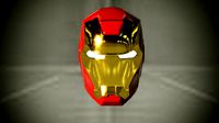
ironman high
...ironman high
3dexport
ironman high poly
turbosquid
$49

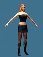
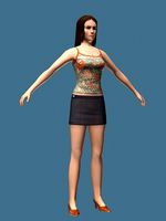
High Heel Girl (High Poly)
... available on turbo squid, the world's leading provider of digital 3d models for visualization, films, television, and games.
turbosquid
$49

High Heel Girl (High Poly)
... available on turbo squid, the world's leading provider of digital 3d models for visualization, films, television, and games.
turbosquid
$49

High Heel Girl (High Poly)
... available on turbo squid, the world's leading provider of digital 3d models for visualization, films, television, and games.
turbosquid
$49
High Heel Girl (High Poly)
... available on turbo squid, the world's leading provider of digital 3d models for visualization, films, television, and games.
turbosquid
$49
High heel girl (High Poly)
... available on turbo squid, the world's leading provider of digital 3d models for visualization, films, television, and games.
design_connected
$16

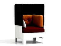
Cantu High
...cantu high
designconnected
linbrasil cantu high computer generated 3d model. designed by rodrigues, sergio.
design_connected
$16
Koja high
...koja high
designconnected
blå station koja high computer generated 3d model. designed by mattson, fredrik.
design_connected
$16

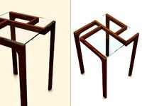
Ribbon High
...ribbon high
designconnected
cappellini ribbon high bar stools computer generated 3d model. designed by nendo.
design_connected
$11
Garry High
...garry high
designconnected
ligne roset garry high computer generated 3d model. designed by jourdan, eric.