Sketchfab
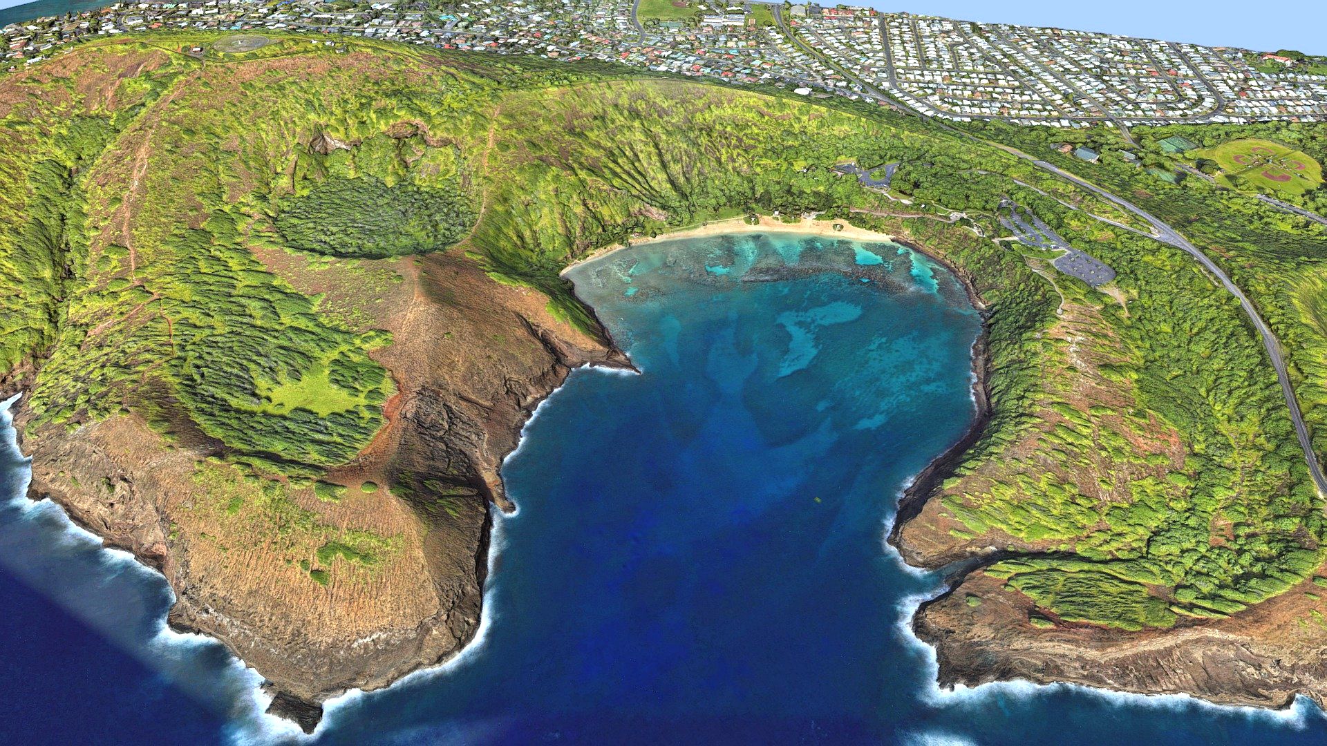
Hanauma Bay, Honolulu island
by Sketchfab
Last crawled date: 1 year ago
Hanauma (Hawaiian: [həˈnɔumə]) is a marine embayment formed within a tuff ring and located along the southeast coast of the Island of Oʻahu in the Hawaii Kai neighborhood of East Honolulu, in the Hawaiian Islands.
Hanauma is one of the most popular tourist destinations on the Island and has suffered somewhat from overtourism. At one time, this popular tourist destination accommodated over three million visitors per year. In 1956, dynamite was used to clear portions of the reef to make room for telephone cables linking Hawaii to the west coast of the US.
The prefix hana means bay in the Hawaiian language (the usual addition of bay in its name is thus redundant). There are two etymological interpretations of the second part of its name. One interpretation derives it from the Hawaiian word for curve, referring to either the shape of the feature or to the shape of the indigenous canoes that were launched there. Another stems from the indigenous hand-wrestling game known as “Uma”.
Source: Wikipedia.org - Hanauma Bay, Honolulu island - Buy Royalty Free 3D model by LibanCiel
Similar models
3dwarehouse
free

Hawaii
...d #ocean #of #pasific #south #state #states #terrain #tropic #tropical #us #usa #united #united_states #unitedstates #warm #water
3dwarehouse
free

Hawaiian Airlines Boeing 767-300ER
...nes livery. #767 #767300 #767300er #airplane #boeing #hawaii #hawaiian #hawaiian_airlines #hawaiian_airlines_767300er #jet #plane
3dwarehouse
free

First Hawaiian Center
...house
textured model of first hawaiian center, also my first textured model. #center #first #hawaii #hawaiian #honolulu #texture
3dwarehouse
free

Bank of Hawaii Kailua
...hawaii kailua
3dwarehouse
bank of hawaii in kailua on the island of oahu. #bank #bank_of_hawaii #hawaii #hawaiian #kailua #local
thingiverse
free

Souvenir for Hawaii by pmoews
...as a charm when printed at 50 to 60 percent of full size. the souvenir plaques are labeled "hawaii aloha" on the back.
3dwarehouse
free

Hawaii - First Hawaiian Center
... hawaii, rising to nearly 430 feet. #first_hawaiian_center #highrise #honolulu_hawaii #island #office_building #palms #skyscraper
3dwarehouse
free

Hawaiian Airlines Airbus A380
...80800 #hal #hawaii #hawaiian_a380 #hawaiian_airbus #hawaiian_airlines #hawaiian_airlines_airbus #honolulu #islands #united_states
3dwarehouse
free

Coastguard Hawaii
...stguard hawaii
3dwarehouse
honolulu harbor coast guard craft. #army #boat #coast #coast_gurad #cool #guard #honolulu #ship #uscg
3dwarehouse
free

Hawaiian Flour Mill in Honolulu, Hawaii, Vereinigte Staaten
...hawaiian flour mill in honolulu, hawaii, vereinigte staaten
3dwarehouse
modelliert mit dem gebäude-erstellungstool
3dwarehouse
free

Honolulu Power Plant
...palm tree component by nesua. #1920s #1950s #hawaii #honolulu #industrial #industry #oahu #power_plant #power_station #smokestack
Honolulu
turbosquid
$229

Honolulu Cityscape
...
royalty free 3d model honolulu cityscape for download as max on turbosquid: 3d models for games, architecture, videos. (1460966)
design_connected
$18

Honolulu Armchair and Ottoman
...honolulu armchair and ottoman
designconnected
alberta honolulu armchair and ottoman computer generated 3d model.
3d_export
$49

Honolulu Daniel K Inouye International Airport 10km
...honolulu daniel k inouye international airport 10km
3dexport
3d_export
$199

Honolulu city hawaii
...ses.<br>note: some city we used our own ai tool to generate buildings, therefore shapes may be little varied from original.
3d_export
$99

Honolulu Hawaii USA Downtown 8km
...ses.<br>note: some city we used our own ai tool to generate buildings, therefore shapes may be little varied from original.
3d_export
$199

honolulu hawaii city usa 50 km
...;1. suitable for games, games, education, architecture etc.<br>2. mainly used for town and urban planning, real estate etc.
thingiverse
free

Honolulu Hawaii by tpsully
.... the source code for creating these files is available up on github under the gnu license. go to github and search for srtm2stl.
3dbaza
$3

Bazar Bizar Honolulu Natural Pendant Lamp (325941)
...rials in the brdf section are microfaset gtr (ggx). if your version is older than 3.1, then the brdf field will be empty. choose
thingiverse
free

Zombie Dragon Skull by esprite
...thingiverse speed sculpt made during a live demo at honolulumini maker faire. haven't printed it...
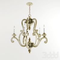
Bay
3ddd
$1
Bay
...bay
3ddd
calligaris
стул bay итальянской фабрики сalligaris /max2011,fbx,obj,mat/
3ddd
$1

MDF / BAY
...mdf / bay
3ddd
bay , mdf italia
диван "bay"
*turbosmooth присутствует
turbosquid
$8

Bay
... available on turbo squid, the world's leading provider of digital 3d models for visualization, films, television, and games.
3ddd
$1
BAY XL
... giulio marelli
giulio marelli italia. bay xl.
диван, дизайн studio crgm в тканевом исполнении.
длина: 2.55
design_connected
$18
Bai Armchair
...bai armchair
designconnected
ondarreta bai armchair computer generated 3d model. designed by lizaso, ander.
3ddd
$1
Kichler Hayman Bay
...kichler hayman bay
3ddd
kichler , hayman bay
люстра kichler lighting 43256daw hayman bay
design_connected
$13

Bai Chandelier
...bai chandelier
designconnected
parachilna bai chandelier computer generated 3d model. designed by neri&hu.
3ddd
$1

Lamp poters bay
...lamp poters bay
3ddd
eichholtz
eichholtz, lamp poters bay
turbosquid
$32
Shuttle Bay
...ty free 3d model shuttle bay for download as ma, obj, and fbx on turbosquid: 3d models for games, architecture, videos. (1475258)
turbosquid
$20

Iris Bay
...free 3d model iris bay for download as 3ds, c4d, fbx, and stl on turbosquid: 3d models for games, architecture, videos. (1367781)
Island
3d_export
$15

island
...island
3dexport
the island is fantastic!
3d_export
$8

of the island
...of the island
3dexport
3d model of the island
3d_export
free

island
...island
3dexport
desert island with crystals
design_connected
$11

Island
...island
designconnected
alberta island computer generated 3d model.
3d_export
free

Island
...island
3dexport
a small island in a minimalist style. with the flag of ukraine.
3d_ocean
$17

Island
...island
3docean
3d island 3d palms cartoon island cartoon palms
made in 3ds max 2014, has 9205 polygons, vray.
design_connected
$16

Island
...island
designconnected
paola lenti island computer generated 3d model. designed by rota, francesco.
3d_export
$5

island
...island
3dexport
this is no longer just a small island, but a whole location for some kind of game or animation!
turbosquid
$10

Island
...
turbosquid
royalty free 3d model island for download as fbx on turbosquid: 3d models for games, architecture, videos. (1672956)
turbosquid
$10

Island
...
turbosquid
royalty free 3d model island for download as fbx on turbosquid: 3d models for games, architecture, videos. (1672543)