CG Trader

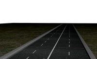
Greater Los Angeles Road Network and Streets
by CG Trader
Last crawled date: 1 year, 10 months ago
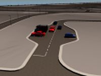
UPDATE March 9, 2018 this model is based on real data therefore this is a realistic road network and streets setup of Greater Los Angeles, USA this model includes the whole territory of Los Angeles such as the downtown area, LAX area, Northern and Western part, Beverly Hills and Hollywood etc. 2 objects included | 1. roads and streets 2. squares and plazas UV mapped with overlapping UVs the model is positioned on a flat surface (road network is on the “floor” - no elevation data included) geometry is polygonal quads and tris model is untextured and renders fast this model is compatible with the Greater Los Angeles Streets and Buildings 3D model :
https://www.cgtrader.com/3d-models/exterior/cityscape/greater-los-angeles-road-network-and-streets this 3D model is/can be licensed (commercial use is fine) under Creative Commons Attribution-ShareALike 2.0 (CC-BY-SA) license buildings and streets data from OpenStreetMap / www.openstreetmap.org Attribution : © OpenStreetMap contributors / http://www.openstreetmap.org/copyright POINTS/VERTS : 5732633
POLYGONS : 5987031 .c4d - native format .fbx - v7.1 .dae - v1.5 .dxf .obj los angeles usa america road network system streets infrastructure map cartography city gps navigation roads squares realistic topology topological street architectural architectural street city street city map city street city streets los angeles usa map
Similar models
cg_trader
$29

Los Angeles Road Network and Streets
...opology street architectural architectural street city street city map city street city streets los angeles united states usa map
cg_trader
$29

Greater Melbourne Road Network and Streets
...navigation roads squares realistic topological topology street architectural street city street city map city street city streets
cg_trader
$29

Boston Road Network and Streets
...es realistic topological topology street architectural street city street city map city street city streets united states usa map
cg_trader
$39

Greater London Road Network and Streets
...s squares realistic topological street architectural street city street city london city map city street city streets london city
cg_trader
$29

Baltimore Road Network and Streets
... realistic topology architectural street architectural street city street city map city street city streets united states usa map
cg_trader
$29

Orlando Road Network and Streets
... roads squares realistic topology street architectural street city street city map city street city streets united states usa map
cg_trader
$29
Philadelphia Road Network and Streets
... roads squares realistic topology street architectural street city street city map city street city streets united states usa map
cg_trader
$29

Detroit Road Network and Streets
... roads squares realistic topology street architectural street city street city map city street city streets united states usa map
cg_trader
$29

Miami Road Network and Streets
...alistic topological architectural street architectural street city street city map city street city streets united states usa map
cg_trader
$29

Dallas Road Network and Streets
... roads squares realistic topology street architectural street city street city map city street city streets united states usa map
Greater
humster3d
$40

3D model of Greater Kudu
...
buy a detailed 3d model of greater kudu in various file formats. all our 3d models were created maximally close to the original.
3d_export
$125

Greater Rhea skeleton 3D Model
...ghtless bird camelbird ostrich skull bones foot leg arm rib nature long neck
greater rhea skeleton 3d model rembex 27924 3dexport
turbosquid
$39

Greater Columbus Convention Center
...mbus convention center for download as 3ds, max, obj, and fbx on turbosquid: 3d models for games, architecture, videos. (1313766)
3d_export
$49

Greater Rochester International Airport 10km
...greater rochester international airport 10km
3dexport
3d_export
$50

Medieval Greater House 3D Model
...entury 14th 15th 16th butress stone brick glass windows seaton holme
medieval greater house 3d model archaeodesign 32812 3dexport
turbosquid
$9

Low Poly Cartoon Greater Kudu Antelope
...u antelope for download as blend, 3ds, dae, fbx, obj, and stl on turbosquid: 3d models for games, architecture, videos. (1519502)
turbosquid
$81

Greater Lizard fish animated low poly toon
...d low poly toon 3d model for download as ma, ma, fbx, and obj on turbosquid: 3d models for games, architecture, videos. (1585804)
3d_export
$9

low poly cartoon greater kudu antelope
...cluded in the .blend file. the model is clean and alone in the other provided files, centered at origin and has real-world scale.
3d_export
$12
VECNA mask stranger things
...mask stranger things 3dexport it is cut for your greater ease of...
3d_export
$199

Greater Buenos city aires 100km
...ses.<br>note: some city we used our own ai tool to generate buildings, therefore shapes may be little varied from original.
Network
3ddd
$1
Network table by Henge
...network table by henge
3ddd
henge
network table by henge
3d_export
$35

network office design
...network office design
3dexport
network office 3d model design
turbosquid
$120

Global Network
... available on turbo squid, the world's leading provider of digital 3d models for visualization, films, television, and games.
turbosquid
$40
Road Network
... available on turbo squid, the world's leading provider of digital 3d models for visualization, films, television, and games.
turbosquid
$4

social Network
... available on turbo squid, the world's leading provider of digital 3d models for visualization, films, television, and games.
design_connected
$16
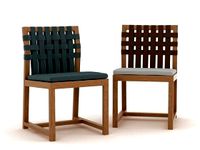
Network 149 chair
...network 149 chair
designconnected
roda network 149 chair computer generated 3d model. designed by dordoni, rodolfo.
design_connected
$16
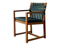
Network 159 armchair
...twork 159 armchair
designconnected
roda network 159 armchair armchairs computer generated 3d model. designed by rodolfo dordoni.
3d_ocean
$15
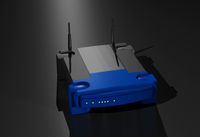
Wireless Broadband Network Router
... computer networking. similar to popular styles of wireless routers. this model was created in 3d studio max 2008 and has a ma...
3d_export
$30
Road Network 3D Model
...
3dexport
roads network highway
road network 3d model download .c4d .max .obj .fbx .ma .lwo .3ds .3dm .stl msaeed 103734 3dexport
turbosquid
$3
DOUBLE NETWORK PLUG
...d model double network plug for download as max, obj, and fbx on turbosquid: 3d models for games, architecture, videos. (1370379)
Angeles
3d_export
$13

angel
...angel
3dexport
pendant angel
3ddd
$1

Angel
...angel
3ddd
addinterior
стул angel от addinteriorhttp://www.addinterior.dk/page/products/29/
3d_export
$80

angel sculpture
...angel sculpture
3dexport
angel
turbosquid
free
Angel
...angel
turbosquid
free 3d model angel for download as obj on turbosquid: 3d models for games, architecture, videos. (421674)
3d_export
$59

Angel sculpture
...angel sculpture
3dexport
angel sculpture
turbosquid
$36

Angel
...turbosquid
royalty free 3d model angel for download as blend on turbosquid: 3d models for games, architecture, videos. (1443719)
turbosquid
$17

Angel
...l
turbosquid
royalty free 3d model angel for download as max on turbosquid: 3d models for games, architecture, videos. (1594913)
turbosquid
$15

angel
...l
turbosquid
royalty free 3d model angel for download as stl on turbosquid: 3d models for games, architecture, videos. (1697805)
turbosquid
$8

angel
...l
turbosquid
royalty free 3d model angel for download as stl on turbosquid: 3d models for games, architecture, videos. (1253675)
turbosquid
$5

Angel
...l
turbosquid
royalty free 3d model angel for download as obj on turbosquid: 3d models for games, architecture, videos. (1404898)
Road
3d_export
free
road
...road
3dexport
ready road with textures.
turbosquid
$4

Cross road Road-sign
...ss road road-sign for download as 3ds, dae, fbx, obj, and stl on turbosquid: 3d models for games, architecture, videos. (1516042)
3d_ocean
$39

Road
...torway nascar oval poly race racetrack raceway racing realtime road speedway talladega track way
racing games for the road system
turbosquid
$1
road
...ad
turbosquid
royalty free 3d model road for download as max on turbosquid: 3d models for games, architecture, videos. (1167278)
3d_ocean
$9
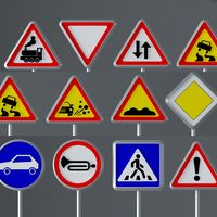
Road Signs
...road signs
3docean
outdoor road signs signpost waymark
road signs 3d models.
3d_export
$5
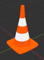
road cone
...road cone
3dexport
road cone
3d_export
free
road
...road
3dexport
3d_export
$5

road markings
...road markings
3dexport
construction of road markings
turbosquid
$25
Road
...lty free 3d model road for download as png, 3ds, obj, and fbx on turbosquid: 3d models for games, architecture, videos. (1380086)
3d_export
$5

road sign
...road sign
3dexport
road sign with the texture of a cyclist.
Los
3ddd
$1

Paperminions - Los Increibles
...inions - los increibles
3ddd
paperminions , los increibles
paperminions - los increibles
3ddd
$1

DO-LO-REZ
...do-lo-rez
3ddd
do-lo-rez , moroso
do-lo-rez sofa
3ddd
$1

Do-lo-Res
... угловой
диван фабрика do-lo-res компонуется из отдельных боксов, разнообразных размеров и тканей.
3ddd
$1
Lo turi
...lo turi
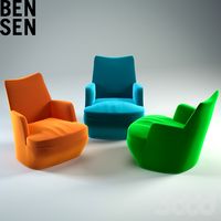
3ddd
bensen
1200x1200
turbosquid
$30
Lock Lo
... available on turbo squid, the world's leading provider of digital 3d models for visualization, films, television, and games.
turbosquid
free

face lo
... available on turbo squid, the world's leading provider of digital 3d models for visualization, films, television, and games.
3ddd
$1

DO-LO-REZ
...бы образовалась форма дивана, и закреплены к основе стальными булавками.
покрытия модели do-lo-rez несъемные. основа деревянная.
turbosquid
$41
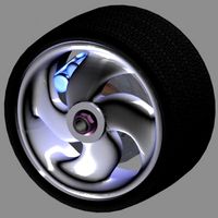
Lo-profile Wheel.max
... available on turbo squid, the world's leading provider of digital 3d models for visualization, films, television, and games.
turbosquid
$2

Espada - sword LO
... available on turbo squid, the world's leading provider of digital 3d models for visualization, films, television, and games.
turbosquid
free

Sofa Los Cabos
... available on turbo squid, the world's leading provider of digital 3d models for visualization, films, television, and games.
Streets
3ddd
$1
street lamp
...street lamp
3ddd
street lamp , фонарь
street lamp
3d_ocean
$4
Street lamp
...street lamp
3docean
3d 3d object lamp street street lamp
street lamp (low poly)
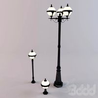
3d_ocean
$20
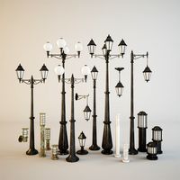
Street lamps
...low metal road street illumination street lamps street lanterns town traffic urban
this eighteen models street lamps high quality
3d_ocean
$7
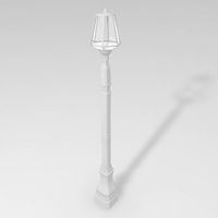
Street Light
...street light
3docean
light lighting street transformer
a semi detailed street light with a transformer.
3d_ocean
$4
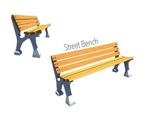
Street Bench
...street bench
3docean
bench streer bench street
street bench model - .ma - .obj
3d_export
free

Street with StreetLights
...street with streetlights
3dexport
street, with streetlights.
3d_export
$5
street lamp
...street lamp
3dexport
street light for parks.
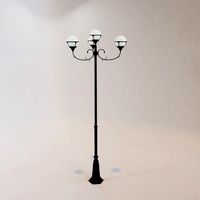
3ddd
free
Street light
...street light
3ddd
фонарь
street light
turbosquid
$1

Street Signs 04 Street Names
...ree 3d model street signs 04 street names for download as fbx on turbosquid: 3d models for games, architecture, videos. (1672588)
turbosquid
$1

Street Signs 03 Street Names
...ree 3d model street signs 03 street names for download as fbx on turbosquid: 3d models for games, architecture, videos. (1672050)