CG Trader

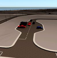
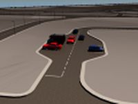
Corpus Christi Road Network and Streets
by CG Trader
Last crawled date: 1 year, 10 months ago
this model is based on real data therefore this is a realistic road network and streets setup of Corpus Christi, USA 2 objects included | 1. roads and streets 2. squares and plazas UV mapped with overlapping UVs the model is positioned on a flat surface (road network is on the “floor” - no elevation data included) geometry is polygonal quads and tris model is untextured and renders fast this 3D model is/can be licensed (commercial use is fine) under Creative Commons Attribution-ShareALike 2.0 (CC-BY-SA) license buildings and streets data from OpenStreetMap / www.openstreetmap.org Attribution : © OpenStreetMap contributors / http://www.openstreetmap.org/copyright POINTS/VERTS : 677940
POLYGONS : 531461 .c4d - native format .fbx - v7.1 .dae - v1.5 .dxf .obj corpus christi usa united states america road network system streets infrastructure map cartography city gps navigation roads squares realistic topology architectural street architectural street city street city map city street city streets united states usa map
POLYGONS : 531461 .c4d - native format .fbx - v7.1 .dae - v1.5 .dxf .obj corpus christi usa united states america road network system streets infrastructure map cartography city gps navigation roads squares realistic topology architectural street architectural street city street city map city street city streets united states usa map
Similar models
cg_trader
$29

Baltimore Road Network and Streets
... realistic topology architectural street architectural street city street city map city street city streets united states usa map
cg_trader
$29

Orlando Road Network and Streets
... roads squares realistic topology street architectural street city street city map city street city streets united states usa map
cg_trader
$29
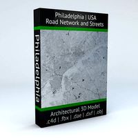
Philadelphia Road Network and Streets
... roads squares realistic topology street architectural street city street city map city street city streets united states usa map
cg_trader
$29

Detroit Road Network and Streets
... roads squares realistic topology street architectural street city street city map city street city streets united states usa map
cg_trader
$29

Miami Road Network and Streets
...alistic topological architectural street architectural street city street city map city street city streets united states usa map
cg_trader
$29

Dallas Road Network and Streets
... roads squares realistic topology street architectural street city street city map city street city streets united states usa map
cg_trader
$29

Houston Road Network and Streets
... roads squares realistic topology street architectural street city street city map city street city streets united states usa map
cg_trader
$29

Boston Road Network and Streets
...es realistic topological topology street architectural street city street city map city street city streets united states usa map
cg_trader
$29

Roswell Road Network and Streets
... roads squares realistic topology street architectural street city street city map city street city streets united states usa map
cg_trader
$29

Seattle Road Network and Streets
... roads squares realistic topology street architectural street city street city map city street city streets united states usa map
Corpus
turbosquid
$3

Glass Table 058 - Corpus Christi
... available on turbo squid, the world's leading provider of digital 3d models for visualization, films, television, and games.
3d_export
$199

corpus christi city texas usa 80km
...der ready. 1. suitable for games, games, education, architecture etc. 2. mainly used for town and urban planning, real estate etc
archibase_planet
free

Chair
...chair archibase planet chair elbow-chair seat corpus chair - 3d model for interior 3d...
archibase_planet
free

Seats
...seats archibase planet seats seat corpus modular 5 seats - 3d model for interior 3d...
archive3d
free

Chair 3D Model
...chair 3d model archive3d chair elbow-chair seat corpus chair - 3d model for interior 3d...
archibase_planet
free
Seats
...seats archibase planet bench seat seats corpus modular 3 seats - 3d model for interior 3d...
archibase_planet
free

Seats
...seats archibase planet seat seats bench corpus modular 4 seats - 3d model for interior 3d...
archive3d
free

Seats 3D Model
...seats 3d model archive3d seats seat corpus modular 5 seats - 3d model for interior 3d...
archive3d
free

Seats 3D Model
...seats 3d model archive3d seats bench seat corpus modular 2 seats - 3d model for interior 3d...
archive3d
free

Seats 3D Model
...seats 3d model archive3d bench seat seats corpus modular 3 seats - 3d model for interior 3d...
Christi
3ddd
$1

Проектор Christie HD10K-M
...проектор christie hd10k-m
3ddd
проектор , christie
проектор christie hd10k-m
3d_export
$10

T3 Christie 3D Model
...t3 christie 3d model
3dexport
tank ww2 ww1 millitary t3 christie
t3 christie 3d model artshtirlic 94010 3dexport
turbosquid
$29

christy hanging chair
...model christy hanging chair for download as max, max, and fbx on turbosquid: 3d models for games, architecture, videos. (1685781)
turbosquid
$28

Christie Lounge Chair by Modloft
... christie lounge chair by modloft for download as max and obj on turbosquid: 3d models for games, architecture, videos. (1204163)
turbosquid
$3
Glass Table 058 - Corpus Christi
... available on turbo squid, the world's leading provider of digital 3d models for visualization, films, television, and games.
3d_export
$199
corpus christi city texas usa 80km
...der ready. 1. suitable for games, games, education, architecture etc. 2. mainly used for town and urban planning, real estate etc
cg_studio
$35

Christie3d model
...christie3d model
cgstudio
.max - christie 3d model, royalty free license available, instant download after purchase.
3d_export
$50

Forpost brand Chair
...l dimensions (w.d.h.) - 440*380*860 mm 3d mdel of chair christy material - microvelour, metal dimensions(w.d.h.) - 640x450x840 мм
3ddd
$1
Wegner and Paul Smith Shell Chair
...shell chairs from the 60s sold for $20,000 at christis in london in 1999. seat and back are made...
3dbaza
$3

Christie Jetclass Chandelier (113317)
...christie jetclass chandelier (113317)
3dbaza
christie jetclass chandelier 3d model
Network
3ddd
$1
Network table by Henge
...network table by henge
3ddd
henge
network table by henge
3d_export
$35

network office design
...network office design
3dexport
network office 3d model design
turbosquid
$120

Global Network
... available on turbo squid, the world's leading provider of digital 3d models for visualization, films, television, and games.
turbosquid
$40
Road Network
... available on turbo squid, the world's leading provider of digital 3d models for visualization, films, television, and games.
turbosquid
$4

social Network
... available on turbo squid, the world's leading provider of digital 3d models for visualization, films, television, and games.
design_connected
$16
Network 149 chair
...network 149 chair
designconnected
roda network 149 chair computer generated 3d model. designed by dordoni, rodolfo.
design_connected
$16
Network 159 armchair
...twork 159 armchair
designconnected
roda network 159 armchair armchairs computer generated 3d model. designed by rodolfo dordoni.
3d_ocean
$15
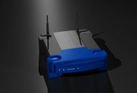
Wireless Broadband Network Router
... computer networking. similar to popular styles of wireless routers. this model was created in 3d studio max 2008 and has a ma...
3d_export
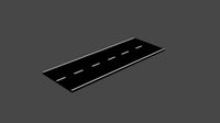
$30
Road Network 3D Model
...
3dexport
roads network highway
road network 3d model download .c4d .max .obj .fbx .ma .lwo .3ds .3dm .stl msaeed 103734 3dexport
turbosquid
$3
DOUBLE NETWORK PLUG
...d model double network plug for download as max, obj, and fbx on turbosquid: 3d models for games, architecture, videos. (1370379)
Road
3d_export
free
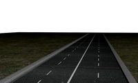
road
...road
3dexport
ready road with textures.
turbosquid
$4

Cross road Road-sign
...ss road road-sign for download as 3ds, dae, fbx, obj, and stl on turbosquid: 3d models for games, architecture, videos. (1516042)
3d_ocean
$39

Road
...torway nascar oval poly race racetrack raceway racing realtime road speedway talladega track way
racing games for the road system
turbosquid
$1
road
...ad
turbosquid
royalty free 3d model road for download as max on turbosquid: 3d models for games, architecture, videos. (1167278)
3d_ocean
$9
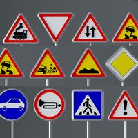
Road Signs
...road signs
3docean
outdoor road signs signpost waymark
road signs 3d models.
3d_export
$5
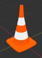
road cone
...road cone
3dexport
road cone
3d_export
free
road
...road
3dexport
3d_export
$5

road markings
...road markings
3dexport
construction of road markings
turbosquid
$25
Road
...lty free 3d model road for download as png, 3ds, obj, and fbx on turbosquid: 3d models for games, architecture, videos. (1380086)
3d_export
$5

road sign
...road sign
3dexport
road sign with the texture of a cyclist.
Streets
3ddd
$1
street lamp
...street lamp
3ddd
street lamp , фонарь
street lamp
3d_ocean
$4
Street lamp
...street lamp
3docean
3d 3d object lamp street street lamp
street lamp (low poly)
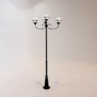
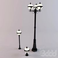
3d_ocean
$20
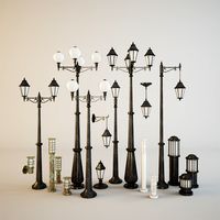
Street lamps
...low metal road street illumination street lamps street lanterns town traffic urban
this eighteen models street lamps high quality
3d_ocean
$7
Street Light
...street light
3docean
light lighting street transformer
a semi detailed street light with a transformer.
3d_ocean
$4
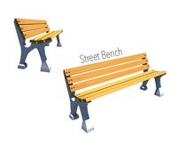
Street Bench
...street bench
3docean
bench streer bench street
street bench model - .ma - .obj
3d_export
free

Street with StreetLights
...street with streetlights
3dexport
street, with streetlights.
3d_export
$5
street lamp
...street lamp
3dexport
street light for parks.
3ddd
free
Street light
...street light
3ddd
фонарь
street light
turbosquid
$1

Street Signs 04 Street Names
...ree 3d model street signs 04 street names for download as fbx on turbosquid: 3d models for games, architecture, videos. (1672588)
turbosquid
$1

Street Signs 03 Street Names
...ree 3d model street signs 03 street names for download as fbx on turbosquid: 3d models for games, architecture, videos. (1672050)