Sketchfab

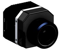
C.I. Sophia Farms IR Band
by Sketchfab
Last crawled date: 1 year, 11 months ago
Flyingworks
Precise information from the air
The area is located near El Carmen De Viboral town, Northern Colombian Andes, South America, a focused application in precision agriculture. This is the IR (Infrared) band model.
Navigating over an area about 1 square kilometer and 720 images exposed. The flight had an altitude level of 140m AGL / 2290m (7514ft) AMSL with an average wind of 6m/s from the east and a time aloft of 50 minutes.
Modelo 3D-VR de altísimo realísmo.
Opcional: Plano con ortomosaico geolocalizado y a escala en AutoCAD. - C.I. Sophia Farms IR Band - Buy Royalty Free 3D model by IAC S.A.S. (@iacsas)
Similar models
sketchfab
$35

C.I. Sophia Farms NBG
...osaico geolocalizado y a escala en autocad. - c.i. sophia farms nbg - buy royalty free 3d model by iac s.a.s. (@iacsas) [52b1f31]
sketchfab
$35

C.I. Sophia Farms NDVI
...saico geolocalizado y a escala en autocad. - c.i. sophia farms ndvi - buy royalty free 3d model by iac s.a.s. (@iacsas) [1f01c61]
3dwarehouse
free

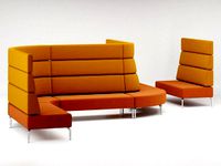
Estante Sophia Baixa AREA
...estante sophia baixa area
3dwarehouse
estante sophia baixa area low bookshelf sophia area
3dwarehouse
free

ESTANTE SOPHIA BAIXA AREA
...estante sophia baixa area
3dwarehouse
area bookshelf sophia - low
sketchfab
$35

Guaimaral Farm 11212018
...
precise information from the air
009ee11212018hf - guaimaral farm 11212018 - buy royalty free 3d model by iac s.a.s. (@iacsas)
grabcad
free

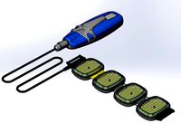
IR sensor Holder
... crafted with precision and versatility in mind, offering a robust and reliable platform to accommodate various ir sensor models.
grabcad
free

Solar panels structure for farm area
...solar panels structure for farm area
grabcad
solar panels structure model for farm area
3dwarehouse
free

Espaces de Sophia - Repère
...espaces de sophia - repère
3dwarehouse
espaces de sophia
3dwarehouse
free

Dual Band IR Sensor
...dual band ir sensor
3dwarehouse
grabcad
free

C.I Jaw Support
...c.i jaw support
grabcad
c.i jaw support
Sophia
3ddd
$1

Limitless / Sophia
...limitless / sophia
3ddd
limitless
limitless sophia
3ddd
$1

Desk Sophia
...desk sophia
3ddd
письменный
desk sophia
3ddd
$1

Торшер SOPHIA (Wunderlicht)
...sophia (wunderlicht)
3ddd
sophia , wunderlicht
торшер из серии sophia фирмы wunderlicht.
3d_export
$7

Galimberti Nino Sophia
...galimberti nino sophia
3dexport
sophia chair by galimberti nino
3ddd
$1

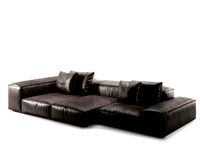
Modern Times Sophia
...modern times sophia
3ddd
кресло modern times sophia
3ddd
$1

Sophia Galimberti Nino
...sophia galimberti nino
3ddd
galimberti nino , sophia
кресло
turbosquid
$50

Hagia Sophia
...rbosquid
royalty free 3d model hagia sophia for download as on turbosquid: 3d models for games, architecture, videos. (1160809)
3ddd
$1

Galimberti Nino Sophia
...galimberti nino sophia
3ddd
galimberti nino
кресло galimberti nino sophia
3ddd
$1

SOPHIA (Wunderlicht) NT9500-06
...licht) nt9500-06
3ddd
sophia , wunderlicht
sophia фирмы wunderlichtвысота 800диаметр 820
turbosquid
$10

Sophia Sofa
...y free 3d model sophia sofa for download as max, max, and obj on turbosquid: 3d models for games, architecture, videos. (1614186)
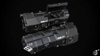
Ir
turbosquid
$65
FLIR Vue Pro IR Camera
... available on turbo squid, the world's leading provider of digital 3d models for visualization, films, television, and games.
turbosquid
$10
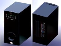
Subwoofer F&D IHOO 5.1 IR
...oofer f&d ihoo 5.1 ir for download as sldpr, max, and ige on turbosquid: 3d models for games, architecture, videos. (1523229)
3ddd
$1

Grohe Eurosmart CE IR electronic
...t ce ir electronic
3ddd
grohe , смеситель
смеситель для раковины с инфракрасным сенсором
turbosquid
$40
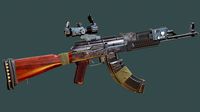
AK 47 Dual Laser Sight with IR Illuminator
...k 47 dual laser sight with ir illuminator for download as obj on turbosquid: 3d models for games, architecture, videos. (1586129)
turbosquid
$30
IR Bracelet Light Therapy Pain Recovery System
...acelet light therapy pain recovery system for download as ige on turbosquid: 3d models for games, architecture, videos. (1493109)
3ddd
$1
GRAMERCY HOME - Bastian Chandelier CH058-5-IR
...5-ir
3ddd
gramercy home
gramercy home
bastian chandelier
ch058-5-ir
ширина 47 см
глубина 47 см
высота 25 см
www.gramercy-home.ru
turbosquid
$20
IR-RF PLC USB TRANSMITTER 2014 RAW
... available on turbo squid, the world's leading provider of digital 3d models for visualization, films, television, and games.
turbosquid
$2
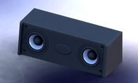
Speakers Centr F-D - Sven IHOO 5-1 IR
... available on turbo squid, the world's leading provider of digital 3d models for visualization, films, television, and games.
turbosquid
$2
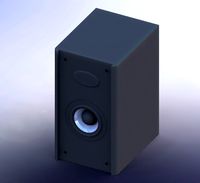
Speakers Front F-D F and D - Sven IHOO 5-1 IR
...) - sven ihoo 5-1 ir for download as max, ige, stl, and sldpr on turbosquid: 3d models for games, architecture, videos. (1144599)
3d_export
$15
be meyers mawl-c1 ir-laser
...station for more<br>tri count: 8,335 vertex count: 4,405 texture: pbr-4k<br>https://www.artstation.com/artwork/yaed4v
Farms
3d_export
$5

Dairy farm and poultry farm
...heme of a dairy farm and a poultry farm<br>the original archikad 22 file is included<br>polygons 65784 vertices 37062
3d_export
$13

Farming Equipment
...this page lists the tools and machines used on farms in an effort to improve local farming (by using...
turbosquid
$29

farm
...squid
royalty free 3d model farm for download as c4d and 3ds on turbosquid: 3d models for games, architecture, videos. (1658834)
3d_export
$15

Farm
...d for the props. - pbr textures (farm and plane 4k textures. props 2k textures) - textures for unity - textures for unreal engine
turbosquid
$60

farm
... available on turbo squid, the world's leading provider of digital 3d models for visualization, films, television, and games.
turbosquid
$20

Farm
... available on turbo squid, the world's leading provider of digital 3d models for visualization, films, television, and games.
turbosquid
$19

Farm
... available on turbo squid, the world's leading provider of digital 3d models for visualization, films, television, and games.
turbosquid
$10

The Farm
... available on turbo squid, the world's leading provider of digital 3d models for visualization, films, television, and games.
3d_export
$65

farm
...farm
3dexport
simple rendering of the scene file
3d_export
$65

farm
...farm
3dexport
simple rendering of the scene file
Band
3d_ocean
$3

Band
...band
3docean
band elastic fitness product sport
4 color band
turbosquid
$3

Band
...
royalty free 3d model band for download as 3dm, stl, and obj on turbosquid: 3d models for games, architecture, videos. (1564868)
3ddd
$1

BANDS chair
... varaschin
http://varaschin.it/en/products/small-armchairs/chair-with-armrests-bands-1407/#
turbosquid
$3

Love Band
...
turbosquid
royalty free 3d model love band for download as on turbosquid: 3d models for games, architecture, videos. (1173692)
turbosquid
free

Eternity Band
...bosquid
royalty free 3d model eternity band for download as on turbosquid: 3d models for games, architecture, videos. (1174397)
turbosquid
$34

Men_s Band
...bosquid
royalty free 3d model men_s band for download as 3dm on turbosquid: 3d models for games, architecture, videos. (1304739)
turbosquid
$29

cartoon band
...squid
royalty free 3d model cartoon band for download as c4d on turbosquid: 3d models for games, architecture, videos. (1508906)
turbosquid
$26

Twist Band
...bosquid
royalty free 3d model twist band for download as 3dm on turbosquid: 3d models for games, architecture, videos. (1318832)
turbosquid
$25

Rose band
...rbosquid
royalty free 3d model rose band for download as 3dm on turbosquid: 3d models for games, architecture, videos. (1198325)
turbosquid
$25

Wedding band
...squid
royalty free 3d model wedding band for download as 3dm on turbosquid: 3d models for games, architecture, videos. (1202055)
C
3ddd
$1
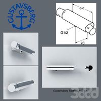
Gustavsberg Skandic 160 c-c
...gustavsberg skandic 160 c-c
3ddd
gustavsberg , смеситель
3dmax 2009
3ddd
$1
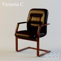
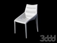
Кресло Victoria C
...кресло victoria c
3ddd
victoria c , стул
victoria c
design_connected
$25
Mobius C
...mobius c
designconnected
zenith mobius c computer generated 3d model. designed by schamburg, marc.
3ddd
$1
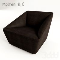
Molteni & C
...molteni & c
3ddd
molteni&c
molteni & c
turbosquid
$10
Raids house C&C Tiberian sun
... raids house c&c tiberian sun for download as max and fbx on turbosquid: 3d models for games, architecture, videos. (1188376)
turbosquid
$10
Civilian Asylum C&C Tiberian sun
...ilian asylum c&c tiberian sun for download as max and fbx on turbosquid: 3d models for games, architecture, videos. (1188365)
3ddd
$1
Molteni & C
...molteni & c
3ddd
molteni&c
стул molteni & c
3ddd
free
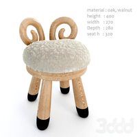
kamina&c
...kamina&c
3ddd
kamina-c , табурет барашек
sheep chair by kamina-c
design_connected
$29
Extrasoft C
...extrasoft c
designconnected
living divani extrasoft c computer generated 3d model. designed by lissoni, piero.
design_connected
$4
Mono C
...mono c
designconnected
scp mono c tables computer generated 3d model. designed by konstantin grcic.