Thingiverse

Camp Susque (Trout Run, PA) Elevation Model by malbert
by Thingiverse
Last crawled date: 3 years ago
The 46002160PAN tile from the 3.2 ft DEM from PASDA. Tiles from the LiDAR survey are 10,000 ft square. This 3D model is natively 127mm (aka 5") square. Area around Camp Susque, including Rattlesnake Mountain and Lookout Mountain.
DEM Source: http://maps.psiee.psu.edu/ImageryNavigator/
My process for creating STL:
-Import GeoTIFF DEM into QGIS (http://www.qgis.org/)
-Convert to rendered GeoTIFF (see this tutorial http://maps.cga.harvard.edu/qgis/wkshop/export_GeoTiff.php)
-Import into Blender as plane (http://www.blender.org)
-Subdivide Plane several times (W)
-Apply sub-surface division modifier
-Apply GeoTIFF texture as Displacement modifier (use Extend image mapping)
-Add 1.0 Mean Crease to perimeter edges
-Apply sub-surface division then displacement modifiers to mesh
-Scale mesh object based on map size / height
-Edit mesh, select all, extrude down in Z
-Scale lower mesh to flat plane (S, Z, 0)
-Export as STL
-Done!
Similar models
grabcad
free

Toronto 3D Map
...toronto 3d map
grabcad
dem into stl via qgis
cg_trader
$8

Pop Up Tent
... applied solidify, displace and shrinkwrap modifier camping equipment hiking foldable popup pop up sport tent sports camping tent
grabcad
free

Adirondack Park - Elevation Model
...out to about 13 millimeters in physical height.
send me a message if you wan't me to make a file for an area of your choice.
cg_trader
$2

High detail sandstone mountain
...r big pbr canyon eroded rock stone mountain rock desert environment desert landscape desert terrain mountain landscape stone rock
cg_trader
$20

Mountains and rocks alpha maps pack and support map
...urvature, position, worldnormal - 2k, .png).
surface textures not included (shown as a possible texturing using additional maps).
thingiverse
free

Mt. St. Helens 1:50000 scale
...to qgis and using the demto3d plugin tool. i set the scale to 1:50000 which resulted in a model 158mm x 191.3mm x 38.5mm in size.
grabcad
free

sphere division (no plane)
...sphere division (no plane)
grabcad
test for spheric surface division
thingiverse
free

Australia by gaellafond
...ources:
bathymetry: http://eatlas.org.au/data/uuid/80301676-97fb-4bdf-b06c-e961e5c0cb0b
png23d: http://kyllikki.github.io/png23d/
3dwarehouse
free

Suzanne - a monkey mesh from blender 3d
...anne - a monkey mesh from blender 3d
3dwarehouse
standard mesh from blender 3d with applied subdivision surface modifier level 2
thingiverse
free

Yellow Creek Lake, Pennsylvania 3D model by NaturallyFocused256
... purchase a 2d lake map of yellow creek lake, pa, visit my online shop at naturallyfocused256.etsy.com and choose custom lake map
Susque
3dwarehouse
free

SUSQUES - URBAN ARTS - IGOR GUEIROS
...alizados - diversas opções de molduras confira no site - https://www.urbanarts.com.br #minimalista #abstrato #fogo #azul #laranja
3dwarehouse
free

SUSQUES DREAMS - URBAN ARTS - IGOR GUEIROS
...izados - diversas opções de molduras confira no site - https://www.urbanarts.com.br #abstrato #quadrourbanarts #quadro #urbanarts
Malbert
thingiverse
free

Pumpkin by malbert
...pumpkin by malbert
thingiverse
hollow decorative pumpkin. add a white led inside to make him glow!
thingiverse
free

Simple Spiral Ornament by malbert
...simple spiral ornament by malbert
thingiverse
spiral tear-drop style christmas ornament.
thingiverse
free

Face Shield (Remix) Assembly by malbert
...m it to fit.
the fit will be very tight. adjust your hole punch spacing if necessary.
sanitize before wearing and after each use.
cg_trader
$3

Malbert
...malbert
cg trader
quality malbert model for drawing malbert wood draw art drawing furniture other
3dwarehouse
free

Batiment, quai du commandant Malbert
...batiment, quai du commandant malbert
3dwarehouse
batiment 1, quai du commandant malbert
Trout
3d_export
$35

Trout
... zbrush 3ds max ztool obj fbx dae 3ds stl properties : 9*20*8 production time : 8.25 hours 103 gram models are drawn with zbrush.
turbosquid
$59

Rainbow Trout
...quid
royalty free 3d model rainbow trout for download as max on turbosquid: 3d models for games, architecture, videos. (1154951)
turbosquid
$26

Lake Trout
...bosquid
royalty free 3d model lake trout for download as max on turbosquid: 3d models for games, architecture, videos. (1294528)
turbosquid
$10

Trout Lily.lwo
... available on turbo squid, the world's leading provider of digital 3d models for visualization, films, television, and games.
3d_export
$49

Brook Trout 3D Model
... fontinalis eastern brook trout speckled squaretail coaster coasters north american
brook trout 3d model humster3d 93469 3dexport
humster3d
$40

3D model of Brook Trout
...
buy a detailed 3d model of brook trout in various file formats. all our 3d models were created maximally close to the original.
turbosquid
$45
![7 Rainbow Trouts 7 River Set [+ Caustics VFX]](/t/13464949.jpg)
7 Rainbow Trouts 7 River Set [+ Caustics VFX]
... available on turbo squid, the world's leading provider of digital 3d models for visualization, films, television, and games.
archive3d
free

Flower 3D Model
...flower 3d model archive3d flower lily plant flower trout lily n160612 - exterior 3d...
cg_studio
$49

Brook Trout3d model
...tudio
.max .obj .mb .lwo .fbx .c4d .3ds - brook trout 3d model, royalty free license available, instant download after purchase.
3d_export
$26

Piranha Fish 3D Model
...fish 3d model 3dexport piranha fish eat angry teeth trout salmon carp river amazonka sea red yellow gold goldfish...
Camp
3d_export
$5

camping
...camping
3dexport
high poly model of camp... rendered with vray
turbosquid
$8

Camping
...turbosquid
royalty free 3d model camping for download as max on turbosquid: 3d models for games, architecture, videos. (1210768)
turbosquid
$10

Camp
... available on turbo squid, the world's leading provider of digital 3d models for visualization, films, television, and games.
3d_export
$5

camping character
...camping character
3dexport
high poly model of camp... rendered with vray
3d_export
$65

camping
...camping
3dexport
simple rendering of the scene file
3d_export
$65

camping
...camping
3dexport
simple rendering of the scene file
turbosquid
$1

Camp.3DC
...dc
turbosquid
royalty free 3d model camp.3dc for download as on turbosquid: 3d models for games, architecture, videos. (521542)
turbosquid
free

Camping Chair
...ir
turbosquid
free 3d model camping chair for download as ma on turbosquid: 3d models for games, architecture, videos. (1237616)
turbosquid
$80

Camping island
...quid
royalty free 3d model camping island for download as ma on turbosquid: 3d models for games, architecture, videos. (1434143)
turbosquid
$15

Camping Tent
...squid
royalty free 3d model camping tent for download as max on turbosquid: 3d models for games, architecture, videos. (1439656)
Pa
turbosquid
$9

PA 0815
... free 3d model pa 0815 for download as max, max, obj, and fbx on turbosquid: 3d models for games, architecture, videos. (1695438)
turbosquid
$9

PA 1218
... free 3d model pa 1218 for download as max, max, fbx, and obj on turbosquid: 3d models for games, architecture, videos. (1695344)
turbosquid
$9

PA 1215
... free 3d model pa 1215 for download as max, max, fbx, and obj on turbosquid: 3d models for games, architecture, videos. (1695338)
design_connected
$27

Pas si classique
...pas si classique
designconnected
ligne roset pas si classique computer generated 3d model. designed by mourgue, pascal.
3ddd
$1

pieter adam PA 823
...pieter adam pa 823
3ddd
pieter adam
pieter adam pa 823
turbosquid
$9

PA H006 X5
...ee 3d model pa h006 x5 for download as max, max, fbx, and obj on turbosquid: 3d models for games, architecture, videos. (1695447)
turbosquid
$85

DEFAULT PA BOT.pz3
... available on turbo squid, the world's leading provider of digital 3d models for visualization, films, television, and games.
3d_export
$5

pa-ornament-01
...rnament-01 version v-ray: 3.6 corona: 4.1 units: cm polys: 543,973 -------- verts: 557142 uvw map: yes formats: 3ds max 2015, obj
3d_export
$5

pa-modern-sofa-03
...t
pa-modern-sofa-03 dimension: 232 × 141 × 76 units: cm polys: 952,000 verts: 952,656 models unwrapped manually material: fabric
turbosquid
$1

Pensupreme lancaster pa Box
... available on turbo squid, the world's leading provider of digital 3d models for visualization, films, television, and games.
Run
turbosquid
$2

Run
... available on turbo squid, the world's leading provider of digital 3d models for visualization, films, television, and games.
design_connected
$20

Run Personal
...run personal
designconnected
technogym run personal computer generated 3d model. designed by citterio, antonio.
turbosquid
$49

Elf running
...osquid
royalty free 3d model elf running for download as fbx on turbosquid: 3d models for games, architecture, videos. (1500360)
turbosquid
$20

running machine
...id
royalty free 3d model running machine for download as fbx on turbosquid: 3d models for games, architecture, videos. (1207171)
turbosquid
$4

Zombie Running
...uid
royalty free 3d model zombie running for download as obj on turbosquid: 3d models for games, architecture, videos. (1241889)
turbosquid
$40

Fox, Running
... available on turbo squid, the world's leading provider of digital 3d models for visualization, films, television, and games.
turbosquid
$20

Soldier run
... available on turbo squid, the world's leading provider of digital 3d models for visualization, films, television, and games.
turbosquid
$12

Running Man
... available on turbo squid, the world's leading provider of digital 3d models for visualization, films, television, and games.
turbosquid
$2

Skeleton Running
...eleton running for download as blend, fbx, obj, gltf, and dae on turbosquid: 3d models for games, architecture, videos. (1589546)
3d_ocean
$19

Running shoes
...imated .textures and materials are included in (others jpg file) the snapshots was rendered using the vray version of the file...
Elevation
3d_export
$7

elevator
...elevator
3dexport
elevator
archibase_planet
free
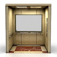
Elevator
...elevator
archibase planet
lift elevator
elevator 2 n240810 - 3d model (*.3ds) for interior 3d visualization.
archibase_planet
free
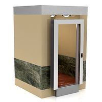
Elevator
...elevator
archibase planet
cage lift elevator
elevator 1 n240810 - 3d model (*.gsm+*.3ds) for interior 3d visualization.
archibase_planet
free
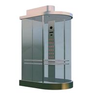
Elevation
...elevation
archibase planet
elevation lift
lift panoramics - 3d model for interior 3d visualization.
turbosquid
$120

Elevator
... available on turbo squid, the world's leading provider of digital 3d models for visualization, films, television, and games.
turbosquid
$29

Elevator
... available on turbo squid, the world's leading provider of digital 3d models for visualization, films, television, and games.
turbosquid
$29

Elevator
...3d model elevator for download as max, max, 3ds, fbx, and obj on turbosquid: 3d models for games, architecture, videos. (1683372)
turbosquid
$29

Elevator
...3d model elevator for download as max, max, 3ds, fbx, and obj on turbosquid: 3d models for games, architecture, videos. (1683369)
turbosquid
$3

Elevator
... available on turbo squid, the world's leading provider of digital 3d models for visualization, films, television, and games.
turbosquid
$19

Elevators
...ators for download as sldas, max, 3ds, dwg, fbx, ige, and obj on turbosquid: 3d models for games, architecture, videos. (1587987)