CG Trader

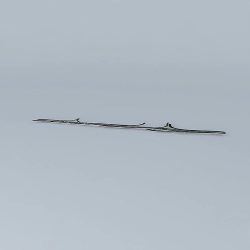
Brisbane Riverside Expressway
by CG Trader
Last crawled date: 1 year, 10 months ago
This 3D model was originally created with Sketchup 7 and then converted to all other 3D formats. Native format is .skp 3dsmax scene is 3ds Max 2016 version, rendered with Vray 3.00 The Riverside Expressway is part of the Pacific Motorway that runs through Brisbane, Queensland, Australia. It is located on the western side of the Brisbane CBD and is made up of various bridges and overpasses. The North Bank development is proposed to alleviate the visual disruption of the expressway and recapture Brisbane for pedestrians. The Expressway runs the entire western length of the Brisbane CBD from Coronation Drive to the Captain Cook Bridge at Gardens Point, an estimated 3 km before becoming the Pacific Motorway which ends at the Gold Coast. Construction on the Riverside Expressway began in late 1968, when the pylons for the bridge were laid on the North bank of the Brisbane River. The bridge was completed in 1975. During September and October 2006, roadworks occurred on the Expressway, and surrounding structures, including the Captain Cook Bridge. Maintenance on these structures had not been done since its construction in the 1970's. On 17 October 2006, parts of the expressway were closed due to safety concerns regarding hairline cracks in the Alice St and Ann St ramps.
Similar models
3dwarehouse
free

Brisbane Riverside Expressway
...ice st and ann st ramps. #australia #bridge #brisbane #expressway #highway #motorway #pacific #queensland #river #riverside #road
3dwarehouse
free

Captain Cook Bridge
...expressway. #australia #bridge #brisbane #captain #cook #expressway #highway #motorway #pacific #queensland #river #woolloongabba
cg_trader
free

Captain Cook Bridge
...a bridge brisbane captain cook expressway highway motorway pacific queensland river woolloongabba exterior street street exterior
3dwarehouse
free

North Fork Bridge
...n pacific rr bridge over the north fork of the feather river #california #feather_river #intake #railroad_bridge #western_pacific
3dwarehouse
free

Zhengzhou Yellow River Bridge
... with two-way and eight-lane, is the biggest bridge of this type bridge in china. #beijingzhuhai_highway #yellow_river #zhengzhou
3dwarehouse
free

Captain Cook Bridge, Sydney
...s souci and taren point to provide easy access along the foreshore. #bridge #captain_cook #lanes #san_souci #taren_point #traffic
3dwarehouse
free

Pacific Western Bank
...acting, originally for pacific western bank. note: current tenant not verified #pacific_western_bank #reno_contracting #san_diego
3dwarehouse
free

St Denys rail bridge
... south-eastern bank. a smaller archway takes the bridge over priory rd to the west. #bitterne #bridge #itchen #river #southampton
3dwarehouse
free

Fig Street Bridge
...expressway became a reality, two extra lanes either side of the bridge could be clipped on, increasing the bridge's capacity.
3dwarehouse
free

Expressway
...expressway
3dwarehouse
#expressway #highway #motorway
Expressway
3d_export
$300

Highway scene 3D Model
...tollway road roadway street asphalt roads lights guardrail traffic expressway interstate cars trucks tunnel highway scene 3d model tartino...
3d_export
$24

Road Highway Basic Set 3D Model
...set 3d model 3dexport road highway roadway freeway divided expressway lane two three four merge basic pavement paving paved...
thingiverse
free

Smart_Tolling_of_Korea_Expressway by needme
...g_of_korea_expressway by needme
thingiverse
this is a basic model of smart tolling in korea expressway.
date 15, december, 2015.
thingiverse
free

Korea_tolling_system by needme
...korea_tolling_system by needme thingiverse updated, 12, january, 2016 korea expressway corporation man-checkout lane auto-ticketing lane auto-checkout lane hi-pass lane...
artstation
$2

3D Traffic Sign Model 01
...marque signage variable led traffic lane control dynamic street expressway sign lowpoly...
artstation
$2

3D Traffic Sign Model 02
...marque signage variable led traffic lane control dynamic street expressway sign lowpoly...
artstation
$2

3D Traffic Sign Model 04
...marque signage variable led traffic lane control dynamic street expressway sign lowpoly...
artstation
$2

3D Traffic Sign Model 04
...marque signage variable led traffic lane control dynamic street expressway sign lowpoly...
cg_trader
$5

expressway 3d superhighway
...rhighway
cg trader
express road 3d for gaming john james cartography plan harvest bond mccartney aston architectural engineering
Brisbane
3ddd
$1

Formitalia / Brisbane
...formitalia / brisbane
3ddd
formitalia , угловой
фабрика formitalia модель brisbane
3d_export
$49

Brisbane Airport 10km
...brisbane airport 10km
3dexport
3d_export
$23

Roche bobois brisbane 3D Model
...is brisbane furniture comfortable beautiful interior 3d model living sitting
roche bobois brisbane 3d model anna3d 92603 3dexport
3ddd
$1

Roche bobois / Brisbane
... bobois / brisbane
3ddd
roche bobois
http://www.roche-bobois.com/#/en-ru/products/all/all/all/all/all/81622/fullscreen/
3d_export
$199

brisbane australia 50km
...;1. suitable for games, games, education, architecture etc.<br>2. mainly used for town and urban planning, real estate etc.
3d_export
$60

eurocopter ec665 arh tiger australian scheme
...to australia in part form and locally assembled at brisbane airport by australia...
3d_sky
$8

Eichholtz / Hurricane Brisbane
...eichholtz / hurricane brisbane
3dsky
eichholtz hurricane brisbane
320x320x430mm
3d_sky
$8

Formitalia / Brisbane
...formitalia / brisbane
3dsky
factory formitalia commence model
thingiverse
free

Brisbane Story Bridge by stoneez
...brisbane story bridge by stoneez
thingiverse
brisbane story bridge
thingiverse
free

Simple mockup of Q1 building in Brisbane by stumphopper
...simple mockup of q1 building in brisbane by stumphopper
thingiverse
simple mockup of q1 building in brisbane
Riverside
3ddd
$1

Riverside
...d
http://www.emets.ru/goods/barnaya-stojjka-riversid , riverside
барная стойка riverside
3d_export
$65

riverside
...riverside
3dexport
simple rendering of the scene file
3d_export
$65

riverside
...riverside
3dexport
simple rendering of the scene file
3d_export
$65

riverside
...riverside
3dexport
simple rendering of the scene file
3d_export
$65

riverside
...riverside
3dexport
simple rendering of the scene file
3d_export
$65

riverside
...riverside
3dexport
simple rendering of the scene file
3d_export
$65

riverside
...riverside
3dexport
simple rendering of the scene file
3d_export
$65

riverside
...riverside
3dexport
simple rendering of the scene file
3d_export
$65

riverside
...riverside
3dexport
simple rendering of the scene file
3d_export
$65

Riverside
...riverside
3dexport
simple rendering of the scene file
