148 topography 3d models found
Download or buy, then render or print from the shops or marketplaces.
3D Models below are suitable not only for printing but also for any
computer graphics like CG, VFX, Animation, or even CAD. You can print these 3d models on
your favorite 3d printer or render them with your preferred render engine.
Please note that the 3D model database is only a Search Engine. You should
visit the original websites. Most of the models can be easily imported and rendered
with Autodesk 3ds Max, Maya, Blender, C4D, and Sketchup. Check for online
3d model conversions tools for your file format.
Shown 1 of
2 pages
thingiverse
free
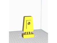
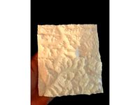
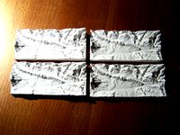
Station Total Topography
...station total topography
thingiverse
topography station total
thingiverse
free
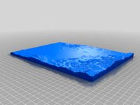
topography of Medford OR by Steamtowers
...topography of medford or by steamtowers
thingiverse
3d printable topography of medford or
thingiverse
free

Lunar topography by ThomWorm
...ingiverse
these tiles show lunar topography from einstein crater into the marea. created with laser topography imagery from 2011
thingiverse
free

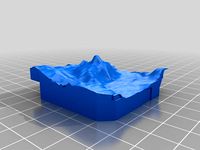
Topography by austinkillgore
...topography by austinkillgore
thingiverse
cool mountain
thingiverse
free

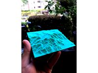
Topography of Westeros by dukeisi
...topography of westeros by dukeisi
thingiverse
the mountains are a bit rough but this is a topography map of westeros
thingiverse
free

Neuchâtel topography by touchthebitum
...neuchâtel topography by touchthebitum
thingiverse
val-de-travers topography with neuchâtel lake
thingiverse
free

Albuquerque Topography by tscott98
...albuquerque topography by tscott98
thingiverse
topography of albuquerque, nm including sandia peak and the rio grande valley.
thingiverse
free

Topography thing by Firetrice
...topography thing by firetrice
thingiverse
thingiverse
free
Devils Tower Topography by hannahball
...devils tower topography by hannahball
thingiverse
topography of devil's tower, wyoming made from jthatch
thingiverse
free

Willamette Valley Topography by kf7ser
...topography by kf7ser
thingiverse
as a fun little geography project i created a 3d topography for (most of) the willamette valley
thingiverse
free

Topographie St.Gallen by c3r3br0
...topographie st.gallen by c3r3br0
thingiverse
made with http://146.148.78.19/
stl generator
thingiverse
free

Topography of Arequipa City, Peru by dafairlie
...ity, peru by dafairlie
thingiverse
topography of the surroundings of the city of arequipa, in peru. including the misti volcano.
thingiverse
free

Topography: Rostock by preealpha
...topography: rostock by preealpha
thingiverse
height ist doubled.
made with http://jthatch.com/terrain2stl/
thingiverse
free

USA Flag Topography by joebl8
...bottom layer concentric have nice result. sorry there is no alaska or hawaii, but michigan is there. https://youtu.be/hrlyj0_p5l8
thingiverse
free
Topography vector by mrjefferson105
...ferson105
thingiverse
this project was made to help teach contour lines in a lecture . giving student a more tactile experience.
thingiverse
free
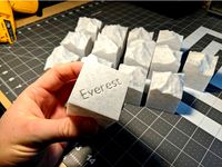
Mount Everest Topography by kevinbrice
...mount everest topography by kevinbrice
thingiverse
a topographical map of mt everest and surrounding mountains.
thingiverse
free

Moon topography
...//www.thingiverse.com/thing:3561651). you won't see much detail though unless you are using something like a 0.25 mm nozzle!
thingiverse
free

Epic 40K Imperial City Topography parts by Tobitob00
...epic 40k imperial city topography parts by tobitob00
thingiverse
topography parts for the epic 40k warhammer game
thingiverse
free
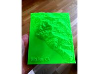
Big Sur, CA Topography by kevinbrice
...g sur, ca southern entrance and south western coast line. inspired from several car-camping trips with friends and girlfriend :)
thingiverse
free
Santa Catalina Island Topography Map by kevinbrice
...opography map by kevinbrice
thingiverse
topography map of santa catalina island at 2x elevation so you can see all the features.
thingiverse
free

Marble Mountain Topography by SilentOkapi
...in topography by silentokapi
thingiverse
this is a model of the marble mountain wilderness region of the klamath national forest
thingiverse
free

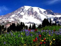
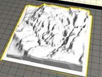
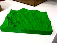
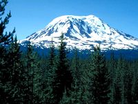
Topography of Mount Rainier by SpaceMachine
...topography of mount rainier by spacemachine
thingiverse
my favorite mountain in washington state.
scaled at 10x10cm
enjoy
thingiverse
free

Saipan topography map
...the northern most of the northern mariana islands. this print takes to scaling very well and comes over sized for fine resolution
thingiverse
free

topography of Kingman AZ by Steamtowers
...topography of kingman az by steamtowers
thingiverse
pretty simple it's a 3d printable of the historical kingman az
thingiverse
free

Formosa (Taiwan) topography models by JiGo
... model has a hole at the place of taipei city - the capital city of taiwan, for the key ring or something else.
hope you like it!
thingiverse
free
Area 51 topography by Jeremycon
...raphy by jeremycon
thingiverse
downloaded from terrain2stl
very strange that a certain area comes out red !
still prints though!
thingiverse
free

Topography - Three Sisters, Canmore, AB by feralferret
...r canmore, alberta, canada.
made in blender using the blendergis addon.
https://en.wikipedia.org/wiki/the_three_sisters_(alberta)
thingiverse
free

Yosemite Valley topography by Amirsf
...shape
added a compass on it and the wording
stretched it a bit in the z axis to make the elevation changes more distinct.
enjoy!
thingiverse
free

San Luis Obispo, CA Topography by kevinbrice
...my college hometown of cal poly. clearly make out bishops peak, madonna mountain, and the surrounding hillsides and poly canyon.
thingiverse
free

Continental United States Topography by Tree_House_Fire
..._fire
thingiverse
1000ft contour topographic 3d model of the continental united states. z values are vertically exaggerated x25.
thingiverse
free
Topography- Hogbacks, Garfield County- Colorado by JayJo
...aphy- hogbacks, garfield county- colorado by jayjo
thingiverse
usgs data converted to topographic map
elevation height enhanced
thingiverse
free

Palo Duro Canyon Topography Texas State Park by Drazen
...larger, but this print shows the part that is inside the state park. palo duro is the second largest canyon in the united states.
thingiverse
free

Canyon topography 2.... by hpucismjrbb85
...ical region after extruding it out in blender so that i don't have to create a platform to house it, please let me know... :/
thingiverse
free

Globe sea topography by Semafloor
...the model -10mm in the z-direction. this creates a hole in the bottom. printed with 100% infill and support touching build plate.
thingiverse
free

Middle Earth Topography Map
...was obtained from https://github.com/bburns/arda (thank you!) built on work from https://github.com/jvangeld/me-gis (thank you!).
thingiverse
free
San Jacinto Peak Topography by kevinbrice
...rough the forest an eventually to the summit, san jacinto peak above palm springs desert. we even found a patch of snow in july.
thingiverse
free

Lake and Mountain Topography by LukeChilson
...object or two that i was using in a water simulation and thought i'd leave them in should anyone care to play around with it.
thingiverse
free

Ukraine topography by Semargl
... the final image of 512x342 pixels.
printed with velleman k8200, gcode was prepared with repetier-host using cura engine slicer.
thingiverse
free
Minecraft Topography by Moceri
...mware.
i have also used mineways to export a model.mineways allows you to export your minecraft creations and print the .stl out!
thingiverse
free
Caprock Canyon Topography by Drazen
...t my similar map of palo duro canyon for an idea of what this will look like when printed!http://www.thingiverse.com/thing:606081
thingiverse
free

Topography of the Sierras de Córdoba (Central Argentina) by Horacio_Canelo
...ructed using 1minute resolution etopo1 data from noaa.
it resulted from the use of the "surface" command in openscad.
thingiverse
free

USA Topography - Less Plastic by OpenSourceClassroom
... of plastic. i simply shaved off over 50% of the base part and made the model skinnier to save plastic, time, and money. enjoy!
thingiverse
free

Seattle / Western Washington Topography by lmgreco
..." x 10" square; split into four 5" squares.
update 12/7/17:
added 10" x 10" combined version by request.
thingiverse
free

Earth topography with coastlines by jeffwinterbourne
... ridge runs down the middle of the atlantic ocean - this is where oceanic crust is created. where are the other mid-ocean ridges?
thingiverse
free

Breakneck Ridge Hudson Highlands Topography. by Charles_Bronson
...4 m) above sea level. the southern face of the peak is remarkable for its striking cliffs, the result of quarrying in past years.
thingiverse
free

Philmont Scout Ranch Topography by LoveWaffle
...ut there, i hope this brings back fond memories. i dunno about you, but i wanna go back to philmont!
https://youtu.be/3tibk8aabk4
thingiverse
free

New Zealand bathymetry and topography. by souan
... 3d image. so if you're compiling from the .scad file just rename the .obj file with a .png suffix and that should work fine.
thingiverse
free

Neuschwanstein by ThomasLlewellyn
...neuschwanstein by thomasllewellyn thingiverse topography hw...
thingiverse
free

Volcan Lanin
...volcan lanin thingiverse lanin volcano in patagonia, topography ...
thingiverse
free

Hawaii - Oahu topo by ohnokono
...hawaii - oahu topo by ohnokono thingiverse oahu topography ...
thingiverse
free

mars
...mars
thingiverse
mars fait avec topographie de mars
thingiverse
free

Sri Lankan Mountain by RyanAlexanderAdams
...sri lankan mountain by ryanalexanderadams thingiverse topography 3d...
thingiverse
free

Gulf of Mexico - Dual Color by grajohnt
...gulf of mexico - dual color by grajohnt thingiverse topography and bathymetry of the gulf of mexico at 3x...
thingiverse
free

Portland, Oregon by DaBeast101
...portland, oregon by dabeast101 thingiverse just a topography print of portland,...
thingiverse
free

Mount Baker by WyattChurch1
...mount baker by wyattchurch1 thingiverse this is accurate topography of mount baker,...
thingiverse
free
Mount Rainier by WyattChurch1
...mount rainier by wyattchurch1 thingiverse this is accurate topography of mount rainier,...
thingiverse
free

chamonix - le mont blanc by fredlepape
...chamonix - le mont blanc by fredlepape thingiverse topography printing is...
thingiverse
free

Portland, Oregon Attempt 2 by DaBeast101
...oregon attempt 2 by dabeast101 thingiverse another attempt at topography ...
thingiverse
free

Bolaven Plateau (Lao PDR / Laos) Topography by MTORO003
...nal details on this project can be found at: https://matthewtoro.com/2016/09/08/topographic-3d-printing-the-bolaven-plateau-laos/
thingiverse
free

Mt Myoko by SpaceKiwi
...mt myoko by spacekiwi thingiverse a topography map of mt myoko, japan and surrounding...
thingiverse
free

Modern House by mikefailing
...modern house by mikefailing thingiverse small house with topography of a nearby river that the house extends...
thingiverse
free

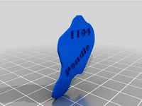
Yosemite Valley Bookmark by fake_tissues
...yosemite valley bookmark by fake_tissues thingiverse the topography of the yosemite valley squashed down to a convenient...
thingiverse
free
Grand Canyon HW assignment by ThomasLlewellyn
...was a assignment for my 3d printing class about topography ...
thingiverse
free
Bassin de Thau by Kalou
...by kalou thingiverse topographic rendering from srtm (shuttle radar topography ...
thingiverse
free
Custom 3D Topography | Topografía 3D personalizada by Innovaland3D
...o.gl/x3urjv
web para generar los stl: http://jthatch.com/terrain2stl/
filamento utilizado: sakata pla verde https://goo.gl/ua6pqw
thingiverse
free

Mount Vesuvius by conorokane
...vesuvius. created with data from the space shuttle radar topography ...
thingiverse
free

Modeling Topography and Erosion with 3D Printing by roberthemlich
...ot; document to engage student interest in stem subjects.
http://www.michigan.gov/documents/mde/science_coursecredit_466083_7.pdf
thingiverse
free

Topographic Puzzle Map of the USA
...thingiverse a puzzle of the usa which showcases the topography as well. an interesting puzzle that will pass the...
thingiverse
free

Living Room Hike, Salt Lake City, Utah by Ndmay
...room hike, salt lake city, utah by ndmay thingiverse topography created using the method created by shapespear (follow...
thingiverse
free

Seattle Skyline and Waterfront by Tree_House_Fire
...seattle skyline and waterfront by tree_house_fire thingiverse topography and skyline of downtown seattle and waterfront. contours are...
thingiverse
free

The Matterhorn by PaulZC
...matterhorn by paulzc thingiverse created from nasa shuttle radar topography mission data, this print covers a 25km x 25km...
thingiverse
free

Lago di Garda 3D Map by BNI
...relief map of lago di garda - garda lake topography pla filament from...
thingiverse
free

Textured Earth by bld
...the land & ice masses above the oceans. a topography map adds texture to the land. this exaggerates the...
thingiverse
free

longboard gopro mount by JohnLord
...longboard gopro mount by johnlord thingiverse i used optimized topography in inventor to make this for school. also this...
thingiverse
free

The FAYZ 3.0 (waves, exaggerated hills, flat bottom) by Nepenthes1029
...with waves, better circular curve, flat bottom, and exaggerated topography ...
thingiverse
free

Mount Everest by iteration2
...everest, using data from the nasa srtm (shuttle radar topography mission). approximately 15 miles...
thingiverse
free
Mount Adams by WyattChurch1
...mount adams by wyattchurch1 thingiverse this is accurate topography of mount adams, washington. i've included a model with...
thingiverse
free

Denmark 3D topographic map (TEST) by Lawec
...map (test) by lawec thingiverse 3d version of denmark's topography made using the script here:...
thingiverse
free

30+ MotoGP WSBK Famous Racetrack Topography Maps
...sonoma raceway
usa - thunderhill east
usa - thunderhill west
usa - willow springs
had trouble getting gpx data
usa - buttonwillow
thingiverse
free

Vail Ski Area by alexandreclalex
...thingiverse model of vail's ski area. used terrain2stl for topography and openstreetmap for location data. elevation is doubled in...
thingiverse
free

Frenchman Mountain (Las Vegas, NV) by mWagner84
...high resolution topographical scans of the area and google topography ...
thingiverse
free

Mount Saint Helens by WyattChurch1
...mount saint helens by wyattchurch1 thingiverse this is accurate topography of mt. saint helens in washington. i've included a...
thingiverse
free

Ireland by conorokane
...model of ireland, created from the space shuttle radar topography mission data. looks good mounted on this display stand:...
thingiverse
free

WoW sabertooth cat_solid.stl by clanmcfadden
...world of warcraft with wow model viewer, cleaned up topography in blender. hope you...
thingiverse
free
Matterhorn (Monte Cervino) by gluetolf
...from dhm25 (dem) sample-data. source: swiss federal office of topography (article 30, geoinformation...
thingiverse
free

Blank Map of Westeros by dukeisi
...plan to fill in the details and possibly the topography when i can. i have not printed it so...
thingiverse
free

Estrella Mountain Arizona by Stemnation
...rivers. phoenix, arizona. ex and exaggerated indicate that the topography has been...
thingiverse
free

Crater Lake by Tree_House_Fire
...topographic 3d model of crater lake, oregon. lake and topographybathymetry are combined in single stl, or can be downloaded...
thingiverse
free
Greenland relief model by ejo60
...present day ice sheet. the ice sheet and bedrock topography come from etopo1, see also...
thingiverse
free

Lidar Terrain model by kitwallace
...my neighbourhood based on lidar data -see my blog http://kitwallace.tumblr.com/post/83011956641/high-resolution-topographyand-lidar its very detailed, showing houses, trees and even...
thingiverse
free
Calatayud (Spain) - Jalon River Valley by talud08
...downloaded from the ign webpage (instituto geográfico nacional) http://centrodedescargas.cnig.es/centrodescargas/index.jsp topography of the jalon river around...
thingiverse
free

Topographical overlay by adamrw91
...of an area in the california napa hills. the topography was done by lidar scans and turned into a...
thingiverse
free

Bathymetric Laser Cut Map of Arabian Sea by hermanZeGerman
...arabian sea by hermanzegerman thingiverse this is a bathymetric (topography of the sea) chart of the arabian sea. the...
thingiverse
free

North West Europe Relief model by ejo60
...focuses on the netherlands of course, we have no topography to speak of but everything around us has, the...
thingiverse
free

Appalachian Mountains - Pennsylvania by thesecapsi
...was created to explore the relationship between geology and topography (hence the attached geological section for the area). note:...
thingiverse
free

Comforming facemask seal by badpassword
...heat shaping after printing to customise to your facial topography remix from:...
thingiverse
free
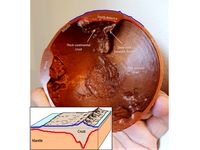
Crustal thickness globe (updated)
...added (about 3.5 mm at 100% scale) source data: topography etopo1 (https://www.ngdc.noaa.gov/mgg/global/) moho depth: crust1.0...
thingiverse
free
La Palma, part of Canary Islands, Spain by rincey12
...origin the island has a very special and interesting topography making it a great object for 3d printing. the...
thingiverse
free

AlexGyver Lamp
...the form of a cylindrical globe with nasa correct topography massive lithophane. performance not tested. printing 10 hours without...
thingiverse
free

3d map of Germany by mosaly
...of germany by mosaly thingiverse this is a 3d topography map of germany. credits: heightmap generated from https://tangrams.github.io/heightmapper/ 2d...
thingiverse
free
Mt. Everest from SRTM data by bld
...thingiverse model of mt. everest generated from shuttle radar topography mission (srtm) 90m topographic data. this fulfills a long...
thingiverse
free

Boulder Topographic iPhone 6 Case by bmartinezrahoe
...6 case by bmartinezrahoe thingiverse this case shows the topography of golden, co on the back. designed with semiflex...
thingiverse
free

Golden Topographic iPhone 6,7,7Plus Case by bmartinezrahoe
...6,7,7plus case by bmartinezrahoe thingiverse this case shows the topography of golden, co on the back. designed with semiflex...
thingiverse
free

Half Dome Sculpture by mtdna
...model of yosemite national park's half dome and surrounding topography it is based on shapespeare's huge yosemite model (thing:351271)....
thingiverse
free

Mercury globe by chhu
...iterations as well. please contact me if interested. data source:http://astrogeology.usgs.gov/search/map/mercury/topographymessenger/mercury_messenger_usgs_dem_global_665m ...
thingiverse
free

V-Shaped Outcrop Patterns by CaptObvious
...the dip of the geological surface relative to the topography in the case of valleys, patterns vee upstream or...
thingiverse
free

Crater Lake, Oregon - with lake-bed by conorokane
...oregon, with lake-bed terrain. created from space shuttle radar topography mission 30m data for the land, and the crater...
thingiverse
free

Great Barrier Reef by conorokane
...studies: https://www.coralcoe.org.au/media-releases/only-7-of-the-great-barrier-reef-has-avoided-coral-bleaching and height data from the space shuttle topography mission: http://dwtkns.com/srtm/ after printing the model was hand-painted to...
thingiverse
free

San Francisco Relief Map by pmoews
...pmoews thingiverse noaa has combined offshore bathymetry with land topography to create coastal relief models of the united states...
thingiverse
free
Bainbridge Washington Topo Print by wdreiling
...washington topo print by wdreiling thingiverse this is a topography print of bainbridge island washington located about 8 miles...
thingiverse
free

Crater Lake by thesecapsi
...lake national park. this model includes both the surrounding topography and the bathymetry of ~655m deep caldera in which...
thingiverse
free
Arduino Sun Project by Rubiks_Cubist
...a model of the sun because it has great topography hollowed it, put a hole in it, and cut...
thingiverse
free

#MakerBotMars modular base by ricvill
...no mistakes. the foundation is leveled depending on the topography of the area of construction. the modular panel functions...
thingiverse
free

3D map of Switzerland by rincewind
...the free dataset dhm200 source: swiss federal office of topography distributed in compliance with the license point 5h: "publication...
thingiverse
free

Santa Barbara County Topographic Print by Xaxis
...modified the vertical scale in meshlab to make the topography more visible when printing a large area at small...
thingiverse
free

Hawaiian Islands with seafloor by conorokane
...this model is taken from the space shuttle radar topography mission dataset (http://dwtkns.com/srtm/) and the seafloor is from the...
thingiverse
free
3D Topographic Maps of US States by nlorang
...by nlorang thingiverse these are individual stls of the topography of each us state, derived from usgs data and...
thingiverse
free
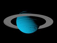
Uranus scaled one in 250 million
...neptune, this model of uranus could not represent a topography because it has not a solid surface. insted of...
thingiverse
free
The Eight-Thousanders by sitts314
...where the pedestals are cut down to emphasize the topography of the mountain. in either case, each model has...
thingiverse
free

Boulder's Flatirons Climbing Area by Shapespeare
...cloud data and digital elevation models for study of topography snow, ecosystems and environmental change at boulder creek critical...