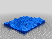
39 Qgis 3d models found
Download or buy, then render or print from the shops or marketplaces.
3D Models below are suitable not only for printing but also for any
computer graphics like CG, VFX, Animation, or even CAD. You can print these 3d models on
your favorite 3d printer or render them with your preferred render engine.
Please note that the 3D model database is only a Search Engine. You should
visit the original websites. Most of the models can be easily imported and rendered
with Autodesk 3ds Max, Maya, Blender, C4D, and Sketchup. Check for online
3d model conversions tools for your file format.
thingiverse
free

QGis rod for ZED-F9P by Eisinator
...qgis rod for zed-f9p by eisinator
thingiverse
my design for an qgis rod.
thingiverse
free
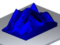
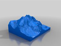
Mount Everest by gluetolf
...odel of mount everest built out of data provided by viewfinderpanoramas.org. using qgis, 3dem and accutrans 3d. reduced polygons.
thingiverse
free

Mount St. Helens by sitts314
...panoramas_org3.htm
software used:
qgis http://qgis.org/en/site/
heightmap2stl.jar http://www.thingiverse.com/thing:15276/#files
thingiverse
free

Mount Feathertop by lockylast
...nt hotham.
dem data sourced from data.vic.gov.au, and converted to stl using the qgis demto3d plugin. label added with fusion360.
thingiverse
free

Yangpyung Map Puzzle (Korean lable)
...m www.juso.go.kr
tools:
qgis for visual inspection
adobe illustrator for svg exporting
www.tinkercad.com for stl model building
thingiverse
free

Teton Mountains by da429boss
...grand teton national park(imagery from the usgs 3dep program). used qgis demto3d tool to create the 3d model and sliced in cura.
thingiverse
free

Pinnacle Mountain, Arkansas by stewardj
...untain state park. data is from elevation orthodata from the ned database. used qgis, meshlab, and meshmixer to pull it together.
thingiverse
free
Calatayud (Spain) - Jalon River Valley by talud08
...o geográfico nacional) http://centrodedescargas.cnig.es/centrodescargas/index.jsp
topography of the jalon river around calatayud.
thingiverse
free

Ben Nevis 3D Terrain Model by gluetolf
... created using opendata from https://www.ordnancesurvey.co.uk/opendatadownload/products.html and software: qgis and accutrans 3d.
thingiverse
free

Gifford Marine Park by lockylast
...s.
data sourced from the ausseabed marine portal, and converted to stl using the qgis demto3d plugin. label added with fusion360.
thingiverse
free

Mount Massive Colorado by stewardj
...s very large, with a lot of detail. it is not to scale. can't remember which way is north on the darn thing either. enjoy.
thingiverse
free
Valle del Jerte (Spain) by t_crego
...s the area where the town of "el torno" is located. the scale is exactly 1: 50.000 and the height is multiplied by two.
thingiverse
free

Bolaven Plateau (Lao PDR / Laos) Topography by MTORO003
...nal details on this project can be found at: https://matthewtoro.com/2016/09/08/topographic-3d-printing-the-bolaven-plateau-laos/
thingiverse
free

montasio by terotero
... our website:https://shop.terotero.it/products/montasio
please contact us first if you plan to print and sell our models. thanks!
thingiverse
free

civetta by terotero
...n our website:https://shop.terotero.it/products/civetta
please contact us first if you plan to print and sell our models. thanks!
thingiverse
free

Mt. St. Helens 1:50000 scale
...to qgis and using the demto3d plugin tool. i set the scale to 1:50000 which resulted in a model 158mm x 191.3mm x 38.5mm in size.
thingiverse
free

monte pelmo by terotero
... on our website:https://shop.terotero.it/products/pelmo
please contact us first if you plan to print and sell our models. thanks!
thingiverse
free

tre cime di lavaredo by terotero
... our website:https://shop.terotero.it/products/tre-cime
please contact us first if you plan to print and sell our models. thanks!
thingiverse
free

Yellow Creek Lake, Pennsylvania 3D model by NaturallyFocused256
... purchase a 2d lake map of yellow creek lake, pa, visit my online shop at naturallyfocused256.etsy.com and choose custom lake map
thingiverse
free
Camp Susque (Trout Run, PA) Elevation Model by malbert
...ed on map size / height
-edit mesh, select all, extrude down in z
-scale lower mesh to flat plane (s, z, 0)
-export as stl
-done!
thingiverse
free
Mount Everest 1:100000 by jawensi
...d.com/
demto3d is a plugin available for free gis software kosmo (http://www.opengis.es/) and qgis (http://www.qgis.org/en/site/)
thingiverse
free
The "Vyskoká" peak in High tatras, Slovakia by Jansvast
...ozzle. beautiful in silk gold.
took just over a day, but can be printed quicker. resuming the print caused one overextruded line.
thingiverse
free

Hawaii (Big Island) by sitts314
...wfinderpanoramas_org3.htm
created using qgis: http://www.qgis.org/en/site/
and hgt2stl: http://www.thingiverse.com/thing:110904
thingiverse
free

Matterhorn 1:30000 by jawensi
...d.com/
demto3d is a plugin available for free gis software kosmo (http://www.opengis.es/) and qgis (http://www.qgis.org/en/site/)
thingiverse
free

Terrain Model of Binghamton, NY by anoved
...ere is a short video clip of adding some detail to the pla version with acrylic paint: http://www.youtube.com/watch?v=lhwayqxne68
thingiverse
free

Yosemite Valley 1:75000 by jawensi
...d.com/
demto3d is a plugin available for free gis software kosmo (http://www.opengis.es/) and qgis (http://www.qgis.org/en/site/)
thingiverse
free

Mars Perseverance Rover Landing Site Jezero Crater: Mars Lesson built with the "NASA Mars Trek" & QGIS by GrowFlavor
...ossibly print a matching handout with details of the discovery index keyed with the same color dot) as the science team explores.
thingiverse
free

Naranjo de Bulnes 1:5000 by jawensi
...d.com/
demto3d is a plugin available for free gis software kosmo (http://www.opengis.es/) and qgis (http://www.qgis.org/en/site/)
thingiverse
free

Sierra Nevada 1:40000 by jawensi
...d.com/
demto3d is a plugin available for free gis software kosmo (http://www.opengis.es/) and qgis (http://www.qgis.org/en/site/)
thingiverse
free

Elevation model from a part of São Paulo by aroldorosenberg
... a 0.8mm nozzle, 0.4mm layer, forgot to turn on retraction.
todo: make a petg chocolate mold from the model using vacuum forming.
thingiverse
free

Australia by gaellafond
...ources:
bathymetry: http://eatlas.org.au/data/uuid/80301676-97fb-4bdf-b06c-e961e5c0cb0b
png23d: http://kyllikki.github.io/png23d/
thingiverse
free

Lower Manhattan Cityscape by MTORO003
...ditional basic details on this model are available at:
https://matthewtoro.com/2016/10/24/lower-manhattan-cityscape-3d-printing/
thingiverse
free

Training run route draped over surrounding terrain by anoved
...rk out the scale; easiest to go 1:1 with the unit pixel size of your elevation dataset. process & settings subject to change!
thingiverse
free

Fagradalsfjall volcano Iceland relief map by Hlynur_taekjavordur
...anually adjusted to remove errors and gaps in the data.
stl files were created using qgis software utilising the demto3d plugin.
thingiverse
free

Lunar Crater Chain Mendeleev: NASA Moon Trek Chang'e 2 DEM 20m by GrowFlavor
...
nasa mars trek: jezero crater perseverance rover landing area terrain model: https://www.thingiverse.com/thing:4747950
enjoy!
thingiverse
free

Binghamton Election District Maps by anoved
...t the upper and lower bounds of the data range accordingly), or use prismap to create extruded prism maps of your own study area.
thingiverse
free

Topographical Push Pin Map
...ive (or other program that can turn topographical data into maps, like qgis)
-inkscape (or other vector program like illustrator)
grabcad
free

Toronto 3D Map
...toronto 3d map
grabcad
dem into stl via qgis
grabcad
free

Adirondack Park - Elevation Model
...out to about 13 millimeters in physical height.
send me a message if you wan't me to make a file for an area of your choice.