Thingiverse
Topographical overlay by adamrw91
by Thingiverse
Last crawled date: 4 years, 5 months ago
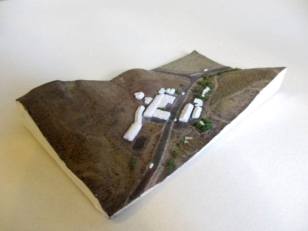
This is a topographical overlay of an area in the california napa hills. The topography was done by LIDAR scans and turned into a heightmap using microdem. The houses were modeled after the LIDAR scans and satalite images. The model was then painted to match the satalite pictures.