
Thingiverse
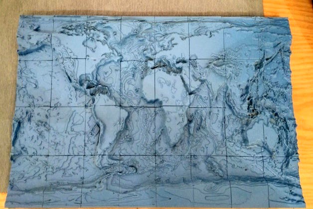
Topographic World Map
by Thingiverse
Last crawled date: 6 years, 6 months ago
Elevation levels roughly to scale, but coast line exaggerated. Everywhere else 1 mm in height corresponds to 1 km. At the equator the planar scale is roughly 1:25000000. My plan was to print this in the scale shown here, but as this would need more than 160 h of printing. I then started with a version which was scaled to 40% in X and Y. The whole map is split in 32 tiles, labeld as shown in the image.