Thingiverse
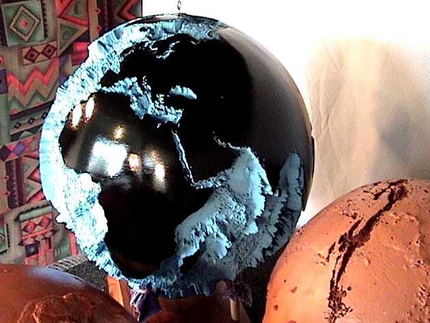
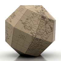
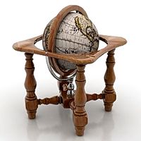
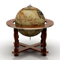
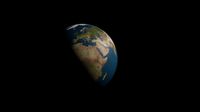
Seafloor Globe 40x, Earth in 130,000 Triangles by GlobeMaker
by Thingiverse
Last crawled date: 2 years, 11 months ago
The bottom of the ocean is shown in 3D for Earth, while the land is smooth. The black photo is from a similar globe in 2005, but that is the Seafloor Globe 150x. The new Seafloor Globe 40x has 9 times less detail per unit area as well as a smoother shape for easier manufacturing. It may need collaboration to cut it in half and to add scaffolding.
Data Sources: ETOPO2 includes:
Smith & Sandwell
The "Smith & Sandwell" database is a worldwide set of 2-minute gridded ocean bathymetry derived from 1978 satellite radar altimetry of the sea surface
GLOBE
The "Global Land One-kilometer Base Elevation" (GLOBE) database is made up of data sets from more than eight US and foreign agencies. It covers all of the world's land masses at a resolution of 0.5 minute (30") of latitude and longitude, which is approximately one kilometer at the equator.
IBCAO
The International Bathymetric Chart of the Arctic Ocean (IBCAO) initiative developed a digital database that contains all available bathymetric data north of 64 degrees North. The version contained in ETOPO2v2 is 1.0, sampled to 2' cell averages.
NGDC Coastal Relief Model (CRM)
The Coastal Relief Model (CRM) is used for US waters from the coastline to as far offshore as the NOS hydrographic data will support a continuous view of the seafloor. Data were sampled to 2' cell averages for areas adjacent to all 48 conterminous states, Hawaii, and NGDC Great Lakes Bathymetric Data
Great Lakes bathymetric data were sampled to 2' cell averages for all five Great Lakes. 3" source grids were available for lakes Huron, Michigan, Erie, and Ontario; preliminary 30" grid data were sampled for Lake Superior. All lake depth data were made consistent with surrounding land elevations and each lake's mean level datum.
Similar models
thingiverse
free
Earth 3D Model in 130,000 Triangles by GlobeMaker
...report on bathymetric details. the photograph is of a similar globe i made using stereolithography in 2004. the 6...
thingiverse
free

Hawaii Region with Seafloor by GlobeMaker
...port explains how the satellites measured the seafloor depths by observing the changes in the height of the water due to gravity.
thingiverse
free
Land Globe 200x in 500,000 Facets by GlobeMaker
...300x is seen in the left and it is similar to the thing (land globe 200x). originator: national geophysical...
thingiverse
free

Inverted Seafloor Globe 350x in 130,000 Facets by GlobeMaker
... data were derived from the national geophysical data center (ngdc) etopo2 global 2' elevations data set from september 2001.
grabcad
free

Gravel Lake
...gravel lake
grabcad
bathymetric lake
thingiverse
free

Earth No Sea Relief Globe by pmoews
...two stl files are available:
earth_no_sea.stl and
earth_no_sea_base.stl - the same globe with a base added at the south pole
thingiverse
free
Bathymetric Map of Lake Michigan by BradSchowanson
...print this then paint the landscape and depth surfaces similar to the colors shown in the...
3dwarehouse
free

NOOA crust & GEBCO topographic-bathymetric globe maps
...queo, глобус, terrestre, globo, planet, globus, planeta, planète terre, glob, duniya, world, mir, alealamia, monde, shìjiè, mundo
thingiverse
free

Lake Michigan Bathymetric Map by bcgeek
...map of lake michigan as designed from the noaa maps. the file is a little simplified and reflects a 20m difference in the layers.
thingiverse
free

Clear Lake Bathymetry Trinket by blackle
...ated bathymetric map of the lake my family's cottage is on. it is adapted from aerial photos.
here is the lake on google maps
Globemaker
thingiverse
free
Hawaii Region with Seafloor by GlobeMaker
...port explains how the satellites measured the seafloor depths by observing the changes in the height of the water due to gravity.
thingiverse
free

Global Warming Globe by GlobeMaker
...as 6 megabytes of data for 120,000 triangles. the amazon basin is under water, the mississippi valley is submerged. and worse...
thingiverse
free

Mexico y El Norte by GlobeMaker
...is 18,000 feet tall: citlaltépetl . past that is yucatan.
the third photo looks south across colorado, texas, and eastern mexico.
thingiverse
free
Land Globe 200x in 500,000 Facets by GlobeMaker
... data were derived from the national geophysical data center (ngdc) etopo2 global 2' elevations data set from september 2001.
thingiverse
free

Moon Globe 5x by GlobeMaker
...team (lunar altimeter team). your data format is easy to use:http://l2db.selene.darts.isas.jaxa.jp/help/en/lalt_format_en_v01.pdf
thingiverse
free

Northeast Africa and Italy 25x by GlobeMaker
...rd photograph shows nigeria and the niger river. the sahara desert is seen to contain vast smooth areas, that must be sand dunes.
thingiverse
free

Mercury Globe 10x by GlobeMaker
...ion = "this data product is a shape map (radius)
of mercury at a resolution of 21.293 km/pix by 21.293 km/pix,
thingiverse
free

Santa Cruz Mountain Model, California by GlobeMaker
... pointing into the bottom left is the san lorenzo river valley with boulder creek.
the gray image is the quad from a lower angle.
thingiverse
free
Mercury Globe 5x in 516,000 Facets by GlobeMaker
...m
producer_full_name = "david e. smith"
producer_institution_name = "nasa/goddard space flight center"
thingiverse
free

Moon 10x Rev 2 by GlobeMaker
...team (lunar altimeter team). your data format is easy to use:http://l2db.selene.darts.isas.jaxa.jp/help/en/lalt_format_en_v01.pdf
Seafloor
3d_export
$40
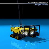
Seafloor ROV 3D Model
...obot minisub marine ocean research rov remote operated vehicle cable deploy seafloor
seafloor rov 3d model tartino 11757 3dexport
3d_export
$50

Cable deploy robot 3D Model
...cable deploy robot underwater auv rov cables submarine ocean seafloor sea cable deploy robot 3d model tartino 11759...
cg_studio
$50
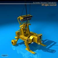
Cable deploy robot3d model
...cable deploy robot underwater auv rov cables submarine ocean seafloor sea .3ds .c4d .obj - cable deploy robot 3d...
3d_export
$19

Underwater habitat sea life seascape ship reef coral panorama seabed
...panorama seabed ocean floor undersea fish cartoon water lake seafloor plant aquatic plants rigged 2. files include...
thingiverse
free
Hawaii Region with Seafloor by GlobeMaker
...port explains how the satellites measured the seafloor depths by observing the changes in the height of the water due to gravity.
thingiverse
free

Hawaiian Islands with seafloor by conorokane
...resin onto the model up to the walls. after the resin had set i painted the islands. the model is painted with acrylics and inks.
thingiverse
free
Inverted Seafloor Globe 350x in 130,000 Facets by GlobeMaker
... data were derived from the national geophysical data center (ngdc) etopo2 global 2' elevations data set from september 2001.
thingiverse
free

Paucipodia inermis by Prehistorica
...a very simple body plan. it walked along the seafloor with a pair of claws on each foot, and...
thingiverse
free

Scuba duck by 3DprinterOS
...who's eligible to dive to the bottom of the seafloor printed on the ultimaker 2 via 3dprinteros. 120 microns,...
40X
turbosquid
$15

Equinox 40x scope
... 3d model equinox 40x scope for download as max, obj, and fbx on turbosquid: 3d models for games, architecture, videos. (1375123)
turbosquid
$10

SWIFT SW380T Microscope 40X-2500X
...d model swift sw380t microscope 40x-2500x for download as max on turbosquid: 3d models for games, architecture, videos. (1603317)
3d_export
$5

alfred taubman sculpture
...alfred taubman sculpture 3dexport sculpture<br>alfred taubman sculpture<br>dimensions: 40x 40 x 120 cm<br>version: 3ds max 2015<br>render: corona render<br>formats:...
3d_export
$8

Bouquets Blue 04
...max (vray 3) obj + mt<br>------------------------------------<br>units: centimeters<br>dimension: 50 x 40x 57<br>polys: 715023<br>verts:...
3dfindit
free

BM-24-40X
...bm-24-40x
3dfind.it
catalog: zemic
thingiverse
free

TIP Holder 40x + clamping sleeve adapter
...der 40x + clamping sleeve adapter
thingiverse
tip holder 40x + clamping sleeve adapter
clamping sleeve adapter diameter : 12,5mm
thingiverse
free
Der Kartograph by Pika106
...dem spiel der kartograph. pro spieler benötigt ihr ca. 40x feld 40x wald 40x wasser 40x dorf 16x monster...
thingiverse
free
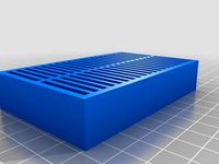
40x SD Card Holder with Lid by phreak42x
..., no raft or support needed for the base (as long as your bed doesn't suck!), might need external support for the lid though.
thingiverse
free

CNC Z mount 40x 20 V-slot
...g:3848327
link to the cnc motor mount (dimension copied from the supplied metal bracket)https://www.thingiverse.com/thing:3850028
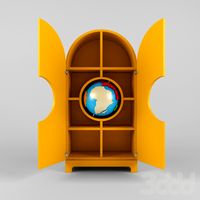
Globe
3ddd
$1
Globe
...globe
3ddd
globe
шкаф для сувениров globe
3d_ocean
$5
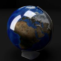
Globe
...globe
3docean
earth geography globe planet shiny
a simple globe
archibase_planet
free
Globe
...globe
archibase planet
globe sphere terrestrial globe
globe paper n041014 - 3d model (*.gsm+*.3ds) for interior 3d visualization.
archibase_planet
free

Globe
...globe
archibase planet
globe sphere
globe n080510 - 3d model (*.gsm+*.3ds) for interior 3d visualization.
archibase_planet
free
Globe
...globe
archibase planet
globe sphere
globe n270810 - 3d model (*.gsm+*.3ds) for interior 3d visualization.
archibase_planet
free
Globe
...globe
archibase planet
globe sphere
globe n220513 - 3d model (*.gsm+*.3ds) for interior 3d visualization.
3d_ocean
$9

Globes
...rt earth globe globes land map ocean sphere world
set of 4models of earth globes made in cinema4d. files included: .c4d .obj .3ds
archibase_planet
free

Globe
...globe
archibase planet
globe sphere
globe n251013 - 3d model (*.gsm+*.3ds+*.max) for interior 3d visualization.
archibase_planet
free
Globe
...globe
archibase planet
globe sphere
globe n181113 - 3d model (*.gsm+*.3ds+*.max) for interior 3d visualization.
archibase_planet
free
Globe
...globe
archibase planet
terrestrial globe sphere
globe n010708 - 3d model (*.gsm+*.3ds) for interior 3d visualization.
000
turbosquid
$15

Sofa 000
...free 3d model sofa 000 for download as 3ds, max, obj, and fbx on turbosquid: 3d models for games, architecture, videos. (1401892)
turbosquid
$40

TIRE 000
... available on turbo squid, the world's leading provider of digital 3d models for visualization, films, television, and games.
turbosquid
$10

chair 000
... available on turbo squid, the world's leading provider of digital 3d models for visualization, films, television, and games.
turbosquid
$32
MOD A 000.max
... available on turbo squid, the world's leading provider of digital 3d models for visualization, films, television, and games.
turbosquid
$1

electric engine BLDC with water cooling for printing 10 000 W stl
...with water cooling for printing 10 000 w stl for download as on turbosquid: 3d models for games, architecture, videos. (1632791)
3ddd
$1

Ручки для кухни Giusti WMN.721Y.128.XXX и WPO.721X.000.XXX
...установить свою степень сглаживания, изначально установлено 2.
в архиве библиотека материалов для ручек. всё настроено для vray.
3d_export
$5
baby
...3dexport baby head<br>poligon min 106 468 x 7 473 000 , max 6 859 000 x 7 473...
3ddd
$1

Статуетка
...статуетка 3ddd 000 00000 0000 00000 0 0 000 0 0 0...
3d_export
$6

Rome Centurion Sculpt
...sculpt 3dexport rome centurion high poly model .ztl 75 000 000...
3d_export
$5

Wendigo Ram Sculpt
...sculpt 3dexport wendigo ram high poly model .ztl 36 000 000...
130
3ddd
$1
THONET 130
...honet
thonet 130
naoto fukasawa, 2010http://en.shop.thonet.de/residential/range-130?a=528
(2 варианта - ясень и черный)
3d_export
$17

C-130 Hercules
...c-130 hercules
3dexport
c-130 hercules
turbosquid
$240
AC 130
...
turbosquid
royalty free 3d model ac 130 for download as fbx on turbosquid: 3d models for games, architecture, videos. (1366260)
turbosquid
$25

Ring 130
... available on turbo squid, the world's leading provider of digital 3d models for visualization, films, television, and games.
turbosquid
$15

Nokia 130
... available on turbo squid, the world's leading provider of digital 3d models for visualization, films, television, and games.
turbosquid
$9

Office 130
... available on turbo squid, the world's leading provider of digital 3d models for visualization, films, television, and games.
turbosquid
$5
Chair 130
... available on turbo squid, the world's leading provider of digital 3d models for visualization, films, television, and games.
turbosquid
free

zil-130
... available on turbo squid, the world's leading provider of digital 3d models for visualization, films, television, and games.
evermotion
$7
railing 130 am79
...key sculptures 130 am79 railing
highly detailed architecture railing with all textures and materials.. evermotion 3d models shop.
design_connected
$13

Jacob Table 130
...jacob table 130
designconnected
minotti jacob table 130 computer generated 3d model. designed by dordoni, rodolfo.
Triangles
3ddd
$1

Тумба Triangle
...тумба triangle
3ddd
тумба , triangle
тумба в современном стиле triangle
3ddd
$1
Triangled posters
...triangled posters
3ddd
постер
triangled posters collection
3ddd
$1
Carpet Triangle
...carpet triangle
3ddd
ковер
carpet triangle, ковер , узоры, треугольник
design_connected
free
Triangle Table
...triangle table
designconnected
free 3d model of triangle table by atelier areti designed by kerschbaumer, gwendolyn.
turbosquid
$2

triangle sign
...quid
royalty free 3d model triangle sign for download as fbx on turbosquid: 3d models for games, architecture, videos. (1421072)
turbosquid
$1
Triangle Signal
...id
royalty free 3d model triangle signal for download as fbx on turbosquid: 3d models for games, architecture, videos. (1162930)
3d_export
$5

impossible triangle
... and materials.<br>https://www.shutterstock.com/video/clip-1057067141-3d-animation-impossible-triangle-that-assembled-cubes
3d_export
$5

triangle house
...triangle house
3dexport
living in a house that is happy
turbosquid
$35

Triangle Hanger
... available on turbo squid, the world's leading provider of digital 3d models for visualization, films, television, and games.
turbosquid
$15

Dinner Triangle
... available on turbo squid, the world's leading provider of digital 3d models for visualization, films, television, and games.
Earth
3d_export
$5
earth
...earth
3dexport
earth with textures
3d_ocean
$5

Earth
...tic world science sphere world terra world illustrations world map
a beautiful model of earth complete with high resolution maps.
3d_export
$5

earth
...earth
3dexport
earth pbr texture
3d_ocean
$9
Earth
...osphere blue chikyuu clouds earth erde globe moon planet satellite solar space system terra tierra universe
realistik model earth
3d_export
$5

earth
...earth
3dexport
3d_export
free
earth
...earth
3dexport
turbosquid
free

Earth
...earth
turbosquid
free 3d model earth for download as obj on turbosquid: 3d models for games, architecture, videos. (1297145)
turbosquid
free

Earth
...earth
turbosquid
free 3d model earth for download as max on turbosquid: 3d models for games, architecture, videos. (1482232)
3d_ocean
$4
Earth
... latest map most new planet plygon ready top world
earth 3d model is available in all major 3d formats like fbx, obj, mb and lxo.
turbosquid
$6

eARTH
...h
turbosquid
royalty free 3d model earth for download as c4d on turbosquid: 3d models for games, architecture, videos. (1215608)