3dExport

scale relief topographic world map
by 3dExport
Last crawled date: 1 year, 11 months ago
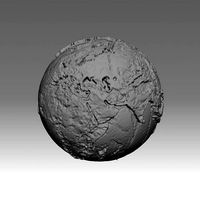
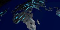
this 3d model is a representation to scale of the terrestrial globe, as you may have noticed, the dimensions represent the continents according to their real size and proporsions. since many maps tend to exaggerate the dimensions of some countries or islands for example greenland that always seems bigger than africa, which is not true, since africa is 14 times bigger. that is why i have dedicated myself to making several models of the terrestrial globe. in this model you can also see the relief and you will see that the files weigh several megabytes since it required too many vertices (258482) and polygons (516960) to make a portrait as close to reality, although i have added a textures (downloaded from the nasa page), to simulate the color; i have also added the renderings both with and without texture, so that you will notice that it is done in detail.
enjoy it.
enjoy it.
Similar models
cg_trader
$25
World map 3D - relief topographic 1in50000000 | 3D
...ate the color; i have also added the renderings both with and without texture, so that you will notice that it is done in detail.
cg_trader
$25

World map 3D - relief topographic 1in100000000 | 3D
... done in detail.
measurements:
x = 12.756 cm (127.562 mm)
y = 12.714 cm (127.136 mm)
z = 12.756 cm (127.562 mm)
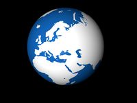
3dwarehouse
free

Terrestrial globe
...terrestrial globe
3dwarehouse
#globe #terrestrial #terrestrial globe
thingiverse
free

Handle for 30 ounce mug by Klineea
... a bigger handle design for folks with bigger hands. hope you like it.
i added a flat handle design that i have not printed yet.
grabcad
free

World Globe Decoration - World Model
...body, or of the celestial sphere. globes serve purposes similar to some maps, but unlike maps, do not distort...
thingiverse
free

Earth No Sea Relief Globe by pmoews
...two stl files are available:
earth_no_sea.stl and
earth_no_sea_base.stl - the same globe with a base added at the south pole
3dwarehouse
free

Terrestrial globe
...terrestrial globe
3dwarehouse
#terrestrial globe
3dwarehouse
free

Terrestrial globe
...terrestrial globe
3dwarehouse
#terrestrial globe
3dwarehouse
free

Terrestrial globe
...terrestrial globe
3dwarehouse
#terrestrial globe
3dwarehouse
free

Terrestrial globe
...terrestrial globe
3dwarehouse
#terrestrial #globe
Topographic
3d_export
$25

Topographic map
...topographic map
3dexport
simple rendering of the scene file
3ddd
free
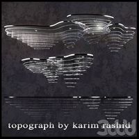
The topograph chandelier by Karim Rashid
... от карима рашида.
the topograph chandelier by karim rashid.http://www.karimrashid.com/projects#category_4/project_247
3d_export
$50
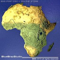
Africa 3D Model
...3dexport africa map terrain elevation satellite landscape mountain land topographic dem africa 3d model braz 21501...
3d_export
$50
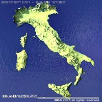
Italy 3D Model
...3dexport italy map terrain elevation satellite landscape mountain land topographic dem italy 3d model braz 21511...
3d_export
$50
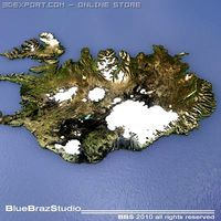
Iceland 3D Model
...3dexport iceland map terrain elevation satellite landscape mountain land topographic dem iceland 3d model braz 21509...
3d_export
$50
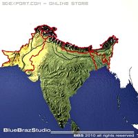
India 3D Model
...3dexport india map terrain elevation satellite landscape mountain land topographic dem india 3d model braz 21510...
3d_export
$50
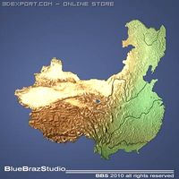
China 3D Model
...3dexport china imap terrain elevation satellite landscape mountain land topographic dem china 3d model braz 21505...
3d_export
$50
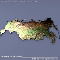
Russia 3D Model
...3dexport russia map terrain elevation satellite landscape mountain land topographic dem russia 3d model braz 21513...
3d_export
$50
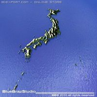
Japan 3D Model
...3dexport japan imap terrain elevation satellite landscape mountain land topographic dem japan 3d model braz 21508...
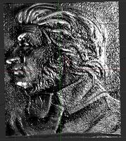
Relief
3d_export
$20
relief
...relief
3dexport
relief
turbosquid
$1

Relief
...
turbosquid
royalty free 3d model relief for download as obj on turbosquid: 3d models for games, architecture, videos. (1438537)
3d_export
$15
horse relief
...horse relief
3dexport
horse relief
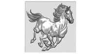
3d_export
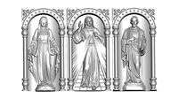
$10

jesus relief
...jesus relief
3dexport
jesus relief
3d_export
$10

rome relief
...rome relief
3dexport
rome relief
3d_export
$10

fish relief
...fish relief
3dexport
fish relief
3d_export
$10

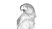
eagle relief
...eagle relief
3dexport
eagle relief
3d_export
$10
eagle relief
...eagle relief
3dexport
eagle relief
3d_export
free

3d relief
...3d relief
3dexport
3d relief
turbosquid
free
Relief
... available on turbo squid, the world's leading provider of digital 3d models for visualization, films, television, and games.
Map
3d_ocean
$5

Map
...map
3docean
geography map ocean travel world world map
a world map
3d_ocean
$5

Old Map
...old map
3docean
dirty map ocean old map paper pirates rotten travel world map
an old map
turbosquid
$3

Map
... available on turbo squid, the world's leading provider of digital 3d models for visualization, films, television, and games.
3d_ocean
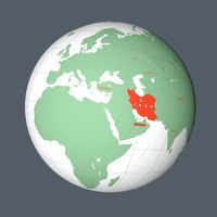
$3

Map of Iran
...map of iran
3docean
flag iran map outline
an outline map of iran
3d_ocean
$2

Map of the USA
...map of the usa
3docean
america flag globe map united states usa
an outline map of the usa
3ddd
$1

Abstract Maps
... город , picture
abstract maps by artist jazzberry blue
3d_ocean
$5

Honduras Map
...honduras map
3docean
3d cinema4d honduras map mapa
honduras map designed in cinema 4d r17
3d_ocean
$2

Map of Germany
...map of germany
3docean
black country europe germany gold map outline red yellow
a simple outline map of germany
3d_ocean
$2

Map of Australia
...map of australia
3docean
australia banner country down under earth flag globe map ocean south
an outline map of australia
3d_ocean
$2

Map of Russia
...of russia
3docean
asia banner earth europe flag globe map russia russian federation siberia sovjet union
an outline map of russia
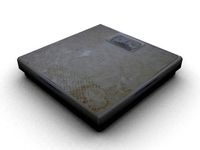
Scale
turbosquid
$20
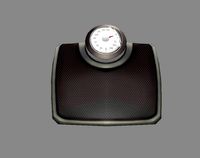
Weight scale or Bathroom Scale
...ght scale or bathroom scale for download as max, fbx, and obj on turbosquid: 3d models for games, architecture, videos. (1664576)
turbosquid
$19

Scale
...e
turbosquid
royalty free 3d model scale for download as fbx on turbosquid: 3d models for games, architecture, videos. (1411722)
turbosquid
$5
Scales
...s
turbosquid
royalty free 3d model scales for download as ma on turbosquid: 3d models for games, architecture, videos. (1393439)
turbosquid
$40

Scale
... available on turbo squid, the world's leading provider of digital 3d models for visualization, films, television, and games.
turbosquid
$17

Scales
... available on turbo squid, the world's leading provider of digital 3d models for visualization, films, television, and games.
turbosquid
$12

Scale
... available on turbo squid, the world's leading provider of digital 3d models for visualization, films, television, and games.
turbosquid
free
Scale
... available on turbo squid, the world's leading provider of digital 3d models for visualization, films, television, and games.
3d_export
$7

of scales
...s have a flat point of support. the samples are rendered in the standard cinema 4d renderer. enjoy your use and creative success.
3d_export
$5
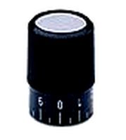
scale knob
...scale knob
3dexport
scale knob
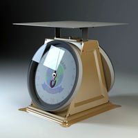
3d_export
$20
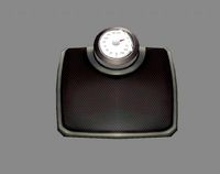
cartoon weight scale or bathroom scale
...cartoon weight scale or bathroom scale
3dexport
texture size:512px number of texture:1 texture format: png
World
3d_ocean
$5
world
...world
3docean
3d earth model world
3d world model
turbosquid
$150

world
... available on turbo squid, the world's leading provider of digital 3d models for visualization, films, television, and games.
turbosquid
$30
world
... available on turbo squid, the world's leading provider of digital 3d models for visualization, films, television, and games.
turbosquid
$9

WORLD
... available on turbo squid, the world's leading provider of digital 3d models for visualization, films, television, and games.
turbosquid
$5

World
... available on turbo squid, the world's leading provider of digital 3d models for visualization, films, television, and games.
turbosquid
free

world
... available on turbo squid, the world's leading provider of digital 3d models for visualization, films, television, and games.
turbosquid
$1

world
...d
turbosquid
royalty free 3d model world for download as 3ds on turbosquid: 3d models for games, architecture, videos. (1487045)
3ddd
free
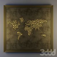
The World
... панно
багет the world. декор для стены в рамке, может так же использоваться как декор во всю стену без багета.
3d_ocean
$5
The world 3d
...the world 3d
3docean
3d map the world world
this is the 3d version of the word
3d_export
$5
a small world
...a small world
3dexport
a small world