CG Trader
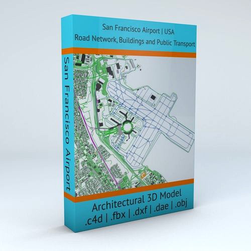
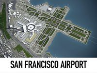
San Francisco SFO Airport Roads Buildings and Public Transport
by CG Trader
Last crawled date: 1 year, 9 months ago
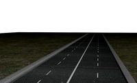
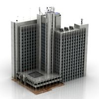
this model is based on real data therefore this is a realistic 3D Model of San Francisco SFO Airport, USA 4 main object groups included | 1. Buildings 2. Road Network 3. Public Transport 4. Aeroway Buildings has 3 building groups setup so that you can add variety to buildings (color materials and/or textures) Groups can be turned off/on
- Road Network has 2 objects included | 1. roads 2. other areas
- Public Transport includes the transport lines
- Aeroway includes the road network for airplanes (runways, airstrips, parking etc.) UV mapped with overlapping UVs
- no textures included / colors setup by materials (can be changed in any 3D software)
- the model is positioned on a flat surface (road network is on the “floor” - no elevation data included)
- geometry is polygonal quads and tris
- model is untextured and renders fast this 3D model is/can be licensed (commercial use is fine) under Creative Commons Attribution-ShareALike 2.0 (CC-BY-SA) license
- buildings and streets data from OpenStreetMap / www.openstreetmap.org Attribution : © OpenStreetMap contributors / http://www.openstreetmap.org/copyright POINTS/VERTS : 177199
POLYGONS : 145692 .c4d - native format
- .fbx - v7.1
- .dae - v1.5
- .dxf
- .obj .blend san francisco sfo usa america airport architecture infrastructure transportation public transport road network roads buildings international installation terminals map architectural engineering san francisco usa map
Similar models
cg_trader
$29

Seattle Tacoma SEA Airport Roads Buildings and Public Transport
...tion public transport road network roads buildings international installation air terminals map architectural engineering usa map
cg_trader
$29

Chicago OHare ORD Airport Roads Buildings Public Transport
...on public transport road network roads buildings international installation terminals map ohare architectural engineering usa map
cg_trader
$29

Phoenix Sky Harbor PHX Airport Roads Buildings and Public Trans
...ure transportation public road network roads buildings international installation terminals map architectural engineering usa map
cg_trader
$29
Madrid Barajas MAD Airport Roads Buildings and Public Transport
...e transportation public transport road network roads buildings international installation terminals map architectural engineering
cg_trader
$29
Paris Orly ORY Airport Roads Buildings and Public Transport
...e transportation public transport road network roads buildings international installation terminals map architectural engineering
cg_trader
$29
London Heathrow LHR Airport Roads Buildings and Public Transport
...infrastructure transportation public transport road network roads buildings international terminals map architectural engineering
cg_trader
$29

Frankfurt FRA Airport Roads Buildings and Public Transport Lines
...ansportation public transport road network roads buildings international installation air terminals map architectural engineering
cg_trader
$29

Seoul Incheon ICN Airport Roads Buildings and Public Transport
...e transportation public transport road network roads buildings international installation terminals map architectural engineering
cg_trader
$29

Changi SIN Airport Singapore Roads Buildings Public Transport
...ansportation public transport road network roads buildings international installation air terminals map architectural engineering
cg_trader
$29

Tokyo Haneda HND Airport Roads Buildings and Public Transport
...ansportation public transport road network roads buildings international installation air terminals map architectural engineering
Sfo
3dfindit
free

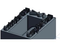
SERIE SFO
...serie sfo
3dfind.it
catalog: zimmer group
thingiverse
free

Conversion Kit Box (Slide Conversion Kit) by Ziggi42
...at print settings misc. thanks and gimme a like!!! sfo ...
thingiverse
free

Parametric Filament Spool Vase by tomburtonwood
...figured most of it out on a flight to sfo and finished the rest here at the opal hotel...
thingiverse
free
Gary V Godot by kbpiper01
...to dig hyperloops throughout the united states, starting with lax-sfo and bwi-jfk, but no one is sure what musk...
cg_trader
$199
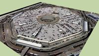
San Francisco International Airport - SFO
...irport - sfo
cg trader
san francisco international airport - sfo 3d model , formats max, obj, fbx, ready for 3d animation and ot
cg_trader
$199

San Francisco International Airport - SFO
...trader
3d asset san francisco international airport - sfo , formats max, obj, fbx, c4d, ma, blend, ready for 3d animation and ot
clara_io
free

SFO Scene
...sfo scene
clara.io
clara_io
free

SFO v5
...sfo v5
clara.io
3dwarehouse
free
SFO Domestic garage
...sfo domestic garage
3dwarehouse
big garage #garage #sfo
Francisco
design_connected
$16
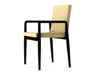
Francisco chair
...francisco chair
designconnected
etel interiores francisco chair chairs computer generated 3d model. designed by etel carmona.
turbosquid
$4
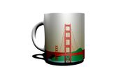
Cup_San Francisco
... available on turbo squid, the world's leading provider of digital 3d models for visualization, films, television, and games.
3d_export
$70

Francisco Lachowski
...francisco lachowski
3dexport
simple stylized character with baked in texture lighting and ao
3ddd
$1

FRANCISCO MIRA model ANAIS
...испания
коллекция: line sofa-cama
модельanais
описание:диван раскладной\ folding sofa
сайт:http://www.franciscomira.com
turbosquid
free

San Francisco House
... available on turbo squid, the world's leading provider of digital 3d models for visualization, films, television, and games.
3ddd
$1

La Creu / San Francisco
...la creu / san francisco
3ddd
la creu
потолочный светильник от la creu. модель san francisco. все текстуры и материалы в наличии.
cg_studio
$110
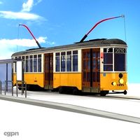
San Francisco tramway3d model
...
cgstudio
.3ds .c4d .dxf .obj - san francisco tramway 3d model, royalty free license available, instant download after purchase.
3d_export
$110
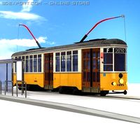
San Francisco tramway 3D Model
...t city public transportation track car railroad italy town sidewalk tram urban
san francisco tramway 3d model braz 23403 3dexport
3ddd
$1

SAN FRANCISCO Leds C4
...rancisco leds c4
3ddd
leds c4 , leds-c4
диаметр 600 мм.
текстуры и материалы в комплекте
3ddd
$1
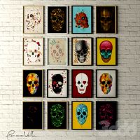
Сборник Картины Skulls Collection by Francisco Valle
... представлены 3 вида рамок - белая глянцевая, черная глянцевая, деревянная.
the collection of paintings in a contemporary style.
Airport
3ddd
$1

Poliform Airport
...poliform airport
3ddd
poliform , airport
диван poliform airport
turbosquid
$10

Airport
...rbosquid
royalty free 3d model airport for download as blend on turbosquid: 3d models for games, architecture, videos. (1338079)
turbosquid
$35

AIRPORT
... free 3d model airport for download as 3ds, max, obj, and fbx on turbosquid: 3d models for games, architecture, videos. (1419439)
turbosquid
$1
Airport
... available on turbo squid, the world's leading provider of digital 3d models for visualization, films, television, and games.
turbosquid
free

Airport
... available on turbo squid, the world's leading provider of digital 3d models for visualization, films, television, and games.
3d_export
$65

airport
...airport
3dexport
simple rendering of the scene file
3d_export
$65

airport
...airport
3dexport
simple rendering of the scene file
3d_export
$65

airport
...airport
3dexport
simple rendering of the scene file
3d_export
$65

airport
...airport
3dexport
simple rendering of the scene file
3d_export
$65

airport
...airport
3dexport
simple rendering of the scene file
Public
3d_ocean
$25
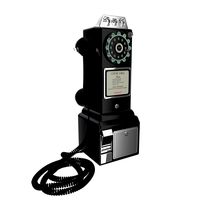
Public telephone
...public telephone
3docean
public telephone
3d model and render (cycles) public telephone 1957
3d_ocean
$2
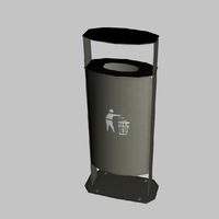
Public Trash
...public trash
3docean
builds city concept trash
public trash
3d_ocean
$5
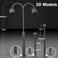
Public Lights
...s
3docean
decor lights outside public ready
this file includes 3 public lights models that you can use in your sceen and prejecs.
3d_export
$10

Public snake
...
the public seats are designed in a snake-like shape, divided into two sides, with a small tree as a divider to divide the zone.
turbosquid
$29

Public Library
...uid
royalty free 3d model public library for download as skp on turbosquid: 3d models for games, architecture, videos. (1250245)
turbosquid
$10
Public wc
...rbosquid
royalty free 3d model public wc for download as max on turbosquid: 3d models for games, architecture, videos. (1427486)
turbosquid
$6

public building
...lty free 3d model public building for download as max and c4d on turbosquid: 3d models for games, architecture, videos. (1451902)
3d_export
free

Public bath
...public bath
3dexport
https://www.dock4all.com/
turbosquid
$19

Public Phone
...ree 3d model public phone for download as blend, obj, and fbx on turbosquid: 3d models for games, architecture, videos. (1707091)
turbosquid
$5

Chair Public
... 3d model chair public for download as 3ds, obj, c4d, and fbx on turbosquid: 3d models for games, architecture, videos. (1502190)
Transport
turbosquid
$2

Transportation
...quid
royalty free 3d model transportation for download as ma on turbosquid: 3d models for games, architecture, videos. (1393977)
turbosquid
$20
Transport
... available on turbo squid, the world's leading provider of digital 3d models for visualization, films, television, and games.
turbosquid
$3

transporter
... available on turbo squid, the world's leading provider of digital 3d models for visualization, films, television, and games.
turbosquid
free

transporter
... available on turbo squid, the world's leading provider of digital 3d models for visualization, films, television, and games.
turbosquid
free
transport
... available on turbo squid, the world's leading provider of digital 3d models for visualization, films, television, and games.
turbosquid
free

Transporter
... available on turbo squid, the world's leading provider of digital 3d models for visualization, films, television, and games.
3d_ocean
$12

bags transport
...bags transport
3docean
bags bags transport travel vacation
bags and trasport car
3d_export
$8

CubeMechine transport
...xport
cubemechine a transport machine with a cube shape and 4 joints, it comes with 4 textures included, ik in the blender scene
archive3d
free
Transport 3D Model
...ars
transport muti-troops n090316 - 3d model (*.gsm+*.3ds+*.max) for interior 3d visualization.
3d_export
$9

volkswagen transporter t2
...volkswagen transporter t2
3dexport
volkswagen transporter t2
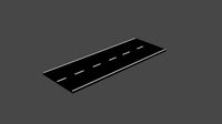
Roads
3d_export
free
road
...road
3dexport
ready road with textures.
3d_ocean
$39
Road
...torway nascar oval poly race racetrack raceway racing realtime road speedway talladega track way
racing games for the road system
turbosquid
$1
road
...ad
turbosquid
royalty free 3d model road for download as max on turbosquid: 3d models for games, architecture, videos. (1167278)
3d_ocean
$9
Road Signs
...road signs
3docean
outdoor road signs signpost waymark
road signs 3d models.
3d_export
$5
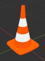
road cone
...road cone
3dexport
road cone
3d_export
free
road
...road
3dexport
3d_export
$5

road markings
...road markings
3dexport
construction of road markings
turbosquid
$25
Road
...lty free 3d model road for download as png, 3ds, obj, and fbx on turbosquid: 3d models for games, architecture, videos. (1380086)
3d_export
$5

road sign
...road sign
3dexport
road sign with the texture of a cyclist.
turbosquid
$39
road
... available on turbo squid, the world's leading provider of digital 3d models for visualization, films, television, and games.
San
3ddd
$1

SAN MARCO / Sofia
...san marco / sofia
3ddd
san marco
напольная лампа san marco — sofia
3ddd
$1
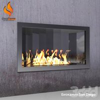
биокамин San Diego
...биокамин san diego
3ddd
биокамин , san diego
биокамин san diego от decoflame
3ddd
$1
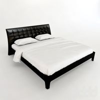
San Giacomo Relux
...san giacomo relux
3ddd
san giacomo
кровать с кожаным изголовьем - san giacomo relux
design_connected
$11
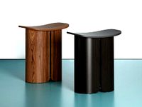
San Stool
...san stool
designconnected
ligne roset san stool computer generated 3d model. designed by studio klass.
3ddd
$1

Гостиная San Giacomo
...иная san giacomo
3ddd
san giacomo , стенка
система полок и ящиков в гостиную san giacomo
3ddd
$1

Гостиная San Giacomo
...mo
3ddd
san giacomo , стенка
система ящиков для гостиной + топ под tv, фирма san giacomo
3ddd
free
San tropez2
...ка , угловой
3d модель дивана мебельной фабрики mebel & zeit, модель san tropez2
3ddd
$1
SAN MICHELE
...е присутствуют форматы obj/fbx,текстуры. сайт производителяhttp://sanmichele.homes.it/sanmichele/en/prodotti.php?idc=28
3ddd
$1
Beni | San-Salvatore
...beni | san-salvatore
3ddd
beni , san-salvatore
текстуры в комплекте
3ddd
$1

Emporio San Firenze подвес
...emporio san firenze подвес
3ddd
emporio , san firenze
emporio san firenze подвес
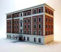
Buildings
archibase_planet
free
Building
...building high-rise building office building construction
building n050115 - 3d model (*.gsm+*.3ds) for exterior 3d visualization.
3d_export
$5
building
...building
3dexport
clasic building
3ddd
$1
building
...building
3ddd
здание
building
archibase_planet
free
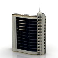
Building
...lanet
building office office building construction
building n090914 - 3d model (*.gsm+*.3ds+*.max) for exterior 3d visualization.
archibase_planet
free
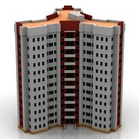
Building
...net
building tower construction high-rise building
building n100214 - 3d model (*.gsm+*.3ds+*.max) for exterior 3d visualization.
3d_export
free
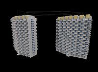
Building
...building
3dexport
low poly building;
3d_export
free
Building
...building
3dexport
low poly building;
3d_export
free
Building
...building
3dexport
low poly building;
3d_export
free
Building
...building
3dexport
low poly building;
3d_export
free
Building
...building
3dexport
low poly building;