Thingiverse

North Carolina County Map by TankTheEngine
by Thingiverse
Last crawled date: 3 years, 5 months ago
A map of North Carolina seperated by counties. Each county is raised according to it's highest point. Not 1:1 scale. Generally want thin slicing as the eastern counties are barely above the base of the model. (see print settings)
Similar models
cg_trader
$40

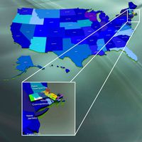
North Carolina Political Map
...w carolina. features every county in the state. the modifier stack is uncollapsed allowing for easy change of extrusion settings.
turbosquid
$56

North Carolina counties
... available on turbo squid, the world's leading provider of digital 3d models for visualization, films, television, and games.
3dwarehouse
free
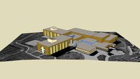
Wakefield High School
...eigh, north carolina. #carolina #county #high #high_school #north #raleigh #school #wake #wakefield #wakefield_high_school #wcpss
3dwarehouse
free
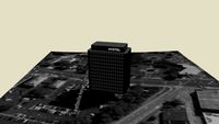
Systel Building
...systel building
3dwarehouse
this is the tallest building in fayetteville, cumberland county, north carolina
3dwarehouse
free

Cumberland County Economic Development Shell Building
...uilding
3dwarehouse
a 'shell' building developed by the cumberland county economic development office of north carolina.
3dwarehouse
free

Building in 1, Charlotte, North Carolina, USA
...building in 1, charlotte, north carolina, usa
3dwarehouse
charlotte, north carolina, usa
3dwarehouse
free

Hurricane Floyd (1999)
...hurricane floyd (1999)
3dwarehouse
a powerful hurricane that struck north carolina flooded greenville in pitt county,nc.
3dwarehouse
free

Building in 1, Charlotte, North Carolina, USA
...building in 1, charlotte, north carolina, usa
3dwarehouse
map was loading strangely, couldnt finish that building
turbosquid
$40

North Carolina Political Map
...orth carolina political map for download as 3ds, max, and obj on turbosquid: 3d models for games, architecture, videos. (1302430)
cg_trader
$299

Wilmington - North Carolina
...h carolina
cg trader
wilmington - north carolina - city and 3d asset city map urban area building, ready for 3d animation and ot
Tanktheengine
thingiverse
free

3D Map of the Roman Empire by TankTheEngine
... is raised above the surrounding land. all land is raised above the water level. rome is marked with a 8 pointed star and circle.
thingiverse
free

Canada 3D Puzzle by TankTheEngine
...s. paint the pieces however you like!
the puzzle is a bit over 1 foot (30.5cm) squared.
all comments for improvement are welcome!
thingiverse
free

USA 3D Puzzle by TankTheEngine
... lakes don't connect to the puzzle but they are slotted in their respective places.
all comments for improvement are welcome!
thingiverse
free

Game of Thrones Westeros Raised Map by TankTheEngine
...also marked with a raised star within the kingdom. i love the show especial lore subjects like this and i hope y'all like it.
Carolina
design_connected
$16

Carolina
...carolina
designconnected
carolina computer generated 3d model. designed by fuksas, doriana.
3ddd
$1

Carolina Herrera
...carolina herrera
3ddd
парфюм
парфюм carolina herrera
3ddd
free
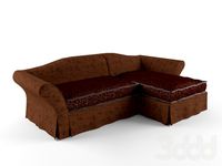
Asnaghi / Carolina
...asnaghi / carolina
3ddd
asnaghi , угловой
asnaghi carolina
design_connected
$11
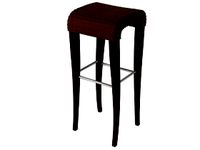
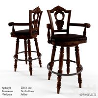
Carolina Barstool
...arstool
designconnected
vincent sheppard carolina barstool bar stools computer generated 3d model. designed by vincent sheppard.
turbosquid
$15
North Carolina
... available on turbo squid, the world's leading provider of digital 3d models for visualization, films, television, and games.
3ddd
$1

GIUSTI PORTOS, Carolina
...ской фабрики giusti portos, модель carolina. выполнена по размерам из каталога. текстуры в архиве. подушки заимствованы.
3ddd
$1

Illuminati Carolina
...ati-lighting.co.uk/
габариты: высота - 90 см; ширина - 32 см; длина - 62 см.
мощность - 6х40вт g9.
материалы - металл, хрусталь
turbosquid
$49

Carolina Standard Loveseat
... free 3d model carolina standard loveseat for download as max on turbosquid: 3d models for games, architecture, videos. (1340792)
turbosquid
$9
Carolina Poplar Tree
...l carolina poplar tree for download as 3ds, obj, c4d, and fbx on turbosquid: 3d models for games, architecture, videos. (1309063)
turbosquid
$56
South Carolina counties
... available on turbo squid, the world's leading provider of digital 3d models for visualization, films, television, and games.
County
turbosquid
$480

USA counties
... available on turbo squid, the world's leading provider of digital 3d models for visualization, films, television, and games.
turbosquid
$56

Oregon counties
... available on turbo squid, the world's leading provider of digital 3d models for visualization, films, television, and games.
turbosquid
$56

Nevada counties
... available on turbo squid, the world's leading provider of digital 3d models for visualization, films, television, and games.
turbosquid
$56

Nebraska counties
... available on turbo squid, the world's leading provider of digital 3d models for visualization, films, television, and games.
turbosquid
$56
Montana counties
... available on turbo squid, the world's leading provider of digital 3d models for visualization, films, television, and games.
turbosquid
$56

Missouri counties
... available on turbo squid, the world's leading provider of digital 3d models for visualization, films, television, and games.
turbosquid
$56

Mississippi counties
... available on turbo squid, the world's leading provider of digital 3d models for visualization, films, television, and games.
turbosquid
$56

Minnesota counties
... available on turbo squid, the world's leading provider of digital 3d models for visualization, films, television, and games.
turbosquid
$56
Massachusetts counties
... available on turbo squid, the world's leading provider of digital 3d models for visualization, films, television, and games.
turbosquid
$56

Maryland counties
... available on turbo squid, the world's leading provider of digital 3d models for visualization, films, television, and games.
North
3ddd
$1
North Shore
...north shore
3ddd
north shore , барный
вращающийся барный стул. моделировал по фото.
3ddd
$1
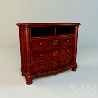
North Shore / Ashley
...north shore / ashley
3ddd
ashley , комод
комод north shore / ashley
3ddd
free
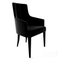
Blainey North Hemingway chair
...blainey north hemingway chair
3ddd
blainey north
blainey north hemingway chair 3d model.
turbosquid
$99
North America
... available on turbo squid, the world's leading provider of digital 3d models for visualization, films, television, and games.
turbosquid
$15
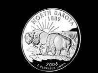
North Dakota
... available on turbo squid, the world's leading provider of digital 3d models for visualization, films, television, and games.
turbosquid
$15
North Carolina
... available on turbo squid, the world's leading provider of digital 3d models for visualization, films, television, and games.
3d_export
$65

north sea
...north sea
3dexport
simple rendering of the scene file
3d_export
$35
North 3D Model
...north 3d model
3dexport
exterior building max stree landscape
north 3d model chen3d 14239 3dexport
cg_studio
$39

north village3d model
...north village3d model
cgstudio
.max - north village 3d model, royalty free license available, instant download after purchase.
3ddd
$1
THE NORTH FACE SHOP FURNITURE
...the north face shop furniture
3ddd
стеллаж
the north face shop furniture
Map
3d_ocean
$5

Map
...map
3docean
geography map ocean travel world world map
a world map
3d_ocean
$5

Old Map
...old map
3docean
dirty map ocean old map paper pirates rotten travel world map
an old map
turbosquid
$3

Map
... available on turbo squid, the world's leading provider of digital 3d models for visualization, films, television, and games.
3d_ocean
$3

Map of Iran
...map of iran
3docean
flag iran map outline
an outline map of iran
3d_ocean
$2

Map of the USA
...map of the usa
3docean
america flag globe map united states usa
an outline map of the usa
3ddd
$1

Abstract Maps
... город , picture
abstract maps by artist jazzberry blue
3d_ocean
$5

Honduras Map
...honduras map
3docean
3d cinema4d honduras map mapa
honduras map designed in cinema 4d r17
3d_ocean
$2

Map of Germany
...map of germany
3docean
black country europe germany gold map outline red yellow
a simple outline map of germany
3d_ocean
$2

Map of Australia
...map of australia
3docean
australia banner country down under earth flag globe map ocean south
an outline map of australia
3d_ocean
$2

Map of Russia
...of russia
3docean
asia banner earth europe flag globe map russia russian federation siberia sovjet union
an outline map of russia