Thingiverse
Similar models
thingiverse
free
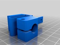
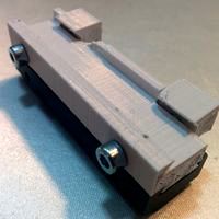
Pen Mount on BLTouch mount by jetspot
...pen mount on bltouch mount by jetspot
thingiverse
pen mount on bltouch mount
thingiverse
free
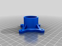
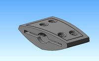
Permanent mount for Modular Mounting System by WIR14
...permanent mount for modular mounting system by wir14
thingiverse
permanent mount for modular mounting system.
thingiverse
free

Keychain Camera Mount by andycap
...eychain camera mount. just use double sided tape to mount the camera to the mount and then use any gopro type mount to mount it.
thingiverse
free
Hexagon Mount for 50mm Mount (Sparkcube) by Draman
...for 50mm mount (sparkcube) by draman
thingiverse
hexagon mount remix from skimmys hotend-mount for sparkcube or other 50mm-mount
cults
free
Dovetail Mount
...dovetail mount
cults
dovetail mount
dovetail mount
thingiverse
free
spool mount by rhinoboy
...spool mount by rhinoboy
thingiverse
this is the mount for the the filament mount
grabcad
free

c mount
...c mount
grabcad
c-mount for various mountings
grabcad
free

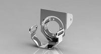
clevis mount
...clevis mount
grabcad
clevis mount or steering mount
3dwarehouse
free

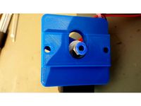
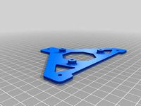
Electrical cabinet mounting fixture
...electrical cabinet mounting fixture
3dwarehouse
used for mounting fixture #fixture #fixture_on_wheels #mount #mounting #wheels
thingiverse
free
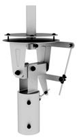
skyhero spyder tarot gimbal mount by L5MEDIA
...arot gimbal mount by l5media
thingiverse
gimabal mount using 3dr mounting plate. 850va1 for mounting without 3dr mounting plate.
Lockylast
thingiverse
free

Bad Kitty by lockylast
...bad kitty by lockylast
thingiverse
modeled from a drawing my daughter drew on a window.
thingiverse
free

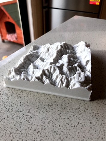
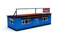
Gifford Marine Park by lockylast
...s.
data sourced from the ausseabed marine portal, and converted to stl using the qgis demto3d plugin. label added with fusion360.
Mount
3d_export
free
mounting bracket
...mounting plate is the portion of a hinge that attaches to the wood. mounting plates can be used indoors, cabinetry and furniture.
turbosquid
$2
MOUNTING
... available on turbo squid, the world's leading provider of digital 3d models for visualization, films, television, and games.
turbosquid
free

Mounts
... available on turbo squid, the world's leading provider of digital 3d models for visualization, films, television, and games.
turbosquid
free

Mount Fuji
...fuji
turbosquid
free 3d model mount fuji for download as obj on turbosquid: 3d models for games, architecture, videos. (1579977)
3d_export
$5
Headphone mount LR
...headphone mount lr
3dexport
headphone mount l+r
turbosquid
$39

Mount rainier
...quid
royalty free 3d model mount rainier for download as fbx on turbosquid: 3d models for games, architecture, videos. (1492586)
turbosquid
$5

pipe mounting
...quid
royalty free 3d model pipe mounting for download as obj on turbosquid: 3d models for games, architecture, videos. (1293744)
turbosquid
$3
Mounting Tires
...uid
royalty free 3d model mounting tires for download as fbx on turbosquid: 3d models for games, architecture, videos. (1708511)
3d_export
$5

Magnetic GoPro Mount
...pro mount
3dexport
cool magnetic mount for gopro. allows you to mount the camera on flat metal surfaces and get exclusive shots.
turbosquid
$5
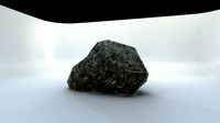
Stone Mount
...ty free 3d model stone mount for download as ma, obj, and fbx on turbosquid: 3d models for games, architecture, videos. (1370306)