CG Trader
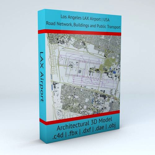
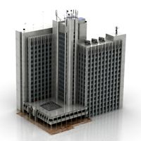
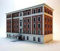
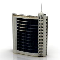
Los Angeles LAX Airport Roads Buildings Public Transport Lines
by CG Trader
Last crawled date: 1 year, 10 months ago
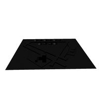
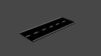
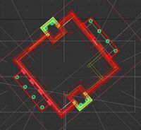
this model is based on real data therefore this is a realistic 3D Model of Los Angeles LAX Airport, USA 4 main object groups included | 1. Buildings 2. Road Network 3. Public Transport 4. Aeroway Buildings has 3 building groups setup so that you can add variety to buildings (color materials and/or textures) Groups can be turned off/on
- Road Network has 2 objects included | 1. roads 2. other areas
- Public Transport (2 objects) includes the transport lines and stations/stops
- Aeroway includes the road network for airplanes (runways, airstrips, parking etc.) UV mapped with overlapping UVs
- no textures included / colors setup by materials (can be changed in any 3D software)
- the model is positioned on a flat surface (road network is on the “floor” - no elevation data included)
- geometry is polygonal quads and tris
- model is untextured and renders fast this 3D model is/can be licensed (commercial use is fine) under Creative Commons Attribution-ShareALike 2.0 (CC-BY-SA) license
- buildings and streets data from OpenStreetMap / www.openstreetmap.org Attribution : © OpenStreetMap contributors / http://www.openstreetmap.org/copyright POINTS/VERTS :1322589
POLYGONS : 1104766 .c4d - native format
- .fbx - v7.1
- .dae - v1.5
- .dxf
- .obj los angeles lax usa america airport architecture infrastructure transportation public transport road network roads buildings international installation terminals map architectural engineering los angeles usa map
Similar models
cg_trader
$29

Seattle Tacoma SEA Airport Roads Buildings and Public Transport
...tion public transport road network roads buildings international installation air terminals map architectural engineering usa map
cg_trader
$29

Chicago OHare ORD Airport Roads Buildings Public Transport
...on public transport road network roads buildings international installation terminals map ohare architectural engineering usa map
cg_trader
$29

San Francisco SFO Airport Roads Buildings and Public Transport
...c transport road network roads buildings international installation terminals map architectural engineering san francisco usa map
cg_trader
$29

Phoenix Sky Harbor PHX Airport Roads Buildings and Public Trans
...ure transportation public road network roads buildings international installation terminals map architectural engineering usa map
cg_trader
$29

Frankfurt FRA Airport Roads Buildings and Public Transport Lines
...ansportation public transport road network roads buildings international installation air terminals map architectural engineering
cg_trader
$29
Madrid Barajas MAD Airport Roads Buildings and Public Transport
...e transportation public transport road network roads buildings international installation terminals map architectural engineering
cg_trader
$29
Paris Orly ORY Airport Roads Buildings and Public Transport
...e transportation public transport road network roads buildings international installation terminals map architectural engineering
cg_trader
$29
London Heathrow LHR Airport Roads Buildings and Public Transport
...infrastructure transportation public transport road network roads buildings international terminals map architectural engineering
cg_trader
$29

Seoul Incheon ICN Airport Roads Buildings and Public Transport
...e transportation public transport road network roads buildings international installation terminals map architectural engineering
cg_trader
$29

Changi SIN Airport Singapore Roads Buildings Public Transport
...ansportation public transport road network roads buildings international installation air terminals map architectural engineering
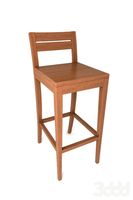
Lax
design_connected
$31

Lax 1151
...lax 1151
designconnected
intertime lax 1151 computer generated 3d model. designed by frigg, reto.
turbosquid
$28

LAX Series Trestles Sofa
...ty free 3d model lax series trestles sofa for download as max on turbosquid: 3d models for games, architecture, videos. (1401157)
3ddd
$1

franke Largo Workcenter
..., мойка , смеситель мойка: franke largo workcenter - lax 211-w-45 с системой сортировки мусора смеситель: tango стек в...
thingiverse
free

lax by Trevor_1088
...lax by trevor_1088
thingiverse
titfiyjfjdurdresfykgiyfyj
thingiverse
free

lax head by drobben
...lax head by drobben
thingiverse
so i have looked for a good lax head and they all are crappy so i fixed it.
thingiverse
free

Snore lax planter
...snore lax planter
thingiverse
design this for a friend she loved it so y not share it with everyone
thingiverse
free

lacrosse lax stick by karakicks
...lacrosse lax stick by karakicks
thingiverse
the rings beside stick will not be printed.
thingiverse
free

LAX Ball Holder by jonesy34
...#39;t rolling all over the place when i was not using it. most likely suitable for other spherical objects of proportionate size.
thingiverse
free

Legal NCAA highschool Lacrosse Lax Head by LittleJohn16
...chool lacrosse lax head by littlejohn16
thingiverse
legal ncaa highschool lacrosse lax head total length is 11.432 inches across
thingiverse
free

ROMA LEONES LAX coin bottle opener by TenenteDan
...a http://www.thingiverse.com/thing:11025 's remix for the lax team roma leones
check it out http://www.romaleoneslacrosse.it/
Airport
3ddd
$1

Poliform Airport
...poliform airport
3ddd
poliform , airport
диван poliform airport
turbosquid
$29

airport
...turbosquid
royalty free 3d model airport for download as c4d on turbosquid: 3d models for games, architecture, videos. (1659395)
turbosquid
$10

Airport
...rbosquid
royalty free 3d model airport for download as blend on turbosquid: 3d models for games, architecture, videos. (1338079)
turbosquid
$35

AIRPORT
... free 3d model airport for download as 3ds, max, obj, and fbx on turbosquid: 3d models for games, architecture, videos. (1419439)
turbosquid
$1
Airport
... available on turbo squid, the world's leading provider of digital 3d models for visualization, films, television, and games.
turbosquid
free

Airport
... available on turbo squid, the world's leading provider of digital 3d models for visualization, films, television, and games.
3d_export
$65

airport
...airport
3dexport
simple rendering of the scene file
3d_export
$65

airport
...airport
3dexport
simple rendering of the scene file
3d_export
$65

airport
...airport
3dexport
simple rendering of the scene file
3d_export
$65

airport
...airport
3dexport
simple rendering of the scene file
Angeles
3d_export
$13

angel
...angel
3dexport
pendant angel
3ddd
$1

Angel
...angel
3ddd
addinterior
стул angel от addinteriorhttp://www.addinterior.dk/page/products/29/
3d_export
$80

angel sculpture
...angel sculpture
3dexport
angel
turbosquid
free
Angel
...angel
turbosquid
free 3d model angel for download as obj on turbosquid: 3d models for games, architecture, videos. (421674)
3d_export
$59

Angel sculpture
...angel sculpture
3dexport
angel sculpture
turbosquid
$36

Angel
...turbosquid
royalty free 3d model angel for download as blend on turbosquid: 3d models for games, architecture, videos. (1443719)
turbosquid
$17

Angel
...l
turbosquid
royalty free 3d model angel for download as max on turbosquid: 3d models for games, architecture, videos. (1594913)
turbosquid
$15
angel
...l
turbosquid
royalty free 3d model angel for download as stl on turbosquid: 3d models for games, architecture, videos. (1697805)
turbosquid
$8

angel
...l
turbosquid
royalty free 3d model angel for download as stl on turbosquid: 3d models for games, architecture, videos. (1253675)
turbosquid
$5

Angel
...l
turbosquid
royalty free 3d model angel for download as obj on turbosquid: 3d models for games, architecture, videos. (1404898)
Public
3d_ocean
$25
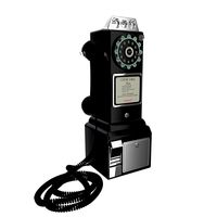
Public telephone
...public telephone
3docean
public telephone
3d model and render (cycles) public telephone 1957
3d_ocean
$2
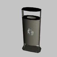
Public Trash
...public trash
3docean
builds city concept trash
public trash
3d_ocean
$5
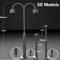
Public Lights
...s
3docean
decor lights outside public ready
this file includes 3 public lights models that you can use in your sceen and prejecs.
3d_export
$10

Public snake
...
the public seats are designed in a snake-like shape, divided into two sides, with a small tree as a divider to divide the zone.
turbosquid
$10

Public Fountain
...squid
royalty free 3d model public fountain for download as on turbosquid: 3d models for games, architecture, videos. (1693150)
turbosquid
$29

Public Library
...uid
royalty free 3d model public library for download as skp on turbosquid: 3d models for games, architecture, videos. (1250245)
turbosquid
$10
Public wc
...rbosquid
royalty free 3d model public wc for download as max on turbosquid: 3d models for games, architecture, videos. (1427486)
turbosquid
$6

public building
...lty free 3d model public building for download as max and c4d on turbosquid: 3d models for games, architecture, videos. (1451902)
3d_export
free

Public bath
...public bath
3dexport
https://www.dock4all.com/
turbosquid
$19

Public Phone
...ree 3d model public phone for download as blend, obj, and fbx on turbosquid: 3d models for games, architecture, videos. (1707091)
Transport
turbosquid
$2

Transportation
...quid
royalty free 3d model transportation for download as ma on turbosquid: 3d models for games, architecture, videos. (1393977)
turbosquid
$20
Transport
... available on turbo squid, the world's leading provider of digital 3d models for visualization, films, television, and games.
turbosquid
$3

transporter
... available on turbo squid, the world's leading provider of digital 3d models for visualization, films, television, and games.
turbosquid
free

transporter
... available on turbo squid, the world's leading provider of digital 3d models for visualization, films, television, and games.
turbosquid
free

Transporter
... available on turbo squid, the world's leading provider of digital 3d models for visualization, films, television, and games.
turbosquid
free
transport
... available on turbo squid, the world's leading provider of digital 3d models for visualization, films, television, and games.
3d_ocean
$12

bags transport
...bags transport
3docean
bags bags transport travel vacation
bags and trasport car
3d_export
$8

CubeMechine transport
...xport
cubemechine a transport machine with a cube shape and 4 joints, it comes with 4 textures included, ik in the blender scene
archive3d
free
Transport 3D Model
...ars
transport muti-troops n090316 - 3d model (*.gsm+*.3ds+*.max) for interior 3d visualization.
3d_export
$9

volkswagen transporter t2
...volkswagen transporter t2
3dexport
volkswagen transporter t2
Roads
3d_export
free
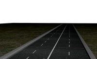
road
...road
3dexport
ready road with textures.
turbosquid
$4
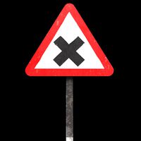
Cross road Road-sign
...ss road road-sign for download as 3ds, dae, fbx, obj, and stl on turbosquid: 3d models for games, architecture, videos. (1516042)
3d_ocean
$39
Road
...torway nascar oval poly race racetrack raceway racing realtime road speedway talladega track way
racing games for the road system
turbosquid
$1
road
...ad
turbosquid
royalty free 3d model road for download as max on turbosquid: 3d models for games, architecture, videos. (1167278)
3d_ocean
$9
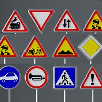
Road Signs
...road signs
3docean
outdoor road signs signpost waymark
road signs 3d models.
3d_export
$5
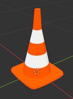
road cone
...road cone
3dexport
road cone
3d_export
free
road
...road
3dexport
3d_export
$5

road markings
...road markings
3dexport
construction of road markings
turbosquid
$25
Road
...lty free 3d model road for download as png, 3ds, obj, and fbx on turbosquid: 3d models for games, architecture, videos. (1380086)
3d_export
$5

road sign
...road sign
3dexport
road sign with the texture of a cyclist.
Los
3ddd
$1

Paperminions - Los Increibles
...inions - los increibles
3ddd
paperminions , los increibles
paperminions - los increibles
3ddd
$1

DO-LO-REZ
...do-lo-rez
3ddd
do-lo-rez , moroso
do-lo-rez sofa
3ddd
$1

Do-lo-Res
... угловой
диван фабрика do-lo-res компонуется из отдельных боксов, разнообразных размеров и тканей.
3ddd
$1
Lo turi
...lo turi
3ddd
bensen
1200x1200
turbosquid
$30
Lock Lo
... available on turbo squid, the world's leading provider of digital 3d models for visualization, films, television, and games.
turbosquid
free

face lo
... available on turbo squid, the world's leading provider of digital 3d models for visualization, films, television, and games.
3ddd
$1

DO-LO-REZ
...бы образовалась форма дивана, и закреплены к основе стальными булавками.
покрытия модели do-lo-rez несъемные. основа деревянная.
turbosquid
$41
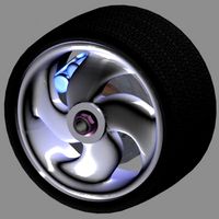
Lo-profile Wheel.max
... available on turbo squid, the world's leading provider of digital 3d models for visualization, films, television, and games.
turbosquid
$2

Espada - sword LO
... available on turbo squid, the world's leading provider of digital 3d models for visualization, films, television, and games.
turbosquid
free

Sofa Los Cabos
... available on turbo squid, the world's leading provider of digital 3d models for visualization, films, television, and games.
Lines
design_connected
$20

Line
...line
designconnected
adriani e rossi line computer generated 3d model.
3ddd
$1
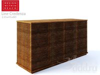
Line Credenza
...line credenza
3ddd
line credenza , комод
line credenza, small
designed by nathan yong
3d_export
$20

cheese line
...cheese line
3dexport
cheese line
3ddd
$1
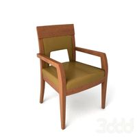
Resta line
...resta line
3ddd
resta line
стул
3d_export
$15
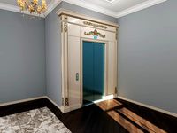
elevator lining
...elevator lining
3dexport
elevator lining with carved elements and gold.
3ddd
$1
Resta line
...resta line
3ddd
resta line , барный
барный стул
3ddd
$1
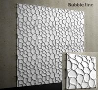
Bubble line
...bubble line
3ddd
панель
гипсовые, стеновые 3д панели - bubble line
turbosquid
$25
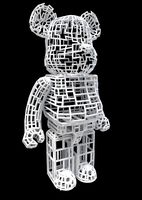
Straight Line BearBrick Straight Line BearBrick
...ck straight line bearbrick for download as 3ds, max, and fbx on turbosquid: 3d models for games, architecture, videos. (1340992)
3ddd
$1

Line roset | Fenge
...3ddd
fenge , line roset , кожа
диван line roset
design_connected
$11
Framed Line
...framed line
designconnected
jacco maris framed line computer generated 3d model. designed by maris , jacco.
Buildings
archibase_planet
free
Building
...building high-rise building office building construction
building n050115 - 3d model (*.gsm+*.3ds) for exterior 3d visualization.
3d_export
$5
building
...building
3dexport
clasic building
3ddd
$1
building
...building
3ddd
здание
building
archibase_planet
free
Building
...lanet
building office office building construction
building n090914 - 3d model (*.gsm+*.3ds+*.max) for exterior 3d visualization.
archibase_planet
free
Building
...net
building tower construction high-rise building
building n100214 - 3d model (*.gsm+*.3ds+*.max) for exterior 3d visualization.
3d_export
free
Building
...building
3dexport
low poly building;
3d_export
free
Building
...building
3dexport
low poly building;
3d_export
free
Building
...building
3dexport
low poly building;
3d_export
free
Building
...building
3dexport
low poly building;
3d_export
free
Building
...building
3dexport
low poly building;