CG Trader
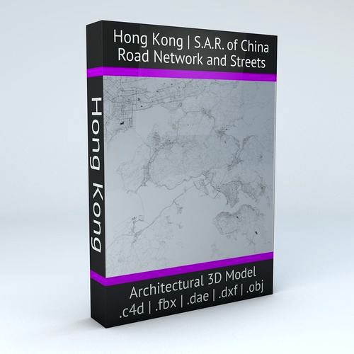
Hong Kong Road Network and Streets
by CG Trader
Last crawled date: 1 year, 11 months ago
UPDATE – April 7, 2018 higher road network details compatibility added with the Hong Kong Streets and Buildings 3D model
Available at : https://www.cgtrader.com/3d-models/architectural/street/hong-kong-18-districts-streets-and-buildings .blend file added POINTS/VERTS : 2549046
POLYGONS : 2626777 this model is based on real data therefore this is a realistic road network and streets setup of Hong Kong 18 Districts, Special Administrative Region of China this model includes the 18 districts of Hong Kong 2 objects included | 1. roads and streets 2. squares and plazas UV mapped with overlapping UVs the model is positioned on a flat surface (road network is on the “floor” - no elevation data included) geometry is polygonal quads and tris model is untextured and renders fast this 3D model is/can be licensed (commercial use is fine) under Creative Commons Attribution-ShareALike 2.0 (CC-BY-SA) license buildings and streets data from OpenStreetMap / www.openstreetmap.org Attribution : © OpenStreetMap contributors / http://www.openstreetmap.org/copyright POINTS/VERTS : 2307434
POLYGONS : 2357238 .c4d - native format .fbx - v7.1 .dae - v1.5 .dxf .obj hong kong china road network system streets infrastructure architectural map cartography city gps navigation roads squares realistic topological topology street architectural street city street china map city map city street city streets hong kong
Similar models
cg_trader
$29

Chongquing Road Network and Streets
... roads squares realistic topological topology street architectural street city street china map city map city street city streets
cg_trader
$29

Beijing Road Network and Streets
... roads squares realistic topological topology street architectural street city street china map city map city street city streets
cg_trader
$29

Chengdu Road Network and Streets
... roads squares realistic topological topology street architectural street city street china map city map city street city streets
cg_trader
$29

Daegu Road Network and Streets
... roads squares realistic topological topology street architectural street city street china map city map city street city streets
cg_trader
$29

Dongguan Road Network and Streets
... roads squares realistic topological topology street architectural street city street china map city map city street city streets
cg_trader
$29

Guangzhou Road Network and Streets
...p cartography city gps navigation roads squares realistic topological topology exterior cityscape china map city map city streets
cg_trader
$29
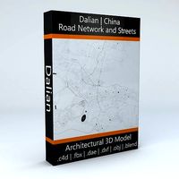
Dalian Road Network and Streets
... roads squares realistic topological topology street architectural street city street china map city map city street city streets
cg_trader
$29

Xiamen Road Network and Streets
... roads squares realistic topological topology street architectural street city street china map city map city street city streets
cg_trader
$29
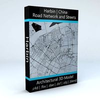
Harbin Road Network and Streets
... roads squares realistic topological topology street architectural street city street china map city map city street city streets
cg_trader
$29

Sanya Road Network and Streets
...s squares realistic topological topology base street architectural street city street china map city map city street city streets
Hong
cg_studio
$60

Map of China3d model
...map of china3d model cgstudio china map beijing hong kong gansu henan shanghai political politics communist .max .obj...
humster3d
$75

3D model of Wuling Hong Guang 2013
...ailed 3d model of wuling hong guang 2013 in various file formats. all our 3d models were created maximally close to the original.
3d_export
$175

St John Cathedral 3D Model
...st john cathedral 3d model 3dexport church cathedral hong kong christian st john cathedral 3d model lvgart 57395...
3d_export
$200

Tian Tian Buddha 3D Model
...buddha 3d model 3dexport buddha temple tian buddhism chinese hong kong tian tian buddha 3d model lvgart 57399...
3d_export
$49
China Hong Kong Junk 3D Model
...3d model
3dexport
china hong kong junk ocean victoria harbor harbour sailboat
china hong kong junk 3d model sophia 53052 3dexport
3d_export
$8
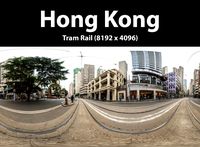
Hong Kong Tram Rail 3D Model
...hong kong tram rail 3d model
3dexport
hong kong asia city
hong kong tram rail 3d model aiviremulla 85920 3dexport
3d_export
$38

Hong Kong Seashore 01 3D Model
...1 3d model
3dexport
hong kong seashore panorama hdri hdr spherical asia
hong kong seashore 01 3d model aiviremulla 85922 3dexport
3d_export
$38

Hong Kong Seashore 02 3D Model
...2 3d model
3dexport
hong kong seashore panorama hdri hdr spherical asia
hong kong seashore 02 3d model aiviremulla 85925 3dexport
3d_export
$9

Hong Kong flag 3D Model
...bric cloth rope realistic standard association organization goverment flag emblem
hong kong flag 3d model rmodeler 38261 3dexport
3d_export
$5

respiration-mask octane render high poly
...mask how to use<br>surgical mask hospital<br>surgical mask hawaii<br>surgical mask hong kong<br>h&s surgical mask<br>h&s surgical face mask<br>isc h&s surgical mask<br>surgical...
Kong
3d_export
$949

Gorilla 3D Model
...gorilla 3d model 3dexport monkey king kong ape silverback gorilla mountain film chimpanzee africa rig animation...
3ddd
$1

Кресла
...отделки. размеры: 63 x 60 x 74 см стол kongs от итальянской фабрики capital decor из дерева с глянцевой...
3ddd
$1

SCARABEO Kong
...o kong
3ddd
w x d x h 900 x 380 x 140http://www.scarabeoceramica.com/wash-basins/kong/washbasin-90x38-kong-90.html
3ddd
$1

Emeco - kong barstool by stark
... барный
сайт:http://www.emeco.net/products/kong-barstool-with-arms
76000 полигонов. стек не свернут.
3ddd
$1

Scarabeo Kong 8052
... kong
http://scarabeoceramica.com/wash-basins/kong/washbasin-72x37-kong-70.html
3ddd
$1

Scarabeo Kong 8054
... kong
http://scarabeoceramica.com/wash-basins/kong/washbasin-109x42-kong-110.html
3d_ocean
$19

Donkey Kong RIGGED
...ter from nintendo games. in max version only, the model is rigged and finely skined. the tie is rigged too. very easy to anime...
3ddd
$1

Scarabeo Kong 8053
...scarabeo kong 8053
3ddd
scarabeo
http://scarabeoceramica.com/wash-basins/kong/washbasin-90x38-kong-90.html
3ddd
$1

Scarabeo Kong 8051
... накладная
http://scarabeoceramica.com/wash-basins/kong/washbasin-48x39-kong-50.html
cg_studio
$199

Ancient Architecture -Kong fu Panda3d model
...l
cgstudio
.max - ancient architecture -kong fu panda 3d model, royalty free license available, instant download after purchase.
Network
3d_export
$55
Internet bar 002 3D Model
...communication server data rack computer corporate intranet office internet network servers nodes 3d electronics internet bar 002 3d model...
3d_ocean
$3

Logo Instagram
...instagram 3docean 3d max 3d model instagram logo social network this time we present a simple logo of instagram....
3ddd
$1

Pioneer network audio player N-70A-K
... usb на передней панели, обработкой многобитного сигнала, usb цап и auto sound retriever (черный)
n-70a-k
пульт ду присутствует.
3d_ocean
$12

Iphone 5 cad model
...cell communication computers detailed digital gadget iphone mobile model networkng new phone screen touch detailed cad 3d model was...
3d_ocean
$14

Apple iphone 5c cad model
...3docean apple cad cell computers digital electronic iphone mobile networkng phone radio smartphone touch touchscreen model was ceated with...
3d_ocean
$10

Social and Media Icon Set
...tube 12 modeled icons of different social and media network. created in 3d max...
3d_ocean
$21

60 Web and Social Media 3D Icons
...evernote facebook flickr forrst google icon imdb media mega network pack paypal picasa pixel reddit round sixty skype social...
3d_ocean
$16

Ethernet Cable
...ethernet cable 3docean cable computer electronics ethernet internet network connected ethernet cable 3d...
3d_ocean
$4

Twitter Icon Logo
...bird computer electronics icon internet logo logos media network networkng news social socialmedia twiter twitter exact 3d model of...
3d_ocean
$12

HD WEBCAM
...cam camera com communication conference connection e-business equipment internet network rhino 3d skype streaming technology vision web web connection...
Road
3d_export
$300
City Plan 007 3D Model 3D Model
...3dexport traffic tree flat tile metro urban structure apartment road plaza office block modular detail high building skyscraper city...
3d_export
$300
City Plan 005 3D Model 3D Model
...3dexport traffic tree flat tile metro urban structure apartment road plaza office block modular detail high building skyscraper city...
3d_export
$150
Skyscraper business center 037 3D Model
...3dexport traffic tree flat tile metro urban structure apartment road plaza office block modular detail high building skyscraper city...
3d_export
$150
Skyscraper business center 045 3D Model
...3dexport traffic tree flat tile metro urban structure apartment road plaza office block modular detail high building skyscraper city...
3d_export
$99

Suzuki Jimny 2013 3D Model
...wide sierra 2013 2014 2015 2016 2-door suv crossover off-road 4x4 mini compact small japan japanese suzuki jimny 2013...
3d_export
$20

Realistic Road High Res 5980 x 4248 3D Model
...ine seamless tileable v-ray photorealistic detailed textures
realistic road high res 5980 x 4248 3d model vkmodels 47546 3dexport
3d_export
$99

Land Rover Defender 90 pickup 2011 3D Model
...90 british crossover defender england land rover landrover off road land rover defender 90 pickup 2011 3d model humster3d...
3d_export
$99

Hummer H1 wagon 2005 3D Model
...1998 1999 2000 2001 2002 2003 2004 2005 4x4 all-road hummer h1 wagon 2005 3d model humster3d 74301...
3d_export
$150
Cityscape pack vol 1 3D Model
...block new york office store shop plaza us ny road apartment structure urban metro tile flat tree traffic environment...
3d_export
$168
New Taipei City 3D Model
...model 3dexport city asia buildings building taiwan taipei street road house mall hall 3d key race bank hospital traffic...
Streets
3d_export
$15
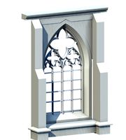
Deutschland Architecture Window001 3D Model
...ieval mediaeval romanesque gothic doric tuscan ionic minoan
deutschland architecture window001 3d model lotusmodel 47433 3dexport
3d_export
$15

Holland Architecture Windows003 3D Model
...medieval mediaeval romanesque gothic doric tuscan ionic minoan
holland architecture windows003 3d model lotusmodel 47480 3dexport
3d_export
$60

Architecture 051 3D Model
...lege campus max street landscape commercial building medical hospital offices
architecture 051 3d model lotusmodel 47599 3dexport
3d_export
$20
Realistic Road High Res 5980 x 4248 3D Model
...ine seamless tileable v-ray photorealistic detailed textures
realistic road high res 5980 x 4248 3d model vkmodels 47546 3dexport
3d_export
$150
3d building 856 3D Model
...metropolis street block detailed definition realistic skyscraper huge collection
3d building 856 3d model kanhtart 46852 3dexport
3d_export
$15

Holland Architecture Windows001 3D Model
...medieval mediaeval romanesque gothic doric tuscan ionic minoan
holland architecture windows001 3d model lotusmodel 47478 3dexport
3d_export
$15

Holland Architecture Door003 3D Model
...re medieval mediaeval romanesque gothic doric tuscan ionic minoan
holland architecture door003 3d model lotusmodel 47475 3dexport
3d_export
$150
3d building 870 3D Model
...metropolis street block detailed definition realistic skyscraper huge collection
3d building 870 3d model kanhtart 46868 3dexport
3d_export
$150

3d building 845 3D Model
...metropolis street block detailed definition realistic skyscraper huge collection
3d building 845 3d model kanhtart 46836 3dexport
3d_export
$60
Architecture 032 3D Model
...lege campus max street landscape commercial building medical hospital offices
architecture 032 3d model lotusmodel 47578 3dexport