Thingiverse
Gulf of Mexico in Relief by pmoews
by Thingiverse
Last crawled date: 4 years, 7 months ago
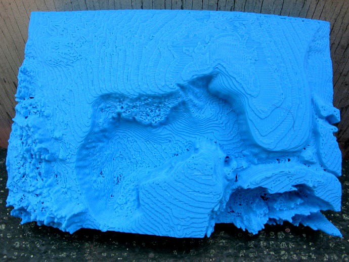
Here is a relief map that shows the bottom of the Gulf of Mexico. It's approximately 83 mm wide x 125 mm long x 29 mm deep. The horizontal scale is roughly 12 miles per mm and the vertical scale about 1 mile per 5 mm. The deepest parts of the gulf go down 2.5 miles which at this scale is about 13 mm.
It was created from a version of the Scripps copyright data set, SRTM30_PLUS V8.0. See srtm30plus_copyright.txt for the license. DJ Moews's program "Globe" was used. The program and the data are available at http://djm.cc/dmoews.html
The program globe can create planes that cut the earth into pieces and then output one of the pieces. The command that created a piece containing the Gulf of Mexico was:
--output-piece 7 --map altitude data/srtm30plus 5400 2700 sbigendiandibyte --gridpoints 800 --map-scale 60 --cut-plane 0 1 -1.5 --cut-plane 0 1 -3 --cut-plane 4.5 -1 0 --cut-plane 4.5 1 0 --explode 100000 >gulf.stl
The bottom portion of gulf.stl was discarded and the remainder of the file centered, scaled, and decimated to give gulf_of_mexico.stl. Both files are included.