Thingiverse
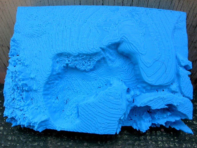
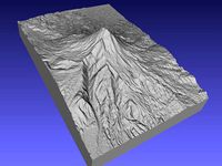
Gulf of Mexico in Relief by pmoews
by Thingiverse
Last crawled date: 3 years, 1 month ago
Here is a relief map that shows the bottom of the Gulf of Mexico. It's approximately 83 mm wide x 125 mm long x 29 mm deep. The horizontal scale is roughly 12 miles per mm and the vertical scale about 1 mile per 5 mm. The deepest parts of the gulf go down 2.5 miles which at this scale is about 13 mm.
It was created from a version of the Scripps copyright data set, SRTM30_PLUS V8.0. See srtm30plus_copyright.txt for the license. DJ Moews's program "Globe" was used. The program and the data are available at http://djm.cc/dmoews.html
The program globe can create planes that cut the earth into pieces and then output one of the pieces. The command that created a piece containing the Gulf of Mexico was:
--output-piece 7 --map altitude data/srtm30plus 5400 2700 sbigendiandibyte --gridpoints 800 --map-scale 60 --cut-plane 0 1 -1.5 --cut-plane 0 1 -3 --cut-plane 4.5 -1 0 --cut-plane 4.5 1 0 --explode 100000 >gulf.stl
The bottom portion of gulf.stl was discarded and the remainder of the file centered, scaled, and decimated to give gulf_of_mexico.stl. Both files are included.
Similar models
thingiverse
free

Earth No Sea Relief Globe by pmoews
...two stl files are available:
earth_no_sea.stl and
earth_no_sea_base.stl - the same globe with a base added at the south pole
thingiverse
free
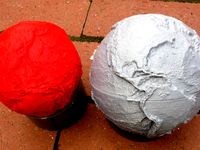
Earth Relief Globe by pmoews
... joined together the two files produce a globe about 5 inches in diameter. the red version in the image above was scaled by 0.8.
thingiverse
free
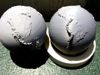
Earth Sea Relief Globe by pmoews
...stl - the same globe with a base added at the south pole
the openscad program used to add the base is relief_plus_base.scad.
thingiverse
free

Relief Map of The Sutter Buttes by pmoews
...ta, and the openscad program that calculated the relief map, are included. "aster gedem is a product of meti and nasa"
thingiverse
free

More Hawaiian Relief Maps by pmoews
... 220 columns
kauai.stl ----------- 150 rows x 300 columns
the vertical scale is a little over 200 meters per mm.
thingiverse
free

The Continents from a Relief Globe by pmoews
...e pieces are quicker to print and easier to handle than a full globe. they can serve as an aid to a map when studying geography.
thingiverse
free
Relief Map of Mount Sinabung by pmoews
...iving mount_sinabung.stl. the stl file was scaled and labeled with a simple openscad program to give mount_sinabung_labeled.stl.
cg_trader
$15

A ring with a square stone | 3D
...a ring with a square stone | 3d
cg trader
gems:
princess 1 pieces 4.5 x 4.5 mm d
rounds 26 pieces 1.75 x 1.75 mm d
thingiverse
free
Popocatepetl - Mexico by tpsully
...r creating files at 3 arcsecond resolution is available up on github under the gnu license. go to github and search for srtm2stl.
thingiverse
free

Simple toy Jet Fighter by mouseas
...tangular slots at the back of "main". sand and smooth to your liking.
i blogged about this thing over at lasercut.blue.
Pmoews
thingiverse
free

Pheasant by pmoews
...pheasant by pmoews
thingiverse
123d catch version of a ceramic pheasant. the stl file is at 40% scale.
thingiverse
free

A Pelican by pmoews
...s
thingiverse
a neighbor's pelican model. it was digitized with autodesk's recap photo. the stl file is scaled at 40%.
thingiverse
free

Walrus by pmoews
...ews
thingiverse
a thrift store walrus, gray, weights over a kilogram, maybe a garden ornament. a 123d-catch copy at half scale.
thingiverse
free

Five Gourds by pmoews
...five gourds by pmoews
thingiverse
here are five gourds suitable for a fall display. they were digitized with 123d catch.
thingiverse
free
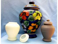
Vase with Lid by pmoews
...vase with lid by pmoews
thingiverse
a neighbor wanted a copy of a favorite vase. here are half size versions as stl files.
thingiverse
free

Pineapple by pmoews
.... fairly accurate - prints well without support. for other stl files based on real pineapples see things 4560, 7228 and 438266.
thingiverse
free
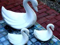
Ceramic Swan by pmoews
...ceramic swan by pmoews
thingiverse
a thrift store ceramic swan without markings. the 123-d catch file is at half scale.
thingiverse
free
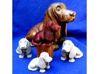
Basset Hound by pmoews
...basset hound by pmoews
thingiverse
an autodesk recap photo copy of a basset hound bought at an estate sale. about 4/10 scale.
thingiverse
free
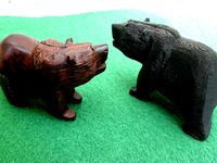
A Black Bear by pmoews
... by pmoews
thingiverse
a 123d catch version of a wood carving of a bear. a souvenir of new mexico. the stl file is full scale.
thingiverse
free

Model Fish - Trout by pmoews
...model fish - trout by pmoews
thingiverse
openscad "doddle". meant to be a rainbow trout.
Gulf
3ddd
$1
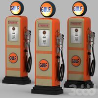
Gulf gas station
... ретро
ретро колонка gulf 50-60-х годов. в моделе используются манипуляторы для удобной регулировки значений счетчика.
3d_export
$40
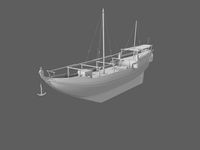
Gulf Ship 3D Model
...gulf ship 3d model
3dexport
boat
old gulf ship
3d_export
$55
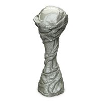
Arabian Gulf Cup
...arabian gulf cup
3dexport
turbosquid
$50
Bahrain Gulf Air
... available on turbo squid, the world's leading provider of digital 3d models for visualization, films, television, and games.
turbosquid
$99

PREMIER-II GULF AIR
... available on turbo squid, the world's leading provider of digital 3d models for visualization, films, television, and games.
3d_export
$71
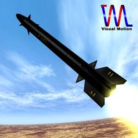
Iranian Persian Gulf Missile 3D Model
...srbm iranian short range ballistic fetah strike force truespace
iranian persian gulf missile 3d model visualmotion 60142 3dexport
turbosquid
$99

PREMIER-II GULF AIR 3DSMAX5
... available on turbo squid, the world's leading provider of digital 3d models for visualization, films, television, and games.
turbosquid
$79

Voshod 3M Gulf Racing TT
... available on turbo squid, the world's leading provider of digital 3d models for visualization, films, television, and games.
turbosquid
$65

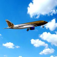
Airbus A340-300 Gulf Air
... available on turbo squid, the world's leading provider of digital 3d models for visualization, films, television, and games.
3d_export
$129
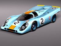
Porsche 917k GULF LeMans 24h 3D Model
...ng supercar fast germany winner classic retro oldtimer vintage antique
porsche 917k gulf lemans 24h 3d model squir 37457 3dexport
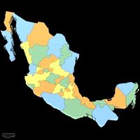
Mexico
turbosquid
$100

Mexico
... available on turbo squid, the world's leading provider of digital 3d models for visualization, films, television, and games.
3d_export
$5
eagle mexico
...eagle mexico
3dexport
tlatelolco eagle<br>for those who remember their trips to mexico, more than memorable
turbosquid
$70

Mexico Map
...ty free 3d model mexico map for download as 3ds, max, and obj on turbosquid: 3d models for games, architecture, videos. (1299218)
turbosquid
$49

New Mexico
... available on turbo squid, the world's leading provider of digital 3d models for visualization, films, television, and games.
turbosquid
$29

Soccerball Mexico
... available on turbo squid, the world's leading provider of digital 3d models for visualization, films, television, and games.
turbosquid
$15

New Mexico
... available on turbo squid, the world's leading provider of digital 3d models for visualization, films, television, and games.
turbosquid
$15

MEXICO-chair
... available on turbo squid, the world's leading provider of digital 3d models for visualization, films, television, and games.
turbosquid
$4

New-Mexico
... available on turbo squid, the world's leading provider of digital 3d models for visualization, films, television, and games.
cg_studio
$60
Mexico Map3d model
...map3d model
cgstudio
.3ds .max .obj .wrl - mexico map 3d model, royalty free license available, instant download after purchase.
turbosquid
$9

Mexico low poly
...lty free 3d model mexico low poly for download as max and obj on turbosquid: 3d models for games, architecture, videos. (1169260)
Relief
3d_export
$20
relief
...relief
3dexport
relief
turbosquid
$1

Relief
...
turbosquid
royalty free 3d model relief for download as obj on turbosquid: 3d models for games, architecture, videos. (1438537)
3d_export
$15
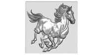
horse relief
...horse relief
3dexport
horse relief
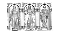
3d_export
$10

jesus relief
...jesus relief
3dexport
jesus relief
3d_export
$10

rome relief
...rome relief
3dexport
rome relief
3d_export
$10

fish relief
...fish relief
3dexport
fish relief
3d_export
$10

eagle relief
...eagle relief
3dexport
eagle relief
3d_export
$10
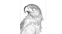
eagle relief
...eagle relief
3dexport
eagle relief
3d_export
free

3d relief
...3d relief
3dexport
3d relief
turbosquid
free
Relief
... available on turbo squid, the world's leading provider of digital 3d models for visualization, films, television, and games.