CG Trader
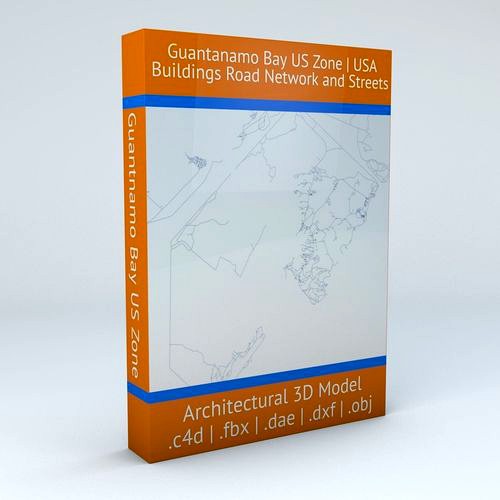
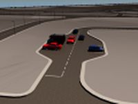
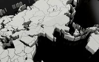
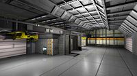
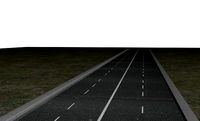
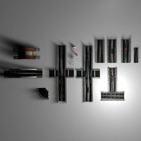
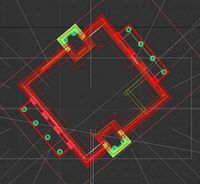
Guantanamo Bay US Zone Buildings and Road Network
by CG Trader
Last crawled date: 1 year, 10 months ago
this model is based on real data therefore this is a realistic buildings, road network and streets setup of Guantanamo Bay US Zone, USA 3 objects included | 1. roads 2. other areas 3. buildings (3 building groups setup) UV mapped with overlapping UVs the model is positioned on a flat surface (road network is on the “floor” - no elevation data included) geometry is polygonal quads and tris model is untextured and renders fast this 3D model is/can be licensed (commercial use is fine) under Creative Commons Attribution-ShareALike 2.0 (CC-BY-SA) license buildings and streets data from OpenStreetMap / www.openstreetmap.org Attribution : © OpenStreetMap contributors / http://www.openstreetmap.org/copyright POINTS/VERTS : 48835
POLYGONS : 40983 .c4d - native format .fbx - v7.1 .dae - v1.5 .dxf .obj guantanamo bay cuba usa united states america road network system infrastructure map cartography city gps navigation roads realistic topology other architectural city map united states usa map
POLYGONS : 40983 .c4d - native format .fbx - v7.1 .dae - v1.5 .dxf .obj guantanamo bay cuba usa united states america road network system infrastructure map cartography city gps navigation roads realistic topology other architectural city map united states usa map
Similar models
cg_trader
$29

San Francisco Bay Eastern Side Road Network and Streets
...istic architectural street architectural street city street city map city street city streets san francisco united states usa map
cg_trader
$29

Baltimore Road Network and Streets
... realistic topology architectural street architectural street city street city map city street city streets united states usa map
cg_trader
$29

Orlando Road Network and Streets
... roads squares realistic topology street architectural street city street city map city street city streets united states usa map
cg_trader
$29
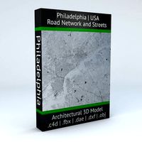
Philadelphia Road Network and Streets
... roads squares realistic topology street architectural street city street city map city street city streets united states usa map
cg_trader
$29

Detroit Road Network and Streets
... roads squares realistic topology street architectural street city street city map city street city streets united states usa map
cg_trader
$29

Miami Road Network and Streets
...alistic topological architectural street architectural street city street city map city street city streets united states usa map
cg_trader
$29

Dallas Road Network and Streets
... roads squares realistic topology street architectural street city street city map city street city streets united states usa map
cg_trader
$29

Houston Road Network and Streets
... roads squares realistic topology street architectural street city street city map city street city streets united states usa map
cg_trader
$29

Boston Road Network and Streets
...es realistic topological topology street architectural street city street city map city street city streets united states usa map
cg_trader
$29

Roswell Road Network and Streets
... roads squares realistic topology street architectural street city street city map city street city streets united states usa map
Guantanamo
thingiverse
free

Guantanamo Bay Prison Key by JeremyRuhland
...ual-proportions and size as i could make it. maybe this will raise awareness about something? i don't know, i just like keys.
thingiverse
free

Top Secret Rocket by racereed
...except no responsibility if you find yourself detained at guantanamo ...
3dwarehouse
free

Flat in Guantanamo
...flat in guantanamo
3dwarehouse
a 2 floors flat in guantanamo downcity #cuba #flat #guantanamo #mt
3dwarehouse
free

Bandera de EE.UU en Guantanamo,Cuba
...bandera de ee.uu en guantanamo,cuba
3dwarehouse
bandera
3dwarehouse
free

ME - IN MY GUANTANAMO
...lture #global #grueter #human #kunst #man #max #men #open_source_art #people #performance #person #the_download_sculpture_project
3dwarehouse
free

Prison
...3dwarehouse simple prison not so good, second sketch up #guantanamo ...
3dwarehouse
free

Camp Delta (Guantanamo Bay) Detention Center Cell
...e space for the koran. #cuba #detention_center #gitmo #illegal #jail #military_base #naval_base #prison #terror #terrorist #wrong
3dwarehouse
free

Flag of Cuba - Bandera de Cuba
...#clara #santa_clara #santiago #santiago_de_cuba #cienfuegos #matanzas #baracoa #trinidad #vinales #guantanamo #pinar_del_rio #pinar #del #rio #bayamo #cardenas #manzanillo #contramaestre #española...
3dwarehouse
free

USS Kansas (BB-21)
...1907 - 1909 and conducted training maneuvers around the guantanamo bay naval base. she sailed off veracruz and haiti...
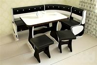
Network
3ddd
$1
Network table by Henge
...network table by henge
3ddd
henge
network table by henge
3d_export
$35

network office design
...network office design
3dexport
network office 3d model design
turbosquid
$120

Global Network
... available on turbo squid, the world's leading provider of digital 3d models for visualization, films, television, and games.
turbosquid
$40
Road Network
... available on turbo squid, the world's leading provider of digital 3d models for visualization, films, television, and games.
turbosquid
$4

social Network
... available on turbo squid, the world's leading provider of digital 3d models for visualization, films, television, and games.
design_connected
$16
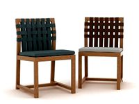
Network 149 chair
...network 149 chair
designconnected
roda network 149 chair computer generated 3d model. designed by dordoni, rodolfo.
design_connected
$16
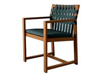
Network 159 armchair
...twork 159 armchair
designconnected
roda network 159 armchair armchairs computer generated 3d model. designed by rodolfo dordoni.
3d_ocean
$15
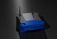
Wireless Broadband Network Router
... computer networking. similar to popular styles of wireless routers. this model was created in 3d studio max 2008 and has a ma...
3d_export
$30
Road Network 3D Model
...
3dexport
roads network highway
road network 3d model download .c4d .max .obj .fbx .ma .lwo .3ds .3dm .stl msaeed 103734 3dexport
turbosquid
$3
DOUBLE NETWORK PLUG
...d model double network plug for download as max, obj, and fbx on turbosquid: 3d models for games, architecture, videos. (1370379)
Zone
design_connected
$16
Zone
...zone
designconnected
jaipur living zone computer generated 3d model.
3d_export
$20
smoking zone
...smoking zone
3dexport
smoking zone
3ddd
$1
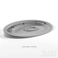
lounge zone
...lounge zone
3ddd
lounge zone, зона отдыха, кострище
turbosquid
$25

Zone industrielle
... available on turbo squid, the world's leading provider of digital 3d models for visualization, films, television, and games.
turbosquid
free
TEST ZONE
... available on turbo squid, the world's leading provider of digital 3d models for visualization, films, television, and games.
3ddd
free
Eaten zone
...eaten zone
3ddd
уголок
обеденная зона для кухни.текстуры прилагаются.
3d_export
$5
world time zones
...world time zones
3dexport
turbosquid
$120

Factory Industrial zone
...lty free 3d model factory industrial zone for download as max on turbosquid: 3d models for games, architecture, videos. (1328111)
turbosquid
$100

TAG sur zone
... available on turbo squid, the world's leading provider of digital 3d models for visualization, films, television, and games.
turbosquid
$99

INDUSTRIAL ZONE SET
... available on turbo squid, the world's leading provider of digital 3d models for visualization, films, television, and games.
Bay
3ddd
$1
Bay
...bay
3ddd
calligaris
стул bay итальянской фабрики сalligaris /max2011,fbx,obj,mat/
3ddd
$1
MDF / BAY
...mdf / bay
3ddd
bay , mdf italia
диван "bay"
*turbosmooth присутствует
turbosquid
$8

Bay
... available on turbo squid, the world's leading provider of digital 3d models for visualization, films, television, and games.
3ddd
$1
BAY XL
... giulio marelli
giulio marelli italia. bay xl.
диван, дизайн studio crgm в тканевом исполнении.
длина: 2.55
design_connected
$18
Bai Armchair
...bai armchair
designconnected
ondarreta bai armchair computer generated 3d model. designed by lizaso, ander.
3ddd
$1
Kichler Hayman Bay
...kichler hayman bay
3ddd
kichler , hayman bay
люстра kichler lighting 43256daw hayman bay
design_connected
$13

Bai Chandelier
...bai chandelier
designconnected
parachilna bai chandelier computer generated 3d model. designed by neri&hu.
3ddd
$1

Lamp poters bay
...lamp poters bay
3ddd
eichholtz
eichholtz, lamp poters bay
turbosquid
$32
Shuttle Bay
...ty free 3d model shuttle bay for download as ma, obj, and fbx on turbosquid: 3d models for games, architecture, videos. (1475258)
turbosquid
$20

Iris Bay
...free 3d model iris bay for download as 3ds, c4d, fbx, and stl on turbosquid: 3d models for games, architecture, videos. (1367781)
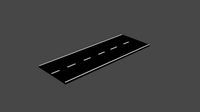
Road
3d_export
free
road
...road
3dexport
ready road with textures.
turbosquid
$4

Cross road Road-sign
...ss road road-sign for download as 3ds, dae, fbx, obj, and stl on turbosquid: 3d models for games, architecture, videos. (1516042)
3d_ocean
$39
Road
...torway nascar oval poly race racetrack raceway racing realtime road speedway talladega track way
racing games for the road system
turbosquid
$1
road
...ad
turbosquid
royalty free 3d model road for download as max on turbosquid: 3d models for games, architecture, videos. (1167278)
3d_ocean
$9
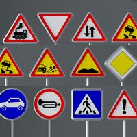
Road Signs
...road signs
3docean
outdoor road signs signpost waymark
road signs 3d models.
3d_export
$5
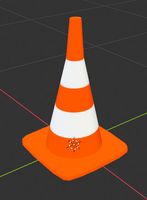
road cone
...road cone
3dexport
road cone
3d_export
free
road
...road
3dexport
3d_export
$5

road markings
...road markings
3dexport
construction of road markings
turbosquid
$25
Road
...lty free 3d model road for download as png, 3ds, obj, and fbx on turbosquid: 3d models for games, architecture, videos. (1380086)
3d_export
$5

road sign
...road sign
3dexport
road sign with the texture of a cyclist.
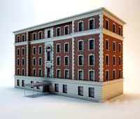
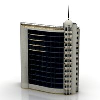
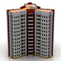
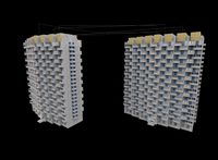
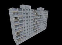
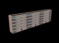
Buildings
archibase_planet
free
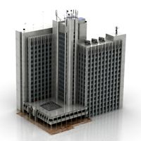
Building
...building high-rise building office building construction
building n050115 - 3d model (*.gsm+*.3ds) for exterior 3d visualization.
3d_export
$5
building
...building
3dexport
clasic building
3ddd
$1
building
...building
3ddd
здание
building
archibase_planet
free
Building
...lanet
building office office building construction
building n090914 - 3d model (*.gsm+*.3ds+*.max) for exterior 3d visualization.
archibase_planet
free
Building
...net
building tower construction high-rise building
building n100214 - 3d model (*.gsm+*.3ds+*.max) for exterior 3d visualization.
3d_export
free
Building
...building
3dexport
low poly building;
3d_export
free
Building
...building
3dexport
low poly building;
3d_export
free
Building
...building
3dexport
low poly building;
3d_export
free
Building
...building
3dexport
low poly building;
3d_export
free
Building
...building
3dexport
low poly building;