3DWarehouse

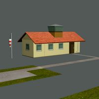
Filton Airfield Control tower, Filton, Bristol
by 3DWarehouse
Last crawled date: 1 year, 8 months ago
Bristol Filton Airport or Filton Aerodrome lies on the border between Filton and Patchway, within South Gloucestershire, 4 NM (7.4 km; 4.6 mi) north of Bristol, England. The airfield is bounded by the A38 trunk road to the east, the former London to Avonmouth railway line to the south and the Old Filton Bypass road to the north west. The aerodrome's main runway runs east-west. The aerodrome is also called Filton Airfield. The original flying ground was on the top of the hill on the site of the current Airbus works. In 1915 the airfield moved down to its current location. On 14 April 2011, BAE Systems announced that the airfield is to close at the end of 2012. #A38 #Airbus #Airifeld #BAE_Systems #Bristol #Control #Filton #Patchway #South_Gloucestershire #Tower #TRM_DA
Similar models
3dwarehouse
free

Aircraft Hangar, Filton Airfield, Bristol
...close at the end of 2012. there is a similar hangar at the oldmixon factory in weston. #a38 #aerodrome...
3dwarehouse
free

WW2 Aircraft Hangar, Filton Airfield, Bristol
...close at the end of 2012. there is a similar hangar at the oldmixon factory in weston. #a38 #aerodrome...
3dwarehouse
free

WW2 Aircraft Hangar, Filton Airfield, Bristol
...close at the end of 2012. there is a similar hangar at the oldmixon factory in weston. #a38 #aerodrome...
3dwarehouse
free

Aircraft Hangar, Filton Airfield, Bristol
...close at the end of 2012. there is a similar hangar at the oldmixon factory in weston. #a38 #aerodrome...
3dwarehouse
free

Building, Filton Airfield, South Gloucestershire
...#1917 #1918 #acceptance_park #aerodrome #airfield #brick #bristol #filton #patchway #south_gloucestershire #trm_da #world_war_one
3dwarehouse
free

1917 Hangar Filton Airfield, South Gloucestershire
...917 at filton airfield in south gloucestershire. #airfield #airport #bristol #filton #hangar #shed #south_gloucestershire #trm_da
3dwarehouse
free

1917 General Service Flight Shed, Filton Airfield, Filton, Bristol
...russ #1917 #aerodrome #aircraft #airfield #belfast_truss #bristol #filton #general_service_flight #plane #raf #shed #trm_da #wwii
3dwarehouse
free

Belfast Truss Triple Bay Hangar, Filton Airfield, South Gloucestershire
...he airfield. #aircraft #airfield #airport #belfast_truss #bristol #filton #hangar #raf #south_gloucestershire #triple_bay #trm_da
3dwarehouse
free

Brabazon Hangar, Filton Airfield, Bristol
...stol britannia and concorde. #airbus #airport #bac #brabazon #bristol #britannia #concorde #filton #hangar #south_gloucestershire
3dwarehouse
free

Directional North, South, East, West signpost
...directional north, south, east, west signpost
3dwarehouse
landmark signpost designating north, south, east and west.
Filton
3dwarehouse
free
1917 General Service Flight Shed, Filton Airfield, Filton, Bristol
...russ #1917 #aerodrome #aircraft #airfield #belfast_truss #bristol #filton #general_service_flight #plane #raf #shed #trm_da #wwii
3dwarehouse
free
1917 Hangar Filton Airfield, South Gloucestershire
...917 at filton airfield in south gloucestershire. #airfield #airport #bristol #filton #hangar #shed #south_gloucestershire #trm_da
3dwarehouse
free
Building, Filton Airfield, South Gloucestershire
...#1917 #1918 #acceptance_park #aerodrome #airfield #brick #bristol #filton #patchway #south_gloucestershire #trm_da #world_war_one
3dwarehouse
free
Aircraft Hangar, Filton Airfield, Bristol
...ol #bristol_aeroplane_company #factory #filton #filton_airfield #hangar #industrial #industry #south_gloucestershire #trm_da #ww2
3dwarehouse
free
Aircraft Hangar, Filton Airfield, Bristol
...ol #bristol_aeroplane_company #factory #filton #filton_airfield #hangar #industrial #industry #south_gloucestershire #trm_da #ww2
3dwarehouse
free
WW2 Aircraft Hangar, Filton Airfield, Bristol
...ol #bristol_aeroplane_company #factory #filton #filton_airfield #hangar #industrial #industry #south_gloucestershire #trm_da #ww2
3dwarehouse
free
WW2 Aircraft Hangar, Filton Airfield, Bristol
...ol #bristol_aeroplane_company #factory #filton #filton_airfield #hangar #industrial #industry #south_gloucestershire #trm_da #ww2
3dwarehouse
free

360 filton kargo karavan iç dizayn
...360 filton kargo karavan iç dizayn
3dwarehouse
3dwarehouse
free
Brabazon Hangar, Filton Airfield, Bristol
...stol britannia and concorde. #airbus #airport #bac #brabazon #bristol #britannia #concorde #filton #hangar #south_gloucestershire
Airfield
turbosquid
$8
RC Airfield
... available on turbo squid, the world's leading provider of digital 3d models for visualization, films, television, and games.
3d_export
$10

airfield
...airfield
3dexport
3d model created by blender 2.90 render eevee.<br>everything except paving stones.
cg_studio
$10
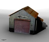
Airfield maintenance building3d model
...o
.3ds .fbx .lwo .obj - airfield maintenance building 3d model, royalty free license available, instant download after purchase.
3d_export
$5
Metal military airfield plate of the USSR
... implementation, please like it! share it with your friends! thanks! for all questions related to this model, please let me know.
3d_export
$10
Motor body 3D Model
...3dexport car body chassis tow tractor military trailers projecting airfield motor body 3d model christopherus 100489...
3d_export
$50
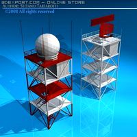
Airport radar towers 3D Model
...radar towers 3d model 3dexport airport radar towers tower airfield airbase base air airport radar towers 3d model tartino...
3d_export
$40
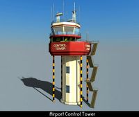
Airport Control Tower 3D Model
...airport control tower 3d model 3dexport tower airport airfield building air traffic trafic airbase airport control tower 3d...
3d_export
$300
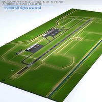
Airport scenario 3D Model
...airport scenario 3d model 3dexport airport scenario airfield medium airbase terrain hangar jet base helicopter airplane airport...
3d_export
$90
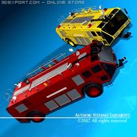
Airport firetruck 3D Model
...airport firetruck 3d model 3dexport airport firetruck fire truck airfield field vehicle engine pumper emergency fireman airport firetruck 3d...
3d_export
$36

Airport control tower 3D Model
...airport control tower 3d model 3dexport control tower airport airfield building air traffic trafic airbase airport control tower 3d...
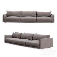
Bristol
3ddd
free

Britannica Bristol
...britannica bristol
3ddd
bristol , britannica
диван фирмы britannica модель bristol
3ddd
$1

Britannica Bristol
... кресло , плед
диван и кресло bristol фирмы britannica
3ddd
$1
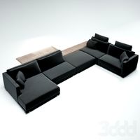
диван BRISTOL
...oliform , jean-marie massaud
диван bristol дизайнера jean-marie massaud
фабрика poliform
3ddd
$1

KUTAHYA SERAMIK BRISTOL
...4, 2013, 2011,
obj
_____________________________________http://www.ngkutahyaseramik.com.tr/en/products/seramik/bristol/
3ddd
$1

Bristol Marron
... вентилятор
люстра вентилятор bristol marron
габариты, мм: 1060x1060x390
в папке: max_2014,max_2011,fbx
3ddd
$1
poliform bristol 04
...iform , bristol , модульный
poliform bristol 04
3ddd
$1
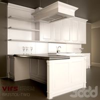
Virs Bristol Two
... bristol-two
кухня bristol two от фирмы virshttp://www.virs.ru/kitchen/bristol-two
design_connected
$27

Bristol Corner
...bristol corner
designconnected
poliform bristol corner computer generated 3d model. designed by massaud, jean-marie.
design_connected
$27

Bristol 311
...bristol 311
designconnected
poliform bristol 311 computer generated 3d model. designed by massaud, jean-marie.
3ddd
$1

Bristol by Poliform
...ud. this sofa allows to combine highly original layouts.http://www.poliform.it/poliform/sofas/bristol_1_78979_12_1.html
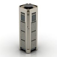
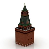
Tower
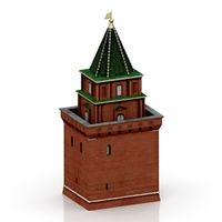
archibase_planet
free
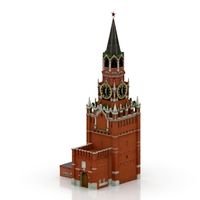
Tower
...kremlin tower spasskaya tower
tower kremlin spasskaya tower n120615 - 3d model (*.gsm+*.3ds+*.max) for exterior 3d visualization.
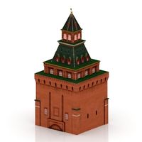
archibase_planet
free
Tower
...r kremlin tower petrovskaya tower
tower petrovskaya kremlin n120615 - 3d model (*.gsm+*.3ds+*.max) for exterior 3d visualization.
archibase_planet
free
Tower
...ino-eleninskaya tower
tower constantino eleninskaya kremlin n120615 - 3d model (*.gsm+*.3ds+*.max) for exterior 3d visualization.
archibase_planet
free

Tower
...tower
archibase planet
tower statuette eiffel tower
tower decor n180914 - 3d model (*.gsm+*.3ds) for interior 3d visualization.
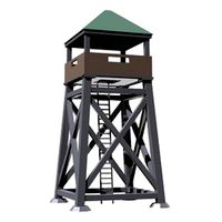
archibase_planet
free
Tower
...lanet
tower construction building
tower polices post street tower n110913 - 3d model (*.gsm+*.3ds) for exterior 3d visualization.
3d_export
$5
tower
...tower
3dexport
a fortified tower with a moat.
archibase_planet
free
Tower
...tower
archibase planet
building tower construction
tower n300712 - 3d model (*.gsm+*.3ds) for exterior 3d visualization.
archibase_planet
free
Tower
...uilding kremlin construction
tower 2 vtoraya bezymyannaya kremlin n100914 - 3d model (*.gsm+*.3ds) for exterior 3d visualization.
archibase_planet
free
Tower
...tower
archibase planet
forcetower tower
forcetower - 3d model for interior 3d visualization.
archibase_planet
free
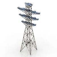
Transmission tower
...lectricity pylon lattice tower framework tower
transmission tower n121015 - 3d model (*.gsm+*.3ds) for exterior 3d visualization.
Control
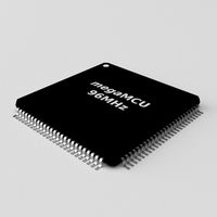
3d_ocean
$4
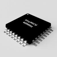
Controller TQFP32
...qfp32
3docean
chip controller cpu electronic gpu mcu micro controller silicon smd tqfp wafer
a micro controller in tqfp32 package
3d_ocean
$4
Controller TQFP44
...44
3docean
chip controller cpu electronic gpu mcu micro controller package smd tqfp tqfp44
a micro controller in a tqfp44 package
3d_export
$15
control unit
...control unit
3dexport
control unit
3ddd
$1
Yacht control
...yacht control
3ddd
yacht control
3d_export
$5
controle pgdm
...controle pgdm
3dexport
carcaca controle pgdm
turbosquid
free
controler
... available on turbo squid, the world's leading provider of digital 3d models for visualization, films, television, and games.
3ddd
$1

Control
...
http://www.schmitz-leuchten.de/html-ru/einzelleuchten-lampentyp-details.php?lamptype_no=700&group;=917&id;=731
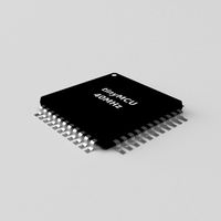
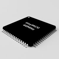
3d_ocean
$4
Controller TQFP100
...100
3docean
chip computer cpu electronic gpu mcu micro controller pin platine silicon wafer
a micro controller in tqfp100 package
3d_ocean
$4
Controller TQFP64
...qfp64
3docean
chip computer cpu gpu mcu micro controller package silicon tqfp tqfp64 wafer
a micro controller in a tqfp64 package
3d_ocean
$7

Remote controller
... control switcher tv remote
remote controller for tv, sound systems etc easy to edit textures photo real rendered with mental ray