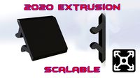
Thingiverse
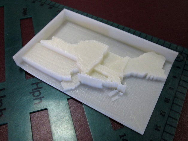
Customizable Extrusion Map of Northeast US States by anoved
by Thingiverse
Last crawled date: 3 years, 1 month ago
Important Tip: Customizer is exceedingly sensitive to number formatting. It will fail to work correctly if you enter values ending with a decimal point or a trailing zero after the decimal. For example, 10 or 10.5 is OK, but 10., 10.0, or 10.50 will cause Customizer to fail.
Open in Customizer and enter new values for each state to create your own extruded thematic map (also called a "prism map").
Naturally, I plan to post templates for a variety of other regions. I am writing a script called Prismap to convert shapefiles of arbitrary areas to these customizable OpenSCAD templates. So, you will be able to use Prismap to make printable prism maps of areas of your choice - states, counties, countries, election districts, etc. Or, just let me know your area of interest and I may be able to prepare a template for you.
State boundaries derived from Natural Earth Data. For better resullts, simplify geometry, prune small features, and reproject shapefiles as desired before processing with Prismap.
Thanks to dddjournal for the test print photo!
Similar models
thingiverse
free

Contiguous United States Prism Map by anoved
...ate your own customizable prism map models from shapefiles without ease using prismap. pull requests and bug reports are welcome.
thingiverse
free

Customizable USA Electoral College Map by TheNewHobbyist
... "contiguous united states prism map" scad file.
all historical information has been pulled from this wikipedia page.
thingiverse
free

Pulley XL Customizable by Nemonehsaz
...dia=6);" function. it is fully customizable. i made use of thing:220868 in producing pulley grooves. enjoy the function. :-)
thingiverse
free

Customizable Greek Temple by knarf2011
...ed to start calling a remix...)!
if you customize it and make your customized design, please hit the "made one" button!
thingiverse
free

Customizable Stand for ActionCams, Gimbals and more using empty tubes by PHolzwarth
...ure the distance of the mid points of two diagonal damper holes and enter this for the "gimbaldamperdiadistance" value.
thingiverse
free

Rectangular Prism for Surface Area with Labels by Taevinrude
...and height, along with the units that will be printed on the sides of the shape. you can also remove the area labels if you wish.
thingiverse
free

Customizable Template by fastkite
...customizable template by fastkite
thingiverse
use makerbot customizer to create a custom template
3dwarehouse
free

Table (Customizable)
...table (customizable)
3dwarehouse
you are able to color this table to your liking. #custom #customizable #customize #lines #table
thingiverse
free

Binghamton Election District Maps by anoved
...t the upper and lower bounds of the data range accordingly), or use prismap to create extruded prism maps of your own study area.
thingiverse
free

Very Customizable Poly Bowl OpenSCAD by mistertech
..., enter numbers between 0-1 (decimals). this being the amount of inward cant of your bowl.) example "body flare = 0.2"
Anoved
thingiverse
free

Marianne by anoved
...t chazal's scan of a marianne bust. closed some holes, clipped background artifacts, and reduced to 50k faces with meshmixer.
thingiverse
free

Faun Torso with Base by anoved
...faun torso with base by anoved
thingiverse
added a lumpy little pedestal for easier printing and display.
thingiverse
free

Customizable Gel Comb by anoved
...f teeth is configurable; tooth width is calculated based on number of teeth, gap between teeth, and available space (comb width).
thingiverse
free

Bike taillight coupler by anoved
...pler to attach a new "laser lane" taillight to planet bike taillight brackets, which are already installed on my bikes.
thingiverse
free
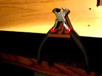
Customizable Plier Holder by anoved
...bench. works alright, but much less stable than the second version, which holds the tools more securely with the heavy side down.
thingiverse
free

Forest Frolic 7k by anoved
...oute. terrain generated from srtm data retrieved from usgs earthexplorer. course generated from gpx recon jog log with gpxtruder.
thingiverse
free
Whiteface Vertical K by anoved
...rtical k route. terrain generated from srtm data retrieved from usgs earthexplorer. course generated from gpx log with gpxtruder.
thingiverse
free

LEGO quadcopter cage by anoved
...ion points. haven't printed it yet. almost certainly requires a lot of revision, as i'm quite new to this sort of design.
thingiverse
free

Forks 15k by anoved
... from mapmyrun trace of course. the file posted here does not include the tcrc logo embossing as pictured in the printed version.
thingiverse
free

Bat-Whistle by anoved
...ally a good idea. since our club is called the bats i remixed this whistle with the club logo to make complimentary bat-whistles!
Northeast
3d_export
$65

northeast rural
...northeast rural
3dexport
simple rendering of the scene file
3d_export
$65

northeast rural
...northeast rural
3dexport
simple rendering of the scene file
3d_export
$65

northeast rural
...northeast rural
3dexport
simple rendering of the scene file
3d_export
$65

northeast rural
...northeast rural
3dexport
simple rendering of the scene file
3d_export
$65

northeast rural
...northeast rural
3dexport
simple rendering of the scene file
3d_export
$65

northeast rural
...northeast rural
3dexport
simple rendering of the scene file
3d_export
$65

northeast rural
...northeast rural
3dexport
simple rendering of the scene file
3d_export
$65

northeast rural
...northeast rural
3dexport
simple rendering of the scene file
turbosquid
$5

Jug_Cray pot from Northeast of Thailand
... available on turbo squid, the world's leading provider of digital 3d models for visualization, films, television, and games.
turbosquid
$5

Jug _Cray pot from Northeast of Thailand
... available on turbo squid, the world's leading provider of digital 3d models for visualization, films, television, and games.
Extrusion
turbosquid
free
aluminum extrusion profiles
...free 3d model aluminum extrusion profiles for download as max on turbosquid: 3d models for games, architecture, videos. (1381707)
turbosquid
$5
Cable Cover Extrusion
... available on turbo squid, the world's leading provider of digital 3d models for visualization, films, television, and games.
3d_export
free

30 x 30 extrusion
... x 30 x 40.sldprt<br>30 x 30 x 50.sldprt<br>30 x 30 x 606.sldprt<br>the sketch.sldprt<br>30 x 30 x 40.stl
3d_export
$300
melt-blown fabric extrusion molding machine
...an email to me.<br>designed with solidworks 2017, render with photoview 360<br>**************************************
3d_export
$5
Spaceship - Galaxy Crusher
...with a more ominous twist. it has lots of extrusion and cubes and comes with a whopping 4k texture,...
3d_export
$20
1600 Meltblown cloth production line set drawing CAD
...width of 1600mm. the steel structure frame, feeding host, extrusion screw, heating system, screen changer, metering pump, melting it...
3d_export
$5

one-eyed scary virus
...cinema, the body relief is formed by the standard extrusion noise. the eye texture is...
3d_export
$20
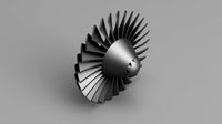
GE TF34 Fan Blade and Nose Cone
...and appropriately sized fillet features are provided.<br>also, a threaded extrusion profile is provided on the fan blade component and...
3d_export
$10
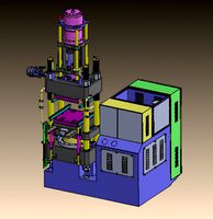
glue injection machine
...injection technology. the ordinary glue injection machine is screw extrusion type, and its instantaneous pressure can reach more than...
3d_export
$1000
bead triangle adhesive laminating machine
...a triangular rubber head with the shape required for extrusion the rear end of the extruder is also provided...
Customizable
3d_export
$10
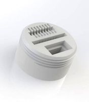
customizable sd port
...customizable sd port
3dexport
customizable sd port
turbosquid
$99
Customizable character
...alty free 3d model customizable character for download as max on turbosquid: 3d models for games, architecture, videos. (1152525)
turbosquid
$1
Customizable Mug
... available on turbo squid, the world's leading provider of digital 3d models for visualization, films, television, and games.
turbosquid
$1
Customizable Spider Mech
... free 3d model customizable spider mech for download as blend on turbosquid: 3d models for games, architecture, videos. (1462055)
turbosquid
$20
Customizable Egyptian Pillar
...zable egyptian pillar for download as ma, obj, fbx, and blend on turbosquid: 3d models for games, architecture, videos. (1307376)
turbosquid
$75
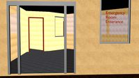
Fully Customizable Hospital
... available on turbo squid, the world's leading provider of digital 3d models for visualization, films, television, and games.
turbosquid
$20

Customizable Caste Pieces
... available on turbo squid, the world's leading provider of digital 3d models for visualization, films, television, and games.
turbosquid
$15
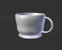
Customizable Tea Cup
... available on turbo squid, the world's leading provider of digital 3d models for visualization, films, television, and games.
turbosquid
free
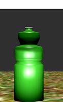
Water Bottle(Customizeable)
... available on turbo squid, the world's leading provider of digital 3d models for visualization, films, television, and games.
3d_export
$49
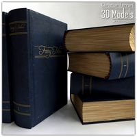
Book customizable 3D Model
...3dexport
book booshelf novel teach library learn read pages cover fairy tales
book customizable 3d model guitargoa 74240 3dexport
States
turbosquid
$9
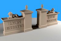
Lyon States
...osquid
royalty free 3d model lyon states for download as stl on turbosquid: 3d models for games, architecture, videos. (1431758)
turbosquid
$5

Empire state
... free 3d model empire state for download as 3ds, obj, and c4d on turbosquid: 3d models for games, architecture, videos. (1310013)
turbosquid
$150

USA States
... available on turbo squid, the world's leading provider of digital 3d models for visualization, films, television, and games.
3d_export
$350

USA states 3D Model
...usa states 3d model
3dexport
usa states
usa states 3d model wickiupinfo 62636 3dexport
turbosquid
free

Empire State Building
...quid
free 3d model empire state building for download as c4d on turbosquid: 3d models for games, architecture, videos. (1509366)
turbosquid
$199

us state department
...royalty free 3d model us state department for download as c4d on turbosquid: 3d models for games, architecture, videos. (1658806)
turbosquid
$59
State House Building
...oyalty free 3d model state house building for download as max on turbosquid: 3d models for games, architecture, videos. (1248175)
turbosquid
$19

Colorado State Seal
...royalty free 3d model colorado state seal for download as max on turbosquid: 3d models for games, architecture, videos. (1291867)
turbosquid
$18

BISHKEK-STATE-CIRCUS
...oyalty free 3d model bishkek-state-circus for download as max on turbosquid: 3d models for games, architecture, videos. (1388670)
turbosquid
$1

State Park Trailhead
...oyalty free 3d model state park trailhead for download as fbx on turbosquid: 3d models for games, architecture, videos. (1648408)
Map
3d_ocean
$5

Map
...map
3docean
geography map ocean travel world world map
a world map
3d_ocean
$5

Old Map
...old map
3docean
dirty map ocean old map paper pirates rotten travel world map
an old map
turbosquid
$3

Map
... available on turbo squid, the world's leading provider of digital 3d models for visualization, films, television, and games.
3d_ocean
$3

Map of Iran
...map of iran
3docean
flag iran map outline
an outline map of iran
3d_ocean
$2

Map of the USA
...map of the usa
3docean
america flag globe map united states usa
an outline map of the usa
3ddd
$1

Abstract Maps
... город , picture
abstract maps by artist jazzberry blue
3d_ocean
$5

Honduras Map
...honduras map
3docean
3d cinema4d honduras map mapa
honduras map designed in cinema 4d r17
3d_ocean
$2

Map of Germany
...map of germany
3docean
black country europe germany gold map outline red yellow
a simple outline map of germany
3d_ocean
$2

Map of Australia
...map of australia
3docean
australia banner country down under earth flag globe map ocean south
an outline map of australia
3d_ocean
$2

Map of Russia
...of russia
3docean
asia banner earth europe flag globe map russia russian federation siberia sovjet union
an outline map of russia