Thingiverse
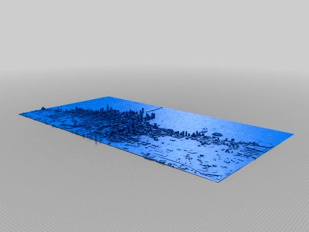
Chicago Skyline 3D Map by BahktoshRedclaw
by Thingiverse
Last crawled date: 3 years, 1 month ago
3D map of Chicago. The intent was to slice it into tiles for printing in sections - maps like this have been posted on social media sites but with no STLs and no workflow, so I wanted to offer both and maybe spark someone else to do a better job, but a hospital stay has me moving slowly for now. Here is the data I got done so far:
Google's 3D data is proprietary, and ripping geometry from Google Earth like this is sort of a hack. I've done it before and it works, but the tools only work on Windows and IMO it's a rather messy process. OpenStreetMap also features accurate building height data like Google does, and while their models usually aren't as detailed as Google's (Google stores actual 3D models whereas OSM stores flat geometric shapes that have height data attached so they can be represented in 3D), it's free for the taking and the tools for doing so are much more straightforward. Also, I've found that the resultant geometry is much cleaner.
So here's what I do in case anyone is interested in the alternative:
Export a .map region file from OpenStreetMap.
Just click the Export button at the top of the page. The default area is the viewport, but you can also manually change that. Make sure the property you want is completely within the export region, then click the blue Export button to download the file.
Convert the OSM .map file to an OBJ model with OSM2World
OSM2World is a free Java program for converting OSM data into 3D models. Just open the .map file in OSM2World with File >> Open, then export the whole thing as an OBJ via File >> Export OBJ file. That's it.
Import the OBJ into your 3D modeling application of choice and delete extraneous geometry before getting to work.
And that's it. Whole process takes about 30 seconds!
This map still needs to have a base added on, and sliced into tiles. I use Netfabb Free to slice things into tiles, it's fast and easy. Also, I wanted to make the ground more textured, I've been playing with using image to STL heightmap generators but haven'y had much time to get it perfect. Finally, the building scales should be pretty close to accurate now; exaggerating them may be nice but I was saving that for last since I'd prefer to have a realistic map as well as a height exaggerated one.
Resources:https://wiki.openstreetmap.org/wiki/3D_printing_OSM_datahttps://www.youtube.com/watch?v=nVhM3IYMF8ohttps://wiki.openstreetmap.org/wiki/3Dhttps://community.simtropolis.com/forums/topic/69935-tutorial-on-how-to-extract-3d-models-from-google-earth-to-get-dimensionsproportions-of-building/https://forums.sketchup.com/t/copying-google-earth-cities-in-entirety-satellite-cartography-3d-models-for-other-3d-programs/43448/4https://osmbuildings.org/http://www.openstreetmap.org/http://osm2world.org/download/http://www.ocsmag.com/2015/10/26/open-3d-worlds/http://blog.nadnerb.co.uk/?p=209
Similar models
thingiverse
free

Wellington Region Heightmap by Daffyflyer
... of looking good as a print. made from koordinates dem data.
have not tested as a print, making for a r/wellington user to try.
thingiverse
free
OpenStreetMap Road Map Ornament by gringer
...h desired ornament shape
change path to straight lines
export as autocad r14 file
import into openscad, add ornament hanging hoop
3dwarehouse
free

logo openstreetmapAR OSM, openstreetmap, Argentina
...map, argentina
3dwarehouse
variant national projects logos openstreetmapar wiki.openstreetmap.org/wiki/es:wikiproyecto_argentina
thingiverse
free

Middle Earth Topography Map
...was obtained from https://github.com/bburns/arda (thank you!) built on work from https://github.com/jvangeld/me-gis (thank you!).
thingiverse
free

Tunisia topographic map by usinguser
... heights are exaggerated to make them stand out more. you can print with 0.2mm layer lines without bottom layers to save on time.
thingiverse
free

Luxembourg topographic map by usinguser
... heights are exaggerated to make them stand out more. you can print with 0.2mm layer lines without bottom layers to save on time.
thingiverse
free

Texas by HarlanDMii
...texas is 87 tiles. i have higher resolution tiles that i will post soon that will make a 5'8 x 5' textured image of texas
3dwarehouse
free

Kopiec Piłsudskiego
...und #independence_mound #kopiec_józefa_piłsudskiego #kopiec_niepodległości #kopiec_piłsudskiego #kopiec_wolności #pilsudski_mound
thingiverse
free

Bart Simpson's Head Sliced by MacGyver
...ed by macgyver
thingiverse
i wanted a model of bart's head so i found one in the google 3d warehouse and sliced it to print.
thingiverse
free

Hawaii Region with Seafloor by GlobeMaker
...port explains how the satellites measured the seafloor depths by observing the changes in the height of the water due to gravity.
Skyline
design_connected
$11
Skyline
...skyline
designconnected
ceccotti collezioni skyline computer generated 3d model. designed by de cotiis, vincenzo.
3d_ocean
$39
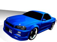
Nissan Skyline
...nissan skyline
3docean
3d model car nissan skyline
nissan skyline tuning
3ddd
free

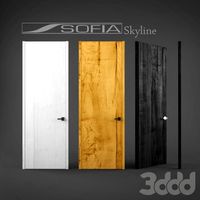
Sofia Skyline
... skyline , двери
двери фабрики sofia. коллекция skyline
8 цветов
3ddd
$1
Sofia Skyline
... door , sofia
коллекция sofia skyline.
высота до 3,5 метров.
turbosquid
$50
Skyline
... available on turbo squid, the world's leading provider of digital 3d models for visualization, films, television, and games.
turbosquid
$40

skyline
... available on turbo squid, the world's leading provider of digital 3d models for visualization, films, television, and games.
turbosquid
$15

Skyline
... available on turbo squid, the world's leading provider of digital 3d models for visualization, films, television, and games.
3ddd
$1
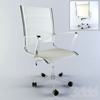
Skyline 1
...skyline 1
3ddd
кресло
office chair skyline 1
3ddd
$1
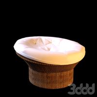
Skyline Creater
...skyline creater
3ddd
ротанг
skyline creater кресло плетеное
3ddd
$1
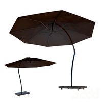
Sunbrella by Skyline Design
...sunbrella by skyline design
3ddd
зонт , skyline
солнцезащитный зонт by skyline design
Chicago
3ddd
free
Диван Chicago
...диван chicago
3ddd
chicago , unital
диван chicago unital
3ddd
$1

Medica | Chicago
... кресло , массажное
офисное массажное кресло chicago фирмы medica
3d_export
$5

street chicago
...street chicago
3dexport
chicago building 120 s riverside. the 3d model has groups on buildings and materials in color.
3d_export
$5

street chicago
...street chicago
3dexport
chicago building 525 w monroe. the 3d model has groups on buildings and materials in color.
3ddd
$1

Busnelli / Chicago
...busnelli / chicago
3ddd
busnelli
диван фабрики "busnelli",модель "chicago",черная кожа.
3d_export
$15

chicago sofa
...chicago sofa
3dexport
turbosquid
$19

Posters - Chicago
...uid
royalty free 3d model posters - chicago for download as on turbosquid: 3d models for games, architecture, videos. (1467158)
3ddd
$1
Sofa Chicago
...3ddd
il loft , chicago
langth - 2400 mm ,
width - 1100 mm ,
height - 800 mm .
+ 2011 max
3ddd
$1

Диван Chicago, Busnelli
... busnelli
диван в кожаной обивке chicago, busnellihttp://www.mebel-mr.ru/content/27697.html
3d_export
$10
Chicago apartments
...chicago apartments
3dexport
Map
3d_ocean
$5

Map
...map
3docean
geography map ocean travel world world map
a world map
3d_ocean
$5

Old Map
...old map
3docean
dirty map ocean old map paper pirates rotten travel world map
an old map
turbosquid
$3

Map
... available on turbo squid, the world's leading provider of digital 3d models for visualization, films, television, and games.
3d_ocean
$3

Map of Iran
...map of iran
3docean
flag iran map outline
an outline map of iran
3d_ocean
$2

Map of the USA
...map of the usa
3docean
america flag globe map united states usa
an outline map of the usa
3ddd
$1

Abstract Maps
... город , picture
abstract maps by artist jazzberry blue
3d_ocean
$5

Honduras Map
...honduras map
3docean
3d cinema4d honduras map mapa
honduras map designed in cinema 4d r17
3d_ocean
$2

Map of Germany
...map of germany
3docean
black country europe germany gold map outline red yellow
a simple outline map of germany
3d_ocean
$2

Map of Australia
...map of australia
3docean
australia banner country down under earth flag globe map ocean south
an outline map of australia
3d_ocean
$2

Map of Russia
...of russia
3docean
asia banner earth europe flag globe map russia russian federation siberia sovjet union
an outline map of russia