CG Trader

San Francisco Bay Eastern Side Road Network and Streets
by CG Trader
Last crawled date: 1 year, 9 months ago
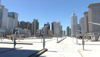
this model is based on real data therefore this is a realistic road network and streets setup of San Francisco Bay Eastern Side, USA UV mapped with overlapping UVs the model is positioned on a flat surface (road network is on the “floor” - no elevation data included) geometry is polygonal quads and tris model is untextured and renders fast this 3D model is/can be licensed (commercial use is fine) under Creative Commons Attribution-ShareALike 2.0 (CC-BY-SA) license buildings and streets data from OpenStreetMap / www.openstreetmap.org Attribution : © OpenStreetMap contributors / http://www.openstreetmap.org/copyright POINTS/VERTS : 2133513
POLYGONS : 2185754 .c4d - native format .fbx - v7.1 .dae - v1.5 .dxf .obj san francisco bay eastern usa united states road network system streets infrastructure map cartography city gps navigation roads squares realistic architectural street architectural street city street city map city street city streets san francisco united states usa map
POLYGONS : 2185754 .c4d - native format .fbx - v7.1 .dae - v1.5 .dxf .obj san francisco bay eastern usa united states road network system streets infrastructure map cartography city gps navigation roads squares realistic architectural street architectural street city street city map city street city streets san francisco united states usa map
Similar models
cg_trader
$29

San Francisco Area Road Network and Streets
...istic architectural street architectural street city street city map city street city streets san francisco united states usa map
cg_trader
$29

San Francisco Road Network and Streets
... realistic topology street architectural street city street city map city street city streets san francisco united states usa map
cg_trader
$29

Silicon Valley and San Jose Road Network and Streets
... realistic topology architectural street architectural street city street city map city street city streets united states usa map
cg_trader
$29

San Antonio Road Network and Streets
... realistic topology architectural street architectural street city street city map city street city streets united states usa map
cg_trader
$29

Baltimore Road Network and Streets
... realistic topology architectural street architectural street city street city map city street city streets united states usa map
cg_trader
$29

Orlando Road Network and Streets
... roads squares realistic topology street architectural street city street city map city street city streets united states usa map
cg_trader
$29
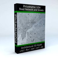
Philadelphia Road Network and Streets
... roads squares realistic topology street architectural street city street city map city street city streets united states usa map
cg_trader
$29

Detroit Road Network and Streets
... roads squares realistic topology street architectural street city street city map city street city streets united states usa map
cg_trader
$29

Miami Road Network and Streets
...alistic topological architectural street architectural street city street city map city street city streets united states usa map
cg_trader
$29

Dallas Road Network and Streets
... roads squares realistic topology street architectural street city street city map city street city streets united states usa map
Eastern
3ddd
$1
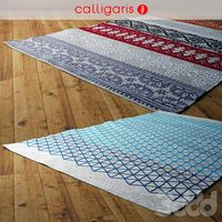
Calligaris ковер NADIRA / APOTEMA rug
...- rug inspired by japanese origami. nadira - middle easterndecorated rug. дизайн: cristian dal bianco (nadira), michele menescardi (apotema)...
3d_export
$24

Shiny decorative jar in green tones 3D Model
...jar in green tones 3d model 3dexport jar oriental eastern shiny varnished glazed green jug pitcher vase house elegant...
cg_studio
$49
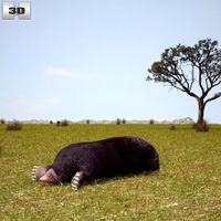
Eastern Mole3d model
...fauna
.max .obj .mb .lwo .fbx .c4d .3ds - eastern mole 3d model, royalty free license available, instant download after purchase.
3d_ocean
$6
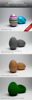
Eastern Egg's
...eastern egg's
3docean
concreate eastern eastern egg egg grass material textures wood
.
3d_ocean
$49

Aero L-39 ZA
...fighter jet l39za slovakia trainer jet trainer of the eastern block, the l-39. with some moveable...
3d_ocean
$12
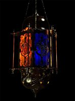
Moroccan/Persia styled Lantern
...east moroccan persian realistic texture a highly detailed middle eastern styled lantern created in maya 2013. materials are provided...
3d_ocean
$7

Gazebo Pergola with Lantern
...however you want to use it) with a middle eastern styled lantern. the gazebo itself is 4000 polygons (.ma,...
3d_ocean
$6
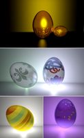
Eggs Set
...eggs set 3docean blue color eastern eastern egg egg faberge eggs golden egg material purple...
3d_ocean
$15
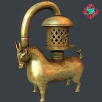
Bronze Bull lamp
...unity virtual reality this model is derived from chinese eastern han dynasty (ad 25 to 220 years) relics –...
3d_ocean
$8

arab moorish minaret low poly building model
...unity urban low poly minaret in north african and eastern mixed style total polygons: 718 clean topology, uv unwrapped...
Network
3d_export
$55
Internet bar 002 3D Model
...communication server data rack computer corporate intranet office internet network servers nodes 3d electronics internet bar 002 3d model...
3d_ocean
$3

Logo Instagram
...instagram 3docean 3d max 3d model instagram logo social network this time we present a simple logo of instagram....
3ddd
$1

Pioneer network audio player N-70A-K
... usb на передней панели, обработкой многобитного сигнала, usb цап и auto sound retriever (черный)
n-70a-k
пульт ду присутствует.
3d_ocean
$12

Iphone 5 cad model
...cell communication computers detailed digital gadget iphone mobile model networkng new phone screen touch detailed cad 3d model was...
3d_ocean
$14
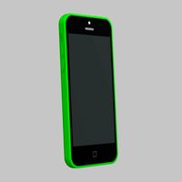
Apple iphone 5c cad model
...3docean apple cad cell computers digital electronic iphone mobile networkng phone radio smartphone touch touchscreen model was ceated with...
3d_ocean
$10

Social and Media Icon Set
...tube 12 modeled icons of different social and media network. created in 3d max...
3d_ocean
$21

60 Web and Social Media 3D Icons
...evernote facebook flickr forrst google icon imdb media mega network pack paypal picasa pixel reddit round sixty skype social...
3d_ocean
$16

Ethernet Cable
...ethernet cable 3docean cable computer electronics ethernet internet network connected ethernet cable 3d...
3d_ocean
$4

Twitter Icon Logo
...bird computer electronics icon internet logo logos media network networkng news social socialmedia twiter twitter exact 3d model of...
3d_ocean
$12

HD WEBCAM
...cam camera com communication conference connection e-business equipment internet network rhino 3d skype streaming technology vision web web connection...
Bay
3ddd
$1
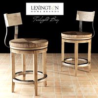
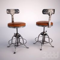
Dalton Counter Stool
...dalton counter stool 3ddd lexington , twilight bay dalton counter stool in twilight bay collection from lexington...
3d_ocean
$7
Lamp 18
...lamp 18 3docean bay bulb cresset illuminator lamp lantern light luminary shine star...
3d_ocean
$12
Lamp 48
...lamp 48 3docean bay bulb cresset illuminator lamp lantern light luminary shine star...
3d_ocean
$5
Lamp 52
...lamp 52 3docean bay bulb cresset illuminator lamp lantern light luminary shine star...
3d_ocean
$69
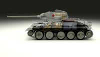
T-34/85 Interior/Engine Bay Full Winter Camo
...nterior and engine bay. the model contains a highly detailed interior(controls, gauges, machine gun, ammo, radio, main gun) an...
3d_ocean
$4
Lamp 45
...lamp 45 3docean bay bulb cresset illuminator lamp lantern light luminary shine star...
3d_ocean
$4

Lamp 47
...lamp 47 3docean bay bulb cresset illuminator lamp lantern light luminary shine star...
3d_ocean
$5

Lamp 07
...lamp 07 3docean bay bulb cresset elephant illuminator lamp lantern light luminary shine...
3d_ocean
$4

Lamp 14
...lamp 14 3docean bay bulb cresset illuminator lamp lantern light luminary shine star...
3d_ocean
$12
Lamp 24
...lamp 24 3docean bay bulb cresset illuminator lamp lantern light luminary shine star...
Francisco
3ddd
$1
SAN FRANCISCO Leds C4
...rancisco leds c4
3ddd
leds c4 , leds-c4
диаметр 600 мм.
текстуры и материалы в комплекте
3ddd
$1
Luceplan Tango
...luceplan tango 3ddd luceplan дизайн: francisco gomez paz...
3d_ocean
$25
Ferry Building
...area building ferry house industrial modern port railway san francisco space station waiting low polygonal 3d model of ferry...
3ddd
$1

Priscilla Side Table
..., приставной столик priscilla side table dimensions diam.360 x h560.http://www.cocorepublic.com.au/furniture-and-homewares/product-listing/oly-san-franciscopriscilla-side-table/ ...
3ddd
$1
Картина в раме: сборник 56. Карта
...чикаго (chicago), карта бостона (boston), карта сан франциско (san francisco. time art 80759kmp-60tmp - состаренные карты, ретро, винтаж. 芬奇美画...
3ddd
$1
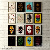
Сборник Картины Skulls Collection by Francisco Valle
... представлены 3 вида рамок - белая глянцевая, черная глянцевая, деревянная.
the collection of paintings in a contemporary style.
3d_ocean
$45

The Golden Gate Bridge
...bridge fence golden gate bridge infrastructure pavement road san francisco street streetlight traffic usa model of the golden gate...
3ddd
free
steampunk chair
...3ddd барный , steampunk стул из interval cafe san francisco ...
3ddd
free
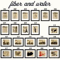
Fiber and Water - City Maps and Skylines
...06 - hello los angeles; 07 - hello san francisco 08 - l' italia; 09 - paris je t'aime;...
3d_export
$60
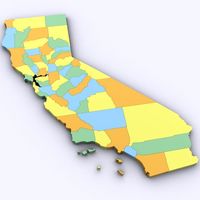
Map of California 3D Model
...of california 3d model 3dexport california los angeles map francisco san diego bernardino county counties political map of california...
Road
3d_export
$300
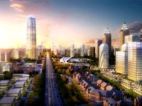
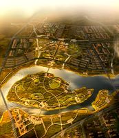
City Plan 007 3D Model 3D Model
...3dexport traffic tree flat tile metro urban structure apartment road plaza office block modular detail high building skyscraper city...
3d_export
$300
City Plan 005 3D Model 3D Model
...3dexport traffic tree flat tile metro urban structure apartment road plaza office block modular detail high building skyscraper city...
3d_export
$150
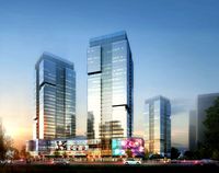
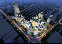
Skyscraper business center 037 3D Model
...3dexport traffic tree flat tile metro urban structure apartment road plaza office block modular detail high building skyscraper city...
3d_export
$150
Skyscraper business center 045 3D Model
...3dexport traffic tree flat tile metro urban structure apartment road plaza office block modular detail high building skyscraper city...
3d_export
$99

Suzuki Jimny 2013 3D Model
...wide sierra 2013 2014 2015 2016 2-door suv crossover off-road 4x4 mini compact small japan japanese suzuki jimny 2013...
3d_export
$20

Realistic Road High Res 5980 x 4248 3D Model
...ine seamless tileable v-ray photorealistic detailed textures
realistic road high res 5980 x 4248 3d model vkmodels 47546 3dexport
3d_export
$99
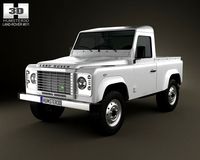
Land Rover Defender 90 pickup 2011 3D Model
...90 british crossover defender england land rover landrover off road land rover defender 90 pickup 2011 3d model humster3d...
3d_export
$99

Hummer H1 wagon 2005 3D Model
...1998 1999 2000 2001 2002 2003 2004 2005 4x4 all-road hummer h1 wagon 2005 3d model humster3d 74301...
3d_export
$150
Cityscape pack vol 1 3D Model
...block new york office store shop plaza us ny road apartment structure urban metro tile flat tree traffic environment...
3d_export
$168
New Taipei City 3D Model
...model 3dexport city asia buildings building taiwan taipei street road house mall hall 3d key race bank hospital traffic...
San
3ddd
$1
SAN FRANCISCO Leds C4
...rancisco leds c4
3ddd
leds c4 , leds-c4
диаметр 600 мм.
текстуры и материалы в комплекте
3d_ocean
$25
Ferry Building
...american area building ferry house industrial modern port railway san francisco space station waiting low polygonal 3d model of...
3ddd
$1
Priscilla Side Table
..., приставной столик priscilla side table dimensions diam.360 x h560.http://www.cocorepublic.com.au/furniture-and-homewares/product-listing/oly-sanfrancisco/priscilla-side-table/ ...
3ddd
$1
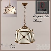
Emporio San Firenze подвес
...emporio san firenze подвес
3ddd
emporio , san firenze
emporio san firenze подвес
3ddd
$1
Картина в раме: сборник 56. Карта
...карта чикаго (chicago), карта бостона (boston), карта сан франциско (san francisco). time art 80759kmp-60tmp - состаренные карты, ретро, винтаж....
3ddd
$1

Мебель для ванной с зеркалом, классика
...3ddd [b]мебель для ванной с зеркалом, классика, материалы vray.[/b][font=comic san ...
3ddd
$1
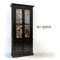
Misendemeure, Bookcase "Albertas" MALB0710
...malb0710 3ddd misendemeure , albertas , книжный , библиотека http://www.misendemeure.com/en/collection/furniture/bookcase/bibliotheque-albertas-san-fond-10744 ...
3ddd
$1
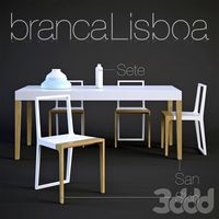
Branca Lisboa (San&Skin)
...; размеры: 350(d)х300(h)
www.branca-lisboa.com
для удобства дополнительно библиотека материалов в комплекте отдельным файлом .mat
3ddd
$1

KOLARZ коллекция SAN DANIELE
...м) 210
высота (мм) 270
глубина (мм) 110
материал металл / стекло
цвет античная бронза / белый сатин
страна производитель австрия
3ddd
$1

Maries Corner San Diego Upholstered
...maries corner san diego upholstered
3ddd
maries corner
текстуры и obj на месте.
Streets
3d_export
$15
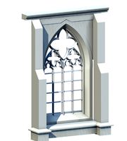
Deutschland Architecture Window001 3D Model
...ieval mediaeval romanesque gothic doric tuscan ionic minoan
deutschland architecture window001 3d model lotusmodel 47433 3dexport
3d_export
$15

Holland Architecture Windows003 3D Model
...medieval mediaeval romanesque gothic doric tuscan ionic minoan
holland architecture windows003 3d model lotusmodel 47480 3dexport
3d_export
$60

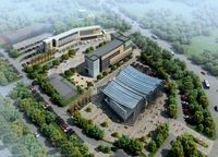
Architecture 051 3D Model
...lege campus max street landscape commercial building medical hospital offices
architecture 051 3d model lotusmodel 47599 3dexport
3d_export
$20
Realistic Road High Res 5980 x 4248 3D Model
...ine seamless tileable v-ray photorealistic detailed textures
realistic road high res 5980 x 4248 3d model vkmodels 47546 3dexport
3d_export
$150
3d building 856 3D Model
...metropolis street block detailed definition realistic skyscraper huge collection
3d building 856 3d model kanhtart 46852 3dexport
3d_export
$15

Holland Architecture Windows001 3D Model
...medieval mediaeval romanesque gothic doric tuscan ionic minoan
holland architecture windows001 3d model lotusmodel 47478 3dexport
3d_export
$15

Holland Architecture Door003 3D Model
...re medieval mediaeval romanesque gothic doric tuscan ionic minoan
holland architecture door003 3d model lotusmodel 47475 3dexport
3d_export
$150
3d building 870 3D Model
...metropolis street block detailed definition realistic skyscraper huge collection
3d building 870 3d model kanhtart 46868 3dexport
3d_export
$150

3d building 845 3D Model
...metropolis street block detailed definition realistic skyscraper huge collection
3d building 845 3d model kanhtart 46836 3dexport
3d_export
$60
Architecture 032 3D Model
...lege campus max street landscape commercial building medical hospital offices
architecture 032 3d model lotusmodel 47578 3dexport
Side
design_connected
$11

Ring Side Tables
...ring side tables
designconnected
minotti ring side tables computer generated 3d model.
design_connected
$13

Ellis Side Tables
...ellis side tables
designconnected
minotti ellis side tables computer generated 3d model. designed by dordoni, rodolfo.
design_connected
free

Androgyne Side Table
...androgyne side table
designconnected
free 3d model of androgyne side table by menu designed by siggerud, danielle.
3d_export
$25
Contemporary Side Chair 12 3D Model
...2 3d model
3dexport
chair armless modern contemporary seating furniture
contemporary side chair 12 3d model cgaxis 29702 3dexport
3d_export
$30
Villa 209 3D Model
...collection neighborhood stucco homes custom midwest suburban architecture building residetial suburbs two story vinyl siding house set villa 209...
3d_export
$30
Villa 200 3D Model
...collection neighborhood stucco homes custom midwest suburban architecture building residetial suburbs two story vinyl siding house set villa 200...
3d_export
$30
Villa 168 3D Model
...collection neighborhood stucco homes custom midwest suburban architecture building residetial suburbs two story vinyl siding house set villa 168...
3d_export
$30

Villa 205 3D Model
...collection neighborhood stucco homes custom midwest suburban architecture building residetial suburbs two story vinyl siding house set villa 205...
3d_export
$30

Villa 158 3D Model
...collection neighborhood stucco homes custom midwest suburban architecture building residetial suburbs two story vinyl siding house set villa 158...
3d_export
$30
Villa 215 3D Model
...collection neighborhood stucco homes custom midwest suburban architecture building residetial suburbs two story vinyl siding house set villa 215...