CG Trader
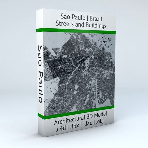
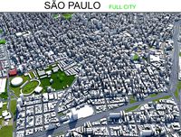
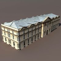
Sao Paulo Streets and Buildings
by CG Trader
Last crawled date: 1 year, 9 months ago
UPDATE – May 30, 2018 .3ds version removed .dxf version added .blend version added 12 building groups (8 in the older version) for more variety much larger area covered with slightly less polygons and points/vertex (better optimized) this 3D model is now compatible with the Sao Paulo Road Network 3D Model - https://www.cgtrader.com/3d-models/architectural/street/sao-paulo-road-network-and-streets POINTS/VERTS : 8255432
POLYGONS : 6622667 .c4d - native format
- .fbx - v7.1
- .dae - v1.5
- .dxf
- .obj .blend Old files still available on purchase.
————————————————— - this model is based on real data therefore this is a realistic buildings and streets setup of Sao Paulo Downtown area and its surroundings, Brazil
- 8 building groups are setup so that you can add variety to buildings (color materials and/or textures) Groups can be turned off/on
- UV mapped with overlapping UVs
- the model is positioned on a flat surface (all buildings are on the “floor” - no elevation data included)
- geometry is polygonal quads and tris
- model is untextured and renders fast
- this 3D model is/can be licensed (commercial use is fine) under Creative Commons Attribution-ShareALike 2.0 (CC-BY-SA) license
- buildings and streets data from OpenStreetMap / www.openstreetmap.org Attribution : © OpenStreetMap contributors / http://www.openstreetmap.org/copyright POINTS/VERTS : 8314574
POLYGONS : 7075540 - .c4d - native format
- .3ds
- .fbx - v7.1
- .dae - v1.5
- .obj sao paulo brazil brasil brasilia south america buildings streets map cartography city gps navigation roads squares realistic topological topology street architectural architectural street city street city buildings city map city street city streets
Similar models
3dwarehouse
free

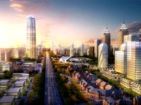
future Building in Sao Paulo
...future building in sao paulo
3dwarehouse
future building in sao paulo
3dwarehouse
free

Sao Paulo future Building
...sao paulo future building
3dwarehouse
sao paulo future building #sao_paulo_future_building
cg_trader
$12

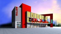
Sao Paulo Futebol Clube | 3D
...sao paulo futebol clube | 3d
cg trader
sao paulo
cg_trader
$29

Sao Paulo Road Network and Streets
...navigation roads squares realistic topological topology street architectural street city street city map city street city streets
cg_trader
$10

POSTE TIPO 16 - Sao Paulo - Brazil - 3D PRINT READY | 3D
... - 3d print ready | 3d
cg trader
this is an model for 3d printing of an antique light post of the streets of são paulo - brazil.
cg_trader
free

Trees street sao paulo
...trees street sao paulo
cg trader
trees are the street london london tree plant street trees outdoor leaf
3dwarehouse
free

Torre Sao Paulo
...torre sao paulo
3dwarehouse
torre sao paulo #sao_paulo
3dwarehouse
free

anhembi hotel
...anhembi hotel
3dwarehouse
sao paulo buildings
3dwarehouse
free

FOTO SAO PAULO
...foto sao paulo
3dwarehouse
foto sao paulo #foto_sao_paulo #praça_sao_salvador
3dwarehouse
free

LOGO SAO PAULO PLAZA
...logo sao paulo plaza
3dwarehouse
logo sao paulo plaza
Sao
3d_export
$9

Sao Tome and Principe flag 3D Model
...bric cloth rope realistic standard association organization goverment
sao tome and principe flag 3d model rmodeler 38351 3dexport
3d_export
$15

Flag of sao tome and principe
...rmats<br>3ds max 2017<br>3ds max 2020<br>3ds max 2023<br>obj (multi format)<br>fbx ( multi format )
3d_export
$15

Flag of sao tome and principe 02
...rmats<br>3ds max 2017<br>3ds max 2020<br>3ds max 2023<br>obj (multi format)<br>fbx ( multi format )
3d_export
$10
my heart beats like yours estudio guto requena
...cenografia<br>video<br>filmes para bailar<br>acknowledges<br>foxlab, museu da diversidade, intel, prefeitura de sao paulo<br>size 11.700*5.800*6600h mm<br>dimension: https://www.archdaily.com/912319/my-heart-beats-like-yours-estudio-guto-requena/5c8717f1284dd106bb00006d-my-heart-beats-like-yours-estudio-guto-requena-detail<br>text description provided by the architects.<br>sao...
3d_export
free

tempered sword from sao
...tempered sword from sao
3dexport
tempered sword from sword art online
3d_export
$10

sao swords- espadas sao
...ao, it has subdivisions, it does not have textures. /modelos de las espadas del anime sao, tiene subdivisones, no tiene texturas.
3d_export
free
swords sao
...swords sao
3dexport
3d_export
$99

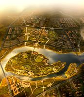
Sao Paulo downtown city brazil 30km
...ses.<br>note: some city we used our own ai tool to generate buildings, therefore shapes may be little varied from original.
3d_export
$39

sao tome and principe flag pack
...r the sake of convenience.<br>for any problems please feel free to contact me.<br>don't forget to rate and enjoy!
turbosquid
$5

Elucidator from SAO
...royalty free 3d model elucidator from sao for download as fbx on turbosquid: 3d models for games, architecture, videos. (1230375)
Paulo
3ddd
$1
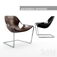
Paulistano
...x w 70 x d 70 см designed by paulo mendes da...
3d_ocean
$20
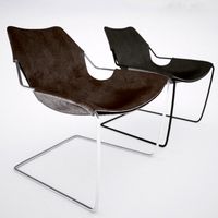
Paulistano armchair
...modern modernist obj scanline textures vray paulistano armchair by paulo mendes da rocha. 1957. both black and brown leather...
3ddd
$1
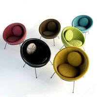
Lina Bo Bardi Bowl Chair Set
...she went on to complete her residence in são paulo the casa de vidro. it was not until 1953...
3ddd
$1

Чайный сервиз Nasty Set
...чайник , чашка чайный сервиз nasty set дизайнер: jose paulo alves...
3ddd
$1
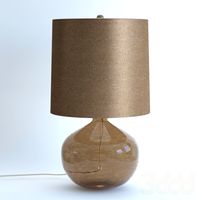
Arteriors Paulo Lamp
...arteriors paulo lamp
3ddd
arteriors
#46838-206
paulo lamp
h: 60.96cm dia: 33.02cm
3d_export
$199
so paulo city brazil 90km
...t;1. suitable for games, games, education, architecture etc.<br>2. mainly used for town and urban planning, real estate etc
3d_export
$10
my heart beats like yours estudio guto requena
...between public urban furniture and sculpture, set in sao paulos iconic praca da republica, where the first meeting of...
3d_export
free
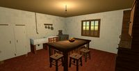
Old kitchen
...aguirre v.<br>- 3d modeling program <br>.<br>- textures by joão paulo <br>.<br>*you can watch this 3d model by dowloading the...
3d_export
$99
Sao Paulo downtown city brazil 30km
...ses.<br>note: some city we used our own ai tool to generate buildings, therefore shapes may be little varied from original.
design_connected
$16

Paulistano armchair
...paulistano armchair computer generated 3d model. designed by mendes, paulo ...
Streets
3d_export
$15
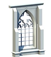
Deutschland Architecture Window001 3D Model
...ieval mediaeval romanesque gothic doric tuscan ionic minoan
deutschland architecture window001 3d model lotusmodel 47433 3dexport
3d_export
$15

Holland Architecture Windows003 3D Model
...medieval mediaeval romanesque gothic doric tuscan ionic minoan
holland architecture windows003 3d model lotusmodel 47480 3dexport
3d_export
$60

Architecture 051 3D Model
...lege campus max street landscape commercial building medical hospital offices
architecture 051 3d model lotusmodel 47599 3dexport
3d_export
$20

Realistic Road High Res 5980 x 4248 3D Model
...ine seamless tileable v-ray photorealistic detailed textures
realistic road high res 5980 x 4248 3d model vkmodels 47546 3dexport
3d_export
$150
3d building 856 3D Model
...metropolis street block detailed definition realistic skyscraper huge collection
3d building 856 3d model kanhtart 46852 3dexport
3d_export
$15

Holland Architecture Windows001 3D Model
...medieval mediaeval romanesque gothic doric tuscan ionic minoan
holland architecture windows001 3d model lotusmodel 47478 3dexport
3d_export
$15

Holland Architecture Door003 3D Model
...re medieval mediaeval romanesque gothic doric tuscan ionic minoan
holland architecture door003 3d model lotusmodel 47475 3dexport
3d_export
$150
3d building 870 3D Model
...metropolis street block detailed definition realistic skyscraper huge collection
3d building 870 3d model kanhtart 46868 3dexport
3d_export
$150

3d building 845 3D Model
...metropolis street block detailed definition realistic skyscraper huge collection
3d building 845 3d model kanhtart 46836 3dexport
3d_export
$60
Architecture 032 3D Model
...lege campus max street landscape commercial building medical hospital offices
architecture 032 3d model lotusmodel 47578 3dexport
Buildings
3d_export
$25
Apartment House 106 Low Poly 3d Model 3D Model
...rior model home old windows background house noeclassical
apartment house 106 low poly 3d model 3d model cerebrate 90493 3dexport
3d_export
$300
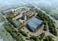
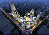
City Plan 007 3D Model 3D Model
...ent road plaza office block modular detail high building skyscraper city
city plan 007 3d model 3d model abemakoto 90638 3dexport
3d_export
$300
City Plan 005 3D Model 3D Model
...ent road plaza office block modular detail high building skyscraper city
city plan 005 3d model 3d model abemakoto 90589 3dexport
3d_export
$150
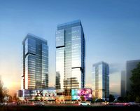
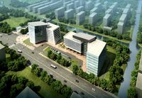
Skyscraper business center 037 3D Model
... plaza office block modular detail high building skyscraper city
skyscraper business center 037 3d model abemakoto 90959 3dexport
3d_export
$150
Skyscraper business center 045 3D Model
... plaza office block modular detail high building skyscraper city
skyscraper business center 045 3d model abemakoto 90970 3dexport
3d_export
$199

Stadium Level 6 Day 3D Model
...ty architecture element block gameready unity lowpoly football upgrade people
stadium level 6 day 3d model fabelar 90971 3dexport
3d_export
$5

Building 3D Model
...building 3d model
3dexport
building 3d model lingesh 71878 3dexport
3d_export
$25

3D Models Mixed Use Building 70 3D Model
...op condo mixed use multi story city game ready vray scanline max
3d models mixed use building 70 3d model vkmodels 71944 3dexport
3d_export
$55
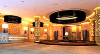
Lobby 049 3D Model
... entrance hall antechamber vestibule entry foyer business centre office center building
lobby 049 3d model pupuhol 56090 3dexport
3d_export
$25
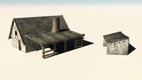
Blacksmiths Cottage 3D Model
...labour labor hammer anvil metalwork steel iron ironmonger casting metal
blacksmiths cottage 3d model archaeodesign 32620 3dexport