Similar models
3d_ocean
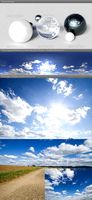
$15
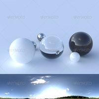
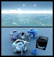
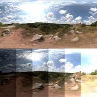
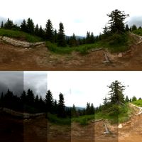
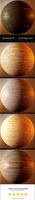
HDRI spherical panorama - 1823- clear sky
... .hdr-file, a .exr-file and a .ldr file of the image (as .jpeg). the environment is a 360° panorama in horizontal and 180° in ...
3d_ocean
$25
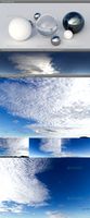
HDRI spherical sky panorama -1548- blue sky clouds
...lue sky (time: 15:48) with beautiful cirrocumulus clouds. the texture has a super high resolution of 10000×5000 pixel and can ...
3d_ocean
$25

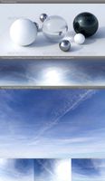
HDRI spherical sky panorama -1556- sun noon clouds
...nny noon sky (time: 15:56) with nice little clouds. many backplates of this sky also included! the panoramic texture has a sup...
3d_ocean
$25
HDRI spherical sky panorama -1421- summer daylight
...r midday sky (time: 14:21) with beautiful summer clouds and some visible condensation trails. the texture has a super high res...
3d_ocean
$20
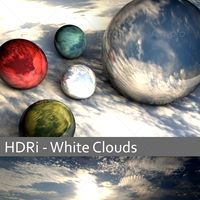
HDRi - White Clouds
...
3docean
clouds exr hdr hdri panaroma sky sun
hdri panorama in .exr and .hdr format for use in 3d scenes. resolution : 11896×2602
3d_ocean
$25

HDRI spherical sky panorama -1532- blue sun sky
...lue summer sky (time: 15:32) with some few clouds. the texture has a super high resolution of 10000×5000 pixel and can be used...
3d_ocean
$15
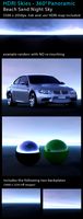
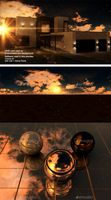
Night Sky - Beach Sand
... sky lighting map is designed to simulate a real world environment, perfect for product and architectural renders alike. this ...
3d_ocean
$49

Clear Sky Pack - Timelapse 16 EXR/HDR pics
... each pic shows hour per hour of the day. from a beautiful dawn with its wide range of lights & shadows to a dusk. it will...
3d_ocean
$25
HDRI spherical sky panorama -1547- sun clouds
...utiful sky with summer clouds (time: 15:47). texture has a high resolution of 10000×5000 pixel and can be used as skydome for ...
3d_ocean
$25

HDRI IBL 1215 Blue Noon Sky
...noon) - sun angle is 31.5 degrees (0° is on the horizon, 90° is straight overhead) - full spherical skydome panorama but every...
Skymap
3d_ocean
$25
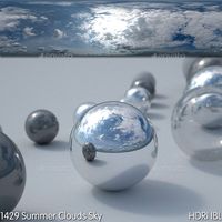
HDRI IBL 1429 Summer Clouds
...3docean blue clouds cloudy exr hdr hdri openexr panorama skymap hdri ibl 1429 summer clouds info: - time of...
3d_ocean
$25
HDRI IBL 1215 Blue Noon Sky
...3docean blue clouds exr hdr noon panorama sky skydome skymap sun hdri ibl 1215 blue noon sky info: -...
3d_export
$10
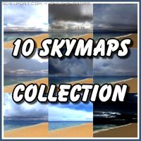
10 Skymaps Collection 3D Model
...dy weather storm sun sunny sunset texture collection game ready
10 skymaps collection 3d model tronitecgamestudios 28198 3dexport
3d_export
$18
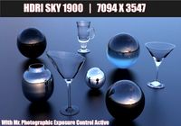
HDR 1900 Spherical Sky 3D Model
...high dynamic range image hdr exr sun up dust skymap sky map hdr 1900 spherical sky 3d model sickleadzdk...
3d_export
$5

Skybox Valley Hills 3D Model
...panoramic quicktime vr rendering seamless single files sky skybox skymap spheremap strip stripfile skybox valley hills 3d model hafgandil...
3d_export
$11

Morning Cloudy Skybox 3D Model
...skybox 3d model 3dexport cloudy sky box skybox map skymap morning game ready seamless morning cloudy skybox 3d model...
blendswap
free

P51_Mustang
...pallet website, background sky was adapted from a free skymap from blender artists. a camera pass animation has been...
blendswap
free

Mitsubishi Zero
...pallet website, background sky was adapted from a free skymap from blender artists. a camera pass animation has been...
blendswap
free

ME 109
...pallet website, background sky was adapted from a free skymap from blender artists. again some basic compositing has been...
15000
3ddd
$1

Вернисаж / Оскар
...категория, основа - кожзам: оригами милк (артэго).габариты (глxдxв, см):88x193x89.стоимость ~15000 ...
3ddd
$1

Saccaro
...saccaro 3ddd saccaro кресло saccaro armchair. 15000 полигонов. складки -...
3d_ocean
$10
Charles Eames DSW Chair 1948
...dsw from 1948. two versions: -highpoly ~72000 polygons. -lowpoly ~15000 polygons. including .mxs next limit maxwell render 2.x files...
3ddd
$1

Унитаз приставной Kerasan Waldorf 4116
...3ddd kerasan , waldorf , приставной , унитаз polys: 15000 fbx model...
3ddd
$1

Olympia Crono 0280011 _ toilet sink + bidet
..., унитаз унитаз и биде olympia crono 0280011 polys: 15000 fbx model...
3ddd
free

Настенная мозаика DaVinci
...с ней). в архиве две модели - под сглаживание (15000 полигонов + поверх одна рендер итерация turbosmooth), и простые...
3ddd
free

Стул Colombo Stile
...stile кресло colombo stile стек не свернут. вес модели 15000 полигонов коллекция decodieci...
3ddd
free
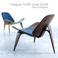
Wegner CH07 Shell Chair
...d | 36 w | seat: 15 h polys: 15000 textures:...
3ddd
$1

Slamp - veli suspension prisma
...slamp - veli suspension prisma 3ddd slamp 15000 полигонов + turbosmooth сайт:...
3ddd
$1
Leolux Tam -Tam / Bongo
...включая имитирующее металл покрытие. количество треугольников одного объекта около 15000 материалы + текстуры...
Exr
3d_ocean
$15
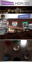
ED Exterior HDR 002 - Night City HDR
...002 - night city hdr 3docean clouds cloudy dramatic exr hdr hdri highres moody night panorama skydome sun hdr...
3d_ocean
$15

ED Exterior HDR 006 - Night Sky
...hdr 006 - night sky 3docean clouds cloudy dramatic exr hdr hdri highres moody night panorama skydome sun hdr...
3d_ocean
$9

HDRI Morning Sun V1
...format: this file is in the following formats: hdr exr jpg resolution: this file is 4128×1932 pixels. it is...
3d_ocean
$9

Cloudy Sun V1
...cloudy sun v1 3docean blue clouds cloudy day dramatic exr fog hdri highres moody morning panorama sky sun sunrise...
3d_ocean
$25
HDR IBL : Thin Swirl Clouds Dusk
...swirl clouds dusk spherical environment map extension : .hdr, .exr .jpg resolution :...
3d_ocean
$25
HDR-IBL : Day Soft Light with Clouds
...light with clouds spherical environment map extension : .hdr, .exr .jpg resolution :...
3d_ocean
$9
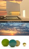
HDRI Morning SunSet V1
...hdri morning sunset v1 3docean blue clear exr haze hdr hdri hi res high resolution horizon morning...
3d_ocean
$9
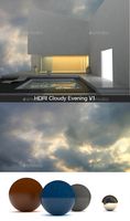
Cloudy Evening V1
...bad weather blue sky cg cloudy dark environment evening exr gi hdr hdri keyshot light lighting panorama rain rendering...
3d_ocean
$9
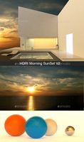
HDRI Morning SunSet V2
...format: this file is in the following formats: hdr exr jpg resolution: this file is 4128×2083 pixels. it is...
3d_ocean
$25
HDRi - 003 - Landscape with trees in high quality
...high quality highres jpg landscape light lighting lightmap nature openexr panorama radiance reflection reflective skydome sun texture tree description:...
Highres
3d_ocean
$15
Ocean Blue Clouds 7 - HDRI
...background blue clouds cloudy dawn deep grey hdr hdri highres liquid ocean overcast panorama red refraction relaxation sea skydome...
3d_ocean
$15
Sunset Desert 40
...sunset desert 40 3docean blue clouds cloudy dawn field highres overcast panorama reflection refraction rock skydome sun white cg...
3d_ocean
$15
ED Exterior HDR 002 - Night City HDR
...city hdr 3docean clouds cloudy dramatic exr hdr hdri highres moody night panorama skydome sun hdr format for use...
3d_ocean
$15
ED Exterior HDR 006 - Night Sky
...night sky 3docean clouds cloudy dramatic exr hdr hdri highres moody night panorama skydome sun hdr format for use...
3d_ocean
$9
Cloudy Sun V1
...3docean blue clouds cloudy day dramatic exr fog hdri highres moody morning panorama sky sun sunrise sunset this is...
3d_ocean
$15

Ocean Blue Clouds 10 - HDRI
...background blue clouds cloudy dawn deep grey hdr hdri highres liquid ocean overcast panorama red refraction relaxation sea skydome...
3d_ocean
$15
Sunset Desert 46
...sunset desert 46 3docean blue clouds cloudy dawn field highres overcast panorama reflection refraction rock skydome sun white cg...
3d_ocean
$15

Dusk Desert 9
...dusk desert 9 3docean blue clouds cloudy dawn field highres overcast panorama reflection refraction rock skydome sun white cg...
3d_ocean
$60

HDRI Pack - Desert vol7
...- desert vol7 3docean blue clouds cloudy dawn field highres overcast panorama reflection refraction rock skydome sun white cg...
3d_ocean
$15

HDRI Pack - Desert vol5
...- desert vol5 3docean blue clouds cloudy dawn field highres overcast panorama reflection refraction rock skydome sun white cg...
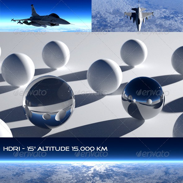
Altitude
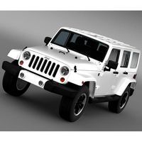
3d_ocean
$85
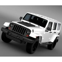
Jeep Wrangler Unlimited Altitude 2014
...tude 2014 (the jeep wrangler is a compact four-wheel drive off-road and sport utility vehicle (suv), manufactured by american ...
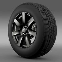
3d_ocean
$18

Jeep Wrangler Anlimited Altitude 2014 rim
...14 rim. model has got physically accurate materials. it is separated on parts and they are correctly named. so it is easy to u...
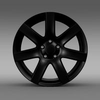
3d_ocean
$20

Jeep Wrangler Anlimited Altitude 2014 wheel
...el. model is created in real units of measurement. model with physically accurate materials. model is separated on parts and c...
3d_ocean
$85
Jeep Wrangler Unlimited Altitude 2012
...tude 2012 (the jeep wrangler is a compact four-wheel drive off-road and sport utility vehicle (suv), manufactured by american ...
3d_export
$30
Jeep Wrangler Anlimited Altitude 2014 wheel 3D Model
...tyre brake brakes vehicle part of avto car
jeep wrangler anlimited altitude 2014 wheel 3d model creativeideastudio 80462 3dexport
cg_studio
$89

Jeep Wrangler Unlimited Altitude 20123d model
... .mb .obj .xsi - jeep wrangler unlimited altitude 2012 3d model, royalty free license available, instant download after purchase.
3ddd
$1

Decorative wall
.../ height from floor to tv 70 / tv altitude 74 / height to a ceiling...
cg_studio
$89

Jeep Wrangler Unlimited Altitude 20143d model
... .mb .obj .xsi - jeep wrangler unlimited altitude 2014 3d model, royalty free license available, instant download after purchase.
cg_studio
$20
Jeep Wrangler Anlimited Altitude 2014 rim3d model
...i .obj .mb - jeep wrangler anlimited altitude 2014 rim 3d model, royalty free license available, instant download after purchase.
Skydome
3d_export
free

Download free HDRI building site 2 3D Model
...street city morning 3d hdr hdri spherical panorama environment skydome dome light hdri building site 2 3d model fabelar...
3d_ocean
$15
Ocean Blue Clouds 7 - HDRI
...highres liquid ocean overcast panorama red refraction relaxation sea skydome sunbeams under vfxtesthub water white yellow skydome panorama of...
3d_ocean
$15
Sunset Desert 40
...cloudy dawn field highres overcast panorama reflection refraction rock skydome sun white cg hdri view 180/360 (8000×4000 px), for...
3d_ocean
$15
ED Exterior HDR 002 - Night City HDR
...cloudy dramatic exr hdr hdri highres moody night panorama skydome sun hdr format for use as a spherical environment...
3d_ocean
$15
ED Exterior HDR 006 - Night Sky
...cloudy dramatic exr hdr hdri highres moody night panorama skydome sun hdr format for use as a spherical environment...
3d_ocean
$9
HDRI Morning Sun V1
...hdri himmel lighting morning outside panorama rain rendering sky skydome spheric spherical sunny textur texture this is a morning...
3d_ocean
$15
Ocean Blue Clouds 10 - HDRI
...highres liquid ocean overcast panorama red refraction relaxation sea skydome sunbeams under vfxtesthub water white yellow skydome panorama of...
3d_ocean
$15
Sunset Desert 46
...cloudy dawn field highres overcast panorama reflection refraction rock skydome sun white cg hdri view 180/360 (8000×4000 px), for...
3d_ocean
$9

Sunset or Overcast High Resolution HDRi
...high lights moody overcast panorama quality resolution setup sky skydome sun sunset description: hdr skydome in .hdr format to...
3d_ocean
$9
HDRI Morning SunSet V1
...hdri hi res high resolution horizon morning panorama sky skydome sun sunset vray this is a morning sunset v1...
Panorama
3d_export
$25
CGAxis HDRI Maps 05 08 3D Model
...high dynamic range image map maps spherical rendering lighting panorama 360 envinronment reflection outdoor hill canion rock cgaxis hdri...
3d_export
$25
CGAxis HDRI Maps 05 03 3D Model
...high dynamic range image map maps spherical rendering lighting panorama 360 envinronment reflection outdoor forest mountains tree cgaxis hdri...
3d_export
free
Download free HDRI building site 2 3D Model
...rest walk street city morning 3d hdr hdri spherical panorama environment skydome dome light hdri building site 2 3d...
3d_ocean
$15
Ocean Blue Clouds 7 - HDRI
...dawn deep grey hdr hdri highres liquid ocean overcast panorama red refraction relaxation sea skydome sunbeams under vfxtesthub water...
3d_ocean
$15
Sunset Desert 40
...40 3docean blue clouds cloudy dawn field highres overcast panorama reflection refraction rock skydome sun white cg hdri view...
3d_ocean
$15
ED Exterior HDR 002 - Night City HDR
...clouds cloudy dramatic exr hdr hdri highres moody night panorama skydome sun hdr format for use as a spherical...
3d_ocean
$15
ED Exterior HDR 006 - Night Sky
...clouds cloudy dramatic exr hdr hdri highres moody night panorama skydome sun hdr format for use as a spherical...
3d_ocean
$9
HDRI Morning Sun V1
...dome environment gi hdr hdri himmel lighting morning outside panorama rain rendering sky skydome spheric spherical sunny textur texture...
3d_ocean
$9
Cloudy Sun V1
...cloudy day dramatic exr fog hdri highres moody morning panorama sky sun sunrise sunset this is a cloudy sun...
3d_ocean
$15
Ocean Blue Clouds 10 - HDRI
...dawn deep grey hdr hdri highres liquid ocean overcast panorama red refraction relaxation sea skydome sunbeams under vfxtesthub water...
Hdr
3d_export
$19

HDR 042 Acre sIBL 3D Model
...field trees horizon afternoon sunset acre environment reflection map resolution
hdr 042 acre sibl 3d model hdrihub 64482 3dexport
3d_export
$25
CGAxis HDRI Maps 05 08 3D Model
...ring lighting panorama 360 envinronment reflection outdoor hill canion rock
cgaxis hdri maps 05 08 3d model cgaxis 59412 3dexport
3d_export
$25
CGAxis HDRI Maps 05 03 3D Model
...lighting panorama 360 envinronment reflection outdoor forest mountains tree
cgaxis hdri maps 05 03 3d model cgaxis 59377 3dexport
3d_export
free
Download free HDRI building site 2 3D Model
...t city morning 3d hdr hdri spherical panorama environment skydome dome light
hdri building site 2 3d model fabelar 53126 3dexport
3d_ocean
$15
Ocean Blue Clouds 7 - HDRI
...al environment or light source in 3d scenes. it includes a 6000×3000 pixels high dynamic range image (hdri) and a 3000...
3d_ocean
$15
ED Exterior HDR 002 - Night City HDR
...dome was virtually rendered to have a very high dynamic range for great looking realistic shadows from the sun! 6000px wide, g...
3d_ocean
$15
ED Exterior HDR 006 - Night Sky
...dome was virtually rendered to have a very high dynamic range for great looking realistic shadows from the sun! 6000px wide, g...
3d_ocean
$9
HDRI Morning Sun V1
...ojects. format: this file is in the following formats: hdr exr jpg resolution: this file is 4128×1932 pixels. it is 32 bit color.
3d_ocean
$9
Cloudy Sun V1
...sun sunrise sunset this is a cloudy sun v1 hdr you can use on your projects. format: this file...
3d_ocean
$15
Ocean Blue Clouds 10 - HDRI
...vironment or light source in 3d scenes. *this product is ideal for realistic architectural renders. it includes a 6000...
Clouds
3d_ocean
$15
Ocean Blue Clouds 7 - HDRI
...al environment or light source in 3d scenes. it includes a 6000×3000 pixels high dynamic range image (hdri) and a 3000...
3d_ocean
$9

Low Poly Motel
...apartment architecture box boxes brick building car city cloud clouds exterior factory home house industrial industry low low poly...
3d_ocean
$15
Sunset Desert 40
...sunset desert 40 3docean blue clouds cloudy dawn field highres overcast panorama reflection refraction rock...
3d_ocean
$15
ED Exterior HDR 002 - Night City HDR
...ed exterior hdr 002 - night city hdr 3docean clouds cloudy dramatic exr hdr hdri highres moody night panorama...
3d_ocean
$15
ED Exterior HDR 006 - Night Sky
...ed exterior hdr 006 - night sky 3docean clouds cloudy dramatic exr hdr hdri highres moody night panorama...
3d_ocean
$9
HDRI Morning Sun V1
...hdri morning sun v1 3docean blue sky clouds day dome environment gi hdr hdri himmel lighting morning...
3d_ocean
$9
Cloudy Sun V1
...cloudy sun v1 3docean blue clouds cloudy day dramatic exr fog hdri highres moody morning...
3d_ocean
$15
Ocean Blue Clouds 10 - HDRI
...vironment or light source in 3d scenes. *this product is ideal for realistic architectural renders. it includes a 6000...
3d_ocean
$15
Sunset Desert 46
...sunset desert 46 3docean blue clouds cloudy dawn field highres overcast panorama reflection refraction rock...
3d_ocean
$9
Sunset or Overcast High Resolution HDRi
...sunset or overcast high resolution hdri 3docean architecture clouds cloudy dramatic great hdr hdri high lights moody overcast...
Airliner
3d_export
$65
News Helicopter 3D Model
...news helicopter 3d model 3dexport aircraft airplane commercial jet airliner civilian flight vehicle transportation helicopter news r44 news helicopter...
3d_export
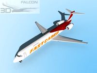
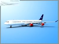
$95

Falcon3D A319 United Airlines 2 3D Model
...a319 united airlines 2 3d model 3dexport airplane aircraft airliner plane transport commercial passenger modern twin jet civil civilian...
3d_export
$95

Falcon3D A340 600 Pacific Charters 3D Model
...a340 600 pacific charters 3d model 3dexport airplane aircraft airliner plane transport commercial passenger modern twin jet civil civilian...
3d_export
$95
Falcon3D MD 80 Hawaiian 3D Model
...md 80 hawaiian 3d model 3dexport airplane airplanes aircraft airliner civil commercial passenger freight cargo corporate mcdonnell douglas us...
3d_export
$65
Aircraft 737 3D Model
...aircraft 737 3d model 3dexport aircraft airplane commercial jet airliner civilian flight vehicle transportation aircraft 737 3d model vanishingpoint...
3d_export
$95
Falcon3D MD 80 Fast Cargo 3D Model
...80 fast cargo 3d model 3dexport airplane airplanes aircraft airliner civil commercial passenger freight cargo corporate mcdonnell douglas us...
3d_export
$50
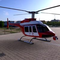
Bell 407 Jetranger 3D Model
...407 jetranger 3d model 3dexport aircraft airplane commercial jet airliner civilian flight vehicle transportation helicopter bell 407 jetranger 3d...
3d_export
$95

Falcon3D A340 600 Virgin Atlantic 3D Model
...a340 600 virgin atlantic 3d model 3dexport airplane aircraft airliner plane transport commercial passenger modern twin jet civil civilian...
3d_export
$95

Falcon3D A340 600 World Charters 3D Model
...a340 600 world charters 3d model 3dexport airplane aircraft airliner plane transport commercial passenger modern twin jet civil civilian...
3d_export
$95
Falcon3D A340 600 SAS 3D Model
...falcon3d a340 600 sas 3d model 3dexport airplane aircraft airliner plane transport commercial passenger modern twin jet civil civilian...
Combat
3d_export
$5
Soldier 3D Model
...soldier 3d model 3dexport realistic soldier zbrush combat human man soldier 3d model vana 73912...
3d_export
$40

Ucav 3D Model
...ucav 3d model 3dexport unmanned air vehicle ucav uav combat drones drone fighter ucav 3d model tartino 6835...
3d_export
$13
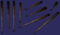
Barbed Bat 3D Model
...bat 3d model 3dexport bat barbed-bat barbed-wire zombie zombie-apocalypse combat melee hand-to-hand extreme fighting apocalypse armageddon wood wooden barbed...
3d_export
free
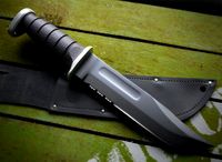
Download free KA BAR USMC combat knife black 3D Model
...e blade weapon tactical military gun modern war human accessory
ka bar usmc combat knife black 3d model anton.dddv 88777 3dexport
3d_ocean
$9
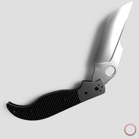
Folding Pocket Knife
...folding pocket knife 3docean army blade combat dagger ergonomic fight folding game high knife melee military...
3d_export
$60

Gundam wings suit 3D Model
...model 3dexport mobile suit custom robot mech anime manga combat military mecha wings gundam wing sword gundam wings suit...
3d_export
$15
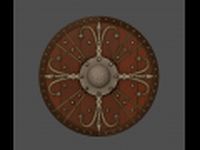
Ornamented shield 3D Model
...melee medieval weapon knight defence warrior war fight battle combat military ornamented shield 3d model download .c4d .max .obj...
3d_export
$99

Remington Model 870 3D Model
...remington model 870 3d model 3dexport remington model 870 combat shotgun shot gun pump semi automatic us american weapon...
3d_export
$25
Cybertech V1 Drone 3D Model
...model 3dexport spaceship starship warship spy fighter drone self combat speeder cybertech v1 drone 3d model download .c4d .max...
3d_export
$15

War Hammer 3D Model
...3d model 3dexport hammer war warhammer medieval knight weapon combat gameready fight military melee war hammer 3d model download...
Sky
3d_export
$19
HDR 042 Acre sIBL 3D Model
...042 acre sibl 3d model 3dexport hdr sibl blue sky clear field trees horizon afternoon sunset acre environment reflection...
3d_export
$30

Kite rigged 2 3D Model
...3d model 3dexport kite toy tethered aircraft fly wind sky child children kid hobby cometa detailed rigged kite rigged...
3d_ocean
$5
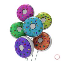
Donut Balloon
...globe happy holiday homer kid meat party shape simpson sky up valentine - preview image rendered using keyshot. scene...
3d_ocean
$15
ED Exterior HDR 006 - Night Sky
...dome was virtually rendered to have a very high dynamic range for great looking realistic shadows from the sun! 6000px wide, g...
3d_ocean
$15
Low poly solar system
...motion motion design planet planets polygonal polygons render simple sky solar solar system space sun universe low poly solar...
3d_ocean
$9
HDRI Morning Sun V1
...hdri himmel lighting morning outside panorama rain rendering sky skyome spheric spherical sunny textur texture this is a morning...
3d_ocean
$9
Cloudy Sun V1
...day dramatic exr fog hdri highres moody morning panorama sky sun sunrise sunset this is a cloudy sun v1...
3d_ocean
$9
Sunset or Overcast High Resolution HDRi
...high lights moody overcast panorama quality resolution setup sky skyome sun sunset description: hdr skydome in .hdr format to...
3d_ocean
$25
HDR IBL : Thin Swirl Clouds Dusk
...thin swirl clouds dusk 3docean dusk hdr ibl mstudio sky hdr ibl : thin swirl clouds dusk spherical environment...
3d_ocean
$25
HDR-IBL : Day Soft Light with Clouds
...soft light with clouds 3docean daylight hdr ibl mstudio sky hdr-ibl : day soft light with clouds spherical environment...
180
3ddd
$1
carpanese bed
...bed 3ddd carpanese art. 6089-29-9051 letto imbottito misure interne 180 x 200 padded bed internal measures 180 x 200...
3ddd
$1

XVL / Coffee tables
...ct alto metal marble: 1542/19182 polys dim cm: l 130/150/180200 d 70/80/90/100 h 38/38/38/38 ct arty: 3154/15634 polys dim...
3ddd
$1
Currey & Company Balthazar
...finish: french black wattage per light: 60 total wattage: 180 bulb type: candelabra chain length: 6 feet item wt:...
3ddd
$1
Коллекция Davos. Стол DVS 23101
...от компании pointex. модель dvs 23101. размеры 250 х 180 х...
3ddd
$1

Antiqua_mirror
...для 2011 макса с текстурами и матами polys - 180 420 verts - 187...
3ddd
$1

IKEA / МИНУТ
...ikea / минут 3ddd ikea ikea / минут 180 ...
3d_ocean
$15
Sunset Desert 40
...reflection refraction rock skydome sun white cg hdri view 180360 (8000×4000 px), for 3d scenes, as the environment and...
3d_ocean
$15
Sunset Desert 46
...reflection refraction rock skydome sun white cg hdri view 180360 (8000×4000 px), for 3d scenes, as the environment and...
3d_ocean
$15
Dusk Desert 9
...reflection refraction rock skydome sun white cg hdri view 180360 (8000×4000 px), for 3d scenes, as the environment and...
3d_ocean
$60
HDRI Pack - Desert vol7
...reflection refraction rock skydome sun white cg hdri view 180360 (8000×4000 px), for 3d scenes, as the environment and...
Sun
3d_export
$15

Earth Moon Texture 3D Model
...world space science spaceage age travel universe galaxy star sun meteor asteroid comet blackhole black hole nebula earth moon...
3d_export
$10

Planet Mercury 3D Model
...world space science spaceage age travel universe galaxy star sun meteor asteroid comet blackhole black hole nebula planet mercury...
3d_export
$10

Planet Venus 3D Model
...world space science spaceage age travel universe galaxy star sun meteor asteroid comet blackhole black hole nebula planet venus...
3d_export
$10
Planet Earth 3D Model
...world space science spaceage age travel universe galaxy star sun meteor asteroid comet blackhole black hole nebula planet earth...
3d_export
$60
Beach Chair Umbrella 3D Model
...exterior wood wooden seat parasol home chaise sun table suned relaxer beach bench umbrella 3d beach chair umbrella 3d...
3ddd
$1
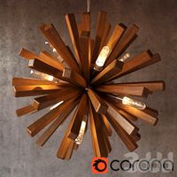
Wood design Sun Lamp
...ция :sun
размеры: диаметр 72 см, высота 152 см
материалы настроены для corona render
в архиве модель в 2014, 2011 3ds max, obj
3d_ocean
$15
Sunset Desert 40
...white
cg hdri view 180/360 (8000×4000 px), for 3d scenes, as the environment and good enough to be used as the actual background.
3d_ocean
$15
ED Exterior HDR 002 - Night City HDR
...dynamic range for great looking realistic shadows from the sun 6000px wide,...
3d_ocean
$15
ED Exterior HDR 006 - Night Sky
...dynamic range for great looking realistic shadows from the sun 6000px wide,...
3d_ocean
$15
Low poly solar system
...polygonal polygons render simple sky solar solar system space sun universe low poly solar system planets. created on cinema...
Hdri
3d_export
$25
CGAxis HDRI Maps 05 08 3D Model
...ring lighting panorama 360 envinronment reflection outdoor hill canion rock
cgaxis hdri maps 05 08 3d model cgaxis 59412 3dexport
3d_export
$25
CGAxis HDRI Maps 05 03 3D Model
...lighting panorama 360 envinronment reflection outdoor forest mountains tree
cgaxis hdri maps 05 03 3d model cgaxis 59377 3dexport
3d_export
$99

Giugiaro Brivido 10 3D Model
...vehicle sport prototype fast brembo xeno realistic racing environment hdri background set lighting giugiaro brivido 10 3d model fabelar...
3d_export
free
Download free HDRI building site 2 3D Model
...t city morning 3d hdr hdri spherical panorama environment skydome dome light
hdri building site 2 3d model fabelar 53126 3dexport
3d_ocean
$15
Ocean Blue Clouds 7 - HDRI
...al environment or light source in 3d scenes. it includes a 6000×3000 pixels high dynamic range image (hdri) and a 3000...
3d_ocean
$15
Sunset Desert 40
...overcast panorama reflection refraction rock skydome sun white cg hdri view 180/360 (8000×4000 px), for 3d scenes, as the...
3d_ocean
$15
ED Exterior HDR 002 - Night City HDR
...night city hdr 3docean clouds cloudy dramatic exr hdr hdri highres moody night panorama skydome sun hdr format for...
3d_ocean
$15
ED Exterior HDR 006 - Night Sky
...- night sky 3docean clouds cloudy dramatic exr hdr hdri highres moody night panorama skydome sun hdr format for...
3d_ocean
$9
HDRI Morning Sun V1
...ojects. format: this file is in the following formats: hdr exr jpg resolution: this file is 4128×1932 pixels. it is 32 bit color.
3d_ocean
$9
Cloudy Sun V1
...v1 3docean blue clouds cloudy day dramatic exr fog hdri highres moody morning panorama sky sun sunrise sunset this...
Degree
3d_ocean
$6
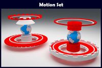
Motion Set
...news world map clean and clear 3d model .360 degree turntable. no overlapping face and vertex, three file format...
3ddd
$1

Jo Stool by Punt
...consist of j-shaped moulded wood cut at a 30 degree angle. the hermetic structure and the j-shaped legs, guarantee...
3d_ocean
$5
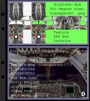
Airplane B1B interior
...unity unity3d airplane b1b:, 360box(cube) texture, view: http://www.xsdentalcenter.com/0/0/0/0/mtv360/www/b1b/index.html 360 degree view,texture,3ds cube box, interior, texture:psd, texture:png...
3d_ocean
$5
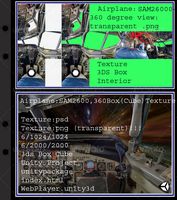
Airplane SAM26000-CPS interior
...unity unity3d airplane sam26000-cps, 360box(cube) texture, view: http://www.xsdentalcenter.com/0/0/0/0/mtv360/www/sam26000cps/index.html 360 degree view,texture,3ds cube box, interior, texture:psd, texture:png...
3d_ocean
$18

HDRI Sunset From The Pier
...taken using canon eos dslr camera setup with 360 degree panoramic head and tripod for full 360 degree area....
3d_ocean
$5
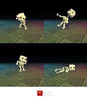
Low Poly 3D Pixel Skeleton
...needs to be self illuminated (flat shaded) to some degree in what...
3d_ocean
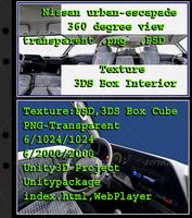
$5
Nissan Urban-Escapade - Interior
...texture unity3d nissan urban-escapade, 360box(cube) texture, view: http://www.xsdentalcenter.com/0/0/0/0/mtv360/www/nissanurbanescapade/index.html 360 degree view,texture,3ds cube box, interior, texture:psd,...
3d_ocean
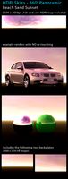
$15
Sunset - Sandy Beach
...hdri lighting panoramic red render skies sky sunset 360 degree panoramic hdri map of a sandy beach at sunset...
3d_ocean
$10
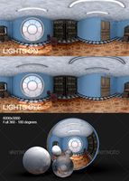
Lit - Unlit Room HDRI
...features: lights on – lights off options. full 360-180 degree. 6000×3000 pixels. jpg – hdr file formats. more hdris...
3d_ocean
$5
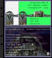
Airplane F4C-R interior
...unity unity3d airplane f4c-r, 360box(cube) texture, view: http://www.xsdentalcenter.com/0/0/0/0/mtv360/www/f4cr/index.html 360 degree view,texture,3ds cube box, interior, texture:psd, texture:png...
Aircraft
3d_export
$85
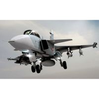
JAS 39 Gripen Jet 3D Model
...jas 39 gripen jet 3d model 3dexport aircraft airplane fighter military attack jet jas 39 gripen jet...
3d_export
$65
News Helicopter 3D Model
...news helicopter 3d model 3dexport aircraft airplane commercial jet airliner civilian flight vehicle transportation helicopter...
3d_export
$40

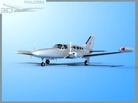
Cessna citation cj4 3D Model
...cessna citation cj4 3d model 3dexport airplane jet aircraft bussines plane private civilian wings cessna citation cj4 cessna...
3d_export
$75
Falcon3D C414 Chancellor Bare Metal 3D Model
...c414 chancellor bare metal 3d model 3dexport airplane airplanes aircraft plane planes civilian civil general aviation executive transport charter...
3d_export
$85
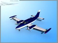
Falcon3D C414 Chancellor F02 3D Model
...falcon3d c414 chancellor f02 3d model 3dexport airplane airplanes aircraft plane planes civilian civil general aviation executive transport charter...
3d_export
$95
Falcon3D A319 United Airlines 2 3D Model
...falcon3d a319 united airlines 2 3d model 3dexport airplane aircraft airliner plane transport commercial passenger modern twin jet civil...
3d_export
$95
Falcon3D A340 600 Pacific Charters 3D Model
...falcon3d a340 600 pacific charters 3d model 3dexport airplane aircraft airliner plane transport commercial passenger modern twin jet civil...
3d_export
$95
Falcon3D MD 80 Hawaiian 3D Model
...falcon3d md 80 hawaiian 3d model 3dexport airplane airplanes aircraft airliner civil commercial passenger freight cargo corporate mcdonnell douglas...
3d_export
$65
Aircraft 737 3D Model
...craft airplane commercial jet airliner civilian flight vehicle transportation
aircraft 737 3d model vanishingpoint 73102 3dexport
3d_export
$95
Falcon3D MD 80 Fast Cargo 3D Model
...md 80 fast cargo 3d model 3dexport airplane airplanes aircraft airliner civil commercial passenger freight cargo corporate mcdonnell douglas...
360
3d_export
$25
CGAxis HDRI Maps 05 08 3D Model
...dynamic range image map maps spherical rendering lighting panorama 360 envinronment reflection outdoor hill canion rock cgaxis hdri maps...
3d_export
$25
CGAxis HDRI Maps 05 03 3D Model
...dynamic range image map maps spherical rendering lighting panorama 360 envinronment reflection outdoor forest mountains tree cgaxis hdri maps...
3ddd
$1
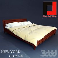
Нью Йорк Кровать (GLOZ 160)
...кровать (gloz 160) 3ddd brw ширина: 1685 мм высота: 360705 мм глубина: 2080 мм спальное место: 1600х2000 мм производство...
3ddd
$1

Of Interni OF.17/6/FR
...особенность дизайна - полностью закрывающая модель "вуаль" из текстильной бахромы.http://www.360ru/goods/0/0/0/84658/ ...
3ddd
$1
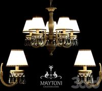
Maytoni СL1028-05-R
...сl1028-05-r 3ddd maytoni люстра maytoni сl1028-05-r (коллекция classic) высота: 360 диаметр: 520 цвет: брасс ламп: 5 x e14 (60w)...
3ddd
$1
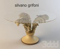
Silvano Grifoni
...silvano grifoni 3ddd silvano grifoni , круглый http://www.360ru/goods/3/461/0/89288/ ...
3d_ocean
$15
Sunset Desert 40
...reflection refraction rock skydome sun white cg hdri view 180/360 (8000×4000 px), for 3d scenes, as the environment and...
3d_ocean
$6
Motion Set
...motion news world map clean and clear 3d model .360 degree turntable. no overlapping face and vertex, three file...
3d_ocean
$15
Sunset Desert 46
...reflection refraction rock skydome sun white cg hdri view 180/360 (8000×4000 px), for 3d scenes, as the environment and...
3d_ocean
$5

Callisto - Realistic HD model
...as lights and setup scene for vray. a short 360 frame rotation animation is also included. available in 3ds...
15
3d_export
$20

The Spandau LMG 0815 3D Model
...pandau machine lmg 08/15 gun fokker firearm assault biplane triplane world war
the spandau lmg 0815 3d model goodl 69009 3dexport
3ddd
$1

люстра blitz Blitz 3866-45
...blitz blitz 3866-45 3ddd blitz люстра blitz 3866-45 площадь освещения:8-15 кв.м высота: 520 мм диаметр:640 м тип лампы:накаливания возможные...
3ddd
$1

Картины vol.1
...картины vol.1 3ddd картина , пейзаж 15 пейзажей, автор david...
3ddd
$1

Maxim Lighting Richmond
...в комплекте версия в 2011 максе. по ссылке доп. инфо.http://www.wayfair.com/maxim-lighting-richmond-15light-chandelier-mxl9052.html ...
3ddd
$1

EAMES DAW
...eames daw 3ddd eames , dar 15 000...
3ddd
$1

Alessi BLIP Utensil and Spoon Rest Holder
...ложка держатель и ложка от фирмы alessi размеры - 15 х 9 х 3,5...
3d_ocean
$5

Billard Balls
...16 low poly billiard balls. numbering from 1 to 15 plus the cue ball. each of the balls excluding...
3d_ocean
$12
Flooring Texture - Vol 005
...tileable timber vintage vinyl wood flooring texture file detail: 5×3=15 png file diffuse + bump + reflect map 6000×6000...
3d_ocean
$12
Flooring Texture - Vol 001
...tileable timber vintage vinyl wood flooring texture file detail: 5×3=15 png file diffuse + bump + reflect map 6000×6000...
3d_ocean
$8
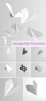
Folding Paper Plane animation
...model – konrad rakowski, package conteins 1 model: folding_paper_plane /15 040 polygons/ animation data is in .max...