38 land latitude 3d models found
Download or buy, then render or print from the shops or marketplaces.
3D Models below are suitable not only for printing but also for any
computer graphics like CG, VFX, Animation, or even CAD. You can print these 3d models on
your favorite 3d printer or render them with your preferred render engine.
Please note that the 3D model database is only a Search Engine. You should
visit the original websites. Most of the models can be easily imported and rendered
with Autodesk 3ds Max, Maya, Blender, C4D, and Sketchup. Check for online
3d model conversions tools for your file format.
3d_export
$89

Globe 3D Model
...globe 3d model 3dexport world map google globe land planet?latitude?longitude?background?space earth plane latitude longitude space terrain advertisement high-precision...
3d_ocean
$19

Cessna Citation Latitude private jet
...cessna latitude charter citation corporate executivevip flight flying jet landng latitude luxury passenger plane private sport transport transportation travel...
3d_export
$80

Planisphere 3D Model
...model 3dexport planisphere earth continents planet oceans world globe land map atlas weather climate geography latitude longitude ground planisphere...
3d_export
$5

Planet Earth MAX 2010 3D Model
...model 3dexport photoreal globe earth map geography latitude longitude land ground space ocean sea world planet continent atmosphere planet...
cg_studio
$89

America3d model
...america3d model cgstudio earth world map google globe land planet latitude longitude science education space high-precision america province...
cg_studio
$80

Planisphere3d model
...cgstudio misc planisphere earth continents planet oceans world globe land map atlas weather climate geography latitude longitude ground .3ds...
3d_export
$79

Globe map 3D Model
...map 3d model 3dexport earth world map google globe land planet latitude longitude science education space globe map 3d...
3d_export
$39

Globe 3D Model
...globe 3d model 3dexport earth world map google globe land planet latitude longitude background space high-precision terrain globe 3d...
3d_export
$79

World map 3D Model
...map 3d model 3dexport earth world map google globe land planet latitude longitude science education space high-precision world map...
3d_export
$39

World map 3D Model
...map 3d model 3dexport earth world map google globe land planet latitude longitude science education space high-precision world map...
3d_export
$89

America map 3D Model
...map 3d model 3dexport earth world map google globe land planet latitude longitude science education space high-precision america america...
thingiverse
free
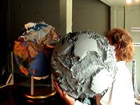
Land Globe 200x in 500,000 Facets by GlobeMaker
...than normal. data points occur every half degree of latitude and longitude. the etopo2 database was used. the photo...
thingiverse
free

Seafloor Globe 40x, Earth in 130,000 Triangles by GlobeMaker
...ocean is shown in 3d for earth, while the land is smooth. the black photo is from a similar...
thingiverse
free
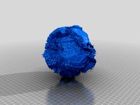
Earth 3D Model in 130,000 Triangles by GlobeMaker
...stereolithography in 2004. the 6 megabyte file has the land mountains added to the seafloor that is shown in...
thingiverse
free

Venus 150x in 2 Million Facets by GlobeMaker
...atmosphere slows down meteorites so they make a slow landng. the meteorites stand on the surface,...
thingiverse
free

Venus Model in 2 Million Triangles by GlobeMaker
...but venus' peaks are seen to form continent sized land masses. the digital data is from the usa's magellan...
thingiverse
free

Relief Map of Canada Generator by fizzup
...is the ice cream. it's mostly round, and the land is the gnarly bits of ice cream that stick...
thingiverse
free

Kraken Mare Xplorer by themindseye
...titan orbit in 2004 with the huygens descent probe landng on titan in january 2005. titan has a methane...
thingiverse
free

Wooden Icosahedron Earth Puzzle
...not fit together to form an icosahedron and the land masses may not line up. the inner triangular edges...
thingiverse
free

Yggdrasil oak tree for CNC by cncmodels4you
...china, which contains approximately 100 species.[3] solitary oak, the netherland oak: male flowers the leaves of a young oak...
cg_trader
$189

Cessna Citation Latitude
...-obj,3ds,fbx,c4d,lwo,xsi exported in three parts:1.main 2.landing gear down 3. landng gear...
cg_trader
$99

Korean Peninsula-globe
...the file.thank you for coming! world map google globe land planet latitude longitude science education space high-precision state korean...
cg_trader
$99

Korean Peninsula satellite map
...high precision state administrative district province korean south exterior landcape ...
cg_trader
$99

Korean Peninsula
...the file. thank you for coming! world map google land planet latitude longitude science education high precision state north...
cg_trader
$15
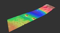
Mars Surface
...height map, grayscale shaded relief mars surface nasa rover landcape topography crater grayscale planetoid craters planet outerspace space mars...
cg_trader
$65

Cessna Citation Latitude business jet
...details.you can use this model for flying and for landng and you can pull wheels inside the fuselage.also elavators...
cg_trader
$3

Annapurna I Mountain
...at least 300 metres (1000 feet) above the surrounding land a few mountains are isolated summits, but most occur...
cg_trader
$14

Globe Low Poly
...hesitate to contact me earth world map google globe land planet latitude longitude background space high precision terrain advertisement...
cg_trader
$7

World cartoon Globe 3D lowpoly Icon
...planet earth world map earth world map google globe land planet latitude longitude background space high precision terrain advertisement...
cg_trader
$7

world globe wire 3D low poly web icon
...planet earth world map earth world map google globe land planet latitude longitude background space high precision terrain advertisement...
cg_trader
$23

Web Icon Pack -02 3D Lowpoly
...planet earth world map earth world map google globe land planet latitude longitude background space high precision terrain advertisement...
cg_trader
$23

Web Icon Pack -03 3D Lowpoly
...planet earth world map earth world map google globe land planet latitude longitude background space high precision terrain advertisement...
3dwarehouse
free

B747-400
...#adc_2009 #airbus #airline #airlines #airplane #airway #airways #altitude #ben #landng #latitude #plane #pressure #sky #takeoff...
3dwarehouse
free

The Entire Kingdom of Bahrain
...i present the 3d map of a piece of land which lies between the latitudes of 25 parallel north...
3dwarehouse
free

Luna 13
...west longitude. unlike its predecessor, the heavier luna 13 landr (113 kilograms) carried a suite of scientific instruments in...
3dwarehouse
free

I DISCOVERED A NEW ISLAND! :-)
...island. i'll give you the location of the island: latitude 23.059846° longitude -161.924456°. i hope you can give me...
3dwarehouse
free

Treasure's island
...there fell out the map of an island, with latitude and longitude, soundings, names of hills and bays and...
3dwarehouse
free

Mitad del Mundo (Middle of the World)
...geodesic mission on those years, people referred to the land north of quito as ‘the lands of the equator’...