98 data radar 3d models found
Download or buy, then render or print from the shops or marketplaces.
3D Models below are suitable not only for printing but also for any
computer graphics like CG, VFX, Animation, or even CAD. You can print these 3d models on
your favorite 3d printer or render them with your preferred render engine.
Please note that the 3D model database is only a Search Engine. You should
visit the original websites. Most of the models can be easily imported and rendered
with Autodesk 3ds Max, Maya, Blender, C4D, and Sketchup. Check for online
3d model conversions tools for your file format.
3d_export
$60

boeing ah-64 d apache longbow
...seconds.a radio modem integrated with the sensor suite allows data to be shared with ground units and other apaches,...
3d_export
$110

f-86 canarias sta maria class frigate
...and 86) received some improvements, such as an improved combat-data system, updated sps-49 and sqr-19 sets, and a new...
thingiverse
free

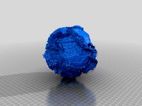
Asteroid models - Toutatis and Mithra by neurothing
...2.4 x 1.9 km) and 4486 mithra (2-5 km). data for these asteroids are based on radar data archived...
thingiverse
free

Mount Vesuvius by conorokane
...mount vesuvius by conorokane thingiverse mount vesuvius. created with data from the space shuttle radar topography...
thingiverse
free

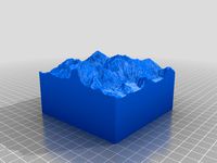
The Matterhorn by PaulZC
...paulzc thingiverse created from nasa shuttle radar topography mission data this print covers a 25km x 25km area centred...
thingiverse
free

Mount Everest by iteration2
...by iteration2 thingiverse topographical map of mount everest, using data from the nasa srtm (shuttle radar topography mission). approximately...
thingiverse
free

Ireland by conorokane
...ireland, created from the space shuttle radar topography mission data looks good mounted on this display stand:...
thingiverse
free
Mt. Everest from SRTM data by bld
...bld thingiverse model of mt. everest generated from shuttle radar topography mission (srtm) 90m topographic data. this fulfills a...
thingiverse
free

Crater Lake, Oregon - with lake-bed by conorokane
...terrain. created from space shuttle radar topography mission 30m data for the land, and the crater lake 2000 bathymetry...
thingiverse
free

Martian moons & Eros by neurothing
...asteroids. these models and builds are part of a data actualization project i am starting with a local nasa...
sketchfab
$8

US Army FAAR (Raw Scan)
...located at the huntsville space and rocket center scan data processed from 472 photos in reality capture, taken with...
thingiverse
free

request for comments and remix: 3D World WGS84 Printed for the use of the Blind by R57
...understand the challenges and limitations of translation from geomatics data to a printable file. i hope work and solve...
blendswap
free

Create Terrain From Digital Elevation
...how to create blender terrain models from digital elevation data downloaded from the internet.the urls to download the free...
thingiverse
free

Seafloor Globe 40x, Earth in 130,000 Triangles by GlobeMaker
...to cut it in half and to add scaffolding. data sources: etopo2 includes: smith & sandwell the "smith &...
thingiverse
free

Asteroid models - Kleopatra, Castalia, Geographos by neurothing
...castalia, kleopatra and geographos based on radar and optical data model reconstruction is based on digital models developed by...
thingiverse
free

Wakam
...this device can produce a live feed painting radar data over the fisheye view.this device and software for it...
thingiverse
free

Hawaiian Islands with seafloor by conorokane
...is taken from the space shuttle radar topography mission dataet (http://dwtkns.com/srtm/) and the seafloor is from the noaa's etopo1...
thingiverse
free
Earth 3D Model in 130,000 Triangles by GlobeMaker
...to the seafloor that is shown in the photo. data sources: smith & sandwell the "smith & sandwell" database...
thingiverse
free

New York, New York by tpsully
...york city - constructed using 1 arcsecond resolution srtm data from the space shuttle (about 2.6 million facets). i...
blendswap
free

Highly Realistic Moon
...science-fiction series.the albedo and color maps are based on data from the us's lunar reconnaissance orbiter, and the bump...
thingiverse
free

Venus 150x in 2 Million Facets by GlobeMaker
...spececraft have some missing data, so i took the data from the soviet union's venera spacecraft and filled the...
thingiverse
free

Handheld Sonic Radar by rjlew
...and the sg90 servo. many of these export the data to processing by an external computer for display on...
thingiverse
free

RCWL-0516 + Battery Enclosure by Michaelo
...up the wifi or ble and send the appropriate data.. once done it returns to deep sleep reducing the...
thingiverse
free

Fowler Pattern Surveyor Carbine by the23Flavors
...feed from whatever sensor is selected and basic environmental data originally built for rogue traders themselves, it was found...
thingiverse
free

Oktober Guard U.R.S.A. Command HQ (GI Joe) by Jabberwock
...mortar is used for fire support, based on radar data gathered by the hq. the top of each tractor...
thingiverse
free

4660 Nereus scaled one in eight thousand by tato_713
...of asteroids compiled by lawrence v1.0. urn:nasa:pds:gbo.ast.jpl.radar.shape_models::1.0. nasa planetary data system, 2020." other astronomical objects object scale [1:x] k...
thingiverse
free

RPi Meteor Camera by mjmazur
...your raspberry pi meteor system will automatically begin collecting data when the sun goes down. in the morning, detected...
thingiverse
free

"Neurobot 3" - Arduino Educational Robotics Kit, Autonomous / RC controlled by NikolayGrigoryev
...{ // fills up the front distance massive with data from front ir sensor irservofront.write(i); delay (10); irfrontmassive[i] =...
cg_trader
$120

9S467 Soviet radar post
...9s467 soviet radar post cg trader 9s467-1 pori-p1 radar data fusion center for the s-300v surface-to-air missile brigades of...
cg_trader
$5

MULTIFUNCTIONAL TACTICAL DISPLAY 3D
...multifunctional tactical display 3d cg trader multifunctional tactical data system. the model is anonymous and designed for using...
grabcad
free

Hard Hat 3000
...rate of the worker when in congestive states and data is sent to supervisor. the hart hat comes equipped...
cg_trader
$15

3D SCI FI OPERATOR COMPUTER AND CONSOLE
...fi operator computer and console cg trader multifunctional tactical data system. the model is anonymous and designed for using...
cults
free

Toutatis Asteroid
...toutatis asteroid cults asteroid the radar data images of asteroid toutatis indicate that it is an...
cg_trader
$20

F16 Multi Function Display - MFD
...systems, specially info about what weapons are available, radar data and optical displays about the weapon in use. each...
cg_trader
$129

55Zh6ME Nebo M RLM-DE L-Band Radar System
...a multiple programmable multi-band design radars and a central data fusion. the radar began to be investigated in 1984....
cg_trader
$119

55Zh6ME Nebo M RLM-S L-Band Radar System
...a multiple programmable multi-band design radars and a central data fusion. the radar began to be investigated in 1984....
cg_trader
$20

Nakajima J1N Gekko Type11kou
...is simple to build. the texture of the original data may have been changed due to exporting. the parts...
cults
free

Golevka Asteroid
...propulsion laboratory in pasadena, calif., have used this comprehensive data set to make a detailed analysis of the asteroid's...
grabcad
free

Versatile Mount
...scientific and weather equipment for scientists and meteorologists for data capture. 3. a mount for a law enforcement taser...
cg_trader
$110

F-86 Canarias Sta Maria class frigate
...and 86) received some improvements, such as an improved combat-data system, updated sps-49 and sqr-19 sets, and a new...
cg_trader
$27

Mitsubishi X-2 Shinshin
...which by replacing traditional wires with optical fibers, allows data to be transferred faster and with immunity to electromagnetic...
cg_trader
$10

ANKA UAV
...vehicles (a/v), a ground control station (gcs), a ground data terminal (gdt), an automatic take-off and landing system (atols),...
cg_trader
$195

High resolution 3D relief map of Gulf of Mexico
...relief is taken from reprojected nasa shuttle radar topography data with the elevation exaggerated. the relief is baked into...
cg_trader
$465

Mercedes-Benz W165
...unreal engine to other software using regular export or data smith mercedes benz w165 3d unreal engine 4 invisive...
grabcad
free

Flying Car / E-Vtol (SKYLINE)
...in this way, it is aimed to obtain consistent data in mathematical models and analyzes. cfd and static analyzes...
cg_trader
$99

R2D2 Robot
...artuditu opacity (8192x8192 pixels) artuditu roughness (8192x8192 pixels) all data on the intensity,allocation and color of the light is...
cg_trader
$195

Iceland High resolution 3D relief maps
...relief is taken from reprojected nasa shuttle radar topography data with the elevation exaggerated. the 3d relief is baked...
cg_trader
$195

Florida High resolution 3D relief maps
...relief is taken from reprojected nasa shuttle radar topography data with the elevation exaggerated. the relief is baked into...
cg_trader
$195

Switzerland High resolution 3D relief maps
...relief is taken from reprojected nasa shuttle radar topography data with the elevation exaggerated. the relief is baked into...
cg_trader
$195

Africa High resolution 3D relief maps
...relief is taken from reprojected nasa shuttle radar topography data with the elevation exaggerated. the relief is baked into...
cg_trader
$195

Iran High resolution 3D relief maps
...relief is taken from reprojected nasa shuttle radar topography data with the elevation exaggerated. the relief is baked into...
cg_trader
$195

Asia High resolution 3D relief maps
...relief is taken from reprojected nasa shuttle radar topography data with the elevation exaggerated. the relief is baked into...
cg_trader
$195

New Zealand High resolution 3D relief maps
...relief is taken from reprojected nasa shuttle radar topography data with the elevation exaggerated. the 3d relief is baked...
cg_trader
$195

Connecticut High resolution 3D relief maps
...relief is taken from reprojected nasa shuttle radar topography data with the elevation exaggerated. the relief is baked into...
cg_trader
$195

South America High resolution 3D relief maps
...relief is taken from reprojected nasa shuttle radar topography data with the elevation exaggerated. the relief is baked into...
grabcad
free

Mobile Lunar Heliostat
...earth control station. it can be derived from satellite data 8- different types of sensors can be installed on...
grabcad
free

Mobile Lunar Heliostat
...earth control station. it can be derived from satellite data 8- different types of sensors can be installed on...
cg_trader
$195

France High resolution 3D relief maps
...relief is taken from reprojected nasa shuttle radar topography data with the elevation exaggerated. the relief is baked into...
cg_trader
$195

Germany High resolution 3D relief maps
...relief is taken from reprojected nasa shuttle radar topography data with the elevation exaggerated. the 3d relief is baked...
cg_trader
$195

United Kingdom High resolution 3D relief maps
...relief is taken from reprojected nasa shuttle radar topography data with the elevation exaggerated. the relief is baked into...
cg_trader
$195

Mexico High resolution 3D relief maps
...relief is taken from reprojected nasa shuttle radar topography data with the elevation exaggerated. the relief is baked into...
cg_trader
$195

Arkansas High resolution 3D relief maps
...relief is taken from reprojected nasa shuttle radar topography data with the elevation exaggerated. the relief is baked into...
cg_trader
$195
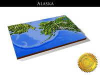
Alaska High resolution 3D relief maps
...relief is taken from reprojected nasa shuttle radar topography data with the elevation exaggerated. the relief is baked into...
cg_trader
$195
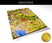
Arizona 3 High resolution 3D relief maps
...relief is taken from reprojected nasa shuttle radar topography data with the elevation exaggerated. the relief is baked into...
cg_trader
$195

Canada High resolution 3D relief maps
...relief is taken from reprojected nasa shuttle radar topography data with the elevation exaggerated. the relief is baked into...
cg_trader
$195

Colorado High resolution 3D relief maps
...relief is taken from reprojected nasa shuttle radar topography data with the elevation exaggerated. the relief is baked into...
cg_trader
$195

China High resolution 3D relief maps
...relief is taken from reprojected nasa shuttle radar topography data with the elevation exaggerated. the relief is baked into...
cg_trader
$195

California High resolution 3D relief maps
...relief is taken from reprojected nasa shuttle radar topography data with the elevation exaggerated. the relief is baked into...
cg_trader
$195

Afghanistan High Resolution 3D Relief Maps
...relief is taken from reprojected nasa shuttle radar topography data with the elevation exaggerated. the relief is baked into...
cg_trader
$195

Louisiana High resolution 3D relief maps
...relief is taken from reprojected nasa shuttle radar topography data with the elevation exaggerated. the relief is baked into...
cg_trader
$195

Australia High resolution 3D relief maps
...relief is taken from reprojected nasa shuttle radar topography data with the elevation exaggerated. the relief is baked into...
cg_trader
$195

Brazil High resolution 3D relief maps
...relief is taken from reprojected nasa shuttle radar topography data with the elevation exaggerated. the 3d relief is baked...
cg_trader
$195

Alabama 3 High resolution 3D relief maps
...relief is taken from reprojected nasa shuttle radar topography data with the elevation exaggerated. the relief is baked into...
cg_trader
$195

Europe High resolution 3D relief maps
...relief is taken from reprojected nasa shuttle radar topography data with the elevation exaggerated. the relief is baked into...
cg_trader
$195

Egypt High resolution 3D relief maps
...relief is taken from reprojected nasa shuttle radar topography data with the elevation exaggerated. the 3d relief is baked...
cg_trader
$195

Pakistan High resolution 3D relief maps
...relief is taken from reprojected nasa shuttle radar topography data with the elevation exaggerated. the relief is baked into...
cg_trader
$195

Near East High resolution 3D relief maps
...relief is taken from reprojected nasa shuttle radar topography data with the elevation exaggerated. the 3d relief is baked...
cg_trader
$70

Boomerang ground attack airplane
...battlefield for an extended period of time, provide recon data provoke air defences and eventually use its warhead to...
3dwarehouse
free

radar fixo RFX
...radar fixo rfx 3dwarehouse controlodores de velocidade data ...
3dwarehouse
free

SCR-296 Set 5 - Coast Artillery short-range Surface Craft Detection Radar
...the coast artillery to provide target range and azimuth data to world war ii gun batteries with 6' and...
3dwarehouse
free

SCR-296 Set 4 - Coast Artillery short-range Surface Craft Detection Radar
...the coast artillery to provide target range and azimuth data to world war ii gun batteries with 6' and...
3dwarehouse
free

SCR-296 Set 3 - Coast Artillery short-range Surface Craft Detection Radar
...the coast artillery to provide target range and azimuth data to world war ii gun batteries with 6' and...
3dwarehouse
free

SCR-296 Set 1 - Coast Artillery short-range Surface Craft Detection Radar
...the coast artillery to provide target range and azimuth data to world war ii gun batteries with 6' and...
3dwarehouse
free

SCR-296 Set 2 - Coast Artillery short-range Surface Craft Detection Radar
...the coast artillery to provide target range and azimuth data to world war ii gun batteries with 6' and...
3dwarehouse
free

SIMRAD, HS60 GPS Compass
...the hs60 gps compass delivers accurate heading and position data for use with simrad chartplotters, autopilots, radar, and ais....
3dwarehouse
free

North portal of the Cheyenne Mountain Operations Center (CMOC)
...mountain operations center and the cheyenne mountain directorate collect data from a worldwide system of satellites, radar, and other...
3dwarehouse
free

Fredrick Von Stettin class Guided-missile frigate (Fictional)
...mod 3 phalanx ciws electronics: two sewaco-ageis xi combat data systems, one 'top plate' 3d surveillance radar, one mk...
3dwarehouse
free

Skyguard Fire-Control Radar System
...mm gdf cannon series towed and anti-aircraft guns. technical data design; skyguard is trailer-mounted and fully air conditioned with...
3dwarehouse
free

SIMRAD V5035 PILOT PLUG
...and charting systems, external gps receivers, radar systems, voyage data recorders and other nmea 0183/2000...
3dwarehouse
free

SIMRAD V5035/ Class A AIS Transceiver
...and charting systems, external gps receivers, radar systems, voyage data recorders and other nmea 0183/2000 devices. https://www.navico-commercial.com/simradcommercial/ais/ais-v5035-class-a-transceiver/ simrad dealer:...
3dwarehouse
free

Edmund Fitzgerald
...anderson could come within transmission range and send radar data the two ships headed toward white fish bay. just...
3dwarehouse
free

SnowHound vehicle
...for recognition and cartography 'deriver 1009-aief 'snowhound' '. technical data motor tomino hh, autoconditioned of hydrogen-6 fuel cells of...
3dwarehouse
free

EVA Service Drone
...bolt door separation; short-range object approach system and transponder; data link system; automatic thruster control; auto hover; eight-channel communication...
3dwarehouse
free

IZH-750 Concept
...night vision capabilities—and the images are overlaid with gps data to provide ‘augmented reality’ navigation for the rider. it’s...
3dwarehouse
free

Katana, T.A. Stealth A.I. System (Sway)
...a ranging or sensing technique), given enough time and data is by far the most versatile and dangerous version...
3dwarehouse
free

CDA H-12 Arrantzalea
...radar (good a picking up periscopes and wakes) 1ea data ball visual acquisition system. although the newest models are...
3dwarehouse
free

Skyguard Anti-Aircraft Defence System with MSPhysics
...- gdf-007: upgrade of gdf-005 with ahead system. technical data cannon; the oerlikon twin-gun uses a 35 mm autocannons,...
3dwarehouse
free

Oerlikon 35 mm Twin Gun
...- gdf-007: upgrade of gdf-005 with ahead system. technical data cannon; the oerlikon twin-gun uses a 35 mm autocannons,...